
Walking to Scotland 1965.
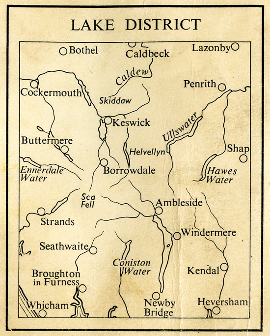
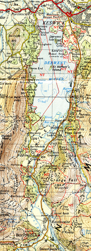
5: The Lake District.
Story so Far… Co.Durham and Northumberland: Dirt Pot and Acomb youth hostels and abandoned railway lines. Teesdale, Weardale, Hexham, and Bellingham. Brewing up in a GPO cable repair and location van, and a horny dog. And lots of rain, and more rain. But the sun shines along Hadrian’s Wall, and Mac the legendary warden at Once Brewed youth hostel…”Get up, you lazy bugger”.
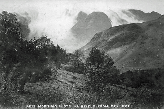
To Come The Lake District: Wonderful mountains, but frightning in bad weather. A hound on Hellvellyn and a hairy, heart stopping time in low cloud on Lord’s Rake 3162′. Magnificent deep U shaped valleys and pictureseque hamlets. And rain, and rain, and rain, enough rain to turn the Sahara green. And three Mod girls.
_______________________________

_____________________
May 2, Sunday, near Tirril. About 10.45 am.
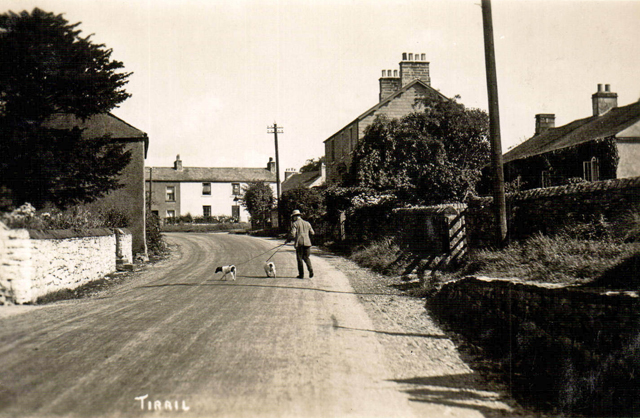

Yes this pen is a good 9d worth (3p) considering how much I’ve used it. A pleasant morning, overcast but warm. So starting on the long ascent – it’ll be uphill for ¾’s of the way to Patterdale, I’m at about 500′ at the moment. Lowland, very green grass, long and lush, cows grazing.

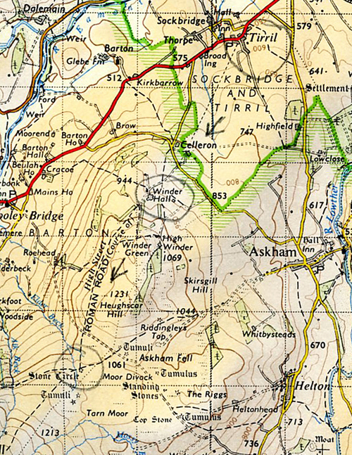
Later, having passed Stone Circle, marked on map but not tall standing stones. From Tirril to Winder Hall, a large farm and from there along the track of the Roman Road – “High Street” – only the track isn’t obvious and after a while I realise I’ve lost it and spend some time getting to the pox-eyed Stone Circle, and continue along the track, it’s not the track, a sheep track, there’s so many of the buggers. Writing this having stopped for lunch of Bournville chocolate and bread – “I’m a plain girl, I like plain things, etc etc”. (An advertising slogan used by Cadbury’s for their Bournville chocolate in the early to mid 1960s.) Some clouds are coming up.
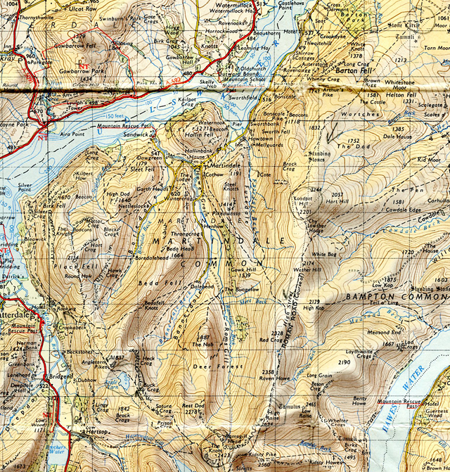
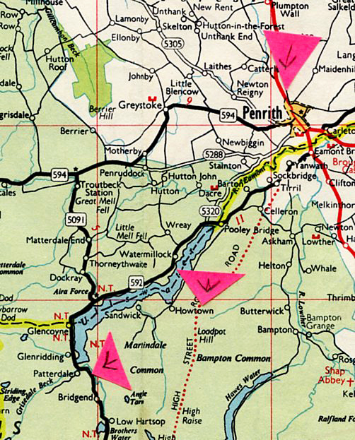
Common Room, Patterdale YH, after my tea. After I said some clouds are coming up, it starts to rain, and the clouds come down even more, but then lift, and I’m on the definite track, and the rain goes off. The track is easy to follow along the ridge, climbing, climbing steadily until I reach Loadpot Hill 2201′. And yes, the Lakes are a great range – dramatic is the word. Look in the grey hazy distance and dark outlines of pinnacle mountains – mountain after mountain – and deep U shaped valleys, fantastically steep sides and very green uninhabited ½ mile long valleys down below. The Lakes really do come up to and surmount all expectations (and the misgivings after the Peak District).

So. Walk along the ridge, yes like a whale back and then when I got to High Raise 2634′ a really great view of Rams Gill – one of those U shaped valleys – really marvellous. Just sit there marvelling at it, almost ecstatic. Then onto The Knott 2423′ and along the steep valley side, past Angle Tarn, and looking down the deep valley of Deepdale – very steep descent and the fields below are a fantastic green and the trees have fresh green leaves.

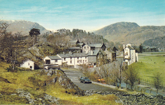
As I descend further, a few mod expensive looking houses built of local stone.
And to the YH.
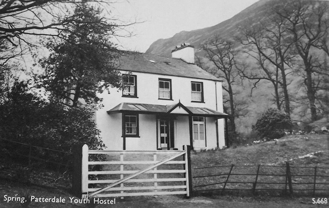

The hostel is filled with excitable and some very attractive girls, 16 – 18 years old. (Le Patron was 19 at the time.) I made myself a meal of Bachelors Chow Mein – quite pleasant. I tried to decide what was in it. Definitely red peppers and Soy Sauce. I find it hard to concentrate with these girls around me in the Common Room. A bloke was trying to chat some of them up, but they ignored him, and he’s gone off. Where? There’s also a couple staying here – in their 30s/40s?
________________________
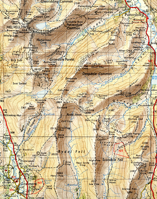
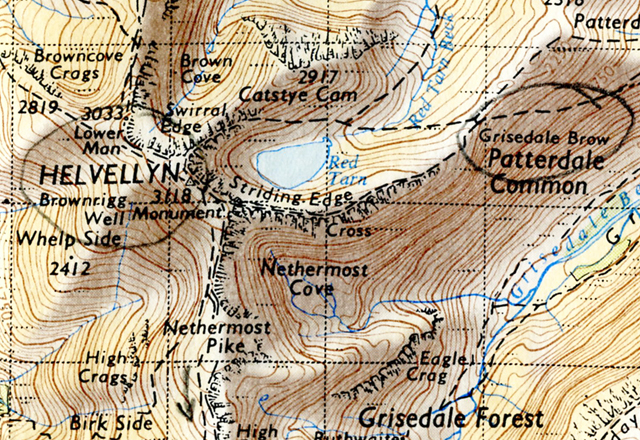
May 3, Monday. 11 am. Grisdale Brow on way to Striding Edge.


When leaving Patterdale hostel this morning I heard a cuckoo – so spring or summer is here. So, sitting on Grisdale Brow, approx. 1500′, heading up for Striding Edge. Looking down below me – fantastic, dramatic – typical glacial mountain scenery, almost Swiss looking. Below me the flat bottomed valley called Grisdale with Grisdale Beck flowing through it – Grisdale Beck coming down a V shaped valley, typical early stage development. The main valley bottom flat and green, a few small plantations of trees, some farms and then these magnificent valley sides. Higher up the sides, scree, crags and lumps and tiny streams, so that it looks as if lava has spilled over the top of the mountains and solidified on the way down.
A lot later, approx. 2.30. “In memory of Robert Dixon, Rookings, Patterdale, who was killed on this place on the 27th day of November 1858 when following the Patterdale Fox Hounds.” Written on a rusted metal plaque.

I started writing that behind the stone wall shelter near Helvellyn 3118′. I’d reached the summit and was returning, but it was too cold and it was raining. So to catch up. I’m writing this looking down on Grasmere and Grasmere lake. Anyway, back to slogging it up the rocky path/ascent to getting onto Striding Edge, passing the couple who were at Patterdale hostel last night, and then they passing me, as we take it in turn to catch our breath.
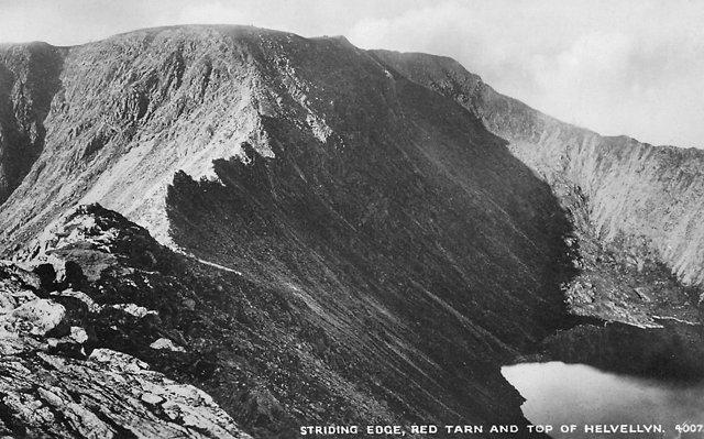
Just as I was getting onto the start of Striding Edge this skinny hound starts following me – appeared from nowhere. No collar, blood near her ear. And she follows me along Striding Edge. In front of me is the sheer wall of Helvellyn, and down there on the right hand side the corrie called Red Tarn, and on your left hand side a U shaped valley. At one point the cloud came rushing up from the left, and I mean rushing up, and over. The path along Striding Edge is about 18″ wide at certain points with sheer drops downwards on either side. That really is a ridge, and at certain points having to climb up, or down rocks where there is no path, and the hound still with me. It’s like walking on top of the earth.

So at the end of the ridge, the edge, I can’t see any definite path up to Helvellyn so it means some very dodgy scrambling up the face – and the dog still with me. I’m now in low cloud. Climb up between two slabs of rock, scree, loose tufts of earth. And when I get to the top the dog’s up there and as I come level with the ledge where she is, she starts going mad and licking my face – which any other time I wouldn’t have minded but as I was trying to haul myself over the ledge I objected and pushed her away. Got on to the ledge.
So on the face of Helvellyn. Follow a track, snow fields above me and I’m looking for a break so I can scramble up and over the brow above me but the track comes to a sheer drop. Sit and eat two packets of dates – yes, packets of loose dates, not blocks – 60zs, 7d (3p) – and they were the best dates I’ve tasted so far, bar the dates you get in boxes at Christmas. Retrace my steps and think I see a break, go up, but it’s slippery, treacherous ice, solid ice. Get back onto the track and walk further back where I’ve already been. Contemplating part of the snow field where it looks narrow when out of the mist below me comes – “Hello?“. I hesitate and then return the call – “Hello“. Them: “Are you on the path?” Me: “No, I’m bloody lost“. And out of the mist they emerge – it’s the couple and another bloke. I say that the spot in the snow field I saw seems the best place. We go up to the edge of the snow field and aha! – the brow, green grass and a cairn.
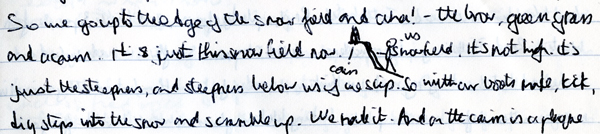
It’s just this snow field now. It’d not high, it’s just the steepness, and the steepness below us if we slip. So with our boots make, kick, dig steps into the snow and scramble up. We made it. And on the cairn is a plaque for another bloke who copped it and whose dog stayed with the body. We go to the O.S. trig point, and I go to the shelter and have a cig, start to write the notes earlier, abandon it because of the cold and rain. The couple and bloke are coming off Helvellyn a different route from me.
I start along the path for Grisdale Tarn.
It’s a steep descent, the rain gets stronger and somehow the wind gets colder as I zig-zag down.
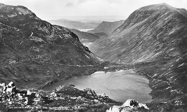
From Grisdale Tarn follow the track that will take me to Grasmere. The rain has stopped, cloud above me but the sun is shining on Grasmere and the lake which I’m looking down on. Flat bottomed broad valley, very green, sides not so steep, wooded sides. With the sun it looks pretty. Nobbly stick out crags all over the place. Looks a bit Swiss.

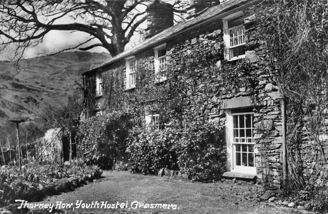
Grasmere (Thorney How) YH. Around 8.30 pm. Picking up from where I left off – descend to the main road and into Grasmere. Some mod houses – mod art gallery and a mod hotel, built of this great local stone – greys, browns, chocolate, fawns, deep reds and small stone like slate so that you get the impression the wall’s built without cement.

In front of me I see a mob of S.J.Ps (School Journey Party) going up the road to one of the hostels. (Grasmere had two YHA hostels in 1965) Thinks “Oh-oh” Buy two stamps in the Post Office and to my surprise it’s 10 to 5. So playing on a hunch I make for Thorney How, it’s further up the road. (Thorney How is now an independent hostel/bunkhouse.) On the way I pass the hound – she’s had a great day, like me. A woman is about to feed her with bread. Get to the hostel and my hunch was right – plenty of room. As I sign in I notice three people have signed in before me, and they’re from Western Road, Billericay, big coincidence, called Chapman. (Le Patron was brought up in a road that ran parallel to Western Road.)
After I’ve made my bed and washed and started cooking my meal I’m thinking: I wonder if I know them, but when they eventually turn up in the self-cookers I’ve never seen them before. Rather peculiar looking bloke in glasses and little Hitler ginger moustache with his young son and son’s older girl cousin from New Zealand who’s stacked and bored. And there’s also two girls from Preston in the self-cookers. Cooked myself a really satisfying meal of bangers and mash with Surprise peas. (Batchelor’s Surprise Peas were dehydrated peas, light to carry in a rucksack and cooked quickly, compared with dried peas.)
________________________
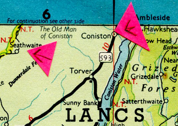
May 4. Tuesday. Outside Coniston Coppermines YH. Around 4.45 p.m.


This morning walked back into Grasmere and bought some food, and as it’s pissing down with rain I decide not to go up onto the mountains and start to walk to Ambleside having decided I will buy a Black’s Nylon Anorak. I heard that there was a climbers equipment shop there. I walk along the track that runs by the side of the lake – Grasmere lake. The water is very calm with the reflection of the mountain sides, the fields, the trees. Pebble beach, water very clear and with the rain there is a hissing sound as the rain kisses the water. Walking in the trees, fresh green leaves, beads – drops of rain on them and last autumn’s leaves under my feet. Then walking along Rydal water and onto an unclassified road into Ambleside. Suddenly dying for a piss and go into the bogs at the Ribble Coach Station.

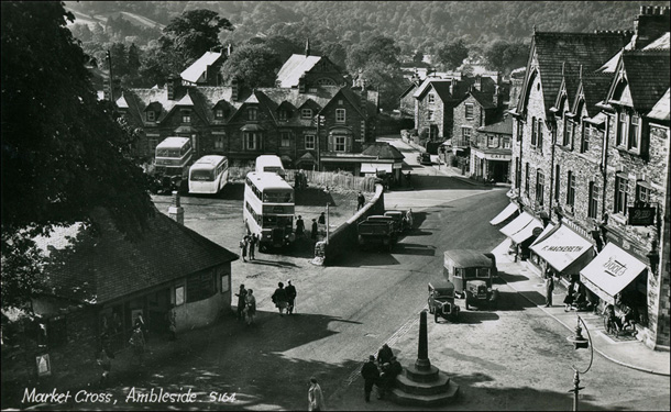
Before I get to the climbing shop I see an anorak shop and buy a Black’s Nylon knee length anorak – £4.7.6 (As a comparison Le Patron’s take home pay was around £10.10s, working as a labourer the previous winter.) Across the way is the climbing shop and I inquire about water-proof anklets – but helpful bloke told me there was nothing but nothing that would keep rain out of my boots. So that was that. Good climbing shop, plenty of nice looking, expensive equipment.
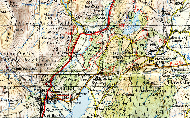
After buying provisions I set off for Coniston, along the A593, turning off onto the B5286 and stopping to devour ½lb of Morning Coffee biscuits and then take my old anorak off and put the new one on. Walking towards Coniston, along the lake for ¼ mile and into Coniston, and it’s only 3.45. Hang around, quite a pleasant village, and then up the miners track to the hostel.
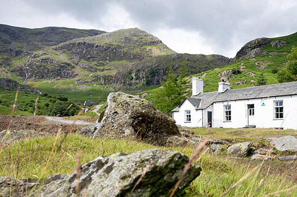
So as I said earlier, now around 4.45 p.m. The hostel is in a great situation – a white cottage at the foot of a fell with steep fells and mountains nearby. Some grey stoned derelict buildings near it and small slag heaps. White streams tumbling seemingly vertically down the mountain slope. And as you come up the stony track to the hostel from Coniston there’s the fast running stream in a little gorge by its side, gurgling, splashing down – a white bleached rock and the water where it is deep a sort of blue – from copper deposits? – like water in s swimming pool.
8pm, in the warden’s living room. I’m the only one here tonight. Hostel front door opened a bit before 5 I think, by young, big anarchistic looking warden, big black beard, worn out climbing trousers, jersey – him, a dog, a cat and me. When I took my new anorak off in the dorm I was surprised to find it wet inside and my sweater soaked. Condensation? Sweat? It’s supposed to be waterproof.
Out into the separate self-cookers. A lot of the equipment is filthy, but cooked myself a pleasant meal of spam, beans and mash, followed by strawberry jam and bread, only the bread’s semi-stale – bought it new in the Co-op. They really are third rate – typical sub-standard food and packaging – just like the Yugoslavian stores. (Le Patron had been in Yugoslavia in the summer of 1964, known then as the Socialist Federal Republic of Yugoslavia.) Just imagine what it would be like if everything was Co-op in this country. Drab, ah drab. One up for private enterprise – “Fascist hyena” cry Southend Y.S’s. at me. (Le Patron had been a member of the Labour Party, and the Labour Party Young Socialists, until he resigned in 1963, having read a pamphlet How Labour Governed 1945 – 1951 published by the SWF – Syndicalist Workers’ Federation. Re. Co-op food, it has improved since 1965.)
Writing this in the warden’s cosy room as he said it wouldn’t be worth lighting a fire in the Common Room. Earlier Johnny Dankworth records on his record player, now classical.
_________________________
May 5. Wednesday. On Walna Scar Road. Around 11 a.m.
Breakfast of porridge, bread and jam. Pissing down outside.

After breakfast go into the surprisingly mod common room and read a CTC Gazette (CTC – Cyclists’ Touring Club) when warden comes in – impeccably dressed – what a change from last night – says would I mind buzzing off fairly soon as he’s going to get the 9.45 bus to Kendal to get a haircut – and if I want, if the weather stays bad I can stay in the self cookers all day. So I take my stuff to the self cookers, he locks the cottage up after giving me some handy advice on the route I should take for Eskdale, and trots off down the track. I prepare to exit in the self-cookers.
Put on my anorak, then my new nylon Black’s anorak over it, wearing shorts and put a thick strip of newspaper in my boots and beneath my knees underneath my socks as an attempt to keep my feet dry. Emerge and go down the track to Coniston and buy rations and a Beef Stroganoff – now have enough food to last me till Sunday. I take the Walna Scar road out of Coniston on the warden’s advice. Because of the rain and low cloud he strongly advised I avoid the hill/mountain path route to Hardknott Pass and take the long way round to Eskdale. He reckoned the route I planned would be hell today.

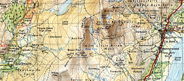
Later. The Walna Scar road – a track – climbs steeply out of Coniston, green trees on either side and then the trees peter out and you’re on a track that goes through lunar, moon type landscape. All along, the brows of the hills are knobbly and pieces of what looks like jagged limestone sticking out of the earth. In front as I walk the track knobbly mountains with great upthrust vertical strata, and a track goes off from the one I’m on, curling up there. and I can hear machinery, men and loose rock, must be a quarry or mine somewhere.
Follow track up as it skirts Brown Pike 2377′ to my right. Ascending the track it gets pretty rough with boulders and there are great white crystalline fissures running down, straight through the vertical strata beneath my feet. Enter cloud on the brow, and then out of it 50′ below the brow as I descend. Below me I can see the hamlet of Seathwaite in the valley of the River Duddon, and in the distance the hills/mountains are really wild, black, lumpy, looking.

Getting on → Descending to the valley of the River Duddon and the scenery is extraordinary with these great slabs of rock 10′, 15′, 20′ high coming out of the ground and ten’s of small craggy knolls with a few cottages between them, by them. Follow what is now a lane to a farm, cross the footbridge over the stream and there’s this great cottage there, at the foot of a small knoll called Holling House Tonge.

The cottage is white-washed, rest of it is a barn which is falling to pieces and in front of it a natural green lawn, caused by the grazing of sheep, and a grey stone wall and trees. Follow the unclassified road to Troutal Tongue, the stream a beautiful greeny/blue colour and then a frothy white as it goes over a waterfall. At this point it is so narrow it is just the road and the stream, and Harter Fell to my left in the distance. The conifer trees are a mixture, with the fresh green of larches. And it’s almost a shock to realise you are in Lancashire, as you think of the Lakes as being in Cumberland or Westmoreland.
Leave the road crossing the stream on an old stone bridge near Hinning Ho Close – the bridge spanning a sort of miniature gorge and the water looks about 8′ deep and is this fantastic blue/green colour. And a couple are descending from Harter Fell and I ask them the time, it’s 20 past 3.
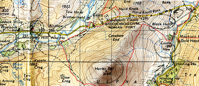
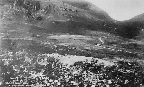
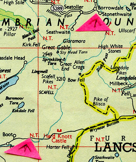
Walk by the river – wide pebble bed here and the valley opens out, and Castle How, only 891′ but sticking out from the slope like a castle. I leave the river and cross a field with a friendly playful sheepdog with me to Black Hall Farm and from the farm the path takes me to Hardknott Pass road, rough narrow road and when you get to the brow you see it curling down – steep S bend after S bend, and valley and mountains in the distance and just make out the sea – a grey murkey line in between the mountains.


Walk down the pass, pausing to look at have a look at the remains of the Roman Fort.
And then continue along the road to the YH. Looks modish on the outside, but 1930s on the inside.


The hostel has good self cookers – yet appalling lack of cutlery and crockery, and there is no decent drying room and I’m very surprised and disappointed that the Black’s anorak isn’t 100% waterproof. It’s OK provided it’s not pressed against anything, i.e. the front, but on the shoulders where the rucksack straps are and the back where the rucksack is it’s virtually no good. So not quite, but nearly £4.7.6 down the drain.
_____________________
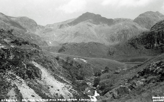
May 6, Thursday. Morning. Stony Tarn (I think, I hope).
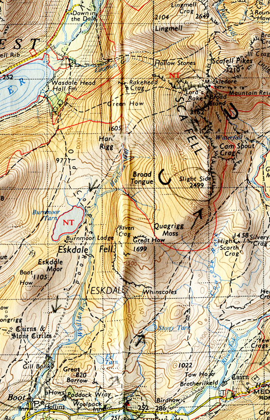
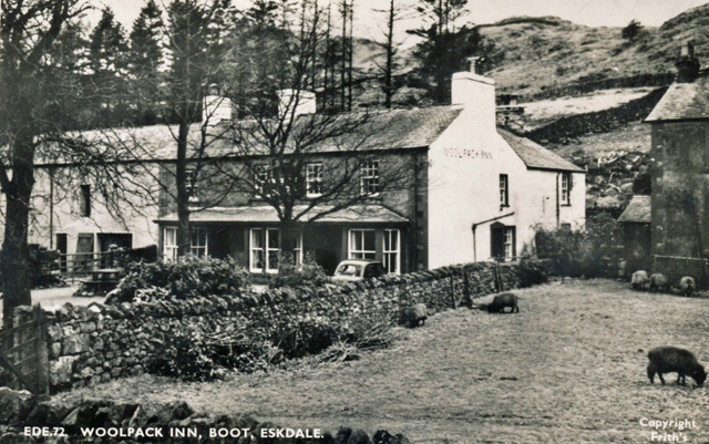
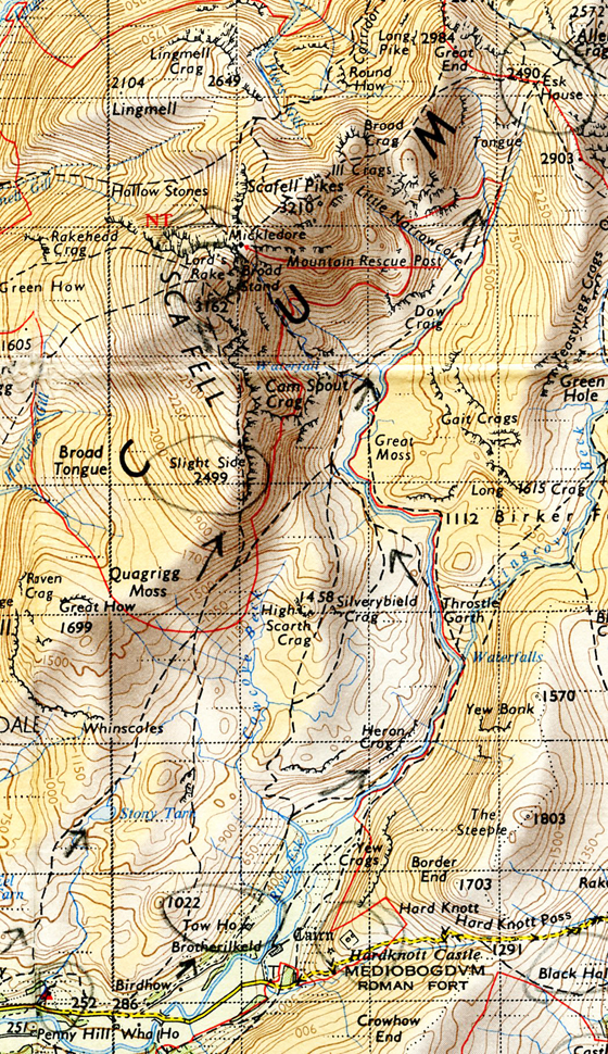
On footpath to Scafell Pikes 3210′. Woke up this morning to blue sky and sun outside. It’s now clouded over but the mountains are reasonably clear except Scafell ahead of me which is capped in cloud. I left the YH walking to the Woolpack Inn and followed the path from behind the Inn, only after a while it’s obvious I’m on a sheep track, but keep going, heading north and I’m now looking down on Stony Tarn where I can rejoin the proper footpath. Mountains all around me, black, knarled, dominant. Outstanding, challenging and frightening.
Eskdale YH. Evening. Yes, certainly challenging and bloody frightening. I did manage to rejoin the proper footpath, only it’s virtually nothing and if it wasn’t for the small cairns it would have been impossible to follow. A steady steep ascent up to Slight Side 2499′ – a lot of the ascent on scree and even in good visibility the cairns are very difficult to see. Great mountains and U shaped valleys ahead and over to my left I can see the sea, but not too clear and two big chimneys, like cooling tower chimneys with smoke/steam coming out, and the visibility is closing in. (The towers would have been part of the Calder Hall nuclear power station on the Cambrian coast, near Sellafield.)

From Slight Side it’s up rocky, stoney scree to Lord’s Rake 3162′. There’s a big cairn there and a stone shelter but I go on, passing a fantastic, very frightening gully on my left – two great slabs of rock and the gully dropping almost vertically down for 100’s of feet. But then, ah then I run into trouble, which mistakenly I thought was only temporary. Lord’s Peak has a great buttress. Below it is a path going up to Scafell Pikes. I’m on the buttress – great slabs of rock all around. Looking down to the path I see two people going up it. Have a look around and realise I can’t get down to it from where I am – but not to worry (says me). Retrace my steps and follow the gully down as advised to me by two blokes who were staying at the YH last night.
It starts to snow but the visibility is OK. Watch 5 blokes in yellow oil skins coming down the path from Scafell Pikes as I light a cig and smoke it feeling – and God knows why – pretty good. One of the blokes stops and has a pee. OK, says me. Put my nylon anorak on. But as I continue, suddenly with, no warning, visibility closes right up. All I can see is the immediate rocks, everything else – Scafell Pikes, the path below me – are now gone, hidden by drifting white mist. Continue down the path in the gully and then it just flakes out. There’s a big slab of rock going down at 45°. Get on my arse and carefully work my way down – rocks wet and slippy, gully to my right dropping steeply, partly full with scree and snow. Gently find places to put my boots and get a grip with my hands. Eventually reach the bottom which is a platform/ledge. Look around me. All I can see in the mist is a sheer drop in front of me.
Dump my rucksack and scout around. Nothing but sheer drops, and then in a break in the mist I can see the path some 15/20′ below me. It comes up to the rock face and stops dead, dividing, going down each side of Lord’s Rake. So near yet so far – and never so true. It’s an impossibility to get down there unless you feel like jumping and I certainly didn’t with the weather, and the mist/rain was getting worse and my hands were getting numb. Get back to my rucksack and then I have to somehow get up this slab I came down.
Only it’s murder going up, and the rucksack’s no help, the frame bangs against the rock on my right as I try to work my way up and my map case keeps getting caught up with my knees and the hood of the anorak doesn’t allow me to look up and see where I’m going, unless you feel like straining and leaning back and with the drop below me into a misty nothing. And by now I’m not sure there isn’t a sheer drop below the glimpse of path I saw. I take it slow, most of the time huddled on my knees, my fingers grabbing pieces of rock – it’s all sheer rock, nothing else, and trying to find places for my boots. At times my body is nearly lying against the rock with one hand grabbing a projection. I slowly haul and push myself up. And BROTHER was I glad when I got to the top.
From then on I’m scrambling up with a few more nasty places to climb until I reach something that vaguely resembles a path. And I decide that the path, or what there was of it and the cairns marking it was either for climbers or for summer use because for a walker the route’s impossible. Even in summer or on a clear dry day it may be a possibility but it’s still murderous and highly dangerous.
I’m back on soil, well, of sorts and sitting behind a rock I munch a packet of Digestive biscuits. Never again will I sneer at Digestive biscuits – Christ they were good, and I notice the small hairs on the back of my hand are like tiny splinters of glass, glistening with the frosty rain/mist. I’ve never seen them like that before. Looked startling. Biscuits finished I go along the ridge, following a couple of cairns, theoretically retracing my steps – only as I soon discover, I’m not. There’s a great mound of big boulders, I clamber over them, following cairns, but all the cairns come to dead ends with sheer drops or steep gullies. I’m getting angry now. Keep slipping on the bastard wet rocks and the wind and the rain belt against me and can’t see more than 10 yards in front of me. I go back. Stop. Hesitate. Try a different route. Again something happens – there’s another big gully and I can make out snow. So back again. Stop and hesitate and I’m really angry now. Try a 3rd time and for some peculiar reason discover some cairns over to my left I’d missed before. I follow them – and yes – it’s a safe – well, fairly safe way down, scree in a lot of the route though, and the more I go down the more reassuring it is. Just the fact that I’m going down, and come to grass, and really happy now, really striding, at times running down the slope, past cairns – man I feel great – I’m safe.
Shouting, singing – almost exhilaration – as I race down, even though my jeans are saturated and boots are getting wet, and I know I’m not on the path I came up on, but who cares – and then, with my little eye, I spy one big lake and one small lake. Stop to consult my map. Have great difficulty getting it out of the map case – my hands are numb, no power in them. But get it out. And hooray. The big lake is Wast Water and the little one over to the left is Burnmoor Tarn, which leads to Bent near Eskdale YH. Great man. They’re about 600 – 700′ below me.


Belt down that slope, singing – absolutely crazy – I should be crying – I’m soaked through, but I feel great. Going down, down, ground getting boggy but I don’t care. Near the tarn there’s a sheep pen, the kind you get in hills, round, built of stone. Sit in there, some protection from the wind, and dry my hands with my handkerchief which miraculously is still dry and roll a cig. Sit there, hunched up, water dripping off me and take drags on the cigarette. And it’s about the best cig I’ve ever smoked. Take it in deeply, hold it, and then let it out. Beautiful – and I must have looked a picture as I drag it down until it’s burning my lips.

Continue along the reasonably well defined path that’s running parallel with Whillan Beck. Boots by now completely wet, water squelching out, but who gives a damn.
Descend into Boot. Funny little place. Farms, cottages in a dead end road, off the main country road. Basically it’s a hamlet, but with a P.O where I buy a tin of creamed rice and a packet of Cream Crackers and find out to my astonishment that it’s 5.15 pm.

_______________________________
May 7, Friday. Langthwaite YH (Borrowdale).
This morning at Eskdale YH after the hairy experience on Lord’s Rake. All my clothes dry after being in front of the wardens (two old ladies) big stove in their kitchen overnight. Breakfast of porridge and skimmed milk and tea and skimmed milk. My duty was to go down to the Woolpack Inn and get the hostel’s milk in a little two pint carrier. (In the 1960s hostellers were given duties by the warden before they left in the morning – it could range from sweeping out a dormitory, or the Common Room to cleaning the self-cookers.)
By the time I get back it’s just gone 10 am, but the rucksack’s packed and I’m ready to go. It’s not raining but there’s low cloud. Go up the track to Tow House, a farm, and from then on start following the Esk all the way up.
Skiddaw on my left. Stop by a sheep fold and eat biscuits and have a cig. It’s starting to rain.

Continue. The further I make my way up the narrower the valley gets, and up there the Esk is a beck tumbling down a V shaped valley, There’s low cloud up there and I start the ascent proper. Rain’s getting heavier. The path’s steep, cairn marked – right by the stream, at times in it, over the boulders. Stop. Stop. Stop for breath. Continue. By now boots contain plenty of water and the rain’s driving into me, from behind, into my back. Climb, climb. Reach Esk Hause in low cloud. There’s a footpath descending, but in the low cloud can’t see if it is the one that will take me down to Sprinkling Tarn which I should be heading for.
Getting lower down the path I emerge from the cloud – there’s a high valley down there, tracks, streams and right at the end of it where it seems to drop – a hanging valley? – Sprinkling Tarn. I’m alright, on the right path.

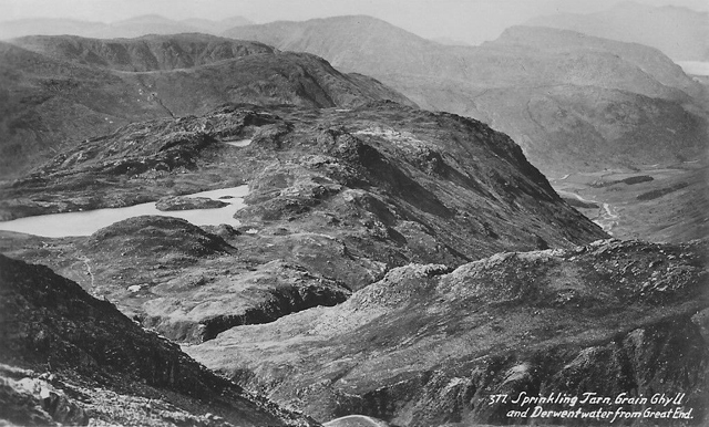
Follow the path down, turn off before I get to the tarn and a steep descent down, following a beck that cuts through a deep V valley and then through a gorge called Grains. On my right are fantastically high steep sides with streams tumbling down – streams everywhere rushing, splashing off the sides with the last 3 to 4 days of rain. Hasn’t been a good day since Saturday.
Continue on my way down to another Seathwaite (Borrowdale, not Duddon Valley!). A hamlet of a couple of farms at the head of Borrowdale. One of the buildings has B&B advertised.

From Seathwaite there is now an unclassified road going down to a junction with a B road. It runs along by the side of Styhead Gill. Rain still pissing down and I’m soaked through Get to the junction with the B road. If I took a turn to the left it takes you up to the Honister Pass, but no fear, I walk on. Surprisingly a red Cumberland bus goes up the B road. A school girl got off it and I ask her the time. It’s about 4.30 she thinks.


Try unsuccessfully to roll a cig but the cig papers have turned to pulp in the rain. Get angry and give up. Shepherd and his dog pass me. I squelch along the B road making for the hostel. As I squelch along a mobile shop is parked outside some cottages. A woman in there getting some stuff. I wait. She emerges with her shopping bag and son. “Terrible weather” says she. “Yes” say I, and into the mobile shop. “Have you got any spuds?” – “Yes.” – “2 lbs please.” – “Only 5 lb bags”, so I squelch on.
Looking at the map I can’t quite work out how to get to the hostel. Catch up with the woman who’s now lit a cigg – a tipped cig. and ask her. I was dying for that cig. Cig. still in her mouth she says “Down there” pointing to track. It’s the track going to Longthwaite, there’s a couple of cottages and then a bridge over the river and there’s the hostel in a woody glade by the river.

Sit in the porch and the slow business of getting my stuff off – hands numb. Eventually get most things off, including socks that weigh ½ lb each with water. Sign in and they have a good store, so buy food. Change clothes and wash. Put the wet clothes in the drying room – a proper one – tinder dry. Meal of tomato soup, cream crackers and fly cemetary biscuits (Garibaldi biscuits) and tea AND managed to get pint of fresh milk. Very nice hostel – clean, warm, log fire and plenty of feeling. A picture on the wall I like – looks like wooden cottages in the Russian steppe – great mood.
___________________________________
May 8, Saturday. Overlooking the valley of Watendlath Beck.
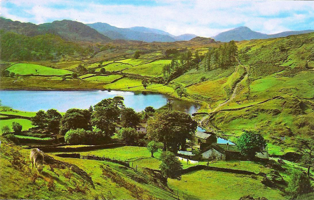
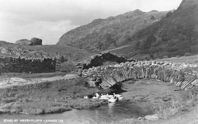
At the head of, overlooking the valley of Watendath Beck which is very beautiful and picturesque. There’s the tarn down there and by it the hamlet of Watendath – farms or farms clustered by the side of the tarn, a few trees.

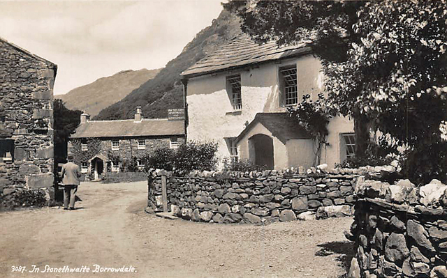
Left Langthwaite hostel at 10 a.m. Everything dry and – I forgot – the bloke from Billericay who was at Grasmere was staying here too – Chapman – and he’s taken my army cape back to Billericay for me, nice of him. Last night it was quite close, I opened a window in the dormitory. Leave the hostel – it’s a bit windy, high cloud, patches of blue sky and dry – so far – and down to the beautiful hamlet of Stonethwaite.

Cross the Stonethwaite Beck – broad here, swollen, angry, rushing down, after all the rain. Very big beautiful U shaped valley. I ascend the steep path to Dock Tarn and nowhere.
Later. So, from “Nowhere” down to Watendlath, through the wood, along by Watendlath Tarn, and right by the tarn the hamlet proves to be really beautiful. Stone hump back bridge going over the stream to it, but I keep on this side of it and follow the stream down.
Further down cross a foot bridge, footpath through a wood and then onto an unclassified road through the same wood. Starts to rain and put my nylon anorak on. The road leads down to Derwent Water – choppy and grey and the B road along to Keswick.


Keswick, around 2.25 p.m. Still raining. Sitting in a shelter in the public gardens with the River Greta 5 yards away. Quarter an hour ago I was looking in the window of Fishers – a superb mouth-watering camping/climbing store. Gaze at the goods on display and go in, and have a chat about my nylon anorak. He says, a bloke says they don’t recommend Black’s Cagoules, that after 6 months the proofing goes – so that’s £4.7.6d down the fucking drain, which needless to say niggles me. (Fishers of Keswick are still very much in business. Blacks no longer make cagoules.)
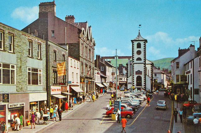
Buy some provisions. Lot of people walking around in anoraks – even a couple of blokes in Duvet jackets – which strikes me as being pure show. A Duvet jacket? It’s not cold, it’s not freezing, no snow on the ground – it’s May 8. So here I am in this shelter in the park, waiting for 5 and opening time. Keswick is a 112 bed hostel – probably be deadly. Imagine the self-cookers with 112 fully booked beds.
Derwent YH. After writing the above I thought, blow it, I’ll go to Derwent hostel, it won’t be as deadly as Keswick, so walk back along the B road to Barrow House, the hostel. It’s a fine big Georgian house.
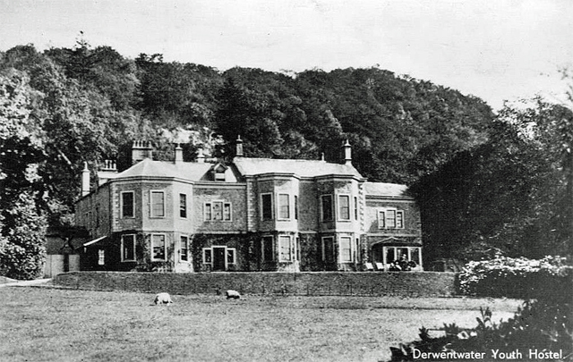
Pleasant inside. Trying not to get too fed up about the blasted anorak. Had a meal of cheese pie – yes, they had a grill. School party here tonight and 3 mod girls from Middlesex. “Yer what?” – “Give over.” Cockermouth tomorrow – will be my last day in the Lakes.
________________________
May 9, Sunday. By the side of Derwent Lake, near Brandlehow Park.
Cloudy outside when I woke up, after a good sleep – woken by the rising bell and dreaming about something other than the hills for a pleasant change. The dormitory all to myself, the school mob in the other dormitories. Breakfast of porridge and grapefruit. About to go, putting on my boots when one of the Middlesex mods says “Do you know the best way to get back to London?” Not really but give her vague directions about making for Manchester via Penrith.
So I leave and trot down the road, past a big Victorian hotel that’s had modern extensions and looks quite expensive – big car park on the other side of the road from it, full of cars including several foreign ones – even a Milan registration plate on a Fiat. Ah, Italia! “Italia bella, si.” (Le Patron had been in Italy the previous summer, 1964. See his Ciao Ciao Bambina post.)
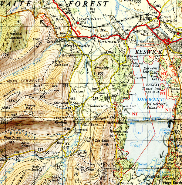
Take the footpath across the bottom of Derwent Water, the path is partly on raised planks as the ground is marshy and so onto the other side of the lake, following the path through the woods, by the lake. Very pleasant. I’m sitting here having a cig and there’s two blokes in a boat out there, rowing, and a pleasure – “We take your money” – motor launch passes me.
Cockermouth YH. About 8 p.m. So to pick up from where I left off – continue along the path then up the minor road that goes into Braithwaite.

Pass several middle-aged mixed parties of Ramblers – and suddenly think of the Chums Rambling Club advertised in Rucksack. (Rucksack was the magazine of the Ramblers Association.) Just before Braithwaite I sit on a bench and eat a date bar and suddenly it starts to piss down. So there I am, sitting on a bench and it’s really pissing as I eat my date bar, and then open a packet of biscuits. And down by a stream there’s a young bloke throwing pebbles in it, and then starts to walk towards a caravan site across the fields, throwing a piece of wood, going up to where it’s landed, picking it up, throwing it again and so on. The pouring rain doesn’t seem to worry him. Stops to inspect his shoes. Curious.
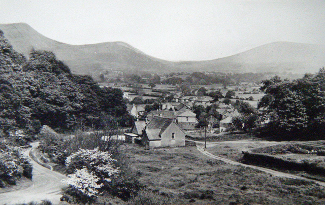
Go into Braithwaite and I’m now soaked. Passed some cottages and get a whiff of Sunday dinner – roast beef, and I suddenly wish I was in there, out of the pissing rain eating a Sunday dinner. But I’m not, I’m outside, move on and get some shelter by a garage. The rain eventually stops. Start to ascend the Whinlatter Pass.
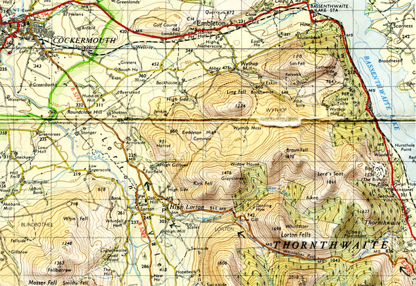

The Pass is not particularly steep, easy going, a pleasant road. Turn off to a minor road and make my way down into High Lorton – a nice quiet village and rejoin the B road that will eventually take me into Cockermouth. The rain’s going off and as I walk along there’s very green hedgerows on either side of me, and the countryside’s low and rambling and fantastically green. There’s primroses in the fields and in the roadside banks. And yes, blue sky now, gloriously friendly blue sky and it’s like, well it is – summer. And I look back and see the Lakes, the great humps, great grey humps rising up out of the lowland, and there’s low cloud and mist enveloping them, and it’s like coming out of the dense jungle into the open, out of a cage into the open.
______________________________
Walking to Scotland 1965
Next
Part 6: Into Scotland. Glasgow, Loch Lomond, Crianlarich and beyond…

____________________________________
