Walking to Scotland 1965
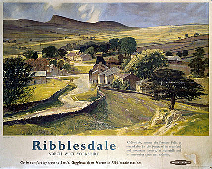
3: The Forest of Bowland, The Yorkshire Dales & Westmoreland.

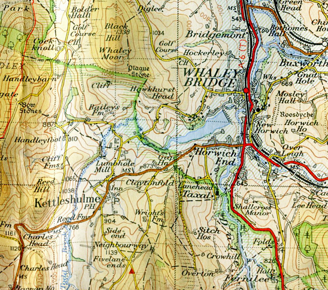
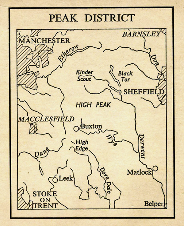
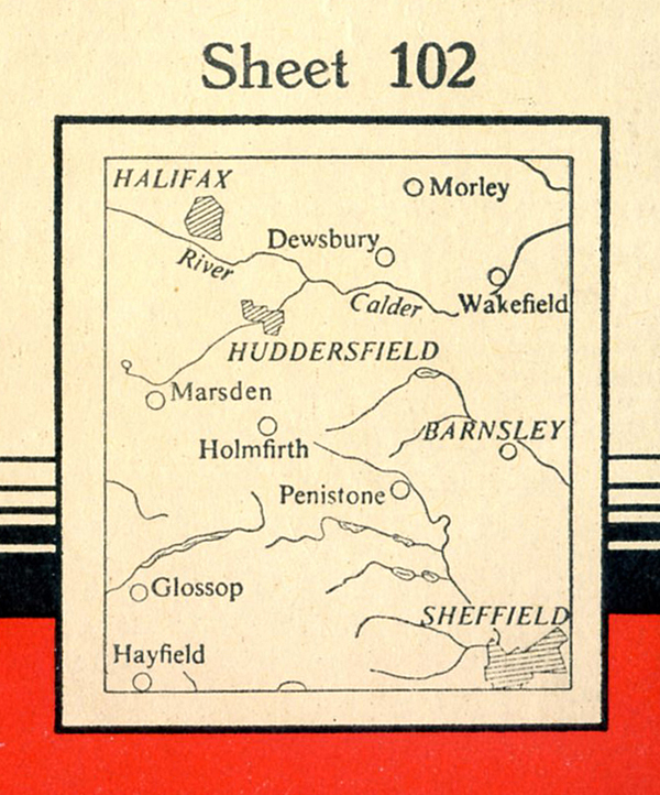
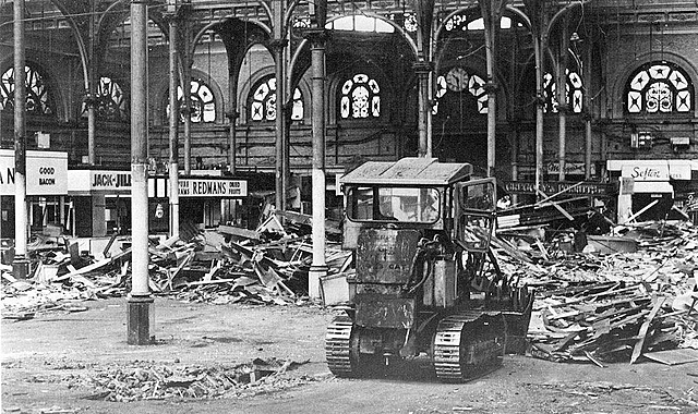
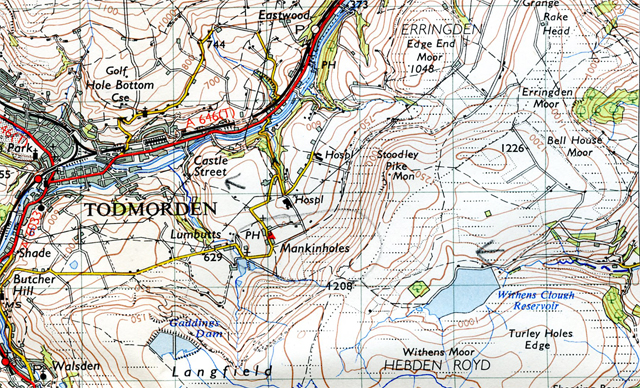
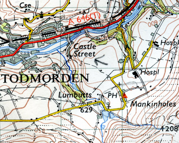
The Story Continues… From the eroded peat tops of the Peak District, the Easter crowds of hikers and sight-seers, the poisoned streams of small Yorkshire valley mill towns and a dead pig in a silage pit, Le Patron continues his walk to Scotland. He has arrived at Mankinholes youth hostel, near Todmorden, and is now setting off for Slaidburn in the Forest of Bowland, north east of Preston.
To Come: Crowded Easter hostels, a dog in Grisdale that lost a paw to a weasel, a nasty military surprise near Kirby Stephen, and a sickly combination of Blue Band Luxuary margarine and Scottish Co-op Apple Jelly….
______________________
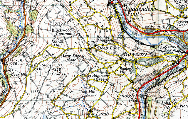
April 17. Near Becon Hill
Woke up this morning and it’s raining and the wind driving the rain against the dormitory window. Last night there was a load of blokes in the next dormitory talking loudly ’til 11.30 and I was trying to get to sleep. Got up early before the mob next door, quick breakfast and got my card from the warden. Short chap who fluctuates between severity and friendliness. Down into Todmorden to buy some food, but no-one sells Knorr Tomato Sauce Mix, date bars or A1 tobacco.

It’s drizzling, the rain’s gone off a bit and I start to hitch.

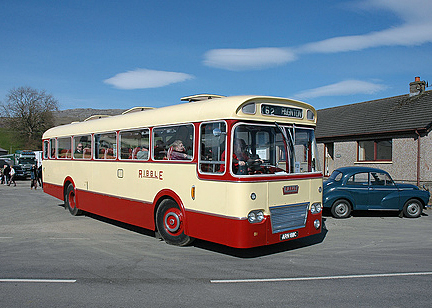
Get a lift from a Scot going to Stranraer – he takes me as far as Whalley, and turns off for Preston and M6. Whalley, small pleasant town, buy some more provisions. Start to hitch, it’s pissing down, think sod it, and get a 11d (4p) bus ride into Clitheroe in a Ribble bus, single decker, mod and bright inside, and thinking it would make a great mobile home, only too big for country roads and drink up the petrol.
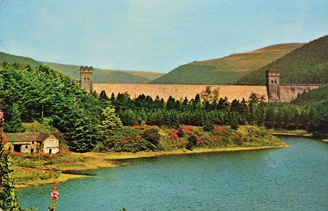
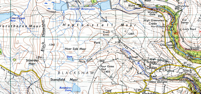
Clitheroe, the rain’s laid off and out onto Waddington Road (B6478). Over the Ribble – brown, swollen with rain, moving fast and silent, and into field and a footpath to West Bradford, a small pleasant village.
West Bradford and road going gently upwards, cutting across the top of Grindleton and an un-classified road on the way to Slaidburn.
25 to 5pm, Field Head near Slaidburn. Sitting behind a stone wall and there’s a great wind blowing, howling through the bare trees over there on the other side of the road and the rain’s pissing down almost horizontally ’til it hits something but with the shelter of this wall I’m completely dry and it’s great. Telephone wires above me, quivering, straining in the wind and crows over there in the trees crowing, some drifting, effortlessly it seems, against the wind. There’s nests up there too. Sky’s black over there but now the sun’s come out and on the other side, blue sky. Wind’s just picked up again – really belting it. Rain’s stopped.
______________________
April 18, Easter Sunday. 10.10. Slaidburn by river.
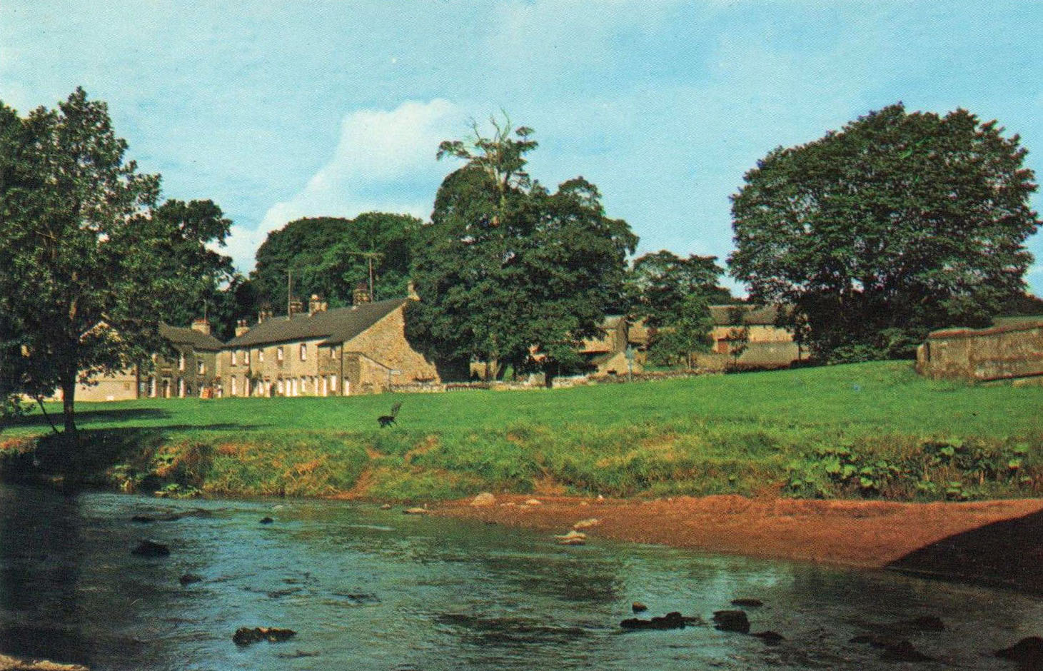
To finish off from yesterday. Descend into Slaidburn, a beautifully situated village in a wide valley – very green the fields and the hills, trees sprouting leaves and Slaiburn built of grey stone. Into Slaidburn over the bridge. Beautiful village, narrow streets, cobbled footpaths, a few shops and into a pleasant YH run by 3 young volunteers. Old YH, old pub or something.

Managed to scrape in for tonight and Monday night. Dormitories are outside, through a yard where there’s one of those corn grinding stones, and up some stairs. Warm common room. Hostel full. Ate overwhelming meal of Veg curry. Rang up Ingleton (Youth hostel to the north east of Slaidburn, in the Yorkshire Dales.) The warden says he’s got places for Tuesday but says he doesn’t accept bookings over the telephone. So when the P.O. opens at 10.30 today I’ve got to try and get a P. Order (Postal Order), but doubt it. (Le Patron was correct to doubt that he would get a postal order on a Sunday. The P.O. would also have been a village shop.)
For breakfast I had a big omelette and two rolls with butter, the latter someone had left behind in the self-cookers. Now to wait. Incidentally, they’ve got those plywood based beds at the YH which are lousy to sleep on – hence the big controversies in the letters pages of Y.Hosteller. (Youth Hosteller, the monthly magazine for YHA members.)
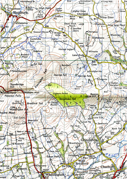
Middle Knoll. 1.15 pm. I couldn’t get a postal order and he told me to put the letter to Ingleton YH in the letter box with 3d and he’d put the stamp on it. Left after buying 4 packets of biscuits.

Blue sky, clouds, showery, fine. Followed track up and over Dunsop Fell – snowed, took shelter behind wall and then continue. Wind getting strong and it’s now cold. Marvellous colours on the hill slopes – ginger, green. Over Dunlop Fell, a little boggy, and descend to foot of Middle Knoll – sticking out at the head of two valleys. Now following the valley down. More great colours on the valley slope opposite – chocolate, ginger, lime green and a few grey ghostly bare trees.
Evening, Slaidburn YH Common Room. Lovely and warm in here and been whistling Milestones – the Miles Davis number – suddenly remembered it – great number, and feeling pretty good what with eating well, a cigarette and this warmth. I’m to be sleeping on a mattress on a floor in another dormitory tonight, and when changing my socks earlier found a hole in my jeans below the flies – aha – so will mend later. To recap, to remember what happened after 1.15 pm.
From Middle Knoll to Brennand House and up Whin Fell. A puffy descent past steep descending stream, great black banks of slate or coal looking stuff.
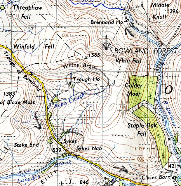
Follow boggy path down to Trough House – tumbled down buildings and on to the Trough of Bowland, a mild gorge, perhaps an old river valley, occupied by minor road that was swarming – and swarming is the right word – with cars. Easter Sunday Day Trippers. They were driving backwards and forwards in their cars, like ants, just like ants, so Peter followed them walking parallel slightly higher up along the hillside, looking down on the ants, past Sykes, a farm where a conglomeration of ants were, and so was an ice cream van, doing a roaring business.

Past Hareden and more ants and over to Beatrix – 2 farms, after crossing the River Dunlop, bi-passing Dunsop Bridge.
And then a walk back to Slaidburn over wooded slopes, black clouds following me, gone 5, make hostel 5.30 and as I get in, it pisses down.
___________________
April 19. Easter Monday 1.45 pm. Kiln on White Hill 1784′
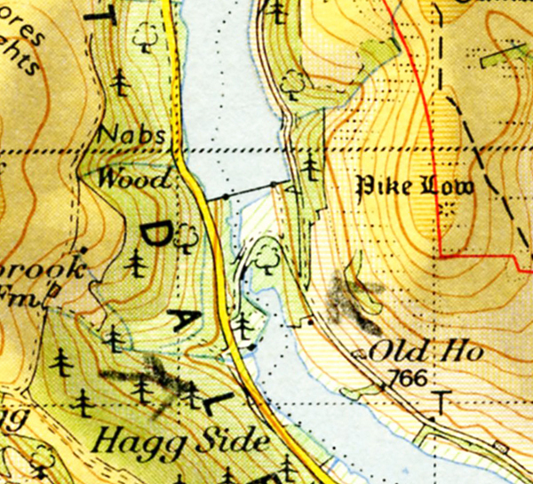
Because of the Easter holiday choc-a-bloc youth hostels Le Patron is marking time until he sets off on April 20 for the village of Ingleton and the Yorkshire Dales.
Kiln on White Hill 1784′ which is about the highest point in the Forest of Bowland. Sitting in this recently constructed out of use kiln, which is a bit of a mystery. For burning peat? Who for? When? How long ago?

Sitting in the kiln and panoramic view of the dissected plateau all around me.

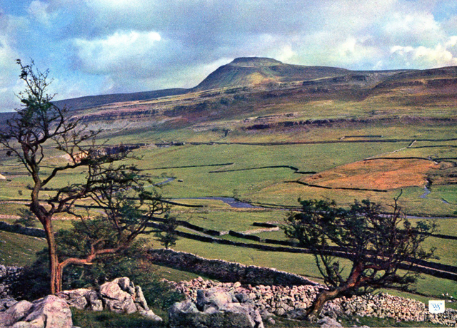
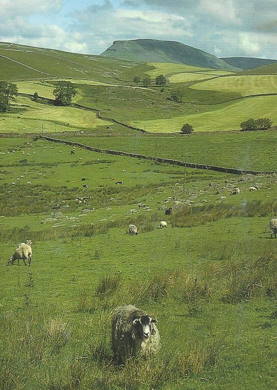
Smooth topped high hills and right over in the distance a good view of Ingleborough, some 12 miles away and Pen-y-Ghent – both very clear and prominent at the moment, rising up out of the ground. (Ingleborough and Pen-y-Ghent are in the Yorkshire Dales, and Ingleton village is near to the foot of Ingleborough.)
Above me a patchy blue sky – cotton wool blobby clouds, but to my right dirty black clouds, and hanging from them like a thin curtain of rain or snow descending, difficult to tell. But it’s dry here. Except they’re moving up the valley.
This morning up at 7, had breakfast, hung around, there’s no hurry and it’s a nice hostel. The informality is great – you feel you’re part of the place – because of the volunteer easy going wardens. One’s at teachers training college. Left at 10 and walked to Gisburn Forest, following Stocks Reservoir, through the forest and out to New House, by the looks of it a recently deserted farm. Down to the stream – the River Hodder, follow it ’til the second bridge and onto the hill road that goes to Ingleton, or at least Bentham. Turn into a track that leads up to what looks like a shooting shack. There’s a car parked on the track, just up from where it leaves the road, couple kissing, and probably more, in the back seat.

Continue up to the shack, it’s still intact, still in use I think and it’s great – by a stream and I start dreaming – stood looking at it, thinking and dreaming, and then continue up Far Costy Clough, a stream up to White Hill. And here I am.
4.50 pm Slaidburn. Sitting outside the Post Office of this beautiful village. Tens of cars passing me, Easter tourists, even a full coach of tourists went by. It’s such a lovely village, better than Malham. (Malham, Yorkshire Dales, where Le Patron was on a school Geographical Field Course in 1962.).
Back to White Hill. Left the kiln, down the hill and get on the track that will take me back to Slaidburn. As the track becomes an unclassified road the curtain of black cloud wipes out the sun and blue sky and guessing it’s going to throw it down, get under a bridge that crosses the stream, and there’s a bank of rock under the bridge and I shelter there. Suddenly there’s a flash of lightning, it starts to snow and then thunder rumbling around. Some small boys from a tourist car come underneath the bridge and think it’s great fun, the snow driving down, the wind howling and peals of thunder. The black sky moves a little on, there’s a peak of blue sky, so I continue down the road, but more snow, in to a derelict farm – clears again and it keeps clear until I get to here, sitting outside the P.O.
10.35 pm Dormitory. Just come back from the pub with the assistant wardens. Earlier a friendly boys and girls youth club group from Keighley – who called themselves the Keighley Mob – were in the self-cookers, and David their leader said I could have their left over food in the morning as they’d brought too much – tea, sugar, margarine and a loaf of bread. Great.
______________________
April 20, Tuesday. Ingleton. 2.30 pm
To my horror Ingleton is swarming with hikers, hanging around like me – counted 20 so far, so doubting whether I’ll get in tonight. It’ll be one mad jostle when it opens at 5. I got here earlier than I expected, at 2.15 p.m. So now I’ve got a horrible wait, eating my guts out. If I can’t get in I’ll have a four hour walk ahead of me to Dent YH, which means I wont get there until 9 pm. Assuming it’s not full. Bloody hell.

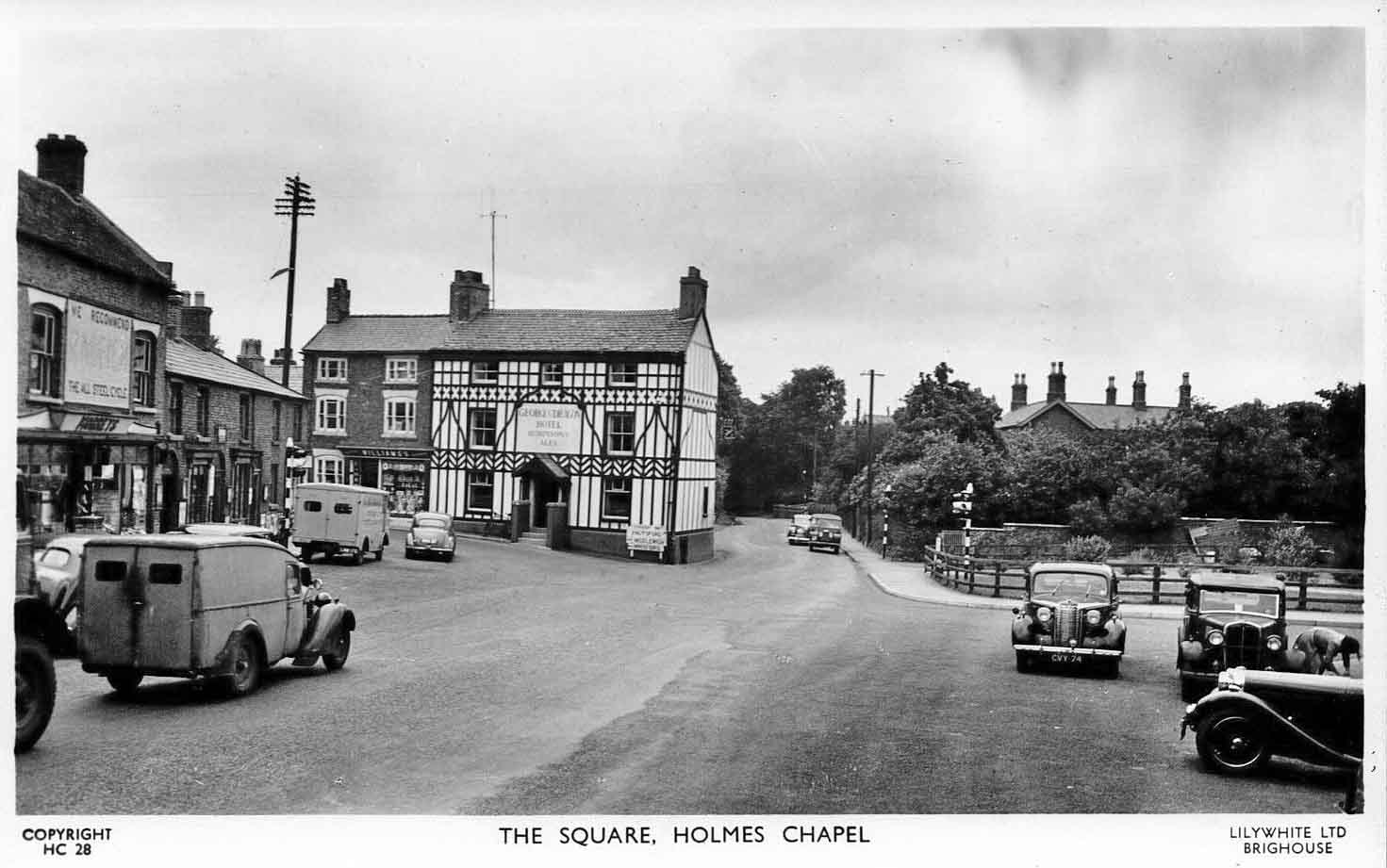
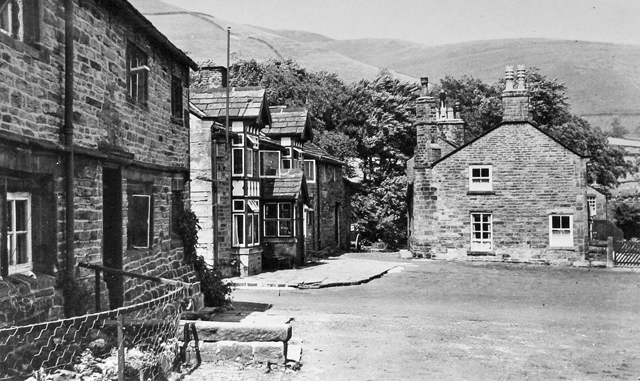
Yes, Ingleton, different to when I was here last – it was virtually deserted then – December 1963 after coming off Ingleborough. It was getting dark, sitting on the same bench I’m sitting on now, looking down that narrow street. (Bottom right view of Ingleton multiview card above.) It looked like a Christmas card then, all you needed was the snow, with little lights on in the cottages and shops. But very different and crowded on this Tuesday after Easter.
Left Slaidburn YH at 9 with my rucksack happily weighed down with stuff from the Keighley Mob, including also spuds and carrots. Walk north on the unclassified moor road, heading for Ingleton, reach the brow with clear sight of Ingleborough 7 – 8? miles away, north east of me.

Then a long gradual descent down this moorland road to Bentham, the limestone bare on the hills in the distance – a ghostly white and the green so faded. Sit on a bench in Bentham and eat ½ lb of Ginger biscuits. Still some tourists in cars, not so many as the weekend.
3.45 pm Just found out from some hikers Ingleton booked up for tomorrow night and from the Ingleton Post office that that letter posted Sunday should have reached Ingleton this morning. Writing this sitting in a hikers cafe – sells hiking equipment – cup of tea 6d. Warm in here and the juke box going, mostly Stones records. Sort of feeling mildly good, daft when I was so anxious about getting in earlier. That eleven mile walk tonight may be good or knackering.
4.17 pm. As the time gets nearer five, as I sit on this green painted bench, as more assorted people wearing anoraks wander aimlessly up and down this little street in Ingleton, as it gets colder, as I start to shiver, as I stare blankly at the maps – I reckon my chances for tonight are getting more and more NIL.
Dentdale YH 9.50 pm Hope rose for a while. When I went down to the hostel and there was a board showing vacancies for men and women. Talked to a couple who were not booked and had rung up last night. So I thought I would be in after all and went and bought 4 eggs. However come 5 o clock I go in and spend 5 minutes waiting while a woman teacher signs in a party of school girls and when it comes to my turn I’m told they’re booked up. He got my letter, but they’re booked up – although the couple got in and warden told the bloke he still had 2 male beds vacant. So sold the eggs to another couple and left cursing like fuck – obviously something fishy – he’d probably put the girls in male beds – switched a whole dormitory to get the school girls in. Yes left cursing and swearing aloud and started a forced walk to Dentdale.

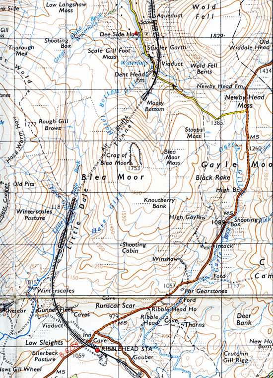
Walked fast – road deserted except for the occasional car full of trippers. Hitch, but no go. Wild moorland, lonely but great road, striding along, passing mileposts, coming up to Ribblehead viaduct.


I hear a car or van in the distance approaching from behind. I turn round and hitch and to my surprise and delight it stops – full of trippers, a Dormobile. I get in the back with two girls and off we go. Get dropped off where the road turns off to Dent. And think – there’s some good people around.

Yes, everything’s going to be OK. Dentdale – nice dale. It’s a steep twisting little road down from the turn off. Passed a barn of hay, stopped, went back, had a look in, in case I couldn’t get into Dent hostel, to sleep in. Continue to walk down the road until I get to the hostel. Half full – I’m in, and booked in for tomorrow night too.

Another good hostel only I gorged myself with Hunters Meat pudding that the Keighley Mob gave me. It tasted bloody awful – more gristle than meat – ate it with the spuds and carrots, but a completely free meal so could afford to throw a ¼ of it away when I couldn’t eat anymore. Yes, made a pig of myself. Into the Common Room and three young yobs bashing the piano until the women warden comes in and tells them to quit it, in a friendly way. Just turned 10. A cig, and now to work out tomorrow’s route.
__________________
April 21, Wednesday. Dentdale 7.20 pm.

Woke up 7.30 and it’s a lovely morning outside – blue sky, touch of light frost on the grass, fresh and crisp. Rather sickly breakfast of bread, Blue Band Luxury margarine – picked up at Slaidburn hostel, and Scottish Coop Apple Jelly bought in Todmorden Coop. Yes, sickly.

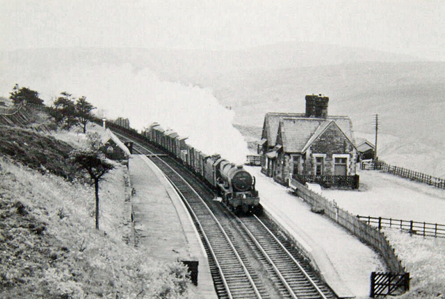
Out at 9 o’ clock. Dentdale is a beautiful narrow dale – wooded and a stream that keeps dropping over waterfalls about 3 – 4 foot high – ledges, rather than falls, and threes starting to get green with leaf and a chill still in the air. Walked down to Stone Houses – a farm and several cottages, and turn right and follow Artengilll Beck. A few chickens scratching in the dirt and a few more cottages, underneath the viaduct built in 1870. Watch a goods train go over, above me.

Continue along Artengill Beck following the wet track, quite a steep walk up to the brow and long gradual stroll down to Hazel House and the B6255. Big rounded rolling hills and blue sky. Sun still shining and starting to get warm.
Walk along the deserted B6255 into Hawes.

Dear old Hawes. Passed the road I came into Hawes from Garsdal in December, 1963. Yes, Hawes is a nice old village, well, big village/small town. Wide main street disintegrating into narrow streets.

Bought a load of groceries, and a birthday card and Cumberland Rum Butter and Wensleydale cheese for Mum’s birthday. Sit on a bench wrapping the presents up, then send them off via the P.O.

Pleasant walk back from Hawes, still warm and sunny. Walk the B6255 to the turn off for Dent. Pause to have a cig, the sun warm on my cheek and watch a train go over the viaduct. Writing this after my tea, in the Common Room. There’s a an organised school group in tonight.
________________________
April 22, Thursday. Watch says 9.15 am, but it’s wrong.
Just past Dent Station, on track to Garsdale. Another sunny morning like yesterday morning, but even warmer.

Bit of a steep walk up to Dent station.

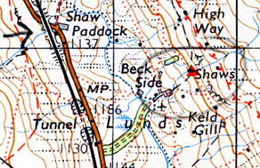
I’ve just looked at the handbook and to my horror it’s got SJP marked for Garsdale YH which is really ridiculous as its only got 30 beds. (YHA Handbook of youth hostel details; SJP = School Journey Parties). If I can’t get in, Keld the next hostel, is closed on Thursdays. That could be a bugger. But for now it’s beautifully warm and a view of the hills and typical Dales stone walls running across them. And the sound of a trickling water, tufts of cotton grass and skylarks singing somewhere above me.
Garsdale Head 11.20 am. It’s very quiet and warm here. Sitting on the turf by a small tarmaced road. An old man walking up from small Post Office on the main road, walking up to the cottages by the deserted station – his walking cane tapping on the road as he takes each step. Occasionally a slight whine from the telegraph wires behind and above me, a cow mooing in a field somewhere, hills all around, green, fawn, and now a curlew singing.

Above Garsdale on other side of main road 1.35 pm? My watch keeps stopping and I’ve got no idea at all of the time. Last time I was in Garsdale was December 1963, and when I arrived at the youth hostel I went in the warden’s door into his private quarters, by mistake. Back of my mind I’m a bit worried about getting a bed tonight. I’ve been sitting here for an hour, I think. Eating, smoking and reading the SHYA handbook (SYHA: Scottish Youth Hostels Association). Also been watching the trains passing below me – goods train, an express and a local steam train pulling three coaches. Now to move on.
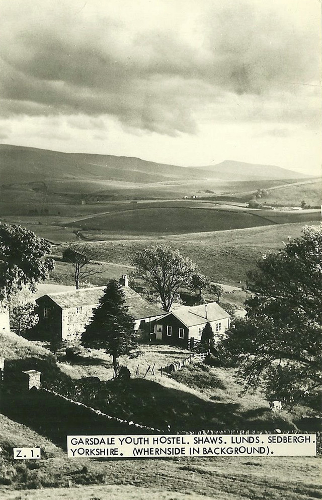
Possibly 3.35 pm. On White Birks Common, looking across to the YH. From Grisdale Head made for Grisdale Beck along the dale of Grisdale. It’s one of those small forgotten dales – a few farms, some derelict and barns, and cottages. A rough made road, disintegrating into a stony track and start to follow it up the hillside. Stop and sit on a tree trunk. Young bloke comes along with black cows and two dogs and one puppy. One of the dogs has only got three paws. The bloke told me a weasel got the fourth paw. We talked for a bit and he had the time, it was 2.35 pm. He walks on with the cows and dogs and puppy. The sun’s still out and I roll an Old Holburn – couldn’t get any A1 in Ingleton.

Continue to a barn called Flust and then steep sweaty gasping wheezing climb up the hill onto the brow. My cape spread (ground boggy), sitting on it and the valley below me, YH up on the other side and the railway below me. More trains, a diesel goods just then.

_________________________
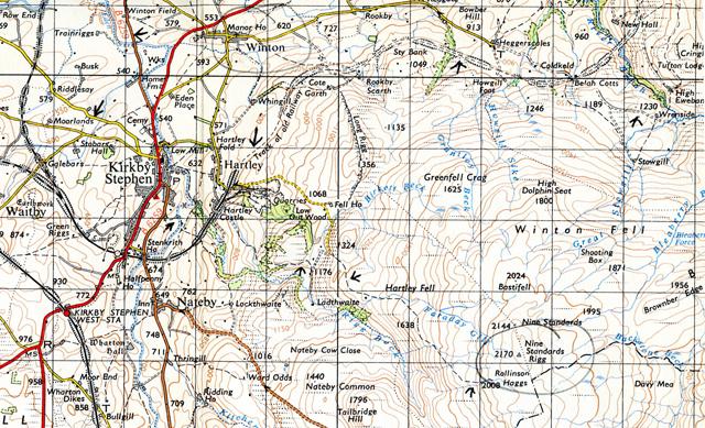
April 23, Friday. On path to Nine Standards Rigg, 2170′.
When I got to the YH I found out it was 5.30pm, had been open half an hour AND that it was FULL. Same warden as 1963 and looked as if he was still wearing the same pullover as last time. And it was the same party of school girls and their teacher, who were at Ingleton YH who had filled the place up. Bloody hell. But when I left not feeling too bitter or angry.
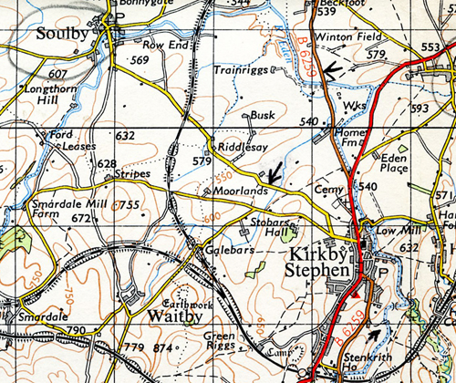
So forced walk north to Kirkby Stephen along the B road, no traffic on it, and going along the Eden valley, quite pleasant. Arrived at hostel at 8.30 pm.

Booked in at the warden’s house – no resident warden. Went to the hostel, three quarter’s full. Three nice looking girl cyclists amongst them. Small nice hostel in the high street, rest of the building belongs to the Quakers. Kirkby Stephen is in Westmoreland – different scenery, less of the Dales, more wide fertile valleys and twisted crag hills.
Nine Standard Rigg 2170′. Dinnertime (for me anyway). I write dinnertime but watch still playing up, so clue what the time really is. Overcast, a bit of a breeze, clear view of hills in the distance. Nine Standard Rigg is a flat plateau top. A lot of peat bog reaching the summit. Apart from the bog an easy ascent.
Later. Marvellous view up here of humpy green plain below, wooded, cultivated, rich green fields, some ploughed, reddish coloured earth, and to the right mountains rising up. And in the distance to the left more mountains.. I don’t know why it looks so great, it should be familiar, but it isn’t. Like nothing I’ve seen in the Pennines or in Central Wales. What I’m looking at is a green fertile lived in land but not industrialised, surrounded by hills and mountains.
So descend from Nine Standard Rigg, passing Nine Standards – high pyramid cairns about 4′ high, the middle one about 8′ in a straight line. I wonder who built them.

Later. Near Winton, on the common near Kirby, looking at the plain and hills which rise steeply from it and the extraordinary thing is that it reminds me of Italy – mid Italy. That hot Saturday, that lift in the old bus, the village and ending up in Campobasso.
4.35 pm, Kirby Stephen. Back in Kirby, sitting on a light blue bench in the main street. Feel the sun on my face – after a cool day the sun’s come out and a definite blue sky. It’s a nice old market town, quiet, but I should imagine with all the cafes that abound it’s a throbbing metropolis of tourists during the summer.

Evening, sustained on tea and cream crackers and Wensleydale cheese. Until I went out to the fish shop and got fish and chips for 1/6 and an extra 8d portion of chips, which were alright. The three girl cyclists are here again tonight. Warden came in and lit a fire and later on a middle aged couple arrived, in their fifties.
_________________________
April 24, Saturday. Soulby, between 10 and 11 am.
Last night the middle aged bloke of the couple talked to me – talked a lot – at times too much – but I admire him. Factory worker, hostelling at 58, been hostelling for 20 years with his wife. I’d like to think I’d still be as active at 58.
Claimed a jar of left-over strawberry jam in the self-cookers before I left this morning to find the P.O. Sent maps back to Billericay. A pleasant walk in the sun to Soulby. Sitting on a bench. Sounds of hens and sparrows in the guttering of a farm, built of a grey yellow stone. A small collection of cottages in the very, very green plain and a stream flowing gently through. A dog’s barking somewhere.

Kirby Stephen YH evening. After Soulby, a big surprise: walked to Warcop across green fields and from Warcop on to the A66 (T), walk down it 20 yards and then turn off on to minor road and Moor House.

But then – wah-hey! and to my annoyance, I walk into a W.D Shelling Range (W.D. = War Department) which is not marked on the map, even though it is a 1964 revision. My planned route goes straight across it.

Red flags flying and a notice saying you walk in here at your own risk, so I do, waiting for a shell to blow me to bits.

There’s a jeep and trailer parked and a large tent and I keep walking to the wood on the slope.
There’s tank tracks everywhere, going over ditches, smashing through walls, and discarded shell cases all over the place. And by the wood two burnt out tanks, the turrets and the guns on the grass, the metal twisted and warped – and all at my expense as a tax payer and that gets me annoyed. A big playground for the army, playing at soldiers with the real thing – live shells. There’s a white board on a trolley and the trolley’s on a track – practice for shooting at a moving target, I guess. All is quiet, no firing and I continue, nearly at the wood. Get to it and through it, up the hillside and onto the track, the limestone scar above me. Stop for lunch. No activity below, no one to be seen.
After a cig continue – the zig zag track leads up to a disused mine, and there are wild looking ponies – pit ponies gone wild? on the hillside. Black velvet coats with tails that reach down to the ground, mane’s fantastically long – long strands that fall down their sides and over their eyes, the wind blowing it into their eyes, and they constantly flicking their heads to get rid of it, and their legs down by their hooves more long hair. Beautiful looking ponies. (They were in fact Fell Ponies, native to the fells of Cumberland, Westmoreland and Northumberland.)

Up here on the scarp slope – a perfect example of a scarp slope, because when you get up here it dips away, and then rises in the distance.
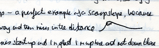
Follow along the scarp and hear batteries open up below and glad I’m up here and not down there. Have to change my route back because it goes through the shelling range and there’s now a lot activity down there. Decide it’s safe to descend through Helbeck Wood, near Fox Tower, a limestone tower.
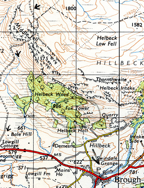

Keep descending through the wood – a lot of primroses – into the fields to Brough. Old town, partially spoilt by the trunk road going through it and catering for tourist traffic. Brough and a boring 4½ mile walk back to Kirby Stephen. Hostel’s quiet tonight just me and three teacher training girls. Have a chat. And I’ve got a stiff walk to Langden Beck tomorrow. May not get in, we’ll see.
_____________________
Walking to Scotland 1965
Next
Part 4: Northumberland, Hadrian’s Wall & Penrith.

__________________________