
Walking to Scotland 1965
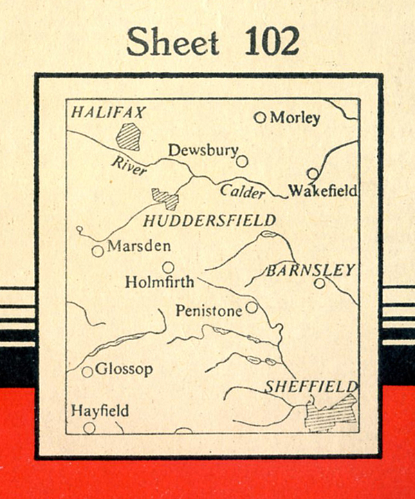
2: England, the Peak District and into the West Riding.
The Story So Far…. In Part One A nineteen year old Le Patron has walked from the Forest of Dean in Gloucestershire in the south west of England, through the rolling hills of mid Wales and then on to the jaggy mountains of north Wales. He started his journey on March 22, 1965. On his seventeenth day he has hitched-hiked from the Idwell Cottage youth hostel in north Wales to Chester in England. With the schools breaking up for Easter he is getting concerned that many of the youth hostels will be fully booked. His destination is the English Peak District, but on April 8, 1965, his overnight night stop will be in the Chester youth hostel. He’s had a sit-in fish and chips in a Chester fish and chip shop where three lads were reading Merseybeat. He earlier noted that the moat by the Chester Old Wall was full of filth and oil. He’s now sitting in the main Public Library, waiting for the youth hostel to open at 5 p.m.
_____________________________
April 8. Thursday. Chester Public Library. 2.10 p.m.
It’s raining, so into the Public Library.
4 pm. Still here. There’s a lot of down and outs sitting or sleeping in here.
Chester YH Common Room. 8 pm. Chester YH Common Room is a CRAPHOLE, one big craphole, as is the whole hostel. So left the library and walked to the hostel in Hough Green road. Not quite open, another five minutes. There’s about 10 people, mostly girls, sitting, waiting, on the steps outside, a transistor (radio) going. Get in. It’s an old hotel, I think. It’s crappy, messy, big and cold. Down in the self cookers – God – everyone nervously glancing at everyone else, strained/restrained. I felt like saying FOR FUCK’S SAKE LET’S BREAK THIS UP, but we all went on being careful, apologetic smiles, and people trying to eat making as least noise as possible. So now this Common Room – there’s two girls playing table tennis and two old people, and an impossible young American who’s capable of unspeakably boring conversation talking to a cyclist bloke who looks half dead.
________________________________
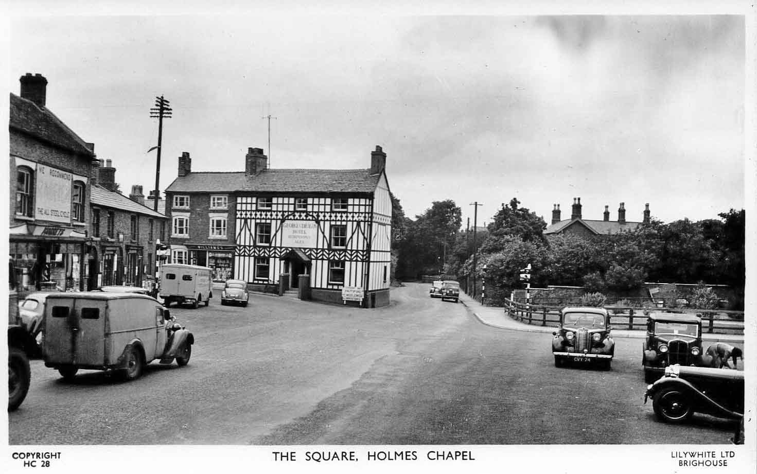
April 9. Friday. Around 1 pm near Holmes Chapel.

Left Chester YH and the talkative American behind at 10 am, heading for Holmes Chapel. Walk to the outskirts of Chester and start to hitch. It’s beginning to rain heavily. Quite a lot of traffic, but with the rain nothing stops until a shagged out Mini van and bloke going to Winsford takes me part of the way, dropping me off at the road for Nantwich.

But consulting my map I realise I should also make for Winsford. Never mind. Into Winsford in a Cortina driven by a Dick Emery type pansy – packet of Benson and Hedges Silk Cut cigs in the front – everything very smooth – watch – ring, etc.

Winsford, small town, loads of school kids. The rain’s going off. The accent around here is getting stronger – sort of Coronation Street accent. Cheshire Plain’s crappy. Winsford to Middlewich lift from a woman – yes, a woman. First woman driver who has picked me up in this country. Son’s a hosteller. She’s driving a NSU Prinz. Nippy cars.

I get dropped off the other side of Middlewich on a main road with no traffic by a field where two blokes are banging poles in for some horse show on Saturday. Still no traffic so walk along the road, cross the M6, look down on it – cars, trucks belting along. (The M6 in Cheshire had opened to traffic 17 months before Le Patron was looking down on it, in November 1963.)

I walk into Holmes Chapel. Buy two Knorr sauce mixes and go into a fish and chip shop and after a wait in the queue along with building site workers get a fish cake and chips for 1/2. (approx. 5½ p.)
3.15 pm and I’m about half a mile from Windgather YH. I’m sitting protected by a limestone wall on a country road, bit of drizzle and I’m wondering what my chances are of getting into Windgather YH tonight.
Anyway, to recap: Holmes Chapel – Sit on a bench in the centre, near the bogs, and eat – and have a smoke. Ask two postman which way for the Macclesfield Road. Buy some rum and raison toffees and get on it. Half heartedly hitch, chewing away on my toffees – they were good – and a big Austin stops. The driver – looks like a headmaster – tells me about his son who goes hostelling, and spent a year working before going to University. Drops me at Chelford for the road to Macclesfield and it’s starting to rain again. Dormobile stops – two youngish blokes going to Buxton.


Sit in the back of the Dormobile, on the floor. Bumpy fast ride into the Peaks through Macclesfield and the rain’s really heavy now. The Peaks, not too impressed. Admittedly this isn’t a good part of them – low moorland. Dropped off in Buxton. A pretty rich looking place – Victorian?
Meet a few other hostellers who tell me Buxton and Castleton are booked up. Buy some bread and milk and sit on a wall, rain’s gone off, looking at the shop front of W.H.Smith’s across the road. Then get on the Stockport road, steep road out of Buxton and an artic with trailer stops and takes me to Whaley Bridge. Start walking to Kettleshume and bloke coming out of a drive delivering swiss rolls to Kettleshume P.O. takes me there. The P.O. is a small tidy cosy well equipped little shop and bought a bar of chocolate. Walk out of Kettleshume to where I’m sitting now, sheltering by this limestone wall, about half a mile from the YH.
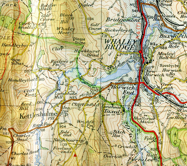
7.30 pm. Windgather YH To my surprise the hostel is almost empty. Just me and 4 girls here tonight.
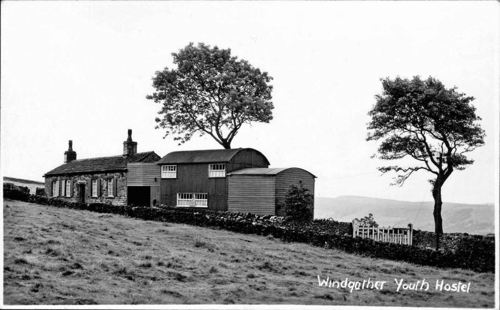
It’s a small friendly place, women warden. The self cookers are outside the main building, where I cooked a meal of spaghetti bolognese. Nice common room/dining room – dark warm panelled wood – looks like the interior of a log cabin.
_____________________________
April 10. Saturday. Around 11 am. On the road from Kettleshulme to Oldgate Nick
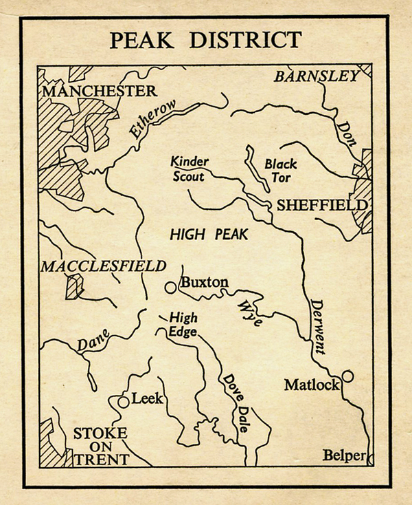
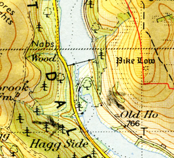
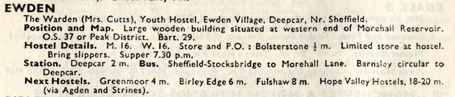
Last night the rain and wind beat against the hostel but in the morning it looked promising and the sun came out, and stayed out. After a breakfast of cornflakes, grapefruit, bread and marmalade (bought last night from the YH stores) and coffee I went down to Kettleshulme P.O. and cashed some money and bought some provisions. One thing I must try while I’m in the Peaks is the pancakes – big ones, like you get on Pancake Day- that I’ve seen in some of the shops. But, I’ve been thinking about hitching up to Scotland for the rest of April/May, as I’ll be able to get in easy at the hostels up there, and stay a week at a lot hostels. I’ll ring up Ewden and see how he’s booked. It depends. Buxton, Castleton, Edale are booked solid. So, on this pleasant road making for Oldgate Nick.

Neat limestone walls and a view of desiccated plateau – mild, nothing outstanding, but pleasant – and the wind’s blowing and the sun’s shining and I feel good and I’m whistling. Yes, for the moment, this is the life.
Dinner time, on Shining Tor 1864′. Eating a packet of Royal Scot biscuits, sitting on Shining Tor. Yes, moorland, dissected by valleys – nothing staggering or outstanding, pleasant but not a region to stay in for too long. Can’t really understand why hostels in the region should be booked up, unless it’s all SJP’s (School Journey Parties). I passed a massive army of them – about 40, scrambling along the ridge, laughing, giggling, with their masters. Or maybe because there’s Manchester on one side and Sheffield on the other there’s not enough countryside to go round for folk. A bit of peat up here.
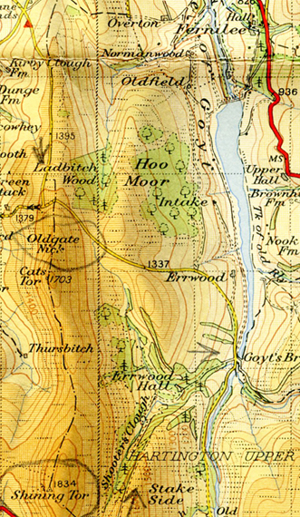
Afternoon near Fernilee Reservoir. Shortly after lunch it started to rain and for an hour I took shelter behind a wall and kept dry as it threw it down. There was a sheep about 10 yards further along the wall also taking shelter. So I sat there singing, whistling, eating chocolate, smoking a cig and watching the low cloud belt along in the wind. Occasionally it cleared and glimpses of the hillside opposite. Then the rain suddenly stopped and I set off again, descending to near this reservoir where it looks as if they’re making an extension, blue huts on the hillside, cranes, diggers, uprooted trees and smashed down walls. A mess. (The “Extension” was to be Errwood Reservoir, opened in 1967. Like Fernilee Reservoir it supplies water to Stockport and its surrounding area.)

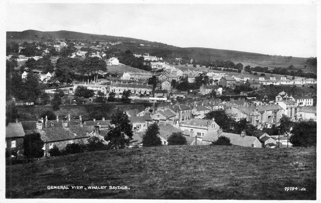
4.15 Hawkhurst Head near Whaley Bridge. Walked along the reservoir on the left hand side and followed path into Whaley Bridge following two other hikers in front of me. Walk down to the Co-op. It’s closed. Peculiar place. It’s quiet – all the shops seem to be Co-op, and all closed on this Saturday afternoon. Find a small independent shop and buy a Vesta Beef Curry but they had none of those big flat pancakes. Walked out of Whaley Bridge past the station, up the hill and the road looks down over the town and a lot of expensive looking houses, and modern houses down there.
Continue walking, past a small sand/gravel pit, and now here at Hawkhurst Head. Rolling hills and farms.
Evening. The YH, Windgather Cottage. Bit of thunder and rain outside just now. Tonight, compared with last night, the place is almost full to capacity – party of Girl Guides in civilian clothes. Before the rain started I went down and phoned up Ewden hostel – cost 1/- (5 p) – and I’m in for tomorrow night provided I can get there for 7.30 pm. Difficult to get to from here – it’ll be a mixture of hitching/bus-ing/walking. We’ll see.
_______________________
April 11. Sunday. Ewden youth hostel, evening.
To recap on the day. Left Windgather Cottage YH around 9.30 and tried hitch-hiking from Whaley Bridge, but no go – few cars being a Sunday, and those that were passing through full of sightseers. Just when I thought I would have to get a bus to Buxton a Cortina stops, a young couple going to Edale, bloke wearing anorak. And so Edale.
Edale was like a hikers centre – hundreds of the buggers. Shop open. Buy two packets of dates, and then get on the track to Nether Booth, near, but not quite, Edale YH.


Follow path down to Woodlands valley and it starts to hail heavily. Cross River Ashop by the ford and I’m getting wet from the hail so shelter in a barn.

The hail goes off so on again – along the A57 and then climbing up and then dropping down to Ladybower Reservoir following a stream through Forestry Commission. Very steep and slippery, me slipping and falling before getting to the road by the reservoir.
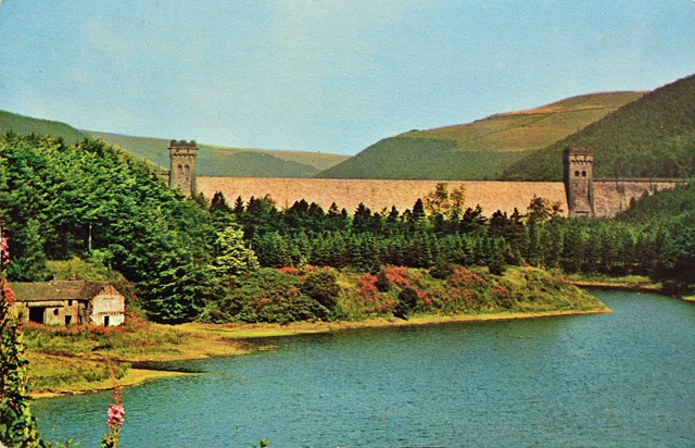
There’s a dam across the reservoir with two towers and water spills down it – white. There’s sightseers, an ice cream van. Kid dropped a cone and mother throws it over the wall. Cross the reservoir by the road and on the other side have dates, cig, etc and then follow road on this side of reservoir and then ascend and follow Abbey Brook – very reminiscent of the Yorkshire Dales – very steep sided small valley and at the top come across what’s marked on the map as ‘shooting cabin’.

Dilapidated wooden cabin – hundreds of scrawlings inside – and of all things a YS symbol (Labour Party Young Socialists) besides CND (Campaign for Nuclear Disarmament) symbols, plus naked women.
![]()
![]()
Continue following a plateau like top, nearly all peat bog and peat erosion.

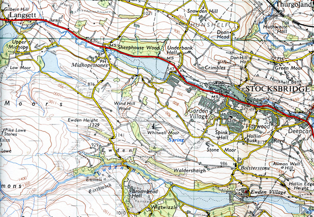
4.10 pm near Ewden. Cold, cold wind blowing. Came off the plateau to fields, and being barked at by a dog and played around with bullocks – like a bull fight. One bullock kept coming at me, I’d shout back, wave my arm, and it would keep coming, ducking its head, and then shear off to the side – I was enjoying myself. Climbing over the fence, turned around and gave the bullock the V sign.
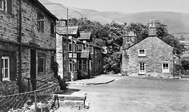
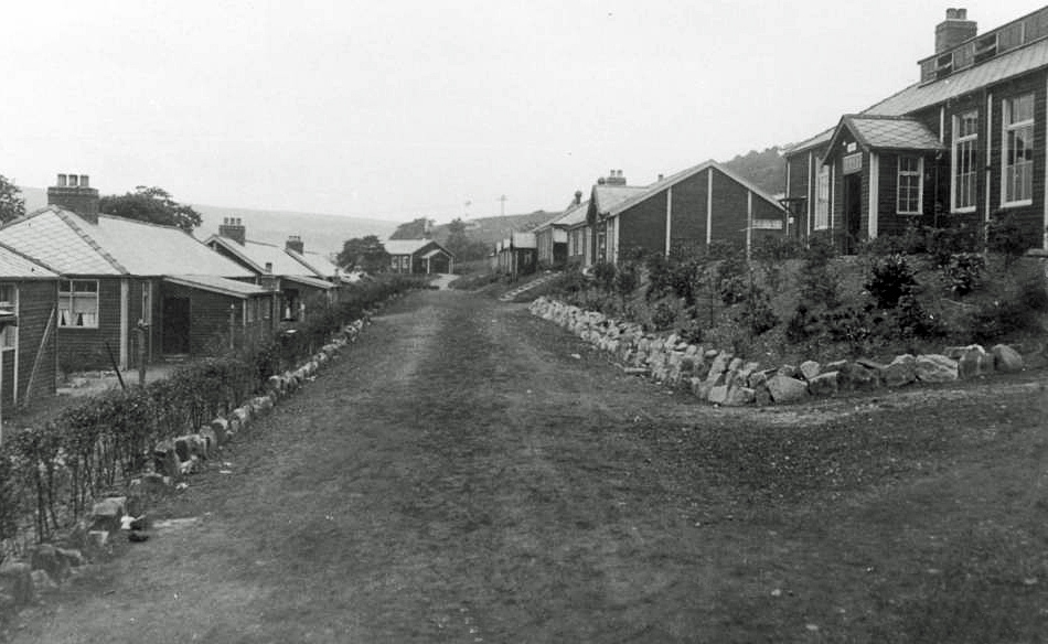
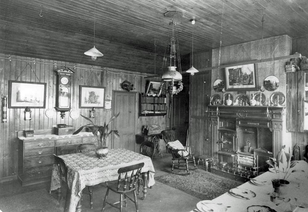
7.30 pm. Ewden Youth Hostel common room. To pick up to where I left off – walked into Ewden, a craphole of wooden houses, all looking the same. Had trouble finding which one was the YH as all the houses look the same.

Four art school type girls here tonight, plus three blokes who said they were at Idwell when I was there. (Idwell, Snowdonia, on April 7, four days before.) Strange, didn’t remember them.
_____________
(“Ewden Village… During the early 20th century a timber built village was constructed, to house workers working on the Morehall and Broomhead reservoirs. The village was completed in 1929. By 1969 only 15 of over 70 buildings were occupied, and by the 21st century the village was practically abandoned. By 2008 a single worker’s cottage remained from the original navvy village.” – Wikipedia entry, with grateful acknowledgement.
The Broomhead and Morehill reservoirs were built for water supply to Sheffield and were completed in 1929. Ewden Village in its day (1914 – 1929, and into the 1930s) was far from being a “craphole”. The village houses, church, social club and village store were built by the Sheffield Corporation Waterworks Dept., for the workers and their families employed in building the reservoirs. The photographs displayed here were commissioned by William Terrey, General Manager of the Sheffield Corporation Waterworks Department. This information, and photos above and below are courtesy of the Stocksbridge & District History Society and are found on their website: stocksbridgehs.co.uk)


_____________________
10.15 p.m. About nine-ish the warden showed us some colour slides he’d taken, including Joe Brown climbing the over hang on Kilnsey Crag in Wharfedale.


Not bad. After warden went the four girls, three boys and me chatted, and now to bed.
_____________________________
April 12, Monday. Holmfirth YH. 7.30 pm

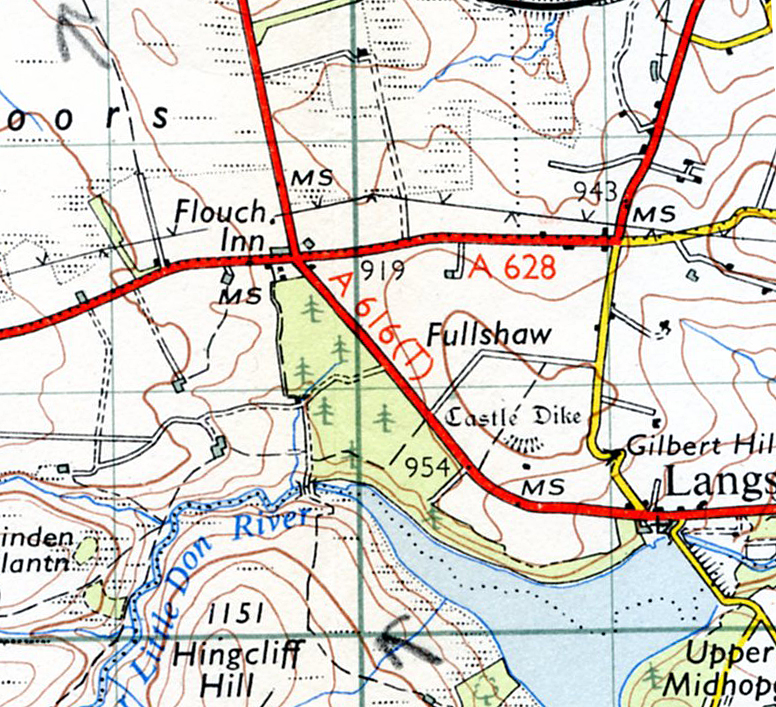
A blustery, wet day of April showers, heavy showers. Left the hostel at 10 o’ clock and it pisses down almost straight away as I climb out of Ewden Valley and along to Bolsterstone where I got into the Coop and buy date bar.
Then along country road and then track and view of Stocksbridge over to my right. Rain turns to driving hail, shelter behind a wall, keeping more or less dry. Drop down into Midhopestones and walk to Upper Midhope and Longsett Reservoir. Upper Midhope is a peculiar collection of farms, and then down to the reservoir. Big notices saying don’t pollute the water, and don’t start a fire.

Continue along track/path until I cross a stone bridge at the end of the reservoir, and ascend, past a farm and boisterous sheep after me. Come onto the main road – A628 and cross it, near Moor Transport and Commercial Cafe – heavy lorries going between Manchester and Sheffield.
(The Moor Transport and Commercial no longer exists. Writing in Truck Net UK, on the ‘Old Cafes’ forum, Fodenway wrote: “…Closed years ago was the Moor Cafe just west of the old Flouch crossroads on the A628 Woodhead road. The derelict building is still there, gradually crumbling into the undergrowth and unseen from the re-aligned main road” – Forum entry of October 15, 2009. With grateful acknowledgement to Truck Net UK and Fodenway.)
Follow a path to Carlecotes, then B6106, then turn off and follow more tracks eventually into Holmfirth. Holmfirth built of black grimed sand coloured stone. It’s in a valley, narrow steep streets down into the town. Real old sort of mill town with little shops, Park Drive cigs.


Down into the town and do some shopping and start making for the hostel and starts to rain heavily. Shelter in a derelict house for a while. Then continue, it’s a hard slog.
It’s a nice hostel, warm common room, but four 13 year old Nottingham yobs spoiling it, arsing about.
______________________________
April 13, Tuesday. Holmfirth YH 7.15 pm
First of all, cooked myself a bloody awful tea earlier, and ate it. Theoretically hamburger, egg and chips – only it was all fat and no salt and I spilt half the fat over the table in the self cookers – one bloody mess and hell trying to clear it up. And those Nottingham yobs here again, and they were doing chips and made an even worse mess – fat everywhere, blocking the sink up with it and putting dirty dishes and cutlery back, and I felt down. Last time I try frying when hosteling – they just don’t have the right equipment – all their frying pans are too thin, and often buckled. So, it was a bad end to an expensive day – spent 27/-. (£1.35p)

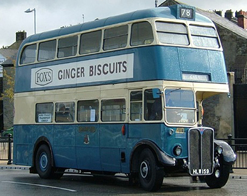
Left hostel nine-ish and walked down to Holmfirth, red double decker Huddersfield bus passes me, run for it, jump on as it waits at the bus stop.

Youngish clippie – small black mop of hair – patched up great-coat, old ticket puncher, leather money bag – a little make up and she had a funny sort of face – a sort of Yorkshire Edith Piaf. I liked her. Huddersfield. Get off and walked down to where Bradford buses go. A blue and cream Bradford Corporation double decker comes. West Indian driver, Pakistani conductor. Get in and we’re off to Bradford.
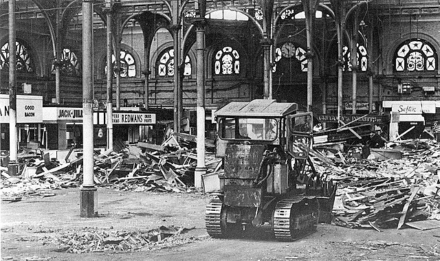
Don’t recognise anything as we get near Bradford until we hit Manchester Road – those old junk shops Pete and I went round. And the garage with the girl in black tights I watched in the pouring rain the first day I was in Bradford (October, 1963.). And the old shops and bomb sites behind where we took the photographs. (Bradford was bombed August 1940 and March 1941, but damage was not that heavy. “Bomb site” was often a term used to describe land where houses had been demolished by the local council, as part of ‘slum clearance’, pending new building.)


They’ve built a load of five storey deathless flats there now. And so into the centre and Kirkgate and hop off the bus. More new buildings. Into the bogs on the island – surrounded by road. And then to Smith’s to get OS 95 (Blackburn & Burnley), and have a general look round. Over to Kirkgate Market, through it and into that bakery as you come out and two long buns – now 4d. instead of the 3d in 1963.
Then up Manningham Lane, making for Norm’s cafe. On the way go up Eldon Place to see No.8 (Le Patron rented a room there, as did a lot of Irish labourers). Still the same, even the same curtains up there in the room, red patterned things, and so along to Norm’s – BUT – big disappointment. No Norm’s, instead an Italian coffee bar. Yes, BIG DISAPPOINTMENT. Go in and no proper cooked meals like two veg, or steamed pudding and custard. Go in and have a coffee. No one else in the cafe – I should think he’ll be going bankrupt at this rate. (Norm’s Cafe, Manningham Lane was a busy little cafe that did a lunch-time “Mains” and “Afters” for 2/6d (12½p). In the autumn of 1963 Freddy & The Dreamers You Were Made For Me seemed to be the most popular tune on the juke box.)
Come out and across the road I see that bloke who put me up for 12/6d in that workers lodging house first night I was in Bradford – still wearing the same beret. Then back down Manningham Lane, went into Forster Square station – exactly the same – dense smell of train smoke – choking.

Then into Fine Fare via the subway which they were building when I was here. Buy sugar and Kellogs. More walking around and then back to bus stop.
On Huddersfield bus back to Holmfirth thinking about cycling to Israel. Thinking about it so much that I nearly went past the stop. Holmfirth 3 o’ clock, writing postcards I’d bought in Bradford for six people, post them and then walking back to hostel.
________________________
April 14, Wednesday. 10.25. Hey Clough.

Sitting behind a stone wall, beck descending in front of me, reminiscent of Dales – well, it is the West Riding. Overcast day, slight rain now and then. Followed a track past several deserted farms, one with a stone front door lintel engraved ‘1782’ on it. Sheep baa-ing – they seem bigger and dirtier coloured sheep than the ones I saw in Wales. I’m walking along thinking of spending Christmas in a tent in the hills somewhere.
8 pm, Holmfirth YH. After I wrote the above it really started to rain and it didn’t stop for the rest of the day. I followed Hey Clough part of the way and then climbed the steep valley slope and up on to the top – a lot of peat bog, peat erosion – peat rivers, peat beds, great banks of them – like a mammoth river bed during the dry season. Rain getting heavier and trying to find Black Hill.

Found it but didn’t stay long and start descent following the cairns – low cloud. After a while I lose the path, but keep going down to Heyden Brook and coming out near Woodlhead Reservoir. Follow path to Greenfield, past Highstone Rocks, valley below me. Start descending but realise something is wrong. Instead of Chew Reservoir there’s a broad stream flowing towards me. I’ve taken a wrong footpath in the low cloud.

I’m following this stream and getting worried. Use compass, keep heading north then come on (as I guessed) Holme Clough. To be on the safe side – cloud is very, very low, I follow it down and a steep dodgy descent to the reservoir, along it, up the hillside past the trees, and man, was I glad to hit the main road. First car I hitch stops and we drive through mist, his wipers going, and he drops me off at the youth hostel. It’s 6 pm and I’m soaked and my jeans and anorak are covered in mud/peat after slipping down a bank coming down Holme Clough. Change into my shorts and hang my stuff into the not very warm drying room.
I’m the only one here tonight, and make myself a reasonable, yes reasonable meal. Incidentally, the warden is a screwy, zany woman, with an ex-boxing manager looking husband and secretarial looking daughter called Christine, who was about to go off to Switzerland and warden was excited about it.
________________________
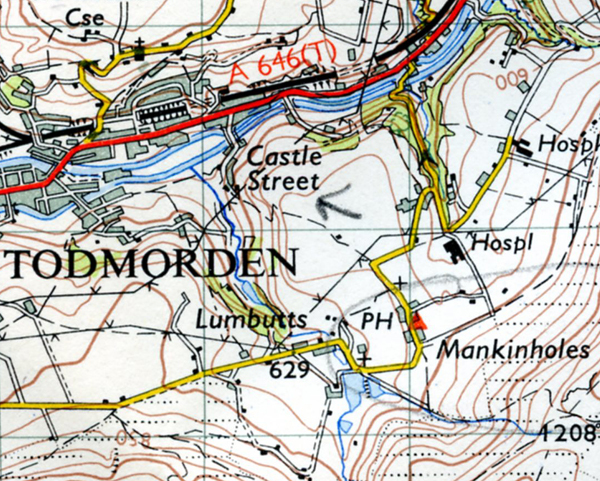
April 15, Mankinholes YH. Evening

Mankinholes is a bloody great hostel – one of the best I’ve been in for a long time: warm, friendly, cosy common room, decent kitchen, really hot water and a tinder dry drying room. After a meal of spaghetti – Knorr Tomato sauce mix and English Cheddar cheese, which was good and tasty, I washed a load of my clothes and stuck them in the drying room.

But the rest of the day: left Holmfirth hostel with mixed feelings about this Walk – damp, dirty and smelly, me smelly, anorak falling to pieces and jeans dirty from yesterday’s slide in the mud and rucksack filthy from the mud and clothes still damp. Walk down into Holmfirth. It’s grey and drizzling and smell of coal smoke. Useless hitching so got bus to Huddersfield. Try and buy OS 77 (Northumberland) but no go. Start along Halifax road. See a shop and nip in and buy spaghetti, sauce mix, Vesta Veg curry. Started hitching and get a lift to Elland from bloke wearing hat – tubby bloke in a Mini.

Elland – walk to Greetland. Towns huddled in the valleys. Smokey, black grimed mill towns with the moors up above. Walk to Greetland past a dead looking mill, but hear them inside the canteen. It’s 12.30. A few young mill girls pass me eating fish and chips and a Pakistani stands near the mill rolling a cig.
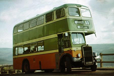
A steep walk out of Greetland. Over on the other side, a factory. Three white coated apprentices chasing each other – one falls, gets up slowly. The game’s over. I continue walking along the road. Halifax Corporation buses pass me – great vulgar colour combination – cream, orange and lime green. (Glasgow buses had a similar livery.)
I’m now on the B road going to Ripponden, climbing, turn off to the right onto a moor road. A view of Halifax in the valley. Big dark chimneys. Walk through a group of cottages. Everywhere the stone is grimy black and the white cement pointing contrasts unpleasantly. Onwards and a steep descent down into Sowerby Bridge. Kids playing in one of the streets, kicking the ball against a wall, bounce off, kick it back. Sowerby Bridge another mill town. Stop on a bridge and look down at the stream. Filthy. From outlets a blue detergent comes, and from others, steam. From another a milky coloured liquid is dribbling into it. Absolutely filthy.
A steep walk out of Sowerby Bridge up to Sowerby, now looking down on the valley and even though it’s overcast I’m beginning to feel good. Despite the gradient I’m belting up it, almost as if I’m going to take off. Feeling really good. Sowerby is crumbled down black grimed houses and two Victorian churches.
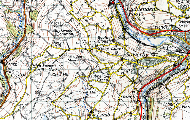
Through Sowerby up to Steep Lane, still striding along, thinking of a maroon 2CV Citreon and a cottage somewhere in Steep Lane, over-looking the industrialised valleys. Stop to have a cig and a girl turns up, with young brother who looks at me, and then hides behind his sister’s coat. The sister asks me if there’s a bus due – don’t know – and by now I feel great. Fuck the smell, the dampness, the filth, I feel overwhelmingly good and satisfied.
Steep Lane down into Cragg, pass a farm, there’s a dead pig, small one, in the silage. Cragg could be a beautiful place with a clean up but spoiled by made up roads of ash and jerry built huts, in a valley with a second valley coming into it.

Walk up the short valley to Withens Clough reservoir. Two workers pass me, presume Water Board, going down to Cragg. One old, one young, the young one’s got a transistor (radio) going. Donkey jackets and ex-WD gas mask bags for their sandwiches, etc.
Slight drizzle as I drop down to Mankinholes and the hostel. Two young girls there and later a Scottish couple – bloke got an unpleasant sour face – and a bloke from Manchester. Me and the bloke from Manchester went to the pub – chic expensive type place. In one room a fire, and a tubby wearing glasses bloke and his mate are playing a banjo and sax. Back to the hostel, write this as the two girls play chess and soon to bed. Staying here tomorrow as Slaidburn booked up.
_________________________
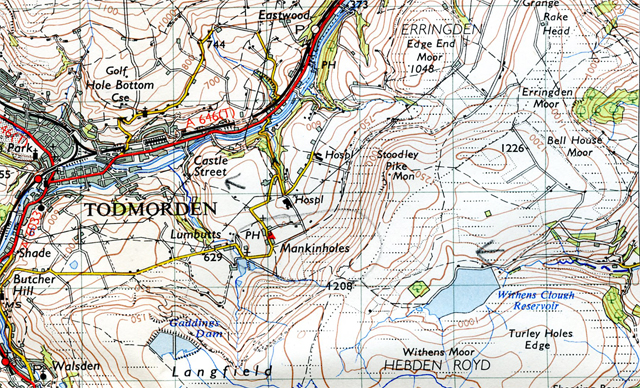
April 16, Good Friday. Todmorden.

Went down into Todmorden earlier, when I left the youth hostel. Another grimy town in a valley, people in their best clothes – Good Friday. Nip into a bakers and bought two Hot Cross Buns – only they were cold and tasted if they were baked a week ago. Out of Todmorden past the railway station and into Centre Vale Park where I ate the hot cross buns.

11.45 am on Heald Moor Smoking a cig. Been walking along to here singing loud. Rolling green moorland and hills and so far it’s keeping dry. Passed a small party of Scouts by a derelict small coal quarry way back. There’s a bird singing somewhere.
Cant Clough reservoir, 1.35 pm. So from a bird singing somewhere up to Thievely Pike 1474′ and then down into Holme Chapel, underneath railway bridge and onto the main road.

Stop to consult map, cross the main road and follow track to reservoir, passing a hill billy scrap farm on the way. Now for a cig.
Mankinholes YH 10 past 8 pm. From Cant Clough reservoir up, following the stream to the track and along. Quite a few others walking around and on the track – I guess because it’s the Easter weekend.
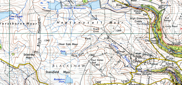
From the track down to Gorple reservoirs and from there down to Colden – a peculiar collection of farms, cottages and unmade roads. And eventually back to the hostel for 5.10 pm. After a meal I walk down to Todmorden – it’s starting to drizzle – over the canal and getting some change from a woman at a bus stop into a phone box, to ring Slaidburn and confirm that I am definitely in for tomorrow night. Yippee. I am. Walk back to a by now very crowded hostel.
_____________________________
Next
Part Three: The Forest of Bowland, The Yorkshire Dales & Westmoreland
_________________
