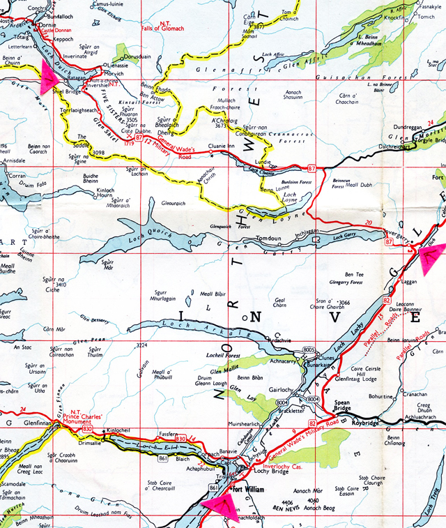
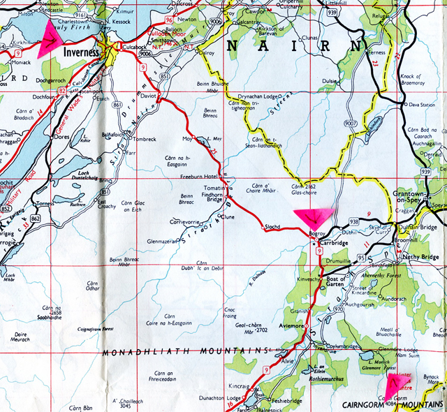
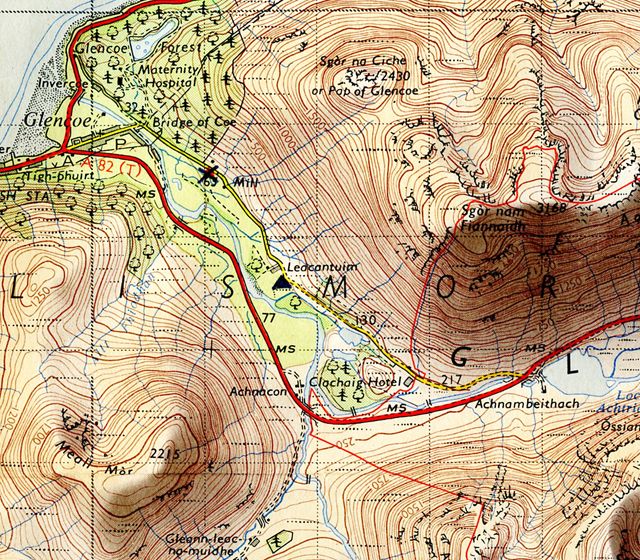
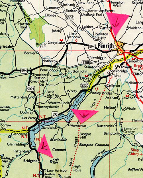
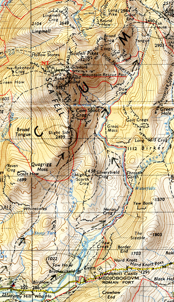
Man on a mobile, start of the working day for some. Abbesses Metro entrance, Montmartre, Paris 18e. November 18, 2009.Map of Paris 18 area. With grateful acknowledgement Le Petit Parisien/Editions L’Indispensable, Paris.Steps up to Rue Garreau, Paris 18, November 18, 2009.Two women, Jardin Burq, off Rue Garreau, Paris 18.Three women, Jardin Burq, off Rue Garreau, Paris 18.
I had three cameras with me. A pre-1939 camera for black and white, and two for colour, one of which could be slipped discretely into, and out of, a jacket pocket.
Reading the morning paper, Rue Garreau, Paris 18.Seeing, Rue Garreau, near Place E.Goudeau, Paris 18. Rue Garreau, Paris 18.Not seeing, Rue Garreau, Paris 18.Two women, three pigeons, Place E.Goudeau/Rue Garreau, Paris 18.November leaves, buildings, a woman, Place E.Goudeau, Paris 18Hugging a tree or something more sinister? Place E Goudeau, Paris 18.The morning baguette, Montmartre, Paris 18.
The morning started with the sun peeking through the grey clouds, but then settled down to being overcast, before perking up again in the late afternoon.
Escorted tourist group, rear of Sacre Coeur, Paris 18. November 18, 2009.
As I took this photo I did not notice the gentleman, off camera, to my right. In his sixties. He smiled as he glanced and then took a closer, admiring look at the camera. It was a bashed early 1930s Rolleicord I was holding.
The bashed early 1930s Rolleicord.
“A good camera”, he said, with almost a loving smile, before he continued to guide the tourist group around the sights/sites of Montmartre. Soon the camera was also to be admired in the Place de Torcy fish market.
The back of Sacre Coeur, November 18, 2009.The back of Sacre Coeur, summer, 2000. Amelie on a moped with her young man. Closing sequence from Amelie (Le Fabuleux Destin d’Amelie Poulain). Grateful acknowledgement Canal+, France 3 Cinema, UGC.The wall of Rue de la Bonne and a couple. Can love flourish here? To the rear of Sacre Coeur, Paris 18, November 18, 2009.The wall of Rue de la Bonne, to the rear of Sacre Couer, Paris 18.Tree invaded ruin, near Parc de la Turlure, Paris 18.Federation Anarchiste flyer: “A Bas Toutes Les Religions!” (Down with All Religions) Near Parc de la Turlure, Paris 18. November 18, 2009.Place Jean Gabin, Paris 18.“French actor Jean Gabin as an army deserter in a scene from the film ‘Quai des Brumes’ (US title: Port of Shadows), directed by Marcel Carne for Cine-Alliance. (Photo by Hulton Archive/Getty Images)” – source imdb.comTop left, Place Jean Gabin. Right, Rue Doudeauville. Grateful acknowledgement Le Petit Parisien/Editions L’Indispensable, Paris.Another morning baguette and a Mum with child in a push chair, and a hint of Autumn. Rue Doudeauville, November 18, Paris 18.Rue Doudeauville travelling east to the junction with Rue Marx Dormoy. The short Rue d’Oran runs patellel to it just to the north. Rue Leon travelling north intersects both. Paris 18.Wake Up, Dude. Rue Doudeauville, Paris 18. November 18, 2009.
As you walk east along Rue Doudeauville toward the junction with Rue Marx Dormoy there is a greater presence of Africans and Arab North Africans, mostly from the former French colonies, such as Algeria (Algérie)
“No Entry”, Rue d’Oran, and a woman. Paris 18.Halal Boucherie Du Rond Point, area of Rue Leon, November 18, 2009. Paris 18.Dar es Salam store, Rue Leon, Paris 18.The Gospel (Jereme Kinzanza) & The Beat (Luckson Padaud, Cote d’Ivorie). Rue Leon area, Paris 18.Restaurant Best Africa, Rue Leon area, Paris 18.Red, White & Blue. Rue Leon area, Paris 18.Rue Doudeauville crossing the tracks of the Gare de Nord approach. Grateful acknowledgement Le Petit Parisien/Editions L’Indispensable.Eurostar, Gare de Nord, Paris . Photo source Unknown.Overhead wires, approach to Gare de Nord, from Rue Doudeauville. Paris 18, November 18, 2009.Rue Doudwauville, looking toward the junction with Rue Marx Dormoy, Paris 18. November 18, 2009.
A group of young gypsy women with long brightly patterned cotton skirts were approaching me as I walked along the left-hand side of the bridge towards the junction with Rue Marx Dormoy. They were relaxed, perhaps moving from one touting/scam spot to another. I have good street radar and I knew instantly something was going to happen. In a blink of an eye I took in that they had no back up, and there was no-one behind me. And then it happened. They were all attractive and almost with a kind of contempt the one in the middle took a look at me and flicked her skirt up. Revealed at the top of her perfect legs was a magnificent triangle of black pubic hair. I instantly responded with a smile and “C’est tres jolie, madame”. There was a snooty flick of her head and they continued walking. No hassle.
A moment or two later, time to focus my Rolleicord: Rue Doudeville looking up towards Rue Marx Dormoy, Paris 18.
Indian Restaurant (right), Rue Marx Dormoy, at the junction with Rue Douudeauville, Paris 18. November 18, 2009. On Google Maps the Indian restaurant was still in business, May, 2019.
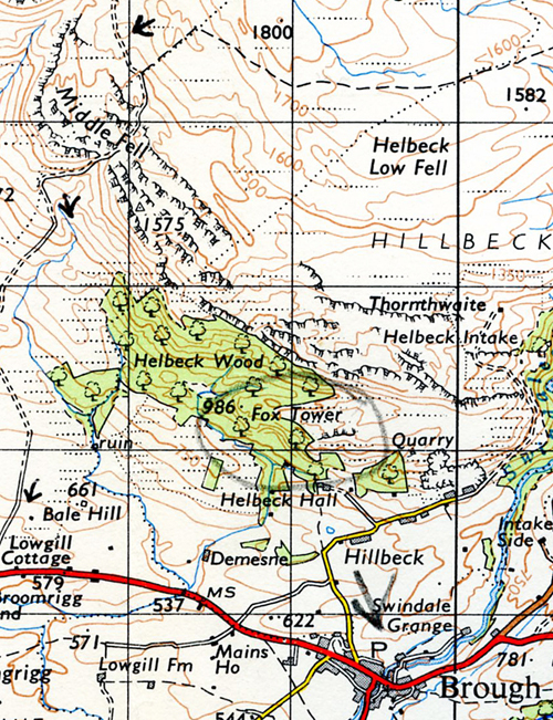
I was making my way north east to Place Herbert, where in 1957 the photographer Robert Doiseneau had taken his well known photograph Les Enfants de la Place Hebert.
Les Enfants de la Place Herbert, Robert Doisneau, 1957. Grateful acknowledgement The Estate of Robert Doisneau.Map of Place de Torcy & Place Herbert, Paris 18. Grateful acknowledgement Le Petit Parisien/Edition L’Indispensable.Place Tourcy, circa 1900. A hot day – note the open roof skylight and the clothes drying from the open windows. Liquers & Vins to wet the throat. Source unknown.Place de Tourcy and bus stop, Paris 18. May, 2019. Google Street view. Grateful acknowledgement Google. The Chapel and building to the left is still there. Everything has been demolished and rebuilt to the right.
On my way I came across an open air market in Place de Tourcy with a lot of fresh fish. Those in the market were predominantly Arab and African, buying and selling. From my past Parisian experience this crowded environment was not good for “candid” photos. My experience was that these groups were usually wary or hostile to photos being taken in their vicinity. However,in the happy celebration that was to erupt later that afternoon, wariness went out the window.
Whilst I was mulling over the pros and cons of of taking a photo, unseen to me a man, a white man, in his 80s had come up to me. Like the guide near Sacre Coure he had spotted the Rolleicord hanging around my neck. He was erect and his clothes were pressed. He had a quiet presence. “C’est tres bon”, and realising French wasn’t my native tounge asked me where I came from. “Ah, Scotland. I know Scotland I was there in 1945. I was in Perth. I had been asked to give talks to your Commandos by Tom Johnstone. I was in the French Resistance, you understand. I liked Scotland. Do you know Tom Johnstone?” Tom Johnstone had retired – two months before I was born in July 1945 – from being Secretary of State for Scotland in the wartime British Coalition Government led by Churchill. I said I knew of Tom Johnston. (1). He smiled and nodded, and after a parting fond look at the Rolleicord, we shook hands and went our separate ways.
Tom Johnston, during his time as Secretary of State for Scotland (1941 – 1945). Photo source Unknown.
I decided not to take a photograph in the Place de Tourcy market, but later wished I had taken a photo of the gentleman who had been in the Resistance..
It was a short walk from there, along Rue de l’Evangile, to Place Hebert and Cafe La Piscine. I’d been there two years before, give or take a month…
White mother and children, Cafe de Piscine, Place Herbert, Paris 18. January 8, 2008. This is a side view of the Cafe de Piscine. Part of the front – the entrance – which has a canopy, can be seen to the left.Arab woman and child, Cafe de Piscine, Place Hebert, Paris 18. January 8, 2008.Les Enfants de la Place Hebert, Robert Doisneau, 1947. Grateful acknowledgement The Estate of Robert Doisneau. The “Coiffeur” and the building is no longer there, replaced by a small single story corner shop. The Police Box has also gone.Place Herbert, Paris 18. November 18, 2009. The front canopy of the Cafe de Piscene is clearly seen. The street to its left is Rue de L’Evangile.
I’d had the Plat du Jour when I was there in 2008, and knew the Cafe had a lively and friendly atmosphere. So sitting inside on the Rue de L’Evangile side of the Cafe I enjoyed the craic, surrounded by locals having their mid-day meal, joshing with each other and the cafe staff. Eating my Crème Caramel I heard a quick blast on a trumpet outside, a happy blast. The meal finished, the pichet drunk, I sat outisde under the canopy with a fresh glass. Again there was a burst on a trumpet and a car went past with the player leaning out the window, and the driving grinning, and then beeping his horn. A wedding celebration?
A woman sat down at the table to my left. I noticed there was a head of a little dog peeking out of the top of her shopping bag, as she put it on the floor. She was joined by a male friend. I was checking my cameras, seeing how much film was left in each, and looking at the notes I had made of what I wanted to photograph near Rue de L’Evangile. At some point I looked up and the man gave a jerk of his head with a smiling hint of a frown as if to say “What are you doing?” I explained I was following in the footsteps of where Robert Doisneau, and others, took photos in the area. He kindly corrected my pronunciation of Doisneau – I didn’t realise the “s” wasn’t pronounced. I showed them the photocopies I had of Les Enfants de la Place Herbert, and Rene Jaques’ La Calvare with the gasometers in the background at the eastern end of Rue de l’Evangile. They told me the gasometers were gone. They told me that above the bar inside was a reproduction of Doisneau’s Les Enfants de Place Hebert. I had never noticed. Like nearly all Parisians of their age they knew their Doisneau’s, their Cartier Bresson’s, their Izis and their Willy Ronis’s. Parisians, old and young, queue patiently to see a major exhibition by any of these Masters.
La Calvare de La Rue de l’Evangile. photo Rene Jacques, Estate of Rene Jaques.
I asked if I could take their photo. “Bien sur”. The little camera in my pocket had a fast film loaded for poor light.
Cafe Piscine, Place Herbert, Madam Fouquet and a friend. November 18, 2009.Madame Fouquet and a friend, Cafe Piscine, Place Hebert, Paris 18. November 18, 2009.
I said I would send her the photos if she gave me an address, once they were developed. She gave me the address of the Cafe Piscine. (I sent the photos. Note: photografton no longer exists. See instead petegraftonphotos.com)
Time to move on, but I needed the toilet. Inside I looked up at the photo of Les Enfants de Place Hebert above the bar. La Patron followed my gaze. “Vous etes Le Patron?” – “Oui”. We shook hands and I went down to the squatter toilet in the basement.
Looking at my street map and the time I decided to skip going down to the very end of Rue de l’Evangile and started heading south making my way to Rue Marx Dormoy. As I almost got there, there was excitement down a one-way side street – flares were going off. Flags were being waved. Algerian flags. This was no wedding, it was a party, a celebration.
Algerie 1 – Egypte 0 celebrations, Rue Riquet, Paris 18. November 18, 2009.
Algerie 1 – Egypte 0 celebrations, Rue Riquet, Paris 18. November 18, 2009.
Algeria and Egypt were fierce football rivals. This was a make or break game played in the Sudan to decide which team would go forward to play in the World Cup.
Algerie 1 – Egypte 0 celebrations, Rue Marx Dormoy, Paris 18. November 18, 2009.
Rue Marx Dormoy, Boulevard de la Chappelle & Barbes Rochechouart Metro. Grateful acknowledgement Le Peitit Parisien/Editions l’Indispensable, Paris.Family group on pavement, Algerie – Egypt 0 celebrations, Boulevard de la Chapelle, Paris 18. November 18, 2009.Algerie 1 – Egypte 0 celebration, man in car smiling at the camera with Algerian flag, Boulevard de la Chappelle. Late afternoon, November 18, 2009.
Walking along Boulevard de la Chapelle towards the Barbes Rochechouart Metro area the light was fading and the crowds and the cars were increasing. Up a quiet dark side street on my right I noticed riot police, “at ease, by the side of parked police vehicles, ready, if necessary. (2)
Algerie 1 – Egypte 0 cleberations , police woman on pedestrian control duty near Barbes Rochechouart Metro. November 18, 2009.Looking back to where the police woman was on pedestrian control. Metro train above. Barbes Rochechouart. Small boy holding the Algerian flag with one hand, and with the other an adult. Barbes Rochechouart, November 18, 2009.
Algerie 1 – Egypt 0, crowd control, Barbes Rochechouart, Paris 18. November 18, 2009.Algeria 1 – Egypt, young woman driving car, celebrations at Barbes Rochechouart, Paris 18.Algerian supporters hold a large photo of the Algerian National Football Team for the camera, Barbes Rochechouart, Paris 18. November 18, 2009.Tati “Les Plus Bas Prix” and two woman and a boy in the celebrating crowds, Algerie 1 – Egypte 0. Barbes Rochechouart, Paris 18. November 18, 2009.
As I walked West towards the predominantly white French area around Place des Abbesses the predominantly Algerian crowds thinned. What a day.
A year later…..
A year later, November 25, 2010, an Algerian flag is still on the steelwork of the Barbes Rochochouart Metro.
_____________________________________________
Footnotes
Tom Johnson (1881 – 1965) was a Labour MP, and was liked by most MPs, irrespective of their Party loyalties, during his time in the wartime Coalition Government. His invitation to the French Resistance gentleman to talk to Commandos in Scotland (or possibly SOE – Special Operations Executive – staff, rather than Commandoes), may have been stimulated by his concern for the possibility of an active Nazi resistance in the immediate post-war period in Germany. He expressed his concern to Robert Bruce Lockhart, a fellow Scot, and Director-General of the Political Warfare Executive, in a private conversation in the North British Hotel, Edinburgh in April, 1945. see The Diaries of Sir Robert Bruce Lockhart, Volume Two, 1939 – 1965.
As far as I know there were no crowd “disturbances” or riot police used during the evening of November 18, 2009, although there were rumours, unconfirmed rumours.
Posted on 6 June, 2019, the 75th Anniversary of D Day.
___________________________________
British Army Royal Engineer:
I was in the first wave on D Day. It was supposed to be half past six in the morning, but we was late again! The British Army was late again! Eight o’ clock we got there.
We went from Gosport. We was kept up there for six weeks in the “cages” – a big white camp, all under canvas, and you had all your last minute secret training in there, but no-one knew when it was going to be. They was all over England these camps. The preparation was so strict, and intense, from the time we got to Gosport. You kept doing the same thing over and over again. Once a week we had to all put on our battle order – we had special assault jackets, different to the Army uniform, and we got on the lorries, took us to Gosport harbour. We embarked on our tank landing craft and they took you out into the Channel. Maybe four hours. The next week you thought: hello, what’s going on here. We were away, so we thought. But they brought you back. Back to the routine.
Gosport High Street, circa late 1940s.
In the camp we couldn’t get to the pub. We couldn’t get out because of the perimeter wire – they had guards on it, Redcaps and dogs. As I say, they brought you back, back to the routine. Of course the last time they took us out I thought to myself “We’re out here a fucking long while”. And the blokes are saying “What the hell’s going on today? We want to get back”. Course they came round, the Captain, this naval officer, whatever he was, who was driving the fucking boat, he came round and gave you the word, that this was the real thing. The old Padre came at us – cor fucking hell. “I wish I’d known this, they wouldn’t have got me out”, but you were in the routine, you was taking orders all the time.
On the boat you was all split up into your little groups. They split everybody up into small groups so that in case of casualties – in case a whole lot got wiped out – you still had a unit. There was only me and a Tosh, a mate of mine – us two engineers on that one boat. Then we had an anti-aircraft gun, bren carrier, few infantrymen, few ambulance men – all mixed, so whoever got there, you had something of each.
Benouville Beach, Benouville and Benouville Bridge were in the “Sword” landing area, to the right.
When we were getting near France and I realised this was it I was like a jelly – nerves. I wasn’t no hero. I don’t think nobody was. Well, some were.
“Monday D Day Held Up”, London Daily Mirror, 7 June 1944.Approaching Benouville Beach, France, D Day, June 6, 1944.
Where we landed was a narrow beach and the tide had started to go out. We were supposed to have got the full tide, but as we were late it was on its way out. We were about fifty yards out, but the Captain of the boat said “You’ll be alright, I’ll run you right up to the beach”, which he did. They were all doing that – banging them right up onto the beach. I hung on the barrel of the anti-aircraft gun so I wouldn’t get a wet arse. I wasn’t going into the water for no fucker.
London Daily Mirror front page, 7 June, 1944.
When you landed you had all your colours – gold, red – and your boats went for that. We were getting shells. The Beachmasters landed first – blokes on the beach with flags, waving them in. They were fucking heroes – all them blokes. Them and the MPs I think. They talk about the MPs being bastards, well the Corps of MPs might have been, because they was a different branch, but you had your own MPs attached to your unit, they was alright. They’d stand on point duty, if they was putting in an attack, and the transport had to move up. They’d be standing on point duty on a branch road in the country, and they’d be getting knocked out right, left and centre. About six in one day we got killed. As soon as one got killed, they’d say to another one: You – point duty, and as they were going up there: Bang!
London Daily Mirror, 7 June, 1944.
You had a map reference when you landed, where to go. If you were interested. Course, some went that way, and some went the other way! But where could you desert to? You took a chance whatever way you went. Everybody was on the beach. It was jammed up. They had a casualty clearing station up one end, dug in some cliffs, they was taking the casualties in there. There was a little stone wall – a parapet wall along the front and we was behind that, crouching. All of us. No fucker would move. They was all piling up behind there. It was Bénouville beach we’d landed on. Our objective was Bénouville Bridge. We had to meet up with the 6th Airborne who’d landed in front of us and captured the bridge. But we didn’t know whether they’d captured it or not! No one knew how to get to where they were supposed to go. You’d say “Where you going mate?” You walked, run or got a lift up there. We were like a load of kids on an outing.
As soon as they realised the first attack had gone in and it was serious they started slinging a few shells back. It was everyman for himself.
British radio programmes, D Day, 6 June, 1944. Source Birmingham Evening Despatch.
There was a bit of an opening where the road came down to the beach and they were all making for that. And the first thing I see, laying in the middle of the road was a green beret and a blown up bike. All smoking. Bits of rag. He got a direct hit with a mortar, this commando. They landed with them folding bikes. That was the first one I saw. I thought: Oh no. I didn’t want to know much, so me and my mate Tosh thought: Let’s fuck off and get out of it. We shot up the road into a churchyard. We sat there for a couple of hours. Had a fag. Thought: Fuck it, what are we going to do now? We gradually worked our way up.
British soldiers moving on from Benouville Beach, D Day, 6 June, 1944.
As we were going up they came over and dropped another load of airborne troops. The 6th Airborne went in first – the old Flying Horse Pegasus. They called it Pegasus Bridge afterwards.
“Field ambulance vehicles evacuating 6th Airborne wounded across Benouville Bridge, towards the beaches.” Note the Allied glider on the right.Birmingham Evening Despatch front page, 6.30 pm edition, D Day, 6 June 1944.“Late News” Birmingham Evening Despatch, D Day, 6 June, 1944.
_______________________________________________
I was in the forward area all the time. It was a three mile area, which wasn’t very nice because you was getting the short distance shells, and you went up with the infantry.
Some of the infantry wouldn’t move without us, and we wouldn’t move without the infantry – that’s how you used to argue. It’s unbelievable. If they had to go out on a night patrol and they came up against a minefield they’d send back for us. “Fuck you”, we’d say, “We’re not going up there to get shot” – and you’re standing there arguing. That’s how the army was running. The officers would sort it out. A sapper in the RE’s was equal to an infantry lieutenant. When the poor infantry used to quake in their shoes at a lieutenant, we used to tell them to fuck off.
After a couple of days at D Day the next wave landed and they went up to take over from our division, but they ran into a counter-attack. They got there but got knocked back again. They got knocked back to where we were, on the Bénouville Bridge, River Orme, it was. We was stuck there. Our division, our infantry, had to hold on where they were. It was six weeks before we got a break, we got a rest. Our objective was Caen. First thing we had to do was to lay 2000 mines, right across our area. This was all night work. Couldn’t do it by day – they’d see you.
When we did move forwards, you had no time that was your own. You lived from day to night, day to night. Working and sleeping, working and sleeping. Sleeping in holes. I’d be sleeping in my hole and a Corporal or one of your mates would say “Come on Spot, we’ve got a job to do”. They called me “Spot” from the poem, because my name was Thorpe: “Under the Thorpe, There’s a little Town, Half a Hundred Bridges” – Tennyson’s Brook.
They’d say, we’ve got a job to do, a minefield to lay. You’d go back and get your boxes of mines on your lorry – take them as near as you could, then you’d hump them across the fields in the middle of the night. But the thing was, months afterwards, when everyone had moved forwards, you was the only who had a map of the mines, so you had to leave the forward area to come back and clear your minefields. We lost one!
I was a nervous wreck on mine clearing. You had to keep your wits about you. We didn’t use the mine detector for the simple reason that they were useless. For the simple reason, once you put those earphones on you couldn’t hear the shells, so we slung them around our necks. They was cumbersome too, they was big. They issued us with a three foot long steel knitting needle. That’s what we had. Probes they called them. With an ordinary mine you wouldn’t set it off, wouldn’t be enough weight. But they surrounded them with little shoe mines, little wooden box shoe mines. If you touched those – they was away. But you could, if you was clever, get your point in ’em and throw ’em up in the air, and they’d go off! That’s how you got, how we all got. “Get out of the fucking way!”, and they’d sling them and bang, off they’d go. They was catching quite a few with them. A half track or a small vehicle would pull up in a field, the bloke would jump out and step on one of these little shoe mines – Bang! They was all losing ankles, and it used to split your bone up your shin. They used to issue us with wellies! Wellington boots to stop ’em – wellington boots and a long bit of wire. When you found a standard mine, you didn’t know whether to lift it or to drag it. To drag it you had a grappling hook and rope and you’d hook it on the handle and drag ’em.
Royal Engineer John Thorpe, centre, circa 1944. Photo Estate of John Thorpe.
I didn’t get any leave until we was well in Germany, at the Dormund-Ems canal. We were supposed to put a bridge across there, but we was under fire from the other side. It was a rota system – getting leave – one at a time, two weeks. I got to see my wife and kiddies. A lot of blokes on active service was glad to get away from London when they were on leave, they couldn’t stand it, because they hadn’t experienced air-raids, being on army service, and they were getting the doodle-bugs in London. They’d say “I don’t want to know this, I want to get back to my unit”. Same as our infantry used to say to us, if they came back for a rest, they weren’t comfortable, they used to say “We don’t like it here. We want to get back to the front. All we we got to face up there is rifle and machine gun bullets”, they used to say “Back here you get shells and mortars. Up there we can keep our head down, we can dodge them little bullets”.
You see some weird things in a war. Once you get involved in a war, I don’t care who you are, if you’re up in the forward area, where there’s any action, I say everyman turned into an animal. The conversion was gradual. From the time you got there you started living like an animal, you got involved in casualties, in dead bodies and living in holes in the ground , or old bombed houses – you gradually changed, didn’t matter how timid, or what sort of person you was, you became an animal. When you first arrived at D day and you see a couple of bodies blown to bits , it turns you up, and you’re looking to see if you can do anything. Three weeks later bodies are lying there, and you just walk past them. It’s a sensation I can’t explain. After a couple of days you’re starting to get used to it. Someone’s slinging shells at you and it goes Bang, Bang, and you’re diving in holes, it becomes a matter of – like a rabbit, you come out to feed and do something, Every time the noise starts you’re down your hole. I was the fastest one of the lot!
Royal Engineer John Thorpe, right. In Germany, circa 1945. Photo Estate of John Thorpe.
In memory of John Thorpe, workmate in 1973 at Plashet Park, East Ham, London.
_______________________________________________
Britain’s black-out, 7 June. Source London Daily Mirror, 7 June 1944.
____________________________
John’s experiences are recorded in You, You & You! The People out of Step with World Two. London, 1981. Print copies are usually available on Abebooks and on Amazon.
Bertrand Russell – “A Wild Beast in Philosopher’s Robes”
Betrand Russell, 1951. photo Alfred Eisenstaedt.
__________________________________________
In a weekend spanning the end of June and the beginning of July in Oxford 1951 the philosopher and mathematician Bertrand Russell gave a talk as part of a British Foreign Office symposium on Communism at Jesus College. Speakers over that week-end also included Isaiah Berlin and the biologist and geneticist C.D. Darlington who was to talk on “Science in the Soviet Union”.
The context was the subjugation by the Russian Soviet Union of the people of eastern Germany, of Poland, Hungary, Czechoslovakia, Bulgaria, Albania and Rumania. Meanwhile the Labour Government of the time had secretly committed millions to developing a British atomic bomb, the American’s were already working on the hydrogen bomb, whilst the Soviet Union exploded their first atomic bomb in 1949. In 1950 North Korea invaded South Korea with the support of the Soviet Union and Communist China. Also attending that weekend was Robert Bruce Lockhart.
The former head of the wartime British Political Warfare Executive and liaison office to the Czechoslovak Government in Exile during the Second World War Robert Bruce Lockhart had already had an interesting past.
The Diaries of Sir Robert Bruce Lockhart, 1939 – 1965, edited by Kenneth Young. Macmillan, London, 1980.
Robert Bruce Lockhart’s Diaries, published in two volumes after his death, give an extraordinarily intimate insight into men and women who were prominent on the world stage from the time of the Russian Bolshevik Revolution through to the immediate post Second World War period. They include writers and dramatists – H.G.Welles, Arnold Bennett, Somerset Maugham, Noel Coward – politicians: Lloyd George, Winston Churchill, Ramsay Macdonald, Oswald Mosley, Nye Bevan, Anthony Eden, the Czech President Tomáš Masaryk, his son Jan Masaryk, Edward Beneš and Klement Gottwald; Bolshevik revolutionaries Lenin and Trotsky, Menshevik exile Kerensky, the newspaper proprietor Beaverbrook, owner of the Daily Express, (the largest selling daily in Britain in the 1930s), Kaiser Wilhelm II in Dutch exile, and many, many others.
He came to prominence when as a young man representing the British Government in revolutionary Bolshevik Russia he was arrested in September 1918 for allegedly being involved in an “Allied Plot” against the Bolshevik Government. His background was Scottish: Highlander and Lowlander and he had a love for many aspects of the Russian character, particularly their gypsy music and heavy drinking. He was clear-sighted about the stupidity of allied intervention and allied support of the White Russians during the Civil War.
Memoirs of a British Agent, Penguin paperback edition, published 1950. Title first published 1932 by Putnam, London.
Imprisoned in Moscow for a month he was released in an exchange deal involving Maxim Litvinov, the unofficial Bolshevik ambassador in London. He was politically insightful, occupying a centre ground. When asked by the British Foreign Office he usually gave startlingly (in hindsight) good summaries of the political situation in the Soviet Union and Central European countries, even though the Foreign Office rarely acted on them. Besides aspects of Russian culture he had a love of Czechs and the Czech nation. He somehow balanced his keen, clear, informed political insights and predictions and his prolific diary writing and work for the London Evening Standard in the 1930s with lunchtimes and evenings of heavy drinking, and was usually in debt. He wrote fourteen books, including a standard work on Scottish Whisky, Scotch, which is still in print. He also loved fly fishing, and wrote My Rod My Comfort. He was sympathetic to the 1940s Scottish Covenant movement for devolution.
1934 film poster for British Agent, loosely based on Bruce Lockhart’s Memoirs of a British Agent. The film was directed by Michael Curtiz who was to make Casablanca in 1942, with Humphrey Bogart and Ingrid Bergman.Actor Leslie Howard and Robert Bruce Lockhart, circa 1934.
_______________________________________
In his Diary for Sunday, 1 July, 1951, Robert Bruce Lockhart wrote:
“…. In the evening about 5.30 p.m. arrived Bertrand Russell by train from London and was taken to his room in Staircase No. XIII where John Richard Green, the historian and writer, and T.E.Lawrence, Jesus’s most famous alumnus, lived.
Jesus College, Oxford.
At 6 p.m I took the chair at his lecture on ‘Democracy’s Defence Against Communism’. All members of the course had expected this to be the highlight and, indeed, I had led them to believe so. The old gentlemen however was not at his brilliant best. He had tried to do something that was not quite in his line; viz. to give a Foreign Office tour d’horizon. He had, too, a script to which he referred occasionally. (Script is perhaps the wrong word; the document was, in fact, two pages of closely typed notes.) Nearly always he had to make an awkward pause before he found his place.
The material was good enough. He was violently, or shall I say strongly, anti-communist: insisted that on our side military strength and rearmament took precedence over all other matters including schemes of world government, etc. He was quite confident that Communism could not and would not last and that things would change in Russian where he believed the regime was more deeply detested than we realised. Made a strong case for anti-Russian sentiment in satellite countries. On our side he said we must do more for the underprivileged and backward races in the East which was fertile ground for communism. We must abandon all imperialism and, above all, we must get rid of the colour bar. He made a strong attack on the policy of the Malan (1) government in South Africa and expressed the hope that South Africa would leave the Commonwealth as soon as possible – the sooner the better, in fact!...(1. Dr.D.F.Malan (1874 – 1959) was Prime Minister and Foreign Minister, South Africa 1948 – 1954. Footnote by Editor Kenneth Young.)
He was fairly, but not very, good in answering questions and was handicapped by the stupidity of some of the questioners, some of whom wanted to know how soon the changes which Russell expected in the U.S.S.R would take place and just what form world government would take and how soon it could be expected. However he stood up fairly well to a long ordeal which began at 6 p.m. and with an hour’s break for dinner, lasted till 10 p.m.
I had two long talks with him alone, and then he was at his best, his eyes twinkling, his huge head resting rather heavily as it seemed on his lean, spare, lithe figure, and his smile lighting up his face. When you ask what is a superior man, the answer is not a Churchill or a Beaverbrook but men like Bertie Russell, Thomas Masaryk and Charles Richet. (2. Charles Richet, French physiologist (1850 – 1935) and Nobel prizewinner. Footnote by editor Kenneth Young.)
Russell very human, had two sherries plus half a pint of beer at dinner, laughed heartily when I asked him what was the secret of his perennial youth. ‘Glands, I suppose, glands. But I hope I’ll live till ninety so that I can say all the wrong things.Shaw had a field day when he was ninety. Ascribed his great age to vegetarianism, teetotalism, non-smoking and goodness knows what other forms of self-discipline. I shall say that I have done everything that doctors think wrong: I’ve drunk, I’ve smoked (he is a great pipe-smoker), I’ve eaten what I liked and I’ve enjoyed myself in every way….’
…… He was also to my surprise anti-Labour – at least he predicted with great assurance that they would be heavily beaten at the next election and seemed to desire this defeat. (The Labour Government called a snap election later that year, in October. They lost the election but were not heavily beaten. They won more individual votes than the Conservative Party but lost parliamentary constituency seats to the Conservatives, who ended up with a majority of 20 seats. Footnote Pete Grafton). Indeed, he wanted to make a bet with me there and then. Told me with great glee how he had won a bet off Culbertson, the U.S. bridge expert who also considered himself an authority on foreign affairs. (3. Ely Culbertson (1891 – 1955) author and pacifist, who created the Culbertson System for bridge in 1930. Footnote by editor Kenneth Younger). Russell bet him early in 1941 that Japan would be in the war before the end of the year and that this would bring the U.S. in. Russell had a narrow squeak – 7 December – but he won.
He was also very interesting on Darlington’s view on Lysenko. (Bruce Lockhart had already written in his diary the previous day about the talk by Darlington: “Lysenko’s theory. Heredity is merely development. enviroment can change development. Therefore environment can change heredity. In Darlington’s opinion Lysenko is a charlatan. His experiments have produced no results. The Russian scientists know this… Under Stalin no room for argument.. The Russian scientists who were prepared to argue have been ‘liquidated’. ) He told me that the whole theory of heredity and that character could be changed by environment (the Lysenko and Stalin theory) was started by Samuel Butler, in hatred of Darwin who he detested. The theory was carried on by Bernard Shaw. (Bernard Shaw, Irish playwright and polemicist, who was an early admirer of the Italian fascist Mussolini, and then the Communist dictator Joseph Stalin. He was an advocate of the cleansing of class enemies, amongst others, suggesting in 1934 a “humane killing gas”. Footnote by Pete Grafton.)
His saddest story was his loneliness after his return from his first visit (probably only visit) to Russia in 1921. He disliked the Communist regime very much after he had seen it. He was then very much to the Left himself, and his comment on his return from the Bolshevik paradise displeased very much his left-wing friends who had not seen Russia and therefore loved it. As during the First World War he had been a pacifist, he not only lost his Cambridge fellowship but also his right-wing and indeed centre friends. After his return from Russia he was, therefore, completely friendless.
Saddest thing of all was when I took him after our longish talk after the lecture to his rooms to go to bed. I knew he had a weak bladder, because I had been forced to take him to the ‘loo’ both before and immediately after his lecture. When I took him to the John Richard Green staircase, I found that his rooms were on the ground floor, that they had no running water and that the nearest ‘loo’ was three floors of steep stairs up, and then along a winding corridor which few young men could have found at night, let alone an octogenarian. (Russell was not in his 80s in June/July 1951, he was 79. Footnote Pete Grafton). He was in quite a fuss and suddenly looked old and tired and I felt sorry for him. He wanted a chamber pot and, above all, a cup of tea first thing in the morning without which he said he was lost. I saw that there was a chamber pot for him and I was lucky enough to catch the head steward by knocking at the locked buttery door and arranged for a cup of tea to be sent to the old boy – tea without sugar or milk!
When I returned from my rounds to see if he was all right, I found him quite quiet, sitting in an easy chair, smoking his pipe and reading his book. He was most grateful.
Later I ran into a member of the course who told me that the room he was occupying belonged to a Communist undergraduate, for the shelves were filled with copies of the Daily Worker and Communist books published by Lawrence and Wishart.
– from The Diaries of Sir Robert Bruce Lockhart, 1939 – 1965, edited by Kenneth Young, Macmillan, London, 1980.
________________________________
George Orwell with his son Richard. London, early 1946. photo Vernon Richards. Richards was a leading member of the editorial group of Freedom, the anarchist newspaper.
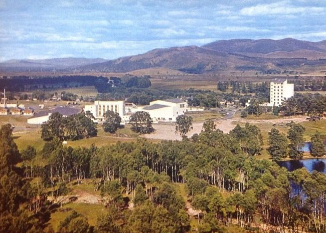
The Cotswold Sanatorium, Cranham, Glouceshire, circa late 1940s/early 1950s
Two and a half years before Russel’s talk at Oxford the writer George Orwell was reading his Human Knowledge: It’s Scope and Limits, at the Cotswold Sanatorium in Gloucestershire. Often in poor health he had been diagnosed with tuberculosis at Hairmyers Hospital, East Kilbride in Lanarkshire, in December, 1947. Despite this he was to write Ninety Eighty Four on Jura, in the Inner Hebrides during 1948. His tuberculosis became worse and he had been helped to travel to the Cotswold Sanatorium by his friend Richard Rees, in January, 1949. Richard Rees had encouraged Orwell’s writing since the early 1930s, and was to be his literary executor. Orwell was writing to him in early February, 1949.
____________________________________
The Cotswold Sanatorium, Cranham, Glos.
4 February 1949
“…. I am reading B.Russell’s latest book, about human knowledge. He quotes Shakespeare, ‘Doubt that the stars are fire, Doubt that the earth doth move’ (it goes on I think ‘Doubt truth be a liar , But never doubt I love.’) But he makes it ‘Doubt that the sun doth move’, and uses this as an instance of S’s ignorance. Is that right? I had an idea it was ‘the earth’. But I haven’t got a Shakespeare here and I can’t even remember where the lines come from (must be one of his comedies I think). I wish you’d verify this for me if you can remember where it comes. I see by the way that the Russian press has just described B.R. as a wolf in a dinner-jacket and a wild beast in philosopher’s robes.”
– Source: The Collected Essays, Journalism and Letters of George Orwell, Volume 4, edited by Sonia Orwell, and Ian Angus. The editors footnote that Russell was right, and that the quotation is from Hamlet.
________________________________________
It was be a further 38 years of Soviet Communist occupation before Poland, Czechoslovakia, Hungary and East Germany had a freedom that West European countries took for granted. During that time the USSR, directly and then under the umbrella of the “Warsaw Pact” crushed, usually with tanks, all demonstrations against Communist rule. The USSR itself lasted until 1992.
East Germany 1953
In a scenario that even George Orwell hadn’t thought of for his Animal Farm, the Communist dictatorship of East Germany (DDR) demanded in 1953 that the already over-worked and undernourished workers increase production.
East German workers demonstrate for better living conditions, including more bread. Berlin, 16 June, 1953.Russian tanks, Berlin, 17 June 1953. Photo Associated Press“Soviet tanks shot at protestors in Potsdam Square. ” Photo source allliance/akg images.
Poland 1956
Tanks in Poznan, Poland, June 1956.
Hungary 1956
Hungary, October 1956.“Jack Esten was in Budapest when this Russian colonel drew his revolver and endeavoured to deprive him of his camera.” Caption & source Photography Year Book 1958. Photo Jack Esten.
Czechoslovakia 1968.
Protestor confronts Soviet tank, morning of 21 August, 1968, Main Square, Bratislava, Slovakia. photo Ladislav Bielik. The invasion of Czechoslovakia in August 1968 was the largest invasion of a European country since Nazi Germany attacked Poland in September, 1939, which precipitated the Second World War.Czechoslovakia, August, 1968. photo Josef Koudelka
Poland, December, 1970.
Unidentified town, Polish Baltic Coast, either Szczecin, Gdansk, Gdynia or Elblag, December 1970.Photo montage: Shipyard workers in Szczecin/”For wages of Communist Party Leaders to be no more than those of an average worker”. source Polski Radio
Poland, 1980s.
Lenin shipyard, Gdansk, 1980. Solidarity movement demonstration.Queuing for toilet paper, possibly Lodz. On July 30, 1981 an estimated 30,000 – 40,000, mostly women and children demonstrated in Lodz with placards reading ‘We want to eat’, ‘Our Children have No Food’, ‘We have no strength to work.”Poland: The Polish Communist dictatorship declares Martial Law, December 13, 1981.
________________________________
Bertrand Russell outlived George Bernard Shaw by 3 years, dying at the age of 97 in February 1970. Robert Bruce Lockhart, curiously, died on the same month and the same year, February 1970 aged 82. George Orwell died from a burst TB lung on 21 January, 1950 at the age of 46. His novel Animal Farm was banned by the Soviet Communists from its 1945 publication until 1988. His Ninety Eighty Four was banned in the USSR from 1950 until 1990. It is not clear if any works of Bertrand Russell were also banned in the USSR.
At present, Marxist Communism still imprisons, in the name of “The People”, the populations of Vietnam, North Korea and China.
Socialist Republic of Vietnam.Democratic People’s Republic of Korea.People’s Republic of China.Lone protestor versus the People’s Republic of China tanks, Tiananmen Square, Beijing, 1989.
_____________________________________________
21st century: London, May Day, members of the Communist Party of Great Britain – Marxist Leninist marching with a portrait of Soviet mass killer Joseph Stalin.
21st century: London, May Day, 2019, British Labour Party Shadow Chancellor John McDonnell with banner of Karl Marx, Friedrich Engels and Marxist mass killers Joseph Stalin and Mao Zedong.
George Orwell, The Collected Essays, Journalism and Letters of George Orwell, four volumes, London 1968.
Robert Bruce Lockhart, The Diaries of Sir Robert Bruce Lockhart, 1915 – 1938, London, 1973; The Diaries of Sir Robert Bruce Lockhart, 1939 – 1965, London, 1980.
John Wheeler-Bennett and Anthony Nicholls, The Semblance of Peace: The Political Settlement after the Second World War, London, 1972.
Americans holidaying in the south of France, circa 1956. There is a rack of picture postcards by the door; the woman holds a pencil, the gent is displaying what seems to be a tourist guidebook.
______________________________
A collection of Kodachrome slides from the Pete Grafton Collection.
Chateau D’If, Tourisme Nautique – Vieux Port, Marseilles, circa 1956.
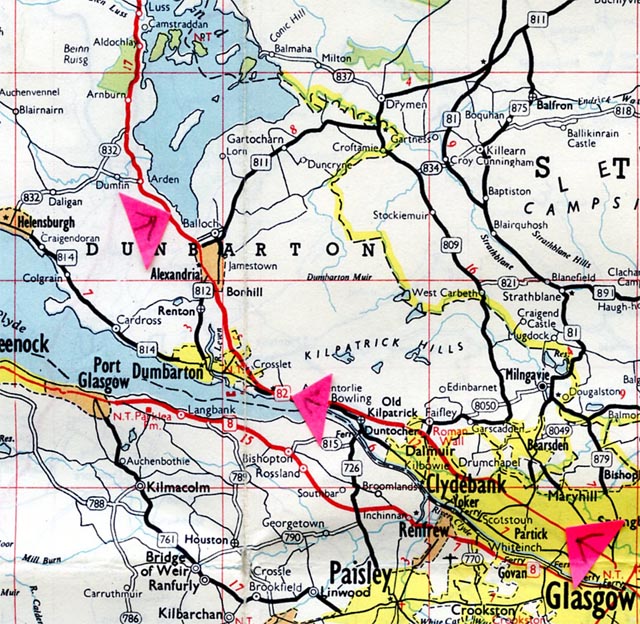
What follows are Kodachrome slides taken by an American couple on holiday in France circa 1956. The year is a guess, based on clothes and cars. The photos are no later than 1957 as Kodak did not start dating the mounts of their Kodachrome slides (when processed) until 1958. The first group of photos including the two above were taken in the Marseilles, Arles and Avignon area in early Spring.
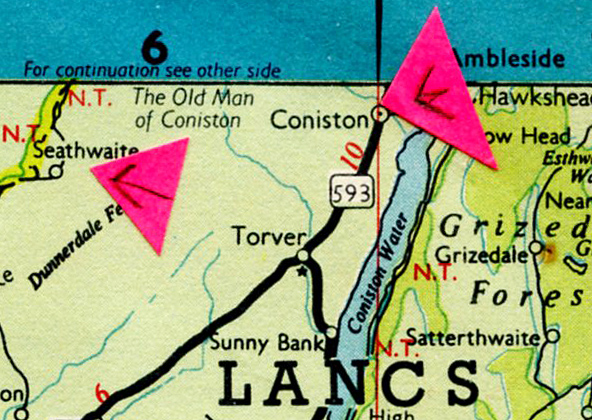
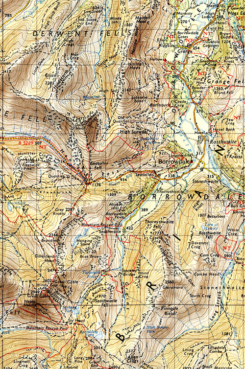
Extract from Michelin Map France Sud, 1965 revision. With grateful acknowledgment to Michelin.
All these Kodachrome slides were bought on ebay by Pete Grafton in 2008, from a vendor who regularly sold slides on the ebay site.
___________________________________
It seems the American visitors above took a trip on the Chateau D’If tourist boat around the old port (Vieux Port), besides taking a couple of snaps of local youngsters fishing.
Vieux Port (The Old Port), Marseilles.Vieux Port, Marseille, 1956.Vieux Port, Marseille. 1956.
Both boys have sand/mud on their hands. In 2019 these boys will now be approaching their mid-seventies.The American couple stayed a night or two in a hotel possibly either in or near Arles or Avignon.The American woman with…? A fellow hotel guest, or Le Patron de L’Hotel ? Or…?
The hotel dining room.The view from the hotel dining room. There is a chance the car seen on the left is a car hired by the American couple. There is a glimpse of a similar car in a photo of Le Palais des Papes (Palace of the Popes) in Avignon.Arles.Arles, Roman ruins.Arles, price of entry to Roman ruins and a cat sniffing the sign.Two young girls. Assumed to be Arles or Avignon. Detail.
Church entrance, with daughter, son and father, possibly. Assumed to be either Arles or Avignon. Detail.
Unidentified town square. “Cycles Magaly” and a Gendarme talks to a car passenger. Detail.
Pont d’Avignon (and dog).Avignon and a parked Cadillac, believed to be a Series 62, with a Norwegian plate. A sign to the right of the Banque de France indicates the way to Le Palais des Papes (The Palace of the Popes)Le Palais des Papes, Avignon.Avignon.Monument du Centenaire (detail), Avignon. Someone is looking out of the window above the Creme Eclipse signMonument du Centenaire, Avignon.Theatre Building, Avignon, detail.
Citroen 2CV and Volkswagen Beatle, believed to be in Avignon. (Detail). The country of origin of the all numeral registration plate on the Volkswagen has not, yet, been identified.
Avignon: “Services Touristiques, Provence Voyages“, and a Gendarme. Detail.
_______________________________________
Eh Maintenant?
Marseille, the Old Harbour, circa 1956. Note the washing drying out on the fourth floor.Marseilles, the Old Harbour. Grateful acknowledgement Vichie81/Shutterstock.
Rationing, Schiaparelli, Washboards & No Sex (by order of the Churches)
_________________________________________
Woman was the most successful ever British magazine for women. (1) Edited by Glaswegian Mary Grieve – the first woman, bizarrely, to edit a women’s magazine (before then it was a mans’ job) – she was the editor from 1937 until 1962. Under her tenure and direction the annual sales income of Woman reached £12 million by 1962. The magazine had continual problems with the established churches, particularly the Roman Catholic Church. She was born in Hyndland, Glasgow.
The dust jacket of her 1964 Gollanz published autobiography – Millions Made My Story – reads:
“During the last war, and specially during the post-war years when the British social revolution was being wrought, one of the principle signposts and the most popular mentor of the female population of the United Kingdom was Woman, the magazine that is now read by eleven million people each week, including, rather surprisingly, two and a half million men.”
____________________________________________
Mary Grieve’s letter to readers, December 23, 1950.
Above, a variation of “Make Do and Mend” and below, post-war rationing still in place in 1950. In 1945 Britain was near bankrupt at the end of the Second World War. Bread, which was not rationed during the war was rationed by the Labour Government in the peacetime 1940s. Unknown to the British public, the Labour Prime Minster Major Clement Atlee had secretly started the costly development of the British Atom Bomb, despite being opposed by his Chancellor of the Exchequer, Hugh Dalton, on the reasonable grounds that Britain could not afford it. Attlee pushed ahead anyway, excluding Dalton from an inner Cabinet group when the decision was secretly taken. By 1950 £100,000,000 had been spent on developing the British Bomb – in today’s value £3¼ billion. One of the first things that Minister of Food and lapsed Marxist Stafford Cripps did in 1946 was to bring in bread rationing. A case of bombs before bread. Bread rationing stayed in place until 1948. Sweets (‘confectionary”) rationing was ended in early 1953 by the Conservative government.
______________________________
Note the washboard in the Pacquins advertisement below, besides the cigarette. Twin tub washing machines were, in the UK, still a few years away. Washboards, boilers and mangles were how clothes were cleaned, and semi-dried in 1950.
Mary Grieve, editor of Woman from 1937 – 1962, highlights in her Millions Made My Story, how careful the magazine had to be about mentioning birth control, and the powerful institutional religious forces against it, and also against other areas of women’s sexual well-being. (On the whole, the same lack of information effected men too). Evelyn Home received hundreds of letters a week, amongst which were a significant number touching on sexual health worries and family planning, and she had to tread carefully (as did Mary Grieve as editor) with what letters were used and how they were answered.
William Temple, Archbishop of Canterbury, then head of the Church of England
The background to this was partly the social times when the magazine started (although the caution was still being exercised in 1963), but also very much the force of the established churches and obscenity laws. In 1942 the then Church of England Archbishop of Canterbury William Temple had been alarmed by an explanatory article on birth control in Everywoman, a sister Odhams magazine. Temple made representations to the owner of Odhams, Lord Southwood, who as a Labour Party member, Julius Elias, had been bumped up to a Lord, to sit on the Labour seats in the undemocratic House of Lords. Lord Southwood sympathised with Temple’s views. “While we must be up-to-date, and if anything in advance of the times,” Southwood reportedly said, “we must not be too much in advance… When the schools put this subject in their curriculum, it will then be time for us to deal with it in our paper.” (Quoted in Millions Made My Story.) Mary Grieve went on to write, in 1962 (the book was published 1964)
“I don’t know how the schools have got on with the subject since then, but the women’s magazines, with other means of communication, have proceeded with caution. This may seem curious, because family planning has become an accepted factor in many marriages, and the Royal Commission on Population gave a clear recommendation that contraceptive advice should be included in the National Health Service. One would think, therefore, that the women’s presses would feel free now, twenty years after the Everywoman incident, to be frank.” Mary Grieve, Millions Made My Story.
The situation for Woman mentioning, even indirectly, “family planning” with their readership in Eire was forbidden by the Irish State, with it written into the 1937 constitution of the right of the Irish Roman Catholic Church to have a say in all areas of family life: adoption, divorce, contraception, and the seemingly innocent area of introducing clinics for mothers and children (which they successfully opposed in 1951 on the grounds that such a scheme was “anti-family”). Meanwhile, single mothers and their babies were put into the notorious Catholic run Mothers and Babies Homes. The opposition of the Irish Roman Catholic Church led to the resignation of Irish Minister of Health Dr. Nöel Browne, who had tried to introduce the scheme against a background, amongst other concerns, of the high infant deaths in the Irish Republic, 26,000 in 1950 for example.
“…. The reason for the continuing reticence about (family planning) is political. A minority religion here (the UK), the Roman Catholic, has such deeply held convictions against the use of contraceptives that it is hard to see any political party embracing with enthusiasm the cause of family planning by this method.
In Eire the subject is completely taboo. Magazines risk, and have experienced, being banned from the country by ignoring the taboo… Woman’s sale in Eire is very small beer in relation to the total sale of three and a quarter million. But at no time in our fight did I find management willing to sacrifice this sale to keep up with the British Joneses…. We ran, as did other magazines, a special slip page for Eire free of comments or information which could offend. Our human problems page, conducted by Evelyn Home, was our chief source of danger. This is the page that is remade every week for Ireland” – Mary Grieve, Millions Made My Story, 1964.
The British Labour Party has had a close relationship with the Roman Catholic hierarchy on mainland Britain since before 1914, where in areas of high numbers of Roman Catholics with an Irish background they made concessions to get their vote. These included the pledge to build Roman Catholic schools. In Glasgow the cry of the opposition to this was “No Popery on the rates”. Besides Liverpool in England, in Scotland, Ayrshire, Renfrewshire, Lanarkshire, Glasgow, and parts of the Lothians were solid Labour areas because of these concessions and accommodation with the Roman Catholic Church, even were there were also protestant Labour voting Scots in constituencies such as Monklands and Airdrie, and elsewhere. The joke in Scotland was that a prospective non Roman Catholic Labour candidate in some constituencies couldn’t get selected unless he had an overnight conversion to Rome.
The Labour Party Roman Catholic voting electorate had a direct effect on the Labour Party’s attitude to family planning and sexual health. When the Catholic Church was suspicious with mooted ideas about such things Labour Prime Minister (and Presbyterian) Ramsay MacDonald as early as 1924 helped to “diffuse Catholic suspicions by appointing the Clydeside Catholic, John Wheatley, as Minister for Health in which capacity he maintained the ban on the provision of advice on birth control by local authority clinics” – Speak for Britain!: a New History of the Labour Party, Martin Pugh, 2010.
Below, the Evelyn Home page for Christmas, 1950, and beneath it, typical letters that were selected to print.
___________________
Tampax tampon advertisement, Woman, December 23, 1950.
Tampons had been developed in America during the 1930s and were starting to be marketed in Europe in the post-war 1940s. Prior to their introduction bulky sanitary towels were available, and continued to be available. The Irish parliament under pressure and persuaded by the Irish Roman Catholic Church banned their sale in 1947 “lest they cause harm (or sexual pleasure) to women”. The Irish Catholic Church opposition was led by Archbishop John Charles McQuaid, who was to lead the successful pressure on the Irish Government in 1951 over their intended introduction of Clinics for Mothers and Children.
Archbishop McQuaid and Irish President Eamon de Valera. de Valera has been described as “a strong social, cultural and economic conservative“.
__________________________________________
____________________________
N O T E S
Mary Grieve: This writer can find no online photograph of Mary Grieve, nor is there any online encyclopedic entry about her.
Footnote
In 2018 the best selling women’s weekly magazine in the UK is Take a Break, with nearly half a million print sales.
Copy of Woman magazine December 23, 1950, and cover of Millions Made My Story: Pete Grafton Collection.
Henri Cartier-Bresson…?Edouard Boubat…?Sniper fire, Paris, August 1944. Photo: Robert Doisneau…?Spain, 1950. Photo: Eugene Smith…?Nehru. Photo: Margaret Bourke-White…?Photo by Willy Ronis…?Photo by Izis…?Photo by Robert Capa…?Photo by Robert Frank…?Photo by David Douglas Duncan…?Audrey Hepburn, 1956. Photo by Bert Stern…?
Photos by Bert Hardy, all of them.
_____________________________________
All above photos are by British photographer Bert Hardy, 1913 – 1995. He was almost to the year an exact contemporary of the marvellous French photographer Robert Doisneau, 1912 – 1994. A Channel on You Tube with examples of Robert Doisneau’s work has, at the time of writing, attracted 40,699 views. A Channel on You Tube with examples of Bert Hardy’s photos, posted in 2016, has attracted 111 views at the time of writing.
At present – October 2018 – there are over twenty books listed on Amazon UK of collections of photographs by Robert Doisneau. There is just one book currently in print that features some of Bert Hardy’s work Bert Hardy’s Britain available from Amazon UK. In fact, Bert Hardy’s Britain, published in 2013, is the only book in print available anywhere in the world, that features Bert’s photographs.
STOP PRESS October 19, 2018. Bert Hardy not listed on the Wikipedia entry for the ground-breaking The Family of Man exhibition at the Museum of Modern Art, New York, 1955. He had three photos in the exhibition. See story further down.
______________________________________
Baby Bert, Bert Hardy summer 1913, Priory Buildings, Blackfriars, London. “My Mum with myself at a few months old“. Source Bert Hardy: My Life, London 1985.
Bert Hardy was born in May, 1913 a year and one month after Robert Doisneau. Robert’s Dad died when he was four, and his mother died when he was seven. He was brought up by an unloving aunt in the working class district of Gentilly, just the other side of the Paris city boundary. Bert was the first of seven children that his Mum and Dad had, and the family lived in one room with a scullery in Priory Buildings, Blackfriars, London, a stone’s throw from the Elephant & Castle district on the south side of the Thames.
Leaving school at the age of thirteen in 1926 he got a job at a place called the Central Photo Service, by chance rather than design. His aunt had seen a “Lad Wanted” sign when she was charring (cleaning) in the London Strand area. It turned out his job was to help a young Scottish girl develop and print rolls of film that he was to collect from some Chemists in central London. He and her were the total staff, the owner being elsewhere in the building.
” (Re. the chemists) I went round twice a day, walking or jumping on the back of carts to save my bus fares. In between rounds, the Scottish girl taught me how to develop and print, and also some other interesting activities you can get up to in a darkroom. I was a quick learner.”
He goes on to describe the primitive set-up and equipment in the darkroom, and then describes the photos that he and the Scottish girl processed.
“Apart from the usual ‘happy snaps’, an astonishing number of people sent in naughty pictures. There were one or two chemists in Soho from whom we expected that sort of thing: pictures of prostitutes for their clients, and we adjusted our rates accordingly. But there was a chemist’s at the top of Northumberland Avenue from which we quite regularly collected films sent in by a famous surgeon.
The surgeon’s pictures were always beautifully taken on a quarter-plate camera on roll film, six pictures in a roll. All the pictures were of popsies: beautiful creatures with nothing on doing the most terrible things, but always wearing marvellous hats. And the last picture on each roll of the film was always of the surgeon himself: a stout gentleman with no clothes on, and the tiniest little withered thing between his legs.
I don’t suppose he appreciated what an opportunity for blackmail he gave. Instead, we charged him double and printed up copies for ourselves.”
Working in the darkroom rubbed off on him and he bought in a pawn shop what he described as an old second hand plate camera – which would make it a turn of the century item. The first photograph he made money from, selling to friends and others, was taken of King George V and Queen Mary, resting the camera on the head of one his sister’s to steady it.
King George V and Queen Mary, Blackfriars Road, London. Photo by a teenage Bert Hardy.
He also photographed his family.
“One of my earliest photos taken with flash powder. Bath time at the Priory Buildings”. Photo by a teenage Bert Hardy.
As his self-taught photo skills developed so did his passion for competitive cycle racing. He began to sell photos to The Bicycle for a good rate.
Photo by Bert Hardy mid to late 1930s. Sold to The Bicycle.
Bert left the Central Photo Service in 1939 and started working for a professional photo agency that supplied photos to the national daily press. His camera skills and his eye for a photo story got noticed and he joined the top British photo news weekly Picture Post on 3 March 1940.
The Picture Post cover on the week Bert Hardy joined the magazine. Picture Post, March 9, 1940 from the Pete Grafton Collection.
Bert was straight away involved in covering stories connected to the Second World War from the British perspective, getting front page coverage.
Mono reproduction of Bert Hardy cover for A Trawler in War-Time, Picture Post March 21, 1942. From Bert Hardy: My Story, London 1985.Bert Hardy photo aboard a trawler in heavy seas, Picture Post March 21, 1942. From Bert Hardy: My Life, London, 1985.
Whilst he was working for Picture Post he received his call-up papers in 1943 (war service in the armed services). His editor Tom Hopkinson tried to get him deferred, arguing that he was valuable as a war photographer with Picture Post. No luck. He had to go in the army and was assigned to the Photo Unit, and had the indignity of being taught as a beginner, and was issued with a sub-standard camera for war work.
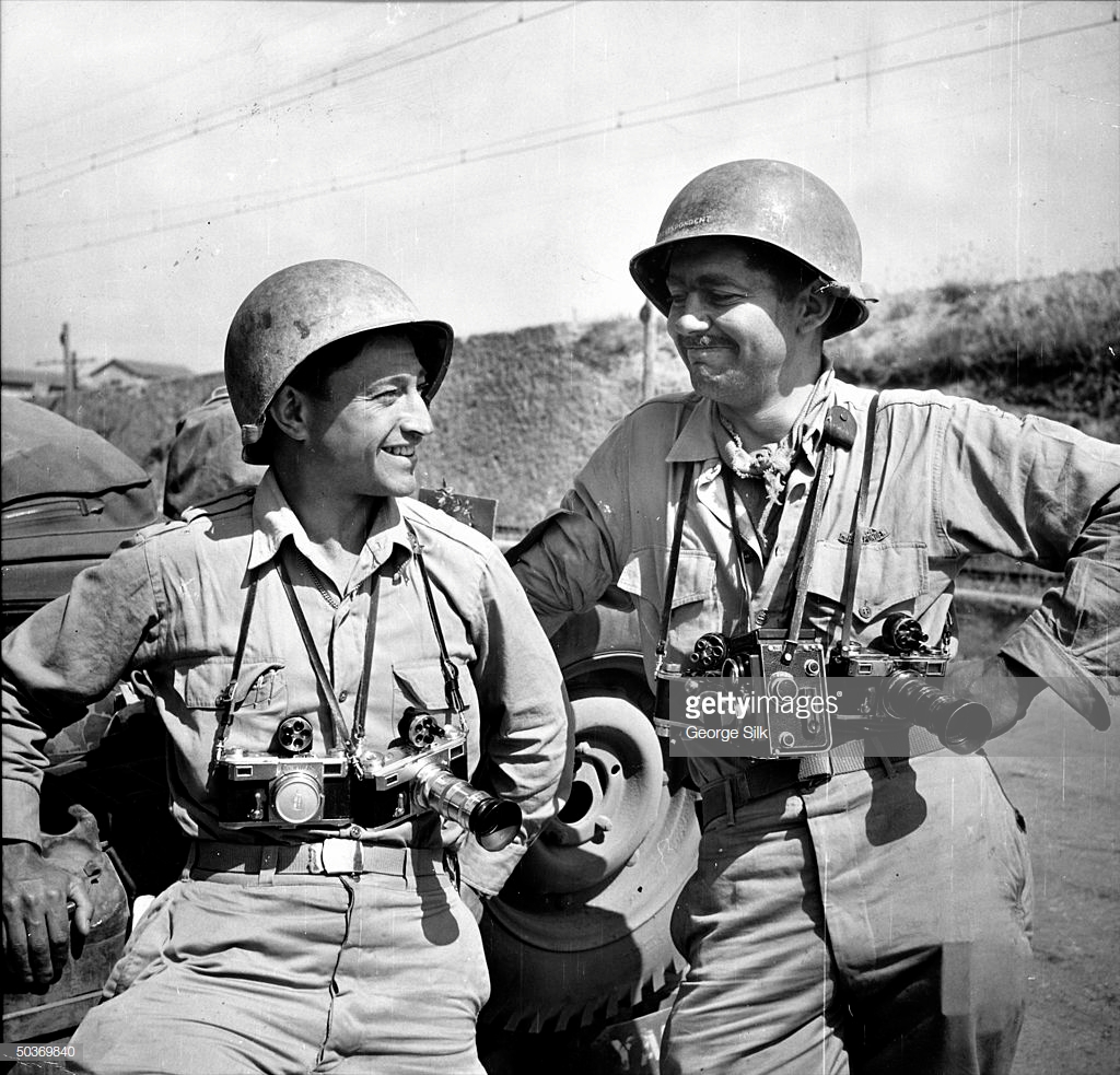
Somehow during his time in the army he managed to supply photos to Picture Post. At that time British press and news magazine photographers did not get a credit byline next to their work, so his photos being anonymous, he could get away with it In France post-D Day, and still with the army, photographer George Silk of Life and Robert Capa were working as war correspondents.
“I met up with them. They both knew me and told me they liked my work. They stayed in some luxury at the billet obtained by the canny officer in charge of public relations, who was very talented at that sort of thing: but when they invited me to come and have a drink with them, I wasn’t allowed to – the Mess was for commissioned officers and war correspondents only.”
Carl Mydans and left, George Silk. Life magazine war correspondnets. Photo source: Getty, with grateful acknowledgement.Robert Capa, war correspondent. Photo: unknown source.
Bert Hardy in jeep with Wehrmacht prisoners on the bonnet. The prisoners are possibly there to deter enemy snipers or an ambush. Photographer unknown. From Bert Hardy: My Life, London 1985.“My first frightening encounter with the enemy came when we were heavily mortared. I came closer to death, however, when I nearly detonated a land mine in my efforts to seek cover.” Photo Bert Hardy. From Bert Hardy: My Life, London, 1985. Robert Capa was to die stepping on a landmine in French Indo-China (Vietnam) in 1954.
_______________________________________
“…when we came in sight of Notre Dame, there was a sudden flurry in the crowds of people. It took me a little time to understand what was happening: there were German snipers firing…” Photo Bert Hardy. From Bert Hardy: My Life, London, 1985.
Bert saw and photographed atrocities by German forces on Belgium civilians; went in on the first crossings of the Rhine, was at Belsen at the time of its liberation and concluded his time with the army in Europe by taking a photos of the Soviet Marshall Zhukov with Generals Eisenhower and Montgomery near Frankfurt. Although in May, 1945 the war was over in Europe, he was still in the army. He was a sergeant.
He was next posted to the Far East, where he continued taking photographs, including the hanging of Japanese war criminals. It wasn’t until 8 September 1946 that, still a soldier, he arrived back in Liverpool on the troopship Monarch of Bermuda. He then had to travel through the night to Number 77, Military Demobilisation Unit, Guildford, where a £2 ‘mess fee’ was extracted from him. (At the time, about a third to a half of an unskilled workers weekly wage.) As he wrote “By nine o’ clock that morning, fleeced, I was a citizen again, plain Bert Hardy”.
_______________________
A few days back in England and Bert got in touch with Tom Hopkinson, the editor of Picture Post, who immediately offered Bert his job back at Picture Post, at £1000 a year. Bert said he wasn’t sure, as the price offered might not cover his expenses. A few days later Tom came back with an offer of £1,500 a year. “It was an offer I couldn’t refuse.. It was good to be back at work for Picture Post at a period when the paper was at its greatest”.
Within a month of working on photo stories in England, Tom Hopkinson sent him out East again, this time working for Picture Post and an assignment in India, covering the opening of the Indian Constituent Assembly after independence from Britain. He and a journalist were granted an interview with the new Prime Minister Jawaharial Nehru.
“Nehru was a fine man for whom I had a tremendous respect, but people’s characters only emerge in their actions, or in certain facial expressions… (as the journalist was talking to Nehru) I was shooting away quietly when Nehru absently-mindedly picked up a rose from the bowl of his desk and sniffed it. I took the picture instantly, it was what I wanted.”
Monochrome reproduction of Picture Post Cover, February 8, 1947, featuring Bert Hardy’s portrait of India’s first prime minister, Jawaharial Nehru.
______________________________________
In the post-war 1940s and into the 1950s Bert covered everything, to racial tensions in London’s Notting Gate, emerging star Audrey Hepburn, Cardiff’s Tiger Bay area, downtown Liverpool, Tito and his wife in Yugoslavia, the village life and grape harvest in a French village…. He loved working with available light – he was a genius with it and with his darkroom experience he knew how to get the best out of a difficult negative.
Chinese cafe, Liverpool. Photo: Bert Hardy.Couple in a basement room, from the Picture Post story on the Elephant & Castle area, London, late 1948. Photo Bert Hardy.
The photo of the loving couple with the light streaming in, in the Elephant & Castle area of London is one of this writers favourite Bert Hardy photos, and has been for many years. However, reading Bert’s own story about it, in Bert Hardy: My Life, it’s not quite as it seems. Working on the Elephant & Castle story Bert was only a stone’s throw from where he was brought up in Blackfriars. Wandering around with his camera a woman shouted out “‘Ow about taking a picture of me love?” Looking at some run-down buildings he asked her what they were like round the back. “Bleedin’ awful. Come and see for yourself.”
“Following her down a narrow passageway to a tiny yard about ten feet square… I saw, through a window, a young couple half-lying on a sofa just inside. I asked “What’s it like inside?” She said, “Come and have a look”.
I went inside and asked if I could take a few pictures. They seemed totally unconcerned. When I set up my camera and tripod, they watched me blankly, without moving. In the end we discovered the reason: the girl was a prostitute and the man was a Canadian who had been released from prison the day before; they had spent a hard night in bed celebrating his release.”
It turned out that his guide Maisie, who had told Bert to take her picture, was also a prostitute, and she was a great help to Bert and A.L.Lloyd, the Picture Post journalist, whilst working on the story.
The two of them had just returned from doing a feature for Picture Post on the Gorbals slum tenements in Glasgow. One of the photos that Bert took, and is well known for, was also his favourite picture.
Gorbals boys, 1948. Photo Bert Hardy. “My favourite picture: this reminds me of what I was like when I was a kid. In this story I concentrated on the children, and how they kept their spirits up in conditions which were often dreadful.” From Bert Hardy: My Story, London 1985.
___________________________
The Pool of London
Just over a year later in December, 1949 he and journalist Robert Kee did a story on the Pool of London. It is reproduced here, from the Pete Grafton Collection, as a representative example of Bert’s work. Picture Post, 3 December, 1949.
Some weeks before the Pool of London story was run by Picture Post its writer Robert Kee had been a Witness at the marriage of George Orwell to Sonia Bronwell in the University College Hospital, London, on October 13, 1949. Orwell was being treated for his damaged TB lungs. Orwell was too weak to stand and sat up in his hospital bed for the ceremony. His novels Animal Farm (1945) and Nineteen Eighty-Four (June, 1949) had highlighted the dangers of totalitarian communism and totalitarian societies dominated by cult personalities, such as Stalin. The post-war 1945 period in the Soviet Union, Eastern Europe and China alarmed him. He died in hospital from a burst lung in January, 1950, aged forty-six.
__________________________
Korea, 1950
In August, 1950 Bert Hardy was again sent to the East, this time Korea, with journalist James Cameron.
Inchon landing, Korea, September 1950. “All hell was going on around us when I photographed the actual landing, but my chief worry was to get my pictures before the last light went.” Bert Hardy, from Bert Hardy: My Life, London 1985.
Communist North Korea, backed by the Soviet Union and communist China, had invaded South Korea on 25 June, 1950. The United Nation condemned the invasion and sent UN forces to repel the invaders. The UN troops were not effective at containing the invading communists until UN forces landing at Inchon in September, 1950. Bert Hardy and James Cameron covered the landings.
Bert Hardy in Korea, 1950. Unknown photographer. Copyright, with acknowledgment, Getty.
Political Prisoners
Whilst doing follow up stories in Korea they came across brutal treatment of prisoners taken by South Korean Forces, which Bert said reminded him of some of the scenes he had seen in German at Belsen in 1945. Making enquiries he and James Cameron were told the prisoners were not North Koreans, but political prisoners, people suspected of having ‘the wrong views’. “We wondered how young boys of fourteen could possible be ‘political’ prisoners…… At intervals a batch of them would be separated from the rest and herded into the back of a lorry which then drove off. Our impression was that they were being taken off to be shot. We were appalled, and decided that we must try and to do something about it. We went to the United Nations Office, and they didn’t want to know.”
They went to the Red Cross who referred them back to the United Nations Office, who said what their allies the South Koreans did was not their concern. “Jimmy Cameron and I were horrified by what we saw, and checked very carefully before sending back our story. We knew it would cause trouble, but not that it would also change Picture Post for ever…”
Bound UN political prisoners, Korea, 1950. Photo by Bert Hardy, from Terror in Korea: We appeal to U.N. Text James Cameron, photos Bert Hardy. Supressed by Picture Post owner Edward Hulton.
Their time in Korea over, they returned to London.
“When we reached London we found that Tom (Hopkinson, Picture Post editor) had been holding over our story on the North Korean political prisoners until we returned, just to make sure that everything about the story was quite right, and that we hadn’t distorted or missed out anything. In fact the story about the incident had already appeared in The Times, but Tom was still worried. The combination of Jimmy’s writing and my pictures would really bring what was going on home to people. Because of its implied criticism of the United Nations, it was bound to create controversy. Tom was concerned because Edward Hulton, the proprietor, was known to dislike controversy. He wanted to be absolutely sure about the story before he printed it.”
Bert and A.L.Lloyd (Bert Lloyd) meanwhile were assigned to do a topical piece on the annual British Bonfire Night.
“Bert Lloyd (A.L.Lloyd) and I were wandering around London looking for the best Guy Fawkes we could find… when we heard that Hulton had personally ordered the presses to be stopped at Sun Engraving in Watford, and the issue of Picture Post to be made up again without the story of the political prisoners.
Bert Hardy: “The layout for the story that was never published, for which Tom Hopkinson was sacked.” From Bert Hardy: My Life, Godron Fraser, London, 1985.
… There was talk of mass resignations if this sort of interference in editorial policy happened again….. Tom was sacked for refusing to comply with Hulton’s request… In spite of all the talk of mass resignation, most of the others stayed put. By sacking Tom, Hulton was forced to make him a payment. But anyone who resigned would not get anything except the salary they were owed. Even for Jimmy and me, who had done the story, resignation was not a luxury we could afford. Tom called a meeting and advised us all to stay on. For the photographers particularly there were no other magazines to compare with Picture Post as outlets for their work…. Looking back on it, it seems quite clear that without Tom’s social commitment, Picture Post lost its edge and its popularity. Contrary to the opinion still held in Fleet Street, people aren’t only interested in pictures of pretty girls when they buy magazines.”
_________________________________
Bert continued to work for Picture Post until it went out of business in 1957, and continued to be the Complete Photographer that he was.
Journalist Katherine Whitehorn, Hyde Park, London, 1956. Photo Bert Hardy.Sunday morning on the Champs Elysees, Paris. Photo Bert Hardy.
In a Picture Post feature he took several photos with a cheap box camera, to show that it was possible to take a good photo without needing an expensive camera. From this feature a photo of two chorus girls on the seafront railings at Blackpool became a well known Bert Hardy photo.
Chorus girls on the front at Blackpool. Photo Bert Hardy. Taken on amatuer Box Brownie camera.Kodak Box Brownie, similar to the one Bert Hardy used on the Blackpool photo. A basic camera but one that had extras such as a push-on close up lens and a yellow filter to bring out the depth of a blue sky and increase contrast.
__________________________
STOP PRESS October 19, 2018. Wikipedia wipes out Bert Hardy at the ground-breaking Family of Man photo exhibition at the Museum of Modern Art, New York, 1955, curated by Edward Steichen.
Family of Man exhibition book, New York, 1955.Bert Hardy full page in the Family of Man exhibition book, p.124, New York, 1955.Bert Hardy, Elephant & Castle couple , with other selected photos, p.131 Family of Man exhibition book, New York, 1955.
“…Most photographers were represented by a single picture, some had several included; Robert Doisneau…” Wikipedia entry on the Family of Man Exhibition, on-screen shot October 19, 2108. Bert Hardy had threephotographs selected.“The following lists all participating photographers. (see original 1955 MoMA checklist)” – online Wikipedia detail from their Family of Man item. Bert Hardy is not on this Wikipedia list, but is on the MoMA list.
The MoMA online site, under the Family of Man entry lists the three selected Bert Hardy as follows:
Section 28, Religious Expression, No. 368, Burma, Bert Hardy.
The writer hopes to correct the omission of Bert Hardy from the Wikipedia entry on the Family of Man photo exhibition, New York, 1955, shortly.
_________________________
Life after Picture Post
When Picture Post folded in 1957 Bert worked freelance for Odhams Press, and found that he was earning more money. Then he had a spell working for the Daily Express as their Paris photographer, and then he branched out very successfully into advertising.
“Advertising jobs began to flood in: when I arrived on the scene advertising photography tended to be rather formal. I introduced the 35mm camera and the inventive story-telling approach which had been so popular in Picture Post, to give a fresher, more candid look.”
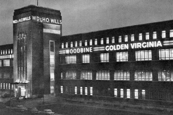
One of his images, that he created, was for the 1959 promotion of a new WD & HO Wills cigarette, Strand.
“At about midnight we were on the Albert Bridge, with some final shots of the model leaning against the parapet. Terry (his younger son) was holding a strong torch to get just enough light on the man’s face to make it look like a lamp-light.” Bert Hardy from Bert Hardy: My Life.“The Strand picture above was the first 35 mm photograph to be made into a 48-sheet poster” – Bert Hardy from Bert Hardy: My Life.Michael Caine as Alfie walks across a night-time Waterloo Bridge, Alfie, 1966.
It was a strong image, the lone man, never alone with a Strand. People of that generation remember it, even though they didn’t take up the cigarette, which bombed. No smoker of that era wanted to be seen as a lonely person. Perhaps an aspect of the image subliminally entered director Lewis Gilbert’s head when he did one of the final shots in Alfie (1966): Michael Caine alone on the Waterloo Bridge, apart from a dog that befriends him. And crossing the Thames, on the Waterloo Bridge and heading down Waterloo Road he would have come to the Elephant & Castle where he grew up, in poverty, like Bert Hardy. And like Bert’s aunt, Michael Caine’s Mum was also a char (cleaner). And like Bert Hardy he was in Korea, two years later in 1952, in the infantry, a conscript on the front line.
________________________
Bert Hardy earned a tremendous amount doing advertising photographic work, but he wrote that it was no substitute for working for Picture Post. In 1964 he and Sheila, his second wife, bought a farm, and he slowly eased himself out of the very lucrative advertising and promotional photography to retire and run the farm.
Bert Hardy ploughing at his farm. Photo Uncredited. The first time he got on a tractor at his new farm he wrote “I tried my hand at chain harrowing. It was the first time I had driven a tractor since the War when I was doing a story of Land Girls for Picture Post.” From Bert Hardy: My Story.
Retired, he still took the occasional snap, for his own pleasure.
“My two grand-daughters taken in 1978, in the lane leading to my house.” From Bert Hardy: My Life.
________________________
At the time of writing, October, 2018, there is only one book of Bert Hardy photos currently in print: Bert Hardy’s Britain, Bluecoat Press, UK. £19.98.
Bert Hardy’s Britain, Bluecoat Press, UK.
There are two cautionary reviews of the book on Amazon.co.uk
“One of the UK’ s best known photographers and from Blackfriars in South London. As with some photographic books the design and more importantly the layout and repro are poor. The repro of the pictures is poor quality and why designers ever split a picture over two pages I will never know, it kills the original image!
As for the pictures, some are a bit of a mish mash and seem to be added to pad out the book. I don’t think even Bert would be happy with this.”
“This is a laudable effort, but it falls short in limiting the pictures to Britain, unfortunately leaving out some of his best work….
______________________________
There are two out of print books of Bert Hardy’s photos available second hand. They compliment each other. Bert Hardy: My Life is his story in his own words, and it’s an extraordinary and fascinating story. It is full of his photos, often with details of how he took the photo. At the back of the book he also lists his favourite cameras and the one he had no time for when issued it by the British Army. The average price second-hand on ebay.co.uk is £24. It runs to 192 pages. Beware of sellers who are either not very bright, or are “at it”, who when listing it describe it as signed by Bert Hardy. There is such a one listed October, 2018 on ebay.co.uk with an asking price of £155. All editions have a printed Bert Hardy signature on the front page.
The second out of print book of Bert Hardy photos is from the Gordon Fraser Photographic Monographs series No.5: Bert Hardy, London 1975. It runs to 72 pages and the reproductions are not always up to the standard that we expect in photographic monographs published in the present decade. A reasonable price to pay on ebay.co.uk is £44 – £45.
All Bert Hardy photos copyright either Getty or the Estate of Bert Hardy. With grateful acknowledge to both copyright holders. All other material: The Pete Grafton Collection.
Unlike Jacques Tati, not all the European film comedy stars of the 1950s and early 1960s crossed boundaries as easily as he did.
FernandelTotòNorman Wisdom
France’s Fernandel had a following in Italy, and Italy’s Totò had a following in France (the two made a film together The Law is the Law in 1958). Whilst Norman Wisdom’s star has faded in Britain, he is still loved in Albania, and his films dubbbed into Hindi are popular on the internet. But it was Jacques Tati who really crossed national boundaries, and still does in the 21st century.
Jacques Tati directing M.Hulot’s Holiday (1953).
In particular it his first two films Jour de Fête (1949) and Monsieur Hulot’s Holiday (1953) that strike a continuing – possibly nostalgic – cord.
__________________________
Michelin France Grandes routes, 1973 edition. With grateful acknowledgement to Michelin.
_________________________________
Jour de Fête (1949)
The Old Lady and her goat in the Place du Marche, Jour de Fete. The film was shot in Sainte Sévère in the Indre department in central France.Sainte Sévère, central France, location of Jour de Fete. Grateful acknowledgement to Michelin. Saint Sévère, location of Jour de Fete. Grateful acknowledgement to Michelin.Jacques Tati and the camera crew setting up, Sainte Sévère, 1949.Showing in the cinema tent the modern methods of La Post en Amerique.
Outside the village bar, Jour de Fete.Jacques Tati and camera crew at Sainte Sévère. Jour de Fete, 1949.The Fair tractor enters the village square along with excited village children. Jour de Fete 1949.
The Pole, Jour de Fete.
_______________________
Pour La Poste
Sainte Sévère postcard, circa 1930s. “Vue prise de la Route de Boussac”Sainte Sévère and to the south south east, Boussac on the N 717. Grateful acknowledgement to Michelin.Sainte Sévère postcard, circa 1940s.Sainte Sévère postcard, circa 1970s.Sainte Sévère postcard, circa 1990s.
_________________________
Et Maintenant?
Despite a declining population – (1946: 1,135; 2009 (last published figure) 851) – Sainte Sévère still has a post office. The bar in the market square has gone, but there is a restaurant elsewhere in the village that seems to be popular with passing through tourists. Sainte Sévère also has a filling station, a ladies hairdressers, a boulangerie, a butchers and a school. It also now has a little museum dedicated to Jour de Fête and Jacques Tati.
La Poste, Sainte Sévère. Google street view, 2013. Acknowledgement Google
______________________________________
Monsieur Hulot’s Holiday (1953)
Les Vacances de Monsieur Hulot
Jacques Tati lining up a shot on location in Saint-Marc-sur-Mer, location of Monsieur Hulot’s Holiday.Location of Saint-Marc-sur-Mer. 1973 Michelin map. Grateful acknowledgement Michelin.
Nathalie Pascaud with clapperboard, Saint-Marc-sur-Mer, on location for Monsieur Hulot’s Holiday.
____________________________
Carte Postale
Saint-Marc-sur-Mer postcard, 1954.Saint-Marc-sur-Mer, 1920.Saint-Marc-sur-Mer, 1930s. Note “X” on the hotel, and middle top window.Greetings from the occupant of the middle upstairs hotel room of the Hotel de la Plage. 1930s.Saint-Marc-sur-Mer, pre-1914.Saint-Marc-sur-Mer, also pre-1914.Saint-Marc-sur-Mer, circa 1950s.Saint-Marc-sur-Mer, 1956.Saint-Marc-sur-Mer, early 1950s.
____________________________________
Et Maintenant?
The Hotel de la Plage is now the Best Western Hotel de la Plage. The rooms have flat screen TVs, free Wi-Fi and there is a business lounge. The restaurant is now called La Plage M.Hulot.
Positive views amongst UK visitors to the Best Western Hotel de la Plage recorded on the hotel site include
– Could hear the waves as we lay in bed at night
-Location is excellent, right on the beach.
-Architecturally interesting in that the original character has mostly been preserved.
Average 3 star ratings reviewers on Trip Advisor complained that there was no aircon, that there was no hot breakfast, that you couldn’t get a beer at 5 pm, that the exterior needed a paint, that the room was cramped and small, and that the place needed a modern eye to overhaul it.
Eh bien…
Au Revoir, Monsieur Hulot.
Jacques Tati’s grave in Saint-German-en-Laye, near Paris. Sophie was his second daughter. Jacques Tati’s full name was Jacques Tatischeff. Photo, with grateful acknowledgement, Daniel Timothy, 2008. Source findagrave.comSaint-German-en-Laye postcard, posted in 1911. The then modern French aeroplane has been added in the publishers photographic darkroom. Many French postcards of this time had planes added by postcard publishers to empty skies. Jacques Tati was 4 years old when this card was posted in his town.
Windmill Theatre, London, 1950s. Gents being serenaded on a G string as they queue to see the Revudeville show. Note the raincoats. Photo source Daily Express
The first job in a theatre that the actor Kenneth More had was in the Windmill Theatre in London. It was the 1930s and he started there as an Assistant Stage Manager. The Windmill was unusual for a London (and British) theatre in that it had women in its revue shows who revealed their bosoms. This was not the Folies Bergère of Paris, or the pre-1933 Berlin revues that had moving women – the Windmill’s theatrical licence strictly depended on the showgirls not moving. They were rigid on the stage in tableaux set pieces.
Part of Kenneth More’s job as the Assistant Stage Manager was to spot where potential trouble-makers were sitting. They would try by various means – sneezing loudly, for example – to make one of the semi-naked showgirls move, thus causing their breasts to move. This would cause a ripple of pleasure in the all male audience. Whilst many rippled in pleasure, other’s were self-pleasuring.
“We had a little peephole covered by a small piece of dark velvet. I would lift this velvet and look into the auditorium without anyone in the audience knowing I was doing so… Middle-aged men, usually wearing raincoats, would place the Evening News and The Times on their laps… and do the same thing when the tableaux was in progress… This sort of behaviour could be embarrassing to other members of the audience, and also might result in our licence being revoked if anyone complained to the police about it.
I was told to keep a lookout for these undesirable activities and I had a simple code with the front office when I spotted anything. I would pick up the house telephone and say: ‘A4, Wanker, Times. C17, Daily Mail.’
The commissionaire would then stride down the aisle to Seat A4, and then to C17, tap the man on the shoulder, and say, ‘The manager wishes to see you in his office.’
The commissionaire, an old soldier, was under strict instructions not to say ‘Stop wanking’, or some other more forthright comment, in case there had been a misunderstanding, or the client denied the charge. His defence could be, ‘I was just scratching myself’ but always the men concerned realised that they had been rumbled, buttoned up their flies and left quietly.”
– More or Less, Kenneth More, Hodder & Stoughton, 1978.
Kenneth More, publicity photo for Genevieve, 1953, wearing anti-self-pleasuring gloves. It could be worse, they could be boxing gloves.
________________________________
UK Sex Under Cover: 1950s and the early 1960s.
Obscenity Laws governed the display or mention of sex in Britain, whether on stage or in print or on film, and had done so since the 1857 Obscene Publications Act. Criminal obscenity was defined as “tending to deprave and corrupt”. Even in the early 1960s Customs & Excise could take off a returning visitor from the continent a pin up magazine bought at a French, German or Danish newsagents if it showed pubic hair. (Most likely the blokes at Customs & Excise were removing the magazine to prevent moral corruption so that they could have a good gander at the contents. And with a cough – “Ahem” – retire to the staff toilet for a quick one.)
One area of erotic interest for gents was the underwear garments section in the Littlewood’s and other Mail Order catalogues, which by the mid 1960s were reproduced in glorious colour. The section on outsize bras and the women modelling them was a well visited page. Incidentally, this mail order catalogue viewing activity was not confined to UK males starved of tit-illating viewing. There were outposts on the Continent as late as 2001.
Lucien (played by Jamel Debbouze), assistant to Collignon the greengrocer, and “Lady Dee” enthusiast.
In the film Amélie (2001) Collignon the greengrocer claims that his assistant Lucien has been sticking photos of the lately deceased “Lady Dee’s” head onto the shoulders of lingerie models in a mail order catalogue.
__________________
Another source of stimulation, this time the printed word, was the weekly magazine Exchange and Mart.
Exchange & Mart magazine. “Physical Culture Equipment” and on the inside “Half Way Inn” (sent under plain cover).
In the section selling cine film and cine film apparatus was a sub-heading where vendors advertised 8 mm films (including the now defunct and almost by then anachronistic French 9.5 mm cine film). Five or ten minute 8mm spools of cine film with suggestive titles such as Halfway Inn were offered, sent “Under Plain Cover”. An assistant bank manager in the London suburb of Gants Hill would probably be sweating blood with the thought of his career downfall, or marital shame if the packet arrived at the family home damaged in a peek-a-boo state so that the saucy title could be read. He’d then go from relief that the contents hadn’t burst out of their confines to fury when, in the back room he set up the projector (the wife gone on the London Underground Central Line for her weekly visit to her friend Maureen in Newbury Park), stared aghast at the images on the viewing screen, and then fury as he watched a five minute travelogue of the Malverns, that in a few shots lingered on a picturesque pub called the Halfway Inn.
Meanwhile, who knows, his wife – on the weekly pretence of visiting Maureen – (real name Maurice, president of the local amateur photography club and salesman in Bri-Nylon goods, including knickers) – was earning some pin money in a Newbury Park front room posing in her nylon “smalls” in front of a cold fireplace.
“Fireside Frills”. UK glamour, the 1950s.
_______________________________
Other Sources of Titillation
If you lived in London a good source of printed ‘beyond suspicion’ titillation – and a safe respectable street to linger in whilst doing so – was the Charing Cross Road and the windows of the art and cinema book shops.
“Bookshop, Charing Cross Road c.1936.” Photo Wolfgang Suschitzky, reproduced in An Exile’s Eye, the Photography of Wolfgang Suschitzky, National Gallery of Scotland, 2002. (Despite”c.1936″, one book in the window is “Specification for 1938”.)
Titles in the above 1930s Charing Cross bookshop window include Curves & Contrast of the Human Form, Beauty’s Daughters and 28 Studies, 7/6. Not much had changed in Charing Cross art book shop windows in the late 1950s and early 1960s, except the prices. The common feature was an artificial line drawn between aesthetic appreciation (legitimate) and sexual appreciation (not at all legitimate, leading to moral corruption, blindness, nasty diseases, and, criminal court cases if it was a man’s love for a man).
Public Lavatory, 1950s, London. From A Maverick Eye: The Street Photography of John Deakin, editor Robin Muir. Thames & Hudson, 2002.Magazine kiosk, 1950s,Paris. From A Maverick Eye: The Street Photography of John Deakin, editor Robin Muir. Thames & Hudson, 2002.
Just off the Charing Cross Road was Soho, whose saucy reputation was a legend amongst men in the know throughout the British Isles. FA Cup finals at Wembley, rugby games at Twickenham and “chaps” down to see the Oxford – Cambridge boat race would, if they had time before the game or race, head in large groups to the fabled centre of sin. Kenneth More mentions this aspect in his More or Less. However the most erotic experience they would probably encounter in the late 1950s and early 1960s would be glimpsing at nude ladies with rigid permed hairdos and a disappointing erased vagina in British pin-up magazines such as Kamera.
But, and care was still needed, Soho was also home to a community of gay men and women, which included the artist Francis Bacon and the photographer John Deakin. Erotic imagery for homosexuals was even more coded – for men, male body building magazines was one source of sex under cover.
Soho, London, 1954. photo Hans Richard Griebe. From London Town 54: the photos of Hans Richard Griebe. (2)
_____________________________
With all this Sex under Cover, contemporary readers – that is, 2018 readers born since say the ‘permissive’ 1970s – would perhaps imagine that sex, as practised, was like its depiction in British films spanning the 1930s to early 1960s period. True, the contraception pill, available in Britain from circa 1967, did mean there might have been more uninhabited “coupling” amongst heterosexuals without fear of pregnancy. The difference in the 1930s – 1960s period was that if an unmarried couple had been “doing it” and the woman became pregnant, they usually got married. The exception was the wartime circumstances of the Second World War where there was a marked increase in children born out of wedlock, often to departing Allied soldiers leaving British shores.
For swingers, their activity was not inhibited during the 1930s – 1960s period. One Scottish island had a post Second World War club that became known in island folklore as the “BBC” – the Bare Bottoms Club. The club was accidentally discovered by a village hall janitor when an external door into the village hall he thought was a bit stiff was wedged by a fornicating couple on the other side, whilst simultaneously other wife/husband combinations were also at it. Trades people and professional people were well represented in this island “BBC”.
An early 1960s work-mate of this writer detailed to him the pleasures to be had in the Union Jack Club in wartime Waterloo, London. The workmate was a regular soldier in the 1930s, mostly based in garrisons in India, and then drafted back to the UK to train up the new Second World War conscripts. With his bi-sexual drive, the Union Jack Club was a Mecca. One encounter he fondly remembered was a man and woman duo who swapped sexual roles, with him happily being piggy in the middle. “Oh, it was lovely” he said,”and what a shame for them. The guy really wanted to be a girl, and the girl really wanted to be a guy”.
Kenneth More, in his previously mentioned autobiography More or Less details how he lost his virginity in the early 1930s to a hormonally rampant nurse at her rented flat after a dance in Shrewsbury, a town where he was a young engineering apprentice. At the dance
I put my arm around her in a two-step and she pressed hard against me… At the end of the evening she mentioned casually that she shared a flat but her friend was away… would I care to go home with her?….
At the flat –
We undressed and climbed into a remarkably cold bed, the chill of which was speedily obliterated by her generous warmth. She instructed me in my part of the proceedings – or at least what she hoped my part would be. But my state of nervousness and excitement was such that it was all over before I really began.
Front cover of ‘Lady Chatterley’s Lover’, Penguin edition, 1960
There are three observations on this recollection by Kenneth More. 1. That he would not have written about this in his earlier autobiography Happy Go Lucky (1959). It was a sign of the times that he did in More or Less in 1978. And the sign of the times was legally ushered in by the unsuccessful 1960 Crown Prosecution of Penguin Publishers for their publishing the full version of DH Lawrence’s Lady Chatterley’s Lover. 2. On the back of this unsuccessful Crown Prosecution, Henry Millers Tropic of Cancer was then published and contemporary authors in the UK and the US were more frank in mentioning, in writing about sexual behaviour, and publishers published. However in the world of film, British or American, it was to be several years after 1960 that films started to be equally frank, and in some sexual thematic areas over 30 years. 3. That the nurse’s hormonal biological imperative was not – in real life – untypical, but, as a theme, continues to be under-played in novels and films, as does the usually earlier age awakening of female sexual drive (when their menstruation starts) compared to boys. It was a curious and un-erotic experience for this writer in 1958 to have a girl take his hand and place it on her blouse/pullovered school breast and rythmatically squash his hand over it.
In the pre-1970s, most nice boys thought that “Sex” was something that boys did to girls, and it was usually nasty boys who did it to girls. There was no awareness that girls liked sex too. And anyway, any girls who did like sex were written off as Bad Girls, and this was clearly inferred in films that started to touch – even fleetingly – on this aspect from the late 1950s onwards.
_______________________________
The prosecution of Penguins by the Crown for publishing Lady Chatterley’s Lover was thrown out by the jury on 2 November, 1960, having been asked in the opening statement by the Prosecuting Counsel – Mervyn Griffith-Jones- if it was a book they would wish their wife or servants to read. The answer was obviously yes (did servants include Buckingham Palace staff ?) and so did large swathes of the British public who’d never read or heard of DH Lawrence. (1)
Mervin Griffith-Jones.
Between then and 1963 four British films that touched on sexual behaviour were released that Mervyn Griffith-Jones might not have wished his wife or his servants to see:
Saturday Night & Sunday Morning, general release early 1961; Victim, 1961; Greengage Summer 1961 and The Comedy Man 1963.
British Board of Film Censors U certificate. Such a caption would appear at the beginning of a film.
With the exception of the “A” certificate Greengage Summer, the other films were”X” certificated – which in those days “X” = seX. The British Board of Film Censors was a timid self-censoring Trade Body established in 1912, and down the years had had an informal and comfortable relationship with the British Governments of the day. During the 1950 – 1964 period the British Board of Film censors ratings were “U” – suitable for everyone, “A” – children must be accompanied by an adult and “X” – sixteen and over.
Pan edition of Saturday Night and Sunday Morning, with Albert Finney on the cover.
However, even they were aware the times were changing, particularly on the back of the Lady Chatterley trial, and a film like Saturday Night and Sunday Morning, based on the already published novel by Alan Sillitoe would be difficult to refuse a film certificate without making them look silly.
The film dealt openly with an extra-marital affair, but what was the real salt and pepper was the explicit mention of abortion and the strap of Rachel Robert’s slip on her naked shoulder as she and bachelor Albert Finney share her marital bed. In 1961 it was the third most popular film at the British box office. The Guns of Navarone with Gregory Peck and Anthony Quinn was the most popular.
_________________________
In 1961, the same year that Saturday Night and Sunday Morning went on general release the ground-breaking film Victim, that dealt with blackmail of male homosexuals was released. It was the first ever English language film in the world that the word “homosexual” was uttered for the first time.
The UK 1961 poster for the Rank Organisation distributed film Victim. Dirk Bogarde as barrister Melville Farr and Sylvia Syms as his wife. Victim, 1961.
_______________________
And then in the same year 1961, along came The Greengage Summer. At first sight, with jolly breezy, dependable Kenneth More it might not seem like a groundbreaking film, so much so that aspects of it slipped under the British Film censors prurient nose and they gave it an “A” and not “X” certificate. But it was probably the first film in the world to acknowledge a woman – in fact a 16 year old girl, Joss – was having a period. And on top of that her young brother Wilmouse makes dresses for dolls. And if that’s not enough we have dependable Kenneth More – the sort of dependable chap you could leave your teenage daughter with – finding himself getting the hots for the 16 year old Joss.
Joss (Susannah York) in her bed talking to Eliot (Kenneth More) Joss is unexpectedly marooned in a French country-side hotel with her two younger sisters and little brother. Her mother has been taken ill on the journey and is in a French hospital in a town some way off.
Joss herself is not unaware of her power of attraction to men, like many girls who have started their puberty. (Interestingly the England & Wales Age of Marriage Act 1929 defined the legal age of puberty for boys as 14, but for girls it was defined as 12.).
And then add the jealousy of the hotel owner Madam Zisi (Danielle Darrieux) who quickly realises that Joss’ hormones are lighting up her lovers hormones – the same Kenneth More. But why stop there, let’s keep going: the hotel manager Madam Corbet has a homosexual attachment to Zisi, which Zisi is aware of. And it is ambiguous whether Zisi and Madam Corbet were lovers or still are lovers. Meanwhile, with Joss’s sexual hormones ricocheting off the hotel walls, the porter-cum kitchen hand is also lusting after her. Imagine this film made by Luis Buñuel with Spanish sub-titles. The British censor would slap an X certificate on it as quick as you could say “Foreign Filth”.
It is a very deft scene where it is revealed that Joss is having her period, and period pains, and is under the weather. It is the first day after they arrived at the hotel the night before, and her sister Hester (played by a young Jane Asher) and her little brother have come into her bedroom to ask why she’s not up as it is such a lovely morning. She says she is ill. Her little brother frowns to which she responds “I’m not ill like Mummy”. In a tight close up on younger sister Hester, excluding the brother in the frame she asks, significantly “Is it…?” Also in a tight close up, her little brother not in frame, Joss nods meaningfully.
Susannah York as Joss and Kenneth More as Eliot, The Greengage Summer, 1961.
_____________________________
Kenneth More had the lead role in the downbeat The Comedy Man 1963. Nudity between male and female went way further in this film than in Saturday Night and Sunday Morning. More plays an actor having a mid-life career and mid-life relationship crisis. Early on in the film he and his ex-lover Billie Whitelaw are physically intimate in a fairly extended bed scene.
Kenneth More and Billie Whitelaw in The Comedy Man.Billie Whitelaw and Kenneth More, The Comedy Man.
Dennis Price, who was also in Victim, plays a lecherous heterosexual agent. In his private, non-acting life Dennis was homosexual. And it is in The Comedy Man that we see for the first time ever, that this writer is aware of, two homosexual men dancing together.
Queer sort of world. The Comedy Man, 1963.“Eh?” This girl has just been “excused” me by one of the men who is now dancing with the man she was dancing with, and she is trying to comprehend what it is exactly she is looking at.
The Comedy Man was finished in May 1963, but Rank, the distributors, were at a loss as to what to do with it, and it didn’t get released until 1964. Along with The Greengage Summer it was Kenneth More’s favourite film.
Homosexual practice was still a criminal offence when the film was made. There were various charges that could be brought, including “Lewd behaviour”. In England and Wales the Sexual Offences Act 1967 decriminalised homosexual acts in private between consenting men over the age of 21. It wasn’t until 1980 that a similar act was passed for Scotland; 1982 in Northern Ireland and 1993 in the Republic of Ireland.
By coincidence, when the film The Comedy Man starring Kenneth More was finally released in 1964, the Windmill Theatre in Great Windmill Street closed its doors and then re-opened as the Windmill Cinema.
And life imitated art for Kenneth More. In The Greengage Summer he is strongly attracted to a girl who is 21 years his junior; in The Comedy Man a source of discord between his contemporary Billie Whitelaw and himself is that she tires of him never wanting to grow up and always wanting to be 25. In the film a 21 year old would-be actress parks herself on him. Her film name was “Shrimp”. At the end of The Comedy Man he leaves Shrimp, and his mostly out-of-work London actor friends and takes a taxi for Kings Cross station and a ticket to the north, to try and get back into repertory theatre, leaving behind the empty experience of being a successful TV advertisement personality selling a mouth freshener.
In real life Kenneth More left his second wife who he had married in 1952 for “Shrimp”, actress Angela Douglas. They got married in 1968. She was 26 years younger than More. They remained married until his death from Parkinson’s disease in 1982, aged 67.
Kenneth More Royal Mail 1st class stamp
_______________________________________
Footnote
Mervin Griffith-Jones was also the Prosecuting counsel in the 1963 trial of Stephen Ward at the time of the Profumo scandal.
Peter Sellers, as Fred Kite, the militant shop steward, and Ian Carmichael in the Boulting Brothers “I’m Alright Jack”, based on Alan Hackney’s novel “Private Life”. – Have you been to Russia, Mr Kite? – No, but that’s one place I’d like to go. All them corn fields, and ballet in the evening.
From life in the wartime British Army (Private’s Progress, 1954), through to the New Towns of the 1960s (Let’s Keep Religion Out of This, 1963, filmed as Heavens Above) and the start of package holidays in Spain (Whatever Turns You On Jack, 1972) the novelist Alan Hackney had his finger on the life pulse of Britain.
Peter Sellers, with a Brummie accent, as the idealistic Rev. John Smallwood in Heavens Above, 1963, loosely inspired by Alan Hackney’s novel Let’s Keep Religion Out of This. The Rev. John Smallwood puts into practice the teaching of Christ, and in doing so upsets the local parish landed gentry, and causes panic and consternation in the national Church of England hierarchy.
His books are so spot-on in nailing the social history and the politics of the time – but luckily, also laugh-out-aloud (with the partial exception of Let’s Keep Religion Out of This) – that they should be on any reading list for first year students doing a degree in that social history/politics post war period of Britain. And watching Private’s Progress and I’m Alright Jack would save them tedious hours of skimping through some inadequate books, which partially miss (because they were written by academics – secure in their jobs and financially comfortably off, and some of whom were also influenced by their political leanings, left or right). Important aspects and commentary on what life was like for many were missed. For instance, Arthur Marwick’s British Society Since 1945 does not mention, even in one passing sentence, the desire of many Britons to escape the class stratification of that period and emigrate to Australia on the £10 scheme. Both the Kinks and the Animals touched on this stifling class ceiling in some of their music. And many Britons, encouraged by the Australian government took the boats heading out via South Africa and across the Indian Ocean to a socially freer continent.
Meanwhile, those of us left behind could go to the pictures on a Friday or Saturday night and bust a gut laughing at the films touched with the Hand of Hackney: Private’s Progress (1956), and I’m Alright Jack (1959).
Private’s Progress by Alan Hackney. Victor Gollanz, London, 1954.
Yet Alan Hackney rarely appears when book critics mention the likes of Angus Wilson, Kingsley Amis and William Cooper in the same breath. Still, I doubt that he would have been bothered. Financially he did alright. And the novelist William Cooper rolled around the floor laughing as he read his novels, and Evelyn Waugh did that rare thing (for him) and invited Hackney down to the Waugh home in Somerset, saying how much he admired his work.
Private’s Progress film poster for the United States market. Note “The Film That is Respectfully Dedicated to All Those Who Got Away With It”. This tag line was also used on the UK poster, and was the concluding dedication on the screen in the cinemas.
Not only do his books have a sharp view of what was happening in Britain at the time he wrote them, but they burst with brilliant dialogue, and the vernacular. The vernacular spilled over into film scripts that he contributed to that weren’t based on his novels, such as Two Way Stretch (1960).
Peter Sellers as Dodger Lane in “Two Way Stretch”, – ‘Ere, close that window, there’s a terrible George Raft.“Two Way Stretch”. Peter Sellers to conman Soapy Stevens (Wilfrid Hyde-White), pretending to be a vicar on a prison visit – What evil plan are you hatching in that disease ridden bonce of yours?“Two Way Stretch”, 1960. Left to right, Bernard Cribbins as Lenny the Dip, David Lodge as Jelly Knight and Peter Sellers as Dodger Lane in the Prison Governor’s garden.
The Film Censor giving Two Way Stretch a “U” – suitable for children – certificate didn’t notice that Alan Hackney had slipped in a choice phrase when Peter Sellers as the trustee Dodger Lane tells visiting welfare ladies in the Prison Governor’s garden that the giant marrow they are admiring was “Hand raised, as they say in the Navy”. There would have been an acknowledged titter in cinemas up and down the country, particularly from ex and serving serviceman.
Two Way Stretch UK cinema poster.
_____________________________________
His novels follow the lives of the same characters as they emerge from the war, such as the gormless Stanley, his naturist father, the unscrupulous, suave Brigadier Bertram Tracepurcel (Uncle Bertie), Stanley’s wartime mate Private Cox (Coxey) who after the war re-invents himself as “Mr de Cameron”, and then Fred Kite, Mrs Kite and Cynthia as they adapt, and some do very nicely thank-you, as Britain moves into the 1970s. The shop steward Fred Kite even makes it to the House of Lords in What Ever Turns You On Jack.
Alan Hackney, left, with Richard Attenborough, Peggy Hackney and baby Jane, and Roy Boulting, on the set of Private’s Progress.
In the obituaries for Alan Hackney when he died in 2009, the consensus is that I’m Alright Jack (“Private Life”) was the apex of his work with its merciless laugh-out-aloud dissection of trade unions super-glued to demarcation disputes and tussles with the Bosses and the Bosses looking after No.I whilst hypocritically spouting on about the “National Interest” (whilst lining their own pockets doing arms deals with corrupt Middle Eastern governments) and consciously provoking union militancy – strikes – for their own financial gain.
In fact, all his novels have an equal weight, but if one has to be highlighted besides I’m Alright Jack (“Private Life”), in the view of this writer it should be Private’s Progress.
The Awkward Squad, aka “Absolute Shower”, in their Holding Unit. Front, left to right, Ian Carmichael (Me Old Stan), Richard Attenborough (Coxey) and Kenneth Griffith (Jonesy). Back row centre Victor Maddern and Ian Bannen. Private’s Progress, 1956.
Here’s a novel (1954), and then a film made shortly after (1956) that appears in bookshops and then on cinema screens, wedged in between celebrations of World War Two British courage, and examples of individual daring-do. Films, often based on non-fiction books, such as Reach for The Sky (1956), The Dam Busters (1955) and Above Us the Waves (1955).
Skiver, buck-passer, and Major – Terry-Thomas as Major Hancock
Private’s Progress is a film that shows some Army Brass who are dodging and skiving as much as the soldiers they are commanding, and Army Brass who are involved in high scale looting of Art Works, shipped back to Blighty for private re-sale and their own financial gain.
High-end looter and Brigadier, Betram Tracepurcel (Dennis Price) and collaborator/girlfriend ATS Prudence Greenslade (Jill Adams).
“Shipped back” should perhaps be more accurately called “air-lifted”. There were elements in the RAF Transport Command and the USAAF equivalent who were assisting in flying back high-end loot.
The film’s dedication to “All Those Who Got Away With It” would have included British army soldiers who held Prince Friedrich Ferdinand of Schleswig-Holstein-Sonderburg-Glücksburg, his family, and their servants at gunpoint in the courtyard of Glücksburg Castle near the border with Denmark in May 1945. They were searching for Heinrich Himmler and looted the castle at the same time. Easily pocketable items with high value such as jewellery disappeared. The British Daily Mail in May 1945 reported that “The Duchess of Mecklenburg had appealed to the King (George VI) for compensation… ‘I wrote to Queen Mary in England who is my aunt, asking her to help me and she replied she would do’.” It’s not clear whether any of the soldiers, which would have included officers were ever detected or disciplined, and most of the jewellery seemingly was never recovered.
Duchess Cecile of Mecklenburg-Schwerin, 1886 – 1954.Prince Friedrich Ferdinand of Schleswig-Holstein-Sonderburg-Glucksburg (1913 – 1989)
In the film Private’s Progress Brigadier Tracepurcell and Private Cox and ATS Greenslade don’t get away with it, but in the novel they do, and they do very nicely too. The Boulting Brothers being realistic, knew the British Board of Film Censors would not allow the “culprits” to get away with it, and would refuse a certificate, and the film, therefore, wouldn’t get shown in British cinemas.
Richard Attenborough in The League of Gentlemen, 1960.
It was for the same reason that in the thriller League of Gentlemen, 1960, ex-British Army officers, and a few Other Ranks having mounted a spectacular and successful bank raid – using skills learnt during their army war training – also didn’t get away with it. Talking in 1985, the screenwriter T.E.B Clark (Hue & Cry, 1947, Passport to Pimlico, 1949) stated that in his screenplay for The Lavender Hill Mob, 1951, Alec Guinness also wasn’t able to get away with it. “The censor would not have allowed it”, he said. This wasn’t copping out – it was knowing what was, and was not allowed. The British Board of Film Censors was a self-censoring Trade Body established in 1912, and down the years had had an informal and comfortable relationship with the British Governments of the day.
In the film, every one else in Private’s Progress either does get away with it, or finds dodges and skives to make their boring, drudge-ridden and pointless army life in the Holding Unit a touch easier.
One extraordinary sequence in the film, not commented on by reviewers (and not in the novel) is when Major Hancock (Terry-Thomas) skives off and leaves the Camp, and is seen entering a Picture House in the local town. The banner poster above the Picture House entrance shows that the featured film is In Which We Serve. In Which We Serve was a deeply felt film written and directed by its star Noel Coward, at a time – 1942 – when the tide had yet to turn for the wartime Allies. When Noel Coward was finishing the films’ script in late 1941 British military were having one defeat after another, and the storyline of In Which We Serve was based on the sinking of the destroyer HMS Kelly in the Battle for Crete – a ship commanded by Louis Mountbatten. Recognising a good propaganda film, it was actively helped by the British Government’s Ministry of Information, in providing service men, and promotion. “A classic example of wartime British cinema through its patriotic imagery of national unity and social cohesion within the context of the war” – Wikipedia entry.
In Private’s Progress the on-screen credits boast that the Producers had help from “Absolutely No-One“. Richard Attenborough was in both films. (1).
Richard Attenborough in his first screen role in In Which We Serve, 1942. Victor Maddern who’s a dodging private in Private’s Progress served in the British Merchant Navy, joining in 1943 at the age of 15. It would have been no picnic. Somewhere in England: In Which We Serve at the local Picture House. “A Stirring Tale of War Heroism.” Private’s Progress.Major Hancock has a sly shufti to spot he’s not being observed before he slips into the matinée at the Picture House. Private’s Progress.Major Hancock being guided down the cinema aisle. Private’s Progress.Major Hancock settles into his cinema seat. A stirring newsreel commentator is heard on the sound-track. Private’s Progress.Turning to his right Major Hancock happens to alight on… Private’s Progress.… Private Ian Bannen and his current girlfriend snogging, and in front, Jonesy and Victor Maddern. They are unimpressed by the stirring voice and words of the unseen newsreel: “The British soldier today is highly skilled and highly trained“. Private’s Progress.Turning to his right Major Hancock spots two more dodgers. Private’s Progress.Spotted, Stanley (Me Old Stan) gives the nod to a half- dozing Coxey. Privates Progress.Stanley and Cox try to make themselves invisible, as, despite the bored audience, the newsreel commentator soldiers on. Private’s Progress.
The following day Major Hancock has them on a forced route march, with full kit. Sweating as they march they are brought to attention by the Company Sergeant Major. Major Hancock addresses them. “You’re an absolute shower. Practically every man in that cinema was from this company.” Cox mutters “Including you, cock.”
Terry-Thomas is rightly associated with the “Absolute shower”expression, but it was Alan Hackney who used it, having first heard it from an irate Commanding Officer in India during the war.
Review quotes of Private’s Progress. (From the front pages of Alan Hackney’s third novel Private Life,1958 aka I’m Alright Jack.)Coxey (Richard Attenborough) mis-appropriating the ABCA class to explain to his fellow squaddies the various ways of dodging railway fares.
ABCA stood for Army Bureau of Current Affairs set up during the Second World War to “educate and raise morale” amongst servicemen and servicewomen. The railway dodges outlined by Coxey included the ATS dodge, that Fusilier Walter Morrison describes in detail, along with others not mentioned by Coxey, in Pete Grafton’s You, You & You: The People Out of Step with World War Two. (2)
In the three Boulting Brothers films based on Alan Hackney’s novels there are omissions, and, the other way around, narratives that are not in the novels.
Catherine introducing Stanley to one of her friends. Private’s Progress.
In the novel Private’s Progress there is a section where the Stanley character is posted to India, mirroring Alan Hackney’s wartime experience. The novel also fleshes out what is only briefly touched on in the film: the London wartime world of Catherine, Stanley’s sister – a world of artists pre-occupied with producing art that is “plastic”, a stressed female vegan, a hardened squaddie who swings both ways, a Quentin Crisp type character who can’t bear the thought of having to wear “that dreadful khaki” and two dodgy art dealers, one of whom manages to “disappear” following the confusion at Dunkirk. This strand is an important – and witty – narrative element throughout the novel.
The “disappearing” of soldiers – “posted missing – presumed dead” – following Dunkirk is also mentioned in the Afterword to You, You & You.
Both the films and the novels they are based on are equally good standing alone by themselves. Alan Hackney was closely involved in the films Private’s Progress and I’m Alright Jack, even though the screen credits are perfunctory. “From a story by Alan Hackney” does not convey that it is a novel.
Alan Hackney’s novels, in order – left to right – that they were published.
His Gollanz published novels have been out of print for years, though most copies – second-hand – are available at reasonable prices on abebooks. Faber and Faber in their Faber Finds series currently list Private’s Progress.
____________________________________
The same happens with Marcello Mastroianni appearing in a film that features another film he starred in: He’s the central character in Germi’s Divorce Italian Style (1961), and is shown making his way to the Picture House in his Sicilian home town where Fellini’s La Dolce Vita (1960) is playing, playing to a packed house despite a pulpit condemnation from the town priest. They’ve seen the film poster featuring Anita Ekberg and heard that the film is full of orgies.
Christmas 1946,Clydebank and Hogmanay 1946 Loch Lomond youth hostel
Bird’s Christmas Custard advertisement, December 1946. Pete Grafton Collection
________________
This material adapted from Len:Our Ownest Darling Girl – Letters between Mother and Daughter 1939 – 1950. Mother was Helen Bryers, Dad was Harry Bryers and their daughter was Helen (“Len’) Bryers.
Mum and Dad Bryers, 1930s.
Mum and Dad Bryers lived in a rented house in Coldingham Avenue, Yoker, near Clydebank. Dad was an engineer and Mum had been a seamstress.
Helen (‘Len’) Bryers, Photo taken in Victory Studios, Argyle Street, Glasgow, 31 October, 1944.
Their only child, Helen, known as “Len” to family and friends, had worked in the latter stages of the Second World War as a shorthand typist for the Ministry of Supply at the Royal Ordnance Factory at nearby Dalmuir. Still working for the Ministry of Supply she transferred to a similar post in Cairo in November 1945. She was almost 20. At the time there was strong Arab anti- British feeling in Egypt, and contempt for the king, Farouk. Occasional demonstrations and targeted explosions at British associated Cairo buildings were occasional irritants. Otherwise Helen (‘Len’) was living in the land of milk and honey- no food or clothing rationing for her. Back in post-war Britain Mum and Dad and millions of others were experiencing rationing harsher than it had been during the war. Bread, freely available during the war, was rationed starting in July, 1946. There was also an acute shortage of houses. The weather wasn’t that brilliant, either.
__________________________
Christmas Eve in ye old Home, 24 December, 1946.
I just couldn’t let this night pass without letting you know you are in our thoughts as always, our darling.
Christmas card from Mum and Dad to Len (Helen) their daughter.
Here’s the latest re. hoose.
“New Houses” Abbey National advertisment, Picture Post, August 5, 1944. Pete Grafton Collection.
I called at the B.S. (building society) yesterday to pay the surveyor’s fee and the under manager told me he’d just been getting a letter typed to ask us to call for an interview with the manager, so I made an appointment there & then for 3 p.m. today. Just as we were getting ready to go out, Mrs Rae from next door called for a loan of a pudding basin as they were just about to put their plum pudd. on to steam when the basin broke. I think ours must be what is termed “a well appointed” house for I was able to produce a selection of basins for her choice.
At last we got away in a ghastly thick fog and frozen roads. We saw the B.S. manager – very efficient & polite – who phoned up their solicitor for an appointment for us and we are to see him at 11 a.m. on Thurs. They evidently got a very favourable report from the surveyor. The surveyor reported that, with vacant possession the house would easily sell for £1,750 or £2,000, so you see honey, if we can get it in the region of £500 to £800 it w’d mean a profit for us anytime we sold whilst the present housing shortage lasts & that looks like being for many many years. (The housing shortage was anticipated during the latter stages of the war by the British Wartime Coalition Government – much housing had been lost in the Blitzes, and the V1 and V2 raids – and the first prefabricated home (prefab) was erected and occupied in London in the Spring of 1945. It is reported that by January 1947, a few weeks on from Mum writing this letter, 100,000 prefabs had been built. However, there was still a housing shortage, particularly in the bomb damaged cities of Britain, most of which also had crowded slum areas.)
Dad & self then went shopping and went into Masseys. (Glasgow wide provisions stores of the time.)
Interior of Massey’s Union Street branch, central Glasgow, circa 1951. Photo source Glasgow Evening Times.A.Massey & Sons shopfront, the 1930s. Somewhere in the Glasgow suburbs.Massey’s shop staff, Shettleston Road branch, Glasgow, circa 1932.
There was a huge pile of mince pies on the counter & Dad asked about them & the guy serving said they were only for registered customers & I said “He (Dad) doesn’t understand all about the difficulties of shopping, ha! ha! But I’m going on holiday and he’ll get to know.”
Dad said “Yes, she is going to the land of milk & honey”, and the fella said “Where is that” & I said “Cairo, Egypt” & that started it – he was recently demobbed and said if he hadn’t been married he’d have rejoined again so as to spend another 6 months in Cairo, which he says is a most exciting city & he liked it very much. Well, we jawed & jawed & he said “Oh! I must give you some of these mince pies as you are old Egyptian friends.” He made up six lovely mince pies for us! – so you see, honey, ‘agaun fit is aye gettin’. (‘A moving foot is always gaining things’.)
We hear on the radio tonight that a bomb exploded in the Anglo-Egyptian Club but no one hurt, thank goodness. Must stop now, my sweetie pie, hope Santa puts something nice in your stocking. It’s raining cats and dogs tonight, the weather is terrible.
Boxing Day. 26.12.46.
Just look at the day it is and we never got this away to you – yesterday just seemed to go in wee bits of cooking, cleaning and shopping. (Shopping on Christmas Day: Christmas Day in Scotland historically was not as significant as it was in England. As late as 1967 it was not a holiday for blue collar and shop workers in Scotland.)
We are just off to the solicitors to make arrangements re. his getting in touch with Mrs Mac’s chap – I guess she’ll throw a pink fit when she hears our offer in the region of £500 – £800! (Mrs Mac was the owner of their home, her name fore-shortened by Mum.) It was such impudence of her solicitor to try to stampede us into £1,200.
Our kitten, Hope, is really a pet and is growing like anything, he is creamy ginger colour & so clean and dainty. How do you like his name? It had to be something beginning with “H” as is our tradition & I thought “Hope” so nice & cheerful.
There’s cards in for you from Mrs Holt and Bob Getchel, I’ll forward them in separate envelopes. (Mrs Holt was a former pre-war neighbour from Dagenham, Essex and Bob Getchel was a U.S. serviceman the family had got to know during the war.) The mantlepiece is decorated with over 20 Xmas Cards we got.
Mum extreme right with her daughter looking up at her, front room, Coldingham Avenue, Yoker, Christmas 1944.
We got a most lovely aluminium teapot and silver jam spoon from Aunt Ena – they are really beautiful and just what we wanted. I got a tin of Bath Salts & tin of talcum from Joan Brandley, very sweet of her to send them. (Joan Brandley was a close friend of Helen’s and family friend) We intend to go to L.L.Y.H. at New Year – what am I to do with Hope? I’ll be running up here every few hours. (L.L.Y.H: Loch Lomond Youth Hostel. The distance between the youth hostel and the family home in Yoker was 3 miles.)
“Och! The sound of it!” Dewars White Label whisky advertisment, Picture Post, December 7, 1946. Pete Grafton Collection.
The day before Hogmanay. (Have been busy making up your parcel – slacks & bra. etc and am now dashing off with it to the G.P.O.)
Dearest and Best,
We are all well and happy, but busy, boy! I’ll say we’re busy! I’m writing this in the middle of a mouthful of lunch. I note all the splendid tips in your letter re. filling in my forms and shall act accordingly, after New Year my thoughts and deeds will be dedicated mostly to arranging my trip. (Mum was planning to visit her daughter in Egypt.) The days just now are so brief and meals so many.
We are going to L.L.Y.H tomorrow – both Jack and Dad stop at 12 so we shall be off soon after. (LLYH: Loch Lomond Youth Hostel. Jack was a young lodger.) Jack is thrilled to bits at the idea of the hostels and I’m going to get a membership card for him in town today – that is to be his New Year gift from Dad & self. Jack is really a lonely soul and has not much young company so he is enthusiastic re. visiting L.L. and yesterday put on the outfit he proposes putting on for the trip so that we c’d O.K. it – or otherwise; he has a camera and films so will try to get some snaps.
We’ll be thinking of you on New Year’s Eve and wishing you all that’s Merry. May all your dreams & wishes come true in 1947.
Your own ever loving Mum and Dad.
_______________
3 January, 1947.
The beginning of the year 1947 in The Old Home.
Our Darling Own One,
This is the very first letter of the year and the first one we received this year was from you – we are so happy you had such a wizard time at Christmas. We just got back from Loch Lomond Y.H. last night and oh! boy – what a time we had! It was one of merriment and fun from the time we got there on Hogmanay till we left last night.
“Group at Auchendrennan (Loch Lomond youth hostel) New Year’s Day, 1947. Mrs Mac is in Centre with Henry Lindsay at her back – that’s Henry’s brother in kilt next to me. The piper appeared playing a tune, he had walked all the way from Tarbert after playing all night!” Mum’s annotation on back of photo. Mum is on the left and Dad is second right.
Loch Lomond (Auchendrennan) youth hostel, circa early 1950s.
Jack was overcome by the Membership card we gave him and some of his Norwegian Pals propose coming over to Scotland for a tour during the summer and he is to get a bike in April so he will be able to make good use of the card.
Like ourselves, he thinks Auchendrennan is wonderful and quite admires Joan MacDonald and thinks she is so pretty “like a doll” as he says, she is certainly a bonnie lassie and as sweet as she is pretty, as I told him, however Jack is so shy, he just remained tongue tied.
Before the clock struck midnight we all (about 85) of us trooped out and Henry Lindsay listened for the Chimes (this was because a piper was playing loudly) then we all trooped upstairs where Mr. & Mrs, Mac (the wardens, surname fore-shortened by Mum, as she has done with the owner of the house in Coldingham Avenue) received us with ginger wine and cake, then we had dancing & singing then Dad, Jack & self were invited into the kitchen where the fun was terrific & later Mrs. Mac. invited us all up to their own flat, it is very nice and, my! what a party – Daddy kept saying it was the best for years, it was hilarious – even riotous with fun and singing and ended up with several prostrate forms lying around, a true Scottish New Year.
At the hostel (but not at the party) there was a party of students from the International Club. Mostly Indians and EGYPTIANS (Mum’s capital letters)) and, as is my wont, I made hay while the sun shone by talking to the nicest Egyptian I could see.
Our festivities were broadcast by the B.B.C. at 8 till 8.20 on New Year and this E. I spoke to was one of two picked to ‘say a few words‘ over the mike, and I found his name is Doctor (it sounds like this) “Kiellally” – however, I’m going to invite him & his girl friend down some night – she is studying social science at the University and lives at Danes Drive, Scotstoun. The doc. is awfully interested in my trip and we talked Egypt for hours and he says what a pity I can’t wait till June to go out as he is going then and would be delighted to travel with me. I bet he knows the ropes re. that journey. He says I could go via France without bothering with Cooks and there’s a regular service of ships once a week from Toulon to Alex or P.S. It w’d be exciting to go like that, the only snag being baggage and customs, but I guess I c’d manage. Cooks make one feel so helpless, it makes me mad.
Now what I want you to do pronto is to give me your views re. travelling via France, free from any agency, I know I don’t need a visa to get into France but if I travel on my own how shall I get a visa to get into Egypt? And what about inoculations?
Re. the house, Dad & I saw the solicitor as arranged and he suggested offering £750. He further said not to worry in any case as the house (with the present legislation) is ours anyway, but that it w’d be nice to buy as one’s own house.
I have the most ghastly feverish cold, the first in years so I sh’dn’t complain – but I do!
Keep well and happy own darling, we are loving you all the time. All the best in the world in 1947.
Cheers and love, Dad & Mum. xx
_______________________
“Len” with her Mum, Cairo.. Taken by a Cairo street photographer, July 1947.
Adapted From Part Two, Chapter One “Fresh and Innocent” of Len:Our Ownest Darling Girl
Part 8: The Cairngorms, Perth to Glasgow and a day and night hitch back to London.
The Story so Far…. Walking Aonach Eagach. The Warden’s husband with a penchant for blokes. A Tiger in his Tank at Fort William and at Glenelg an old woman with rags for shoes and a hat for a pixie. Trouble brewing with the first Sabbath sailing to Kyleakin. Four free-wheeling young wardens in the Kyle of Lochalsh and Kishorn area. Fresh baked bread at Lochcarron. A bumpy ride to Inverness. Aviemore under construction and a Rank “Road Inn” at Loch Morlich.
To Come: Walking the Lairig Ghru Pass. Expensive mince and tourists in Braemar. All at sea Civil Defence on the start to Glen Doll. A street upset in Perth. Glasgow again and day and night hitching back to London, with a Freddie and the Dreamers look-a-like driving madly over Shap. The brand new automatic service ‘Transport Cafe’ at Forton Services, and a better one at the dead of night at the Blue Boar Services, Watford Gap. Trudging around London’s North Circular at dawn. Home.
The nice but maniac Freddie Garrity look-alike lorry driver. Photo of Freddie Garrity in America Stanley Bielecki.
________________________
June 4. Friday. Inverey YH, evening.
I thought the 24 mile walk from Loch Morlich to Inverey, via the Lairig Ghru Pass was going to be difficult, but it was O.K.
Loch Morlich youth hostel to Inverey youth hostel, via the Lairig Ghru Pass. Acknowledgement Esso Map No 7 Northern Scotland, 1962.Loch Morlich youth hostel – Lairig Ghru Pass – Luibeg. Acknowledgement Ordnance Survey One Inch Tourist Map of the Cairngorms, 1964.Lairig Ghru Pass looking south, from direction of Loch Morlich.
Leave YH around 9.30 a.m. Sun’s out but a strong wind and waves are choppy on the loch. Walk along by the loch and take the track making for the Rothiemurchus ski hut. It’s a moderately new track – white crushed stone. Walking along by this characteristic undulating heather area, and then gradually ascend the slope until you reach the hut. Although built in 1951 it’s an awful mess, made of timber and falling to bits. It’s a shabby, jerry built thing. And so the path that brings you onto the Lairig Ghru Pass path. Follows the valley, ascending slowly, sometimes by the burn, sometimes above it and then crossing over by the Sinclair Memorial Hut. Big scree slops on either side, towering up there. I’m going fast, making good time. Pass a party of school boys and their masters, ask the time – one o’ clock. There’s a couple of patches of snow as you get higher, blinded by the sun and the whiteness, one of the few times I wished I had sun glasses. After the snow there are lots of boulders – easy going though, jumping from one to another and unbelievably make the Pass, thinking – this can’t be it, must be further. But it is and there are the Pools of Dee.
Stop by them for a packet of biscuits, a cig and a rest. In front of me the valley descends gradually.
Summit of Lairig Ghru Pass.View from summit of Lairig Ghru Pass.The Pools of Dee, near the summit of the Lairig Ghru Pass
Big sweeping mountain sides coming down to the Dee. Continue after the biscuits, cig and rest. The mountains on my right getting more definite in outline, especially Cairn Toul – snow capped and some interesting, beautiful shaped corries high up at around 4000′.
Cairn Toul, 4241′.
As you start descending from the Pass and look back you see Braeriach and in its corrie what looks like a small landslide, or scree, shifting.
Braeriach, 4248′.
Come to Corrour bothy hut on the other side of the river, and this is where I branch off. following the slope of Carn-a’ Mhaim.
Corrour Bothy and Cairn Toul. Acknowledement Ordnance Survey One Inch Tourist Map of the Cairngorms, 1964.
A party of oldish nice looking, blouses open schoolgirls pass me on the path, we exchange ‘Hellos’. They’re led by ‘Sir’ who gruffly tells me it’s 3 o’ clock when I ask him the time. Onwards now in Glen Luibeg.
Glen Luibeg to Inverey. Acknowledgement Ordnance Survey One Inch Tourist Map of the Cairngorms, 1964.
Looking back it looks like a hanging valley coming out into Glen Dee. Desolate, wild, barren rolling hills around here. Sun’s gone in but it’s still warm. When I come to Luibeg Bridge it is washed away, part of its concrete foundations lying in the boulders of the river bed. There’s a lot of boulders in the river bed – must be quite a torrent during the melts. There’s a new bridge further up the tributary valley but I decide to ford the stream, being told last night by two blokes in Loch Morlich that you couldn’t. They’d done the route from Inverey yesterday. It wasn’t a problem, so not sure what they were on about.
Along the valley until it starts to get wooded on the slopes, and on down to Derry Lodge.
Derry Lodge, a missing bridge and Inverey youth hostel. Acknowledgement Ordnance Survey One Inch Tourist Map of the Cairngorms, 1964.
There’s a big herd of deer, lots of stags, on the other side of the river. They look at me, undecided, move away slowly and as I go past on the other side they move back. Cross the river by the bridge at Derry Lodge and continue walking along the glen, now called Glen Lui, and thinking about Sima and Shula, Israel, and going out to see them and before I know it I’m coming up to the bridge that crosses the river. There’s pine forest on my left. There’s a couple with camera and binoculars and they ask me if I’ve seen any deer – “Yea -two miles down”. “That’s a long way, isn’t it” they say. “Well, that depends”, say I.
Continue until I reach the road near Linn of Dee.
Near Inverey. Pre-1914 picture postcard.
Make for the bridge, some tents pitched on the common, but when I get there it has also been washed away. Cheesed off as I contemplate having to walk right round Muir, but think – blow it. I retrace my steps and cut down to the Dee through the wooded slope. Wander up and down until I find a place I reckon I can ford. This time I need to take off my boots and socks and roll my jeans up above my knees. Socks stuffed in my boots which I’m holding (no room in the rucksack) I wade in. Water’s not as cold as I expected, but the rocks, pebbles and boulders in the river are slippery and hurt my feet. Move slowly across, water up to my knees, strongish current, until I reach the other side. Feel stupidly pleased with myself as I put my socks and boots back on, cut through the wood, make the road, trot down it. Stop by the first cottage, not sure whether it’s the hostel, move along to the next cottage and yes, it’s the hostel.
Enter. The oldish couple with car, the bloke wearing a kilt, who were at Loch Morlich last night are here, and a young couple who were at Glen Nevis on Monday night are also here. Dump ‘sac, go along to the warden’s house and pay my overnight 3/6d fee (17 p), and return to the hostel. Great hostel – must be the smallest in Great Britain – 14 beds. Nant-y-Dernol, Black sail – 16 beds. Beautiful stove – hot oven. Cook pleasant meal for a change. Talk to the young couple – they’re from Croydon, he’s chairman of the Croydon YHA, he gave references for Anne – small world. The girl’s nice, nice and fruity.
The hostel’s on open common ground by the river, there’s trees, big patch of grass and some campers are in tents out there. Two girls barge in – “Is this the key for the bogs?” Tarts. They take it, go in the bog and probably fix themselves up for the night. I eventually go to bed. Outside you can hear people moving around, trying the back door. Fuck ’em. Sleep.
________________________________
June 5. Saturday. Braemar YH. Evening.
Woke up this morning and sitting in bed patched my jeans by ingenious method of cutting a piece off one of the back pockets. Jeans patched, arse’ole presentable I emerge and have breakfast, porridge minus milk – haven’t had any fresh milk for three days. Bad. Raining heavily outside.
Leave at 10.30 when the rain had dropped off to a steady drizzle. The young couple from Croydon ahead of me, catch them up, walk together for a bit, then leave them as I cross the bridge over the Dee.
Inverey youth hostel to Braemar. Acknowledgement Ordnance Survey One Inch Tourist Map of The Cairngorms, 1964.Inverey youth hostel to Victoria Bridge over the Dee and Mar Lodge. Acknowledgement Ordnance Survey One Inch Tourist Map The Cairngorms, 1964.
Boring walk through parkland, the drizzle eventually eases up
Mar Lodge, between Inverey and Braemar. Pre 1914 picture postcard.
Eventually come to Invercauld Bridge, which is two miles further on from Braemar, on the north side of the Dee.
Invercauld Bridge, near Braemar.View from Invercauld Bridge. Pre 1914 picture postcard.Invercauld Bridge and Braemar. Acknowledgement Ordnance Survey One Inch Tourist Map The Cairngorms, 1964.
Cross the bridge and walk along back along the road into Braemar, past a vile looking Braemar Castle, open to the public 10 to 6, and it looks about 60 years old.
Braemar Castle. Circa 1920s picture postcard.
Into the craphole that is Braemar – there’s fuck all to it. Mostly Victorian hotels, gift shops and coach loads of old people. There’s nothing else – no beauty to it, no age, so why all these tourists, all these hotels.
Braemar, 1960s. Bristol cigarettes and Capstan. “Fancy Gifts”, and a Post Office Land Rover.
The scenery around here’s OK, but it’s not that great. Withdraw £10 from the P.O. and sent a postcard to the warden at Glasgow YH, after buying some food – including ½lb mince that cost 2/4!!. (11p). Me walking out of the butchers murmuring with great feeling “Robbing bastards”.
Walk a bit out of Braemar, going south, past the awful looking Victorian hostel, along the main road with deer fence each side until I find a tight space to sit down behind a crumbled down stone wall on the roadway, deer fence a foot away and eat wads of bread and jam whilst cars zoom past. Eat too much.
Looking down on Braemar
Guessing that it’s around 4 I walk back to the youth hostel.
Braemar Youth Hostel.
It’s full of jerks, and when it’s like this I can only agree with Willie about hostels – hostels are OK, it’s the hostellers who are a problem, is the way he put it.
A party from South Shields – 3 blokes, 3 birds, 2 cars, one pair of skis, one of the blokes a ponce. But to top it all a S.J.P. (School Journey Party), with a woman teacher who’s got no sense. They take over the self-cookers, and each took a frying pan to fry 4 sausages, when they could have fried the lot in two pans. Masses of lard spitting all over, the place a mess, and everyone else – including me – having to wait until they’ve finished and cleared out. I cooked the mince and had it with spuds, and it didn’t taste bad. (The grudging acknowledgement from Le Patron that it was O.K. was not surprising. Being ignorant, he wouldn’t have realised that the bought in Braemar mince was probably prime Aberdeen Angus, and worth the extra pennies to spend on it.)
More people arrive, amongst them Americans and a young couple with children. Oh accursed hostellers. Sitting at the table after my meal are the young couple, who are touring around in a car. They’ve put their kids to bed, and the bloke has got his National Benzole map spread out all over the table, over my things, and keeps disgustingly sniffing all the time as he pours over his map, mouth half open, looking mental, and these deep, take it down the throat, green snot sniffing, until I feel like smashing his face in. Which of course I didn’t.
National Benzole petrol.
_____________________
June 6. Sunday. Morning.
A foul night. Small dormitory – too many blokes – that bloke sniffing, people snoring, stuffy, couldn’t get the window open. Yes Willie, you’re right about hostels being OK, and hostellers being the problem. Not all, though. The answer is be independent – a new tent, sleeping bag, a paraffin stove and Bob’s your uncle.
Gladly left the hostel at half past nine, and oh gladly walked away from it along the main road until Auchallater Farm, the glen getting more definite as I walk. Opposite the farm where the track starts for Glendoll there are a couple of Civil Defence lorries parked. As I cross the road and walk past them a bloke asks “Are you going to Alpha?” – “Do what?” – “Are you going to Alpha?” What the hell’s he going on about. “Have you got a map?” he asks. “Yea.” – “I’ve got a better one in the lorry, I’ll show you where Alpha checkpoint is.” He shows it to me. The map’s the same as mine. Then I point out I haven’t got the faintest idea what the fuck he is talking about. – “You’re a scout aren’t you?” – “No.” – “Ah.” I trot off after he tells me Alpha checkpoint is a good 3 miles down the track, when it’s only 2. Can you imagine after a nuclear attack relying on these people to organise anything? (In the early to mid 1960s Civil Defence seemed to be mostly involved in training for preparation for a post-nuclear Britain. As the Beyond The Fringe sketch of the time wittily put it, in an answer to a question from Dudley Moore (in a pre Pete and Dud voice) about when normal services will be resumed after nuclear attack, a plummy mouthed Jonathan Miller replies “Fair question, fair question. I have to tell you that it will be somewhat in the nature of a skeleton service.”)
Braemar youth hostel to Glendoll youth hostel. Acknowledgement Esso Road Map No. 7 Northern Scotland, 1962.Braemar youth hostel – Auchallater Farm – Loch Callater – Tolmount. Acknowledgement Ordnance Survey One Inch Tourist Map The Cairngorms, 1964.
The track along the Callater Burn is easy walking, scouts pass me every now and then, part of this exercise. Come to Lochallater Lodge which I presume is a shooting lodge. Stop and have a cig and then walk along the loch, steep hill side tumbling down and continue to follow the path up the glen until I start branching off to the left, by a broken signpost saying ‘Footpath to Glendoll’.
Start to climb up to near the summit of Tolmont, at the 3014′ point. I meet three scouts on their way down. It’s a sharp gradient as I climb. I stop, start, panting and suddenly, there I am, unexpectedly on top when I thought I had farther to climb. Roll a cig and look around. Incredible plateau top, the first I’ve seen in Scotland.
Tolmount to Glendoll youth hostel. Acknowledgement Ordnance Survey One Inch Tourist Map The Cairngorms, 1964.
Someone comes up behind me, hadn’t noticed him. Older bloke with Dartmoor cropped hair and turns out we’re both going in the direction of the hostel, so we set off together. Notice a big boulder with ‘Home Rule for Scotland” painted on it as we walk along. It’s a straight-forward walk down Glen Doll. He shows me where when it snows it can pile up in 50’ drifts, and a plaque to the memory of 5 hikers who died in a blizzard New Year, 1955. So what seems an easy going glen can be very different in winter. Reach the hostel and put off by the number of cars parked outside, but it turns out it’s a SYHA work party. Go in, it’s an ex-shooting lodge.
Warden not in, make myself at home. When she does come in she’s a young at heart warden. Sign in and buy some food from the hostel store. There’s also a couple of elderly English touring around in a car, a Swede and a Scot in kilt with a dirty long whispery grey/white beard. The working party left soon after I arrived. It’s a nice hostel.
___________________
June 7. Monday. Perth YH. About 7 pm.
Whit Monday in England, but just a day here. A big breakfast of 3 bowls of porridge with sugar and sterilised milk which the warden sells at the hostel. The hostel’s in a good situation, up here at 1000′, at the head of the glen. Very green, plenty of trees, the mountain-sides sweeping down to the valley floor.
After taking empty crates of orange juice outside bought six heavy ones back in to the hostel, my duty, and then was off.
Walking down Glen Clova – quite a beautiful, green U shaped valley, a few farms – a coach load of kids passes me going up the road to Glendoll. I continue down the glen, Clova further than I thought.
Glen Clova.
Stop and sit on a rock and drag on a fag. Coach returns empty. I look up, coach driver points down the road, I nod. He stops. Great. I get in. Nice driving along in a big modern empty coach, sitting up front next to the driver, driving down to Kirriemuir. The scenery’s getting smoother, rolling hills, lowland and very green. Hedges, fields, ploughing. Kirriemuir is on the plain. Flat around here, not a mountain in sight and a lot of council houses.
Kirriemuir, circa early 1970s.
Driver drops me off just outside Kirriemuir, and as he told me, was continuing up Glen Isle, up the Devil’s Elbow and on to Braemar where he’ll pick the party of school-kids up. Walk back a bit into the town. Into a shop and out with dinner – packet of biscuits, date bar and a 1lb of Canadian honey. Walk back out, past the garage on the corner, out into the country. Not many cars. Eat the biscuits and dates, hitch the occasional car. Spend some time there, then as a Vivia (Vauxhall Vivia) zooms round the corner I hitch and he slams the brakes on. It jolts to a halt, I run down the road, rucksack banging, get in and off we zoom. Got quiet a lot of power those cars.
And then I have a horrible feeling I’ve left my map case on the verge. (These map cases were ex-WD cases, usually from the Second World War, bought in Army Surplus stores.) Feel behind the seat and feel it’s strap. Am I relieved. Driver’s some sort of rep – nice bloke. Notice going dirty white shirt sleeve cuffs, slightly frayed. Tells me about the fruit around here – black currants, etc, that are grown and bought by Chivers, Robertson’s. Tells me about what happened when the ferry went over to Skye last Sunday. Apparently 8 were arrested for obstruction as the cars came off the ferry at Kyleakin. A minister got arrested. I can imagine Fred and Willy going over on the ferry out of interest, Willie drunk and shouting at the protestors about religion being the opium of the masses. That would have made him popular.
No sailings on the Sabbath protest, Kyle of Lochalsh – Kyleakin ferry, May 30, 1965. Photo source Glasgow Herald.
The driver drops me off at Blairgowrie. He’s off to Dundee.
Blairgowrie, 1960s.
Sun now hot. Walk out of Blairgowrie on the Perth road. Stand by a golf course. Bloke with shoulder length blond hair is cutting the grass with a lawn mower. On the other side of the road there’s temporary built asbestos sheet houses, and a woman with a small kid in a push chair waiting by the wooden bus shelter. I’m just up from a bend where cars come zooming round and then roar down the straight. It’s hot. Smoke a couple of cigs. Hitch, but no go. Opposite, bus comes, mother and child get on, and off it goes into Blairgowrie. Hitch, but still no go. Perth bus comes – yellow Northern bus – it stops, some kids get off and with a “Will I? Won’t I? – Ah fuck it” I run up and get in. 2/5d (12p) to Perth.
Blairgowrie to Perth. Acknowledgement Esso Map No.6 Southern Scotland. 1962.
Watching the driver slowly chewing in the reflection of the window where I’m sitting. After travelling through flat green countryside arrive in Perth. Perth. Pleasant enough, although still very hot. Stacks of school children around, it’s just turned 4. School girls trying to look fetching in uniform. Actually, there’s something pleasantly provocative about 17 year old girls in school blouses and blue skirts and satchels. Yes.
Perth, late 1950s, early 1960s.
A long trek to find a bakers, but when I find one no brown bread. Directed up a side street, that also sells milk. Two women, middle-aged, possibly pros (prostitutes) are crying and screaming at each other, one in trousers, cotton tee shirt, long straggly dirty flaxen hair, crying and waving her arms and saying “I’ve had enough”, and her mate trying to restrain her – she’s also crying, wearing a red 1949 type cut suit. The first one pulls away and goes in a telephone box. People stand on the sidewalk looking, shop keepers come out and look. A bloke slowly dragging on a fag. Some watchers are smiling, others have blank expressions. No-one seems concerned.
Hot sweaty walk up to the YH. Along a short drive off the main road, after a lorry driver passed me, leaned out and pointed up the drive. I nod. Victorian house but peculiarly pleasant inside.
Perth youth hostel in winter.
It’s slightly on a hill and looking out of the big windows at the front there’s a view of Perth. 2 Australian women, a sour faced Scot, 2 Scottish girls, a Scottish bloke who’s boring, and tries to get in on everyone’s conversation. Spent a lot of the evening talking to the Australian women and the oldish bearded relief warden.
_________________________
June 8. Tuesday. Perth YH.
Still early morning but it’s incredibly hot – probably going to be the hottest day so far this year. There’s a misty heat haze over Perth and the slate roofs are shining a brilliant white in the sun. Television aerials, spires and buildings.
Perth and the new road bridge over the Tay. 1960s.
A Glasgow Corporation park, around 12 noon. Burning hot, sitting on a green painted bench. So hot you can smell the paint, even though it’s old. Boating type lake in front of me. Several people sitting on the benches, or wandering around, main road outside, heavy traffic. (This was probably Haggenfield Park.)
Left hostel 9.30 am, walked along the road and pursuing a policy of hitching everything it worked – a Jag stops, 1959 type but well kept, shiny black, automatic transmission, feel it pull under you. Quiet engine, sun roof open, radio on. Cruising through the sun burning countryside – very green and somehow foreign, could easily be in Germany or France and strangely there happen to be Mercedes and Fiats passing us on the other side – and even a continental train crossing with the bars up and the warning notice that are all over the continent.
Cruising along, driver’s OK, but says little. Going to Manchester – Jesus what a lift, if I wasn’t stopping overnight in Glasgow. Go through Stirling. Look out at a girl on the pavement, she turns her head and smiles back. If I had an E Type I couldn’t go wrong.
Jaguar E Type. Photo source and acknowledgement Autocar. No photographer I.D.
He drops me off on the outskirts of Glasgow and continues for Manchester. I walk in a bit, and come across this park by the main road. Write this, and will find a bus stop in a moment.
Glasgow YH Yeah-hey. I’ve got the job as assistant warden. Although I sometimes thought I didn’t want it, now I’ve got it I’m looking forward to it. It’s a dusty old hostel – the Glasgow dirt. Got a small, rather dingy room in the finance office cum annexe 2 doors along. Top floor, looking south and a magnificent view of the city, should look great by night. Warden hearing I can do posters wants some for the hostel – directions for where the self-cookers are, common room, dormitories, etc.
So, from the park. Decided to walk into the centre rather than get a bus as still mid-day. Hot, hot day and Glasgow’s a dirty city, but a nice dirty city. Seems to be a lot of poverty – dirty and soiled clothes, dirty tired faces. (Le Patron was walking through the East End.) Bloke’s in boiler suits, women, kids, a few bomb sites, pros, big black dirt grimed tenements. Get to the centre and big shopping streets. Down Sauchiehall Street to Charing Cross. Only 2, walk further on. And remembering that Glasgow has no bogs, I come across one, for Gents only. Green painted iron railings, on an island, circular staircase winding down to it. Have a pee and ask the attendant where the nearest Ministry of Pensions and Insurance office is. Maryhill, he says. Uh-huh, and it’s quite a walk, dropping into a tobacconists, asking if I was near it. “Aye well, you’ve got a wee walk yet” and given directions.
Made it. Exchanged my card, just like that – no comments or questions about why it’s only got 20 stamps in it. Wander around until four, then go up to the hostel in Park Terrace – get the news, shown vaguely what I have to do, then upstairs to their quarters and a cup of tea. Then to next door and the room I’ll be sleeping in and a clear out. My Struggle by Adolf Hitler and Albert Moravia’s Two Adolescents in a drawer. Carpenters have been in to replace the window. Swept out all the chippings and filings but can’t get the window open.
_______________________
June 10. Billericay.
Billericay, Essex. 1960s.
Got a lot to catch up on and try and remember. Left hostel around 8.30 am, and decided to get the bus to Rutherglen – the warden had suggested that as the best way to start hitching south. Warmish cloudy morning. A lot of people around and traffic, all going to work. Walk to George Square and can’t see bus stop for Rutherglen.
George Square, Glasgow. 1960s.
Go into the Information Centre. “Get a No.18 in Argyll Street” bloke says. Find Argyll Street and the bus stop and get the No.18 to Rutherglen – outskirts of Glasgow.
Not much chance of a lift so start a long walk out to Hamilton, hitching as I do. No go, walk, hitch, no go. I’m standing opposite a school, iron railings. Derelict expanse of ground, weeds, pylons, industry and houses in the distance. Now very warm. A woman waiting at a bus stop opposite. Hitch and at last my first lift. Bloke in an Anglia, going to his office, takes me out of his way onto the Carlisle road the other side of Hamilton, youngish bloke who’s done camping, hiking in his time.
Ford Anglia. Photo source and acknowledgement Daily Telegraph
Don’t have to wait long. Hitch and get a lift to Carlisle in a brand new sky blue Morris van, youngish bloke – some sort of photographic salesman, only I mistook him for an engineer. Van pretty filthy. Doing a steady 40 back along the route I came into Glasgow by. Driver going to New York for his holidays, taking wife and kids, got relations over there. Seems to be making some money. Carlisle about 2 o clock.
Carlisle, 1960s.
I get dropped off at the same spot I was dropped off when I hitched from Cockermouth in May. Into that small round bog where the cars are parked. A pee and a walk through Carlisle – about as hot as it was when I did the same walk to hitch to Penrith. Walk out of Carlisle, sit on that bench by the big ad. board and eat a packet of biscuits. Walk on, past the garage, and hitch. No go for a time then a lorry pulls out of the garage, just misses hitting an office. I don’t hitch but driver indicates down the road. I nod, he stops, the Austin behind nearly going into the back of him, and overtakes with an angry blast on the horn. Driver and his mate. “Where yer going?” Penrith way, I say. He tells me to climb up into the back of the lorry, low-loader. I’m thinking he’s only a local lorry, at first it’s OK but when he picks up speed slate dust starts whirling around, blowing in my eyes. Keep my head down, eyes closed – and oh, what a driver.
Really belting that Morris lorry along, getting impatient when he gets behind a lorry and can’t overtake. Feel the engine, hear the engine start up for a spurt, then relax, start up, relax. Get stuck in a jam in Penrith. Driver’s mate leans out the window. “Where yer going?” – “Lancaster”, thinking they’re not going further, “Well Manchester, actually.” Mate talks to driver then leans out. “Here”, he says, “get in cab, we’re going there.” Oh, fucking great.
Get in cab, sitting on the engine, my back to the windscreen – driver puts a heavy coat over the engine as it’s pretty hot. “Aye, we’re going past Manchester, Sheffield way.” says the driver. He’s a youngish bloke, late 20’s, early 30’s, black curly hair, rough textured face, oily almost, needs a bit of a shave, wearing glasses. He looks like Freddie of Freddie and The Dreamers.
Freddie Garrity in 1965.Freddie at the wheel. Believed to have been taken whilst Freddie and the Dreamers were touring in the U.S. photo Stanley Bielecki.
He’s sun-tanned, tattooed arms on the wheel, his mate, Pop, old bloke, wearing a sweat rag. He speaks. “‘Ee, it’s fooking marvellous up here, eh?” They’re great blokes. Been out 2 days, delivering a load of slate to Carlisle. We belt along and then get stuck behind a lorry and trailer on Shap Pass.
Looking up Shap Pass. Before the motorway this was the main road – the A6 – into Glasgow and Scotland from England. Going down the other side there was a sliproad for runaway lorries. Photo circa late 1950s, but would have looked the same in 1965. Note the ‘phone box in the lay-by bottom left for drivers with problems. This ‘phone box is not seen in earlier photos of Shap Pass.
This is Shap – a narrow road with bends. Driver: “Look at that fooking lorry, fooking hell.” Then makes a break for it, gripping the steering wheel, the engine revving madly and start to overtake, driver jerking backwards and forwards frantically in his seat trying to make the lorry go faster and pass the wagons before he smashes into something coming the other way. We make it, but bloody hell. Pop hands Woodbines around. Then he hangs a damp dirty white shirt out the open window to try and dry it. Crazy. We’re now on the M6, belting along, Pop hanging his shirt out, hanging on to it for grim death, hauling it in every time we pass a lorry, clicking of lights lorry to lorry as we pass and pull back in.
Forton Services, on the M6 just north of Preston. Circa 1965/1966. Photo acknowledgement tpbennett.com
Pull off the motorway at a newly opened Rank cafe. (This would have been the newly opened Foxton Services, between Lancaster and Preston. Wikipedia says it was opened in November, 1965, but it was open in June, 1965. November may have been the official opening. The nearest other M6 motorway stop in Lancashire was run by Forte.) It says above one entrance ‘Transport’, so up we go, up the stairs and go on in. Transport? Everything’s money in a slot to get your food. You have to buy your tea from an automatic machine – 6d. I go out and down, to buy some Woodbines. Go in the bog – Christ, I look like a coalman – face black, from the slate dust when sitting in the back of the lorry. Buy the Woodbines from yet another automatic machine. Coaches in, coach crowds. Back to the cafeteria, the so-called ‘Transport’ section. They’re sitting there, looking suspiciously at all the ‘nice’ dressed people. Join them and hand round the cigs. “Ee, this is a fooking place, 4/- for fooking salad.” We get egg and chips for 2/- but a slice of wrapped bread and butter is 6d. Fucking robbery.
There’s a bloody stupid woman going around, sort of manageress, going around asking everyone if their food’s alright. Comes to our table. “Everything alright, sir?” It’s fucking ridiculous. Pop looks at her as if she’s from outer space, but doesn’t say anything about the prices. None of us do, sort of shifting around uneasily in our seats. I nip out to have a wash and brush up. Run across to the lorry. Climb in the back. Rucksack’s covered in black dust. Take out my towel and washing stuff.
Into the washroom. Spend a couple of minutes trying to work out how to get water out the tap. Start to dismantle the tap when a bloke comes in, starts to wash his hands, can’t see where the water’s coming from. Ask him. He indicates the floor. A-ha. Underneath the sink there’s an oval rubber thing you press with your foot, and it works. Wash. Return to lorry, cleaner. They return. Check oil. There’s a lorry parked next to ours, artic with a J.C.B going to Staines. Driver tells me to go and see its driver. Do. – “Are you going to London? Could you give me a lift?” – “I would, yea, but I’m not allowed to.” Fair enough. I get in our cab. Artic. driver comes round to inspect his back tyres. Talks to my driver. “No, I can’t take lifts, we have spot checks, insurance, you know.” They have a friendly chat. Artic driver: “Burnt my breaks coming down Shap.” – “Did you?” And then we’re off again, belting down the motorway.
I’d be wondering if I should get dropped off to where they’re going on their way to Sheffield, but decided to get dropped off when they turned off the motorway at the Manchester turn-off. I do. Friendly waves and thumbs up all round as they pull away. Good blokes.
I’m where the main Manchester – Liverpool road passes underneath the motorway approach roads. Plenty of traffic. Get my fawn socks out of the ‘sac and start to brush off the dust. Got most of it off when Anglia stops. I look up. And get a lift. Within 5 minutes. Great. Quietish bloke going down to South Wales. Dropped me off in Wolverhampton around 8 pm. By now I’ve decided to push on regardless.
Road network in the Wolverhampton – Birmingham area, 1965. The M6 north of Wolverhampton stops at Dunston. No London bound motorway out of Birmingham. Acknowledgement Esso Map No.4, Wales and Midlands, revision 1965.
On Birmingham road – built up, factory type area. Birds dolled up for the evening. Cars with young couples. Hitch and green Ford Prefect stops. Irish chap – looks like a typical Irish labourer – and there is such a thing as a bloke looking like an Irish labourer. Quiet, soft spoken. It’s all built up between Wolverhampton and Birmingham. Drives carefully. Pleasant chat – he’s a ganger for Wimpey. Just about to cross some lights and they turn red and he protectively puts a hand out over my chest as he brakes to a halt. (UK car manufacturers had to fit seat belts from 1967 models onwards, but it was not compulsory to use them until 1983.) Drops me off outside Birmingham, apologising he can’t take me further.
Hitch and a new dark green Zodiac stops. Youngish well dressed smooth bloke, smelling of aftershave. Must have plenty of money as he gets 8 gallons put in the tank at a petrol station. Goes out of his way to drive me to the other side of Birmingham. Now getting dusk, even though it’s only 9.15 pm. Go through the centre that’s called The Bull Ring and surprised me – all mod, underways, overways, looks really mod, lights, colours. Yes, I like it, then back to industrial areas. Drops me off near a sign that says ‘Birmingham Airport 5 miles’.
Start walking. Past a bingo hall around 9.30 pm. Women, nearly all women pouring out, some to get buses, others being picked up by their husbands. Keep walking. A couple of cubs (Junior boy scouts) ask me where I’m going. Walk on and on, never-ending built up areas – no let up in houses, shops, pubs, fish bars. Now getting late – 10.30 p.m, and no lifts. Put 6d (2½p) in a Walls Ice Cream machine, only don’t get an ice-cream or the 6d back. Narked. Into a fish bar, just about to close for the night. Buy a ‘Hubbly’ coke. Further 9d down the drain.
Sit on a bench by a bus stop, a big ghostly empty looking cinema opposite – everyone gone home. Bus stops at the bus stop as I spread honey on my sliced brown bread. Three girls giggle – “Can I have a bite of your sandwich?”. Bus pulls way. Get up, keep walking, keep hitching the occasional motor. Now nearly out in the countryside, of sorts. Lorry stops. Cockney, says he’ll take me to the Blue Boar (Watford Gap). Great lift. Chat in the cab. He’s not going into London, hence why he’s dropping me off at the Blue Boar. Which he does. There’s a specially built transport cafe, proper cafe, beside filling station, a posh cafe for others and large parking space. Around quarter to 1 a.m. Warm night, cloudy night sky, a lot of lorries on the motorway, headlights streaming past, huge amount of BRS (Motorway: The M I and BRS: British Road Services), and a tremendous amount of haulage parked. Go in the transport cafe.
It’s modern, but it is a proper transport cafe. Crowded. Drivers sitting at tables. A young tart sitting by herself. A very young couple – mod couple, can’t be more than 15, at another table. Otherwise, solid with drivers, smoking, drinking tea, talking, arguing, laughing. Two West Indian women serving behind the counter and one white.
Keith Richard at the Blue Boar Cafe, circa 1963. Cup of tea, 6d. Note the West Indian lady behind the counter. (See text above)
Buy two cups of tea and saturate them with sugar, tea like syrup and hot. Idea is to keep me awake. Half eaten plate of egg and chips opposite me on my table. Juke box occasionally plays, pin tables going. Go out to the bogs. Have a wash. 1.15 am.
Outside, walk between the lorries down to where they drive back onto the motorway. Hitch the occasional few that start up and set off, but it’s a car that stops. Austin Cambridge. Young bloke going to London. Casually dressed. Tee shirt and slacks. Gives me the boot key to put my rucksack in. There’s golf clubs in there. Lock the boot, get in and we’re away. 80 – 85 mph all the way. Try not to fall asleep and wondering how it is that the driver doesn’t, as he has the heating on, the windows are up and it’s a warm night. I’m sweating. Pass plenty of lorries, roaring, grumbling along in the night, red tailboard lights. Flicker of acknowledgement lights from one to another when pulling in after overtaking. From picking me up until near the North Circular he doesn’t say a word. Near the North Circular he offers me a cig. Half smoken, he drops me off, him going into central London.
Ah great, cool air after that car. London 2.15 am. Left Glasgow 9 am. Not bad. So a walk round the fucking N.Circular – oh so many times walked. Past familiar landmarks – Hendon Dog Track – making for Edmonton 6½ miles.
The London North Circular (A406). Hendon on the left, Edmonton on the right. Acknowledgement Ordnance Survey One Inch Sheet 160, London N.W, revision 1967.
The traffic has melted. Hitch the occasional lorry. Stop for more bread and honey. Continue, hitching now and then when something passes. Birds are starting to sing. It’s getting lighter. Cars parked outside houses. A few lights start to go on in flats and houses. I’m now 2 miles from Edmonton and it’s completely light. See a first, early morning red London Transport double decker. Go into a bog and have a wash. My back aches. I’m pretty tired. Hear someone in one of the bogs, paper being ripped at spasmodic intervals. As I pack my washing gear a down and out emerges with his bundles. Stands around aimless after, I guess, spending the night in there.
He’s still in there when I emerge. Sit on a bench. Roll a cig. Go across and ask a bloke standing at a bus stop the time. 5.30 am. Wood Green’s only a mile, so I walk there, passing a couple of coppers. No one else. Near Wood Green a couple of old women off to their early morning office cleaning. Find the Eastern National bus depot. Small inconspicuous place. Get on a 151.
Eastern National 151 bus, at the Southend terminus, before the return run to London (Wood Green). Circa 1967. Acknowledgement Photo by Terry Coughlin in the Paul Harrison Collection. sct61.org.uk
Sit upstairs at the front. Two other blokes on it. Around 6.15 am we move off, and it’s ridiculously cheap to Billericay – 3/3d (16p). I’m asleep most of the journey. There’s a pause at Brentwood and I nip off for a pee and then back on. Some blokes going to work have got on. Brentwood 7.15 am. Nearing Billericay from the top deck I see Dad belting like mad in his Austin 1100, overtaking – and think, Christ what a life. Get off at the Green. Walk round the back of the house. Mum’s making the bed in the bedroom. Doesn’t see me, must be deaf. Go in the kitchen. Pour myself a cup of tea, pot’s still hot. Mum enters – “Oh, hello.” And that’s it. Back again. I could have been just round the corner, popped out and come back. And even though I left when the trees were bare when it was March, it seems time’s stood still, it’s just the same as when I left. Yes, I’m back.
___________________
What Happened Next?
Le Patron worked at the Glasgow youth hostel during the summer of 1965. He never got to see Sima and Shula in Israel. In early 1967 he returned to Glasgow and got a job with the Glasgow Parks Dept. Whilst working there he met what became a life-long friend who tipped him off about a job with the Forestry Commission on Arran. He got the job and moved to Arran, September, 1967.
Front cover Ordnance Survey One Inch Series Sheet 66, Isle of Arran, revision 1956.Pete Grafton (Le Patron), Glasgow, 1967. Photo Doreen Marks.
Part 7. Glen Coe, Fort William and Glen Nevis, Kyle of Lochalsh and Kishorn. East to Inverness.
Part 7 is dedicated to the memory of Fred, Kyle of Lochalsh warden, Willie, North Strome warden, Anne, Kishorn warden and Dave, Achnashellach warden, summer 1965. If you’re still around do get in touch, or if you know of them, let me know. Use the Leave A Reply facility at the bottom of this Chapter. Thank you.
___________________________
The Story So Far… Liking sooty Glasgow, mysterious MOD development near Garelochhead, Loch Lomond. Frogs at 3100′ in a peat pool by Beinn a’ Chroin and the Crianlarich hostel warden (at the old original hostel) with a sense of humour. Loch Awe and Ben Cruachan before the dam and power station, (but nearly completed). Oban railway station before it was demolished, and on to Glencoe.
To Come Walking Aonach Eagach. The Warden’s husband with a penchant for blokes. A Tiger in his Tank at Fort William and at Glenelg an old woman with rags for shoes and a hat for a pixie. Trouble brewing with the first Sabbath sailing to Kyleakin. Four free-wheeling young wardens in the Kyle of Lochalsh and Kishorn area. Fresh baked bread at Lochcarron. A bumpy ride to Inverness. Aviemore under construction and a Rank “Road Inn” at Loch Morlich.
Ratagan youth hostel and Loch Duich
__________________________
Glen Coe youth hostel, 1960s.
May 19. Wednesday. Around 9.30 a.m. Glencoe hostel.
To finish off what happened last night. I finished the paper work the warden had given me, but realised he wasn’t the warden after all, but the warden’s husband. When I started on the paperwork he disappeared with the young bloke who’s staying here, to the pub, and then turns up later. He says “Would you like to be the Assistant Warden” and drags me into their living quarters. It’s coming up to 11 p.m. His wife, the warden, is there and a sexy bird – her daughter I think – plus a bearded walker and two other oldish blokes, all of whom I think are local. They’re all drinking whisky and watching the Queen in Germany on the TV.
“This is Peter, he’d like to be Assistant Warden.” “Hello Peter” says the warden who I think has a German accent. “Go out to the wee shed and get yourself a bottle of beer”. I do and return, sitting on a cushion on the floor. It’s not too bad, as we sit there watching the TV. I think the warden is interested in watching the TV as it is the first time the Queen has visited Germany.
The Queen HR Elizabeth 11 arrives at Bonn Airport on 17 May, 1965. She is inspecting the Guard of Honour with the West German Federal Republic President Heinrich Lubke. Prince Phillip is just out of picture to the right. This is the first time a British monarch had been on a Royal visit since the Nazi era and the Second World War.
But within ten minutes the warden’s husband creates a scene – he’s pissed, making unpleasant remarks. People pretend to ignore him but there’s an embarrassing atmosphere. I excuse myself and leave. I didn’t need that. It’s 11.30 p.m. The electricity in the hostel itself is off, so find my way up the stairs to the dormitory in the dark.
This morning there’s a blue sky outside as I write this, just a few clouds, the Common Room windows are open and the air’s warm. I’m about to set off for the Aonach Eagach.
Am Bodach – on the ridge. Left the hostel around 10. Blue sky, some cloud. Warm. Walk along the road until joining the main road at Loch Achtriochtan, small loch at head of Glencoe Pass with the River Coe running into it, and several smaller streams. Walk along and the Three Sisters really impressive, especially Aonach Dubh with layer after layer of crag going up, and trees on these crags and the grain seems to be running down to the valley. Three big buttresses sticking out into Glen Coe.
The Three Sisters, Glen Coe. Aonach Dubh on the right.
Walk along the road – some transport passes – until I come to Hamish MacInnes’s cottage – a delightful low white-washed cottage at the Meeting of the Three Waters.
Bridge of the Three Waters, Glen Coe. 1930s postcard. In the 1960s the cottage was lived in by the climber Hamish MacInnes.Meeting of the Three Waters, Am Bodach and the Aonach Eagach, Glen Coe.
Eat a packet of Glen Garry biscuits and then take the path along, up the stream. There’s a little electrical generator for the cottage, worked off a wheel with paddles that the water turns. Ingenious. So up the steep slope, keeping to the left of Am Bodach. At Am Bodach, 3080′ there’s a view over to the north of Ben Nevis, still quite a lot of snow over there.
From Am Bodach it looks like a challenging walk along the ridge of Aonach Eagach.
The Aonach Eagach ridge, Glen Coe.
Glen Coe Hostel, evening. Yes, from Am Bodach it was challenging walking along the Aonach Eagach. It was more a mix of climb/scramble/walk. At first it doesn’t seem as challenging as Striding Edge, but by Christ, it turns out doubly dangerous, and this is in good weather. In bad weather it would be suicidal. At places it’s a foot wide with sheer drops either side – and that’s no exaggeration. At times the path comes up against solid rock, so it’s a case of crawling up, gripping on rock, luckily there are plenty of hand and foot holds. Then at times it’s a case of carefully working your way down a gully. The ridge is like spire after spire, so it’s not fast or easy going. And fresh white snow sprinkled all over the place. Soft to tread in. Beautiful compared with the other old stuff.And on either side there’s more spires and pinnacles coming up and big, deep gullies going down. Magnificent, but frightening. On my left the Three Sisters and occasionally the valley and road below when you catch a glimpse of it between the pinnacles. And on the right Ben Nevis all the time and Loch Leven. After 3080′ it’s plain forward green grass and wide ridge walking, and you see Loch Leven widening out into Loch Linnhe, and in the distance the sea.
Come to trig point at Sgor nam Fiannaidh which isn’t marked on the map. Yes, there’s a lot of inaccuracies on this map.
Sgor nam Fiannaidh. Acknowledgement Ordnance Survey One Inch Tourist Map Ben Nevis & Glen Coe, 1959 revision.
Built around the trig point is a round stone shelter and some bloke with a misplaced sense of humour has stuck a small Union Jack on the trig point – but I laughed. I continue and all of a sudden I see Glencoe village and Ballachuillish.
Glencoe village and Ballachulish. Acknowledgement Ordance Survey One Inch Tourist Map Ben Nevis & Glen Coe, 1959 revision.
The street down there in Glencoe looks dead straight, with houses lining it, and the main road, looks all planned. And there’s a Sikh wearing a turban going door to door with a suitcase. Probably a Betterware salesman. And the green valley flat, flat and fertile, and the Loch. I can also see the hostel and the wood by it. All very small, like a model. I start the descent, but make a stupid mistake – the descent is steep with loose scree hidden by heather. Treacherous. Try going down a gully, but that’s too steep too, with rocks shifting under my feet so climb back up, swearing gently. Walk further on and descend on the lower, greener slope – running down it, a kind of exhilaration, and at the bottom come right out by the hostel.
Take my boots off outside and enter. The warden’s husband’s there, and so begins the cat and mouse game – only I don’t know who’s the cat and who’s the mouse. “Would you like some soup?” “O.K.” So I have some very peppery home made soup. He’s lurking around. Wash the bowl in the self-caterers. “Come out for a drink, around 9, Peter?” “No thanks.” “Have you read Lawrence of Arabia?” Makes a variation of the usual “Have you read Giovanni’s Room” approach. (Giovanni’s Room by James Baldwin. In the UK in the 1960s the title of this book was used by many male homosexuals to test out the sexual orientation of other men. The former Liberal Party leader Jeremy Thorpe used this approach. T.E Lawrence wrote Seven Pillars of Wisdom. Lawrence of Arabia, a biographical film of his life with Peter O’ Toole, directed by David Lean was made in 1962.)
No, I haven’t, I respond. He tells me he was captured during the war and it shocked him to realise he was a masochist – (he pronounced it ‘machochist’). And then “Did you go public school, Peter?” Presumably he thinks all public school boys are queers. And then I started remembering things from last night – he’d said his wife wanted a male assistant, yet later in their quarters she had said they had a girl assistant in mind. She will know what a young male assistant would be in for. Hence a girl assistant. He continues for a bit with me and I act cool throughout all this. He’s not getting anywhere and takes the hint. The pestering stops, and he makes some excuse about having to check something, and pushes off.
Make myself a meal. Quite a few in tonight, including a couple of Scottish girls, a couple in their thirties, two English girls and a male Canadian and a bloke called Lou. Around five to eleven the warden’s husband comes into the Common Room where we are and gets stupid – nasty. “Lights out in two minutes, folks.” One of the girls asks him where she can hang her washing and he says “Outside”. “How can I get out there?” “Through the door”, not smiling. He follows us upstairs to the dormitory. I’m brushing my teeth, he hangs around. And before we’ve had a chance to get into our beds, he turns the light out.
____________________
May 2o. Thursday. Late morning. In the valley of Allt Coire Gabhail.
Leave the hostel about 9.30 a.m, along the road that leads to Meeting of Three Waters, until I leave it, taking the track from Achtriochtan which runs at a lower level. The track follows the small gorge where the River Coe gurgles and rushes through. It’s wooded and pleasant. Cross by the bridge at the Meeting of the Three Waters to the other side and climb up, following the burn to Allt Coire Gabhail, otherwise called Hidden Valley and it’s really something. Looking at the map you’d think just another V shaped grass sloped valley. But no. It’s a beautiful wide gorge going up to Bidean nam Bian 3766′.
Allt Coire Gabnail, Bidean nam Bien and Stob Coire. Acknowledgement Ordnance Survey One Inch Tourist Map Ben Nevis and Glen Coe, 1959.
Cliff face on one side of Gearr Aunach and on the other side the wet dark cliff face of Beinn Fhada, water running off it. But there’s more to it then that – the gorge is full of large slabs of rock, boulders AND trees, trees, trees, seemingly growing out of the stone. Beautiful delicate green fresh leaved trees – ash and sycamore – and then the scree and boulders and the sun’s so warm, the sky’s so blue. As I made my way up following the stream I thought “Aha – pitch a tent here for sometime”. And I may do if I get the job at Glasgow, and get a break for a week. I’m writing this at the point where the stream emerges, comes pouring out like water from a tap, from the dry stone, boulder filled stream bed.
Bidean nam Bien, photographed in late June.
Hostel, night time. The boulder filled stream bed was quite a scramble, and suddenly and dramatically it opens out into a flat valley, no trees, no boulders with Bidean nam Bian up there, and the flat valley looks like a big arena with three mountain sides, and the wooded valley I’ve just come up below.
Start climbing up the pass between Bidean nam Bien and Stob Coire. It’s a steep climb through snow fields. I’m surprised there is so much snow, it really is extensive, one hundred, two hundred yards up to the pass, where it hangs over, as if it were going to break off. Slowly make my way up, digging my toes in – occasionally my foot goes right through, but it’s mostly alright. Make the pass.
View from Bidean nam Bien. Circa 1930s/1940s postcard.
The other side is extensive scree, nothing but scree. Descend, at times sliding with the scree that in places is the size of chippings.
Get down into the valley and a fairly easy descent along a sheep track to near the farm. I think I can cross the River Coe, rather than go the long way round by the road to the hostel, but after trying to cross twice unsuccessfully I’m forced to go by the road.
River Coe.
Make myself a meal at the hostel. A Scottish couple arrive, we talk. Some other new people too, but not crowded. One of the new blokes, and Lou who came last night have gone down the pub with the warden’s husband. Lou seems to be his attraction for the moment.
________________________________
May 21. Friday. Glen Nevis Hostel. 9 p.m.
Glencoe to Kinlochleven and the Old Military Road to Fort William and on to Glen Nevis youth hostel. Acknowledgement Esso Map No 7 Northern Scotland, 1962.
Walked along to Glencoe village from the hostel this morning and stand on the Kinglochleven road and hitch, but no go, so walk to Kinlochleven. The road follows the loch, above it, looking down.
Kinlochleven foreground and Loch Leven. The road from Glencoe to Kinlochleven is on the left.
And down there at the head of the loch is Kinlochleven surrounded by mountains. Orange roofs amongst green trees.
Kinlochleven at the head of Loch Leven. “Orange roofs amongst green leaves.”
Kinlochleven is a pretty horrible 1930-ish development. Unpleasant council looking houses, grey with green or orange/red roofs. Probably developed with HEP (Hydro electric power) pipe line that comes down the mountain side. (Kinlochleven was built earlier than the 1930s. It was built when a hydro electric power scheme was built by the British Aluminium Company to power an aluminum smelter in 1907. At its height British Aluminum Company employed 700 people at the smelter. Kinlochleven was the first village in the world, in 1907, to have every house connected to an electricity supply. The smelter closed in 1996, with subsequent loss of jobs. In his ignorance Le Patron did not realise that the grey external cement rendering over brickwork on most twentieth century Scottish social and company housing was a necessity imposed by the adverse weather of Scotland – rain and frost in particular).
There’s the inevitable Co-op, but it’s closed, but there’s a grocers that’s open and I buy some food and matches and find out that it’s 1.45 p.m. I ask about a bus in the grocers and am told there is one to Fort William at 20 past 6. Outside I eat a packet of Fruit Shortcake biscuits and decide to walk it, along the old Military Road. A steep sweaty walk up the hillside out of Kinlochleven to the “road”.
The old Military Road from Kinlochleven to Fort William. Acknowledgement Ordnance Survey One Inch Tourist Map Ben Nevis & Glen Coe, 1959 revision.
The Military road is murderous to walk along, pebbles, boulders, crushed rock. Difficult under foot. It follows the valley Allt na Lairige Moire. Pass a couple of derelict farms. Turn the corner and follow it down to Blau a’ Chaoruinn, a derelict cottage.
Blar a’ Chaoruninn, Blarmachfoldach and Glen Nevis youth hostel. Acknowledgement Ordnance Survey One Inch Tourist Map Ben Nevis & Glen Coe, 1959 revision.
Grey/black clouds suddenly forming. Along to Blarmachfoldach, now a properly made up road under foot. Turn to the right, up a track to a small loch and by now it’s raining heavily, and descend down the hillside, through a very dense coniferous forest, until emerging out into a field and the hostel. Hostel is fairly full with school parties and walkers. There’s a youngish Australian bloke here and a Scottish couple, John and Betty, and the four of us natter away in the self-cookers.. I’ve just paused to write this up, whilst John has put the kettle on to make us all a cup of tea.
____________________________
May 22. Saturday. Glen Nevis hostel, evening.
Fort William and Ben Nevis. Acknowledgement Ordnance Survey One Inch Tourist Map Ben Nevis & Glen Coe, 1959 revision.Glen Nevis youth hostel.
The day starts with a downcast, downcloud morning, and John and Betty – who’s attractive – and Barry the Australian and me walk down to Fort William. Barry’s OK, great to listen to. So we walk down to Fort William, the hills covered in white misty cloud.
Fort William and Ben Nevis on a sunny day.Glen Nevis youth hostel (bottom right) to Fort William. Acknowledgement Ordnance Survey One Inch Tourist Map Ben Nevis & Glen Coe, 1959 revision.Fort William, circa 1965.
We wander aimlessly around Fort William, looking in at shops, a Scottish crafts exhibition, 1/- admission (5p.). Into a coffee bar. Whilst we’re in there I nip out to buy a packet of biscuits. First shop I go in there’s this girl assistant packing groceries into a cardboard box, taking no notice of me as I stand at the counter, and then goes into the back and that’s the last I see of her. I say “Excuse me”, but no one comes out to serve me. “Anyone there?” Still no-one comes out, no-one’s bothered, so saying “Sod it” I leave and buy 3 packets of biscuits in another shop.
Go back to the coffee bar, but it’s a curious place – not really a coffee bar – two old women in a small space pouring out miserable cups of 6d. tea. We’re sitting by the window, looking out onto the street. We haven’t got much to say, place is depressing. Finish the tea, leave and into a pub for a pint. First pint I’ve had in Scotland and it tastes sweet. (Scottish beer – “heavy” – is not hoppy like English bitter.) Barry talks and he’s entertaining to listen to, beautiful soft Australian accent and makes Australia sound interesting.
Mostly locals in the pub. Old blokes drunk, arguing amongst each other about nothing. Some very drunk. One bloke concentrating on slowly picking his pint up, and trying to match the glass to his mouth without pouring it down his neck.
We emerge and go into the museum – another 1/-, not that good, and after shuffling round it, emerge, slowly starting to make our way back. Pause to watch a shinty match. Hockey for men, sticks swinging high, looks dangerous.
So wander back to the hostel. Alan joins us, who was there last night, a Scottish bloke who’s a laugh with his yellow cape and “I’ve Got a Tiger in My Tank” sticker on the back, as we walk down the glen back to the hostel. (“I’ve Got a Tiger in My Tank” were stickers that many motorists stuck on the rear window of their car. They were part of a promotion campaign by Esso.)
Esso: Put a Tiger in Your Tank. 1960s promotion campaign.
I cook my tea, but made too much spaghetti and put too much water in the tomato sauce. However. Never mind. We’re sitting around afterwards at a table in the self cookers and a Chinese/American turns up from California, who Barry says he met in Glasgow a couple of days back.
Later in the evening we decide to go back to Fort William for a drink, and I went with them as I was bored. Try to find a quiet pub, going from pub to pub, and Alan’s caught up with us, still wearing his cape, with two bloody awful girls he met in the hostel. And as Barry says “What are we doing?” Yea, what are we doing, so I turn around and start to walk back to the hostel with a mate of Alan’s. We buy some chips from a mobile fish and chip van. Plenty of local drunks around. Half way down the glen road we get a lift and the driver drops us off at the hostel.
And a phoney bloke – a con man – who we’d seen in Fort William earlier in the day seems to be staying the night. Well, he’s hanging around the hostel. He dresses up as a sort of Bonny Prince Charlie, kilt, berry, feather, the whole works like something out a Walt Disney film. He was charging tourists money to let them take photos of himself. And he’s English.
______________________________
May 23. Sunday. Glen Nevis YH. Evening.
Today it was overcast and occasionally it rained. After breakfast eleven of us set off to the waterfall at Steall. Myself, Barry, John, Betty, Tom – the Chinese Yank – Alan, Ian his mate and four girls who remained nameless but two of them were worth looking at. Along the road to Achriabhach.
Achriabhach, Water of Nevis, Steall waterfall and Steall cottage. Acknowledgement Ordnance Survey One Inch Tourist Map Ben Nevis & Glen Coe, 1959 revision.
Where the road finishes there’s a coach parked and lots of tourist cars. Cross the bridge, now on the track.
Water of Nevis, Glen Nevis. 1930s postcard.
Onwards. Mountains towering either side and a mountain in front so that it looks like a cul-de-sac. The track ends and it’s now a footpath that runs into the gorge, the River Ness frothing through it. Me and Barry ahead, Barry taking the rucksack. Along the path and the gorge opens out into a valley and there’s the waterfall, falling down the mountain side.
Steall Waterfall, Upper Glen Nevis. Photo and Acknowledgement Geological Survey and Museum, London.
And Steall Cottage. A tent is pitched by the wire bridge that spans the river. Go over the bridge – swinging around – V – that’s how it looked – one wire to walk on, two to hold. Barry and me work our way across OK. The cottage is locked and belongs to some climbing group. Eventually the others catch up, crossing the wire bridge OK too, and we sit in the woodshed attached to the cottage. Alan’s primus stove going and my coffee, as no-one – who? – remembered to bring any tea. We had five cups – enamel cups – that we took it in turns to drink out of. Eventually we all leave and Alan and I return by the other path, on the other side of the river only when you come to the gorge you’re amongst the boulders and rushing water, so we climb up and over the hill, rejoin the path, continue, cross the river, join the other path and catch up with the others. Barry’s talking to the Swiss girl and her father, who turned up at the hostel last night. As we walk along the road a RAF Mountain Rescue Landrover picks us up and drops us off at the hostel. I spend most of the night talking to two warped Catholic girls.
I don’t feel like writing anymore at the moment. Could write a lot more but won’t.
____________________
May 24. Monday. On the path to Ben Nevis.
Glen Nevis youth hostel to Ben Nevis cliffs. Acknowledgement Ordnance Survey One Inch Tourist Map Ben Nevis and Glen Coe, 1959 revision.
Up 8, left 11. In between had breakfast, collected food people didn’t want, said goodbye to Barry as he left with his heavy rucksack. Yea, nice bloke. The Chinese Yank left too, after doing his job. When asking the warden what his hostel job was he said “Sir”, which I’ve notice all Americans say. Hung around until John and Betty left, said goodbye. And then set off, crossing the bridge over the Ness Water, up the slope and along the path for Ben Nevis summit. And at the moment, sitting here, writing this I feel I’m just standing still. I can’t define how I feel. I’m just not using up my energy. Felt it very strongly at breakfast. I’m drifting and I’m fed up. I want to write. One thing I want to work into a play is the way when you’re listening to someone you look at his girlfriend and she looks at you and he doesn’t notice. It’s a nice touch.
There’s four girls coming up the slope towards me, as I’m writing, and there’s one in tight black tights and tight red jumper that I’d like to screw. However, that’s not going to happen, is it. Cloud again, like yesterday – mist and low cloud on Ben Nevis, so there’s no point in going to the summit. Totally pointless – I won’t see anything and I’ll get wet. Snow capped peaks behind me. Overlooking Lochan Meall an t-Suidhe – a loch perched, or rather, in the saddle between Meall an Suidhe and Carn Dearg. Sweaty walk up to here, boulder pebble path, pass an oldish couple, me still feeling useless, bit of blue sky now, but it won’t last.
Ben Nevis “cliffs” on the north east side of Ben Nevis.
Hostel, evening. So, I continue round to the cliffs, although you can’t see them to their full height as low cloud was swirling around, rather interesting and terrifying. Jagged, rising up, like fairy tale mountains in a cartoon Walt Disney – mountains where wicked witches live in castles. The mist’s swirling around and small streams are running down the face and disintegrating into spray with the fierce wind. There’s a mountain hut for climbers. Go past it, smoke a cig, return. It’s now pissing down and I’m getting wet. Walk back and down to the hostel.
The Bonnie Prince Charlie con man is hanging around again this evening. He’s talking phoney nonsense to anyone who will listen, but most can see through him.
________________
May 25. Tuesday. Near Ratagan YH. 3.15 p.m.
Yes, near Skye – great luck. But first the story. It’s sunny and close when I leave the hostel this morning and walk along the road towards Fort William. Last half mile into Fort William I’m accompanied by one of those insufferable “guess where I’m from” blokes. A very boring bloke from Rotterdam who’s telling me how he spent 25 days in Edinburgh waiting for his passport.
Fort William – that none too pleasant town and turn right and walk along the Inverness road until I get past the turn off for Corpach. I stand just past a filling station and the “Ben Nevis” distillery opposite, and the British Aluminum factory up the road. The leaves on the trees are very green, and there’s something about where I’m standing that reminds me of the Continent – reminiscent of times spent by roadsides waiting for lifts. And I wait a long time. Most traffic turns off for Corpach – big pulp mill there – and I reckon any lift I get will be going towards Inverness. Hitch, smoke, watch a lorry get loaded with barrels of whisky and then driven to the store sheds just down the road and back again, and gravel lorries and contractor’s lorries – “Logan” – going backwards and forwards. They’re widening the bridge into Corpach. So I’m standing there thinking “Where the hell am I going to be tonight – Will I have to get a bus or train?” But they’re so infrequent – MacBrayne’s Royal Mail Highland buses – but Mini stops. Young bloke with little wispy Edwardian moustache, tweed jacket, old school tie, trousers, socks up to knees and shoes. From Berwick upon Tweed. Smoking Silk Cut and, AND he’s going to Kyle. Real luck – and off we go.
Fort William – Invergarry – Shiel Bridge – Ratagan. Acknowledgement Esso Map No.7 Northern Scotland, 1962.
Along Loch Lochy to Invergarry Hotel and turn off left for Skye, driving along Loch Garry, Loch Loyne and Loch Cluanie. Good scenery – getting wild, barren, rocky around Loch Cluanie, the road becoming single track with passing places. Stop at an Inn which has a complete monopoly on this stretch of road – hence 7/- (35p.) for 8 small cheese and ham sandwiches, and I mean small, really tiddly. 7/-. Fucking robbery, only I wasn’t paying. I bought two Mackeson’s – 4/- no draught. Another oldish couple in the place. Edward Gardner, Conservative, Round Table sort, and his wife. (Edward Gardner, Conservative MP for Billericay, Essex 1959 – 1966.)
Kintail Mountains from Shiel Bridge. Early Spring view.
They leave and we leave. Driving along a rough, unmade road – it’s rough as it is being widened, with Ed. Gardner and wife in front in a Rover. I get dropped at Spiel Bridge and again, luck of luck, there’s a petrol station, cafe and store and manage to get OS 26. (OS Map 26: Locharron.) So I’m all set.
One Inch Seventh Series Ordnance Survey Sheet 26 Lochcarron. Published 1957. Minor Revisions 1961.Area covered by Ordnance Survey One Inch Map 26 Lochcarron.
Ratagan YH around 8.30 pm. The hostel’s bang on the shore of Loch Duich.
Ratagan youth hostel, Inverness-shire.Ratagan youth hostel and Loch Duich.
I’m sitting in the common room cum kitchen, small friendly, little window directly in front of me with the loch and the opposite hills. Beautiful, but the place is spoilt by some insufferable inmates. A sun-tanned Englishman with a moustache – looks like a 1928 colonial tea planter – who drove me up the wall making a foul noise eating his meal, slurp, slurp, and two cyclists, a male and female (in electric green glasses) plus the warden, all talking shit, passing bitchy comments. Feel like mowing the lot down. But if I had the place to myself, if it was quiet in here, it’d be as good as Nant-y-Dernol. The men’s dorm is a warm attic in good repair. It’d be a beautiful place to live in.
The view from Ratagan.
As I walked by the side of the loch to the hostel from Spiel Bridge there was a strong smell of salt in the air – it’s a sea loch, seaweed on the shore. Instead of being in the hostel with this lot it would be nice to sitting in a tent by the lochside, and have a scooter. Be really independent. If I get the job at Glasgow I’ll probably buy a scooter.
_________________________________
May 26. Wednesday. Glenelg YH. Evening.
Before I set off for Glenelg this morning I left my rucksack at Ratagan and walked back to Shiel Bridge to get some more provisions. The 1928 English tea planter accompanied me as he was returning eggs he had bought there, which he said they were “Off”.
Low cloud on the hills but lovely day and the Loch very, very still, and again the strong smell of salt in the air. Plus the coconut smell of the yellow gorse in bloom. The coconut cake pointy hills opposite. One has a forest on its lower slopes and the rest is bare – looks as if it’s had a shave. Provisions bought I return to YH, pack them into my rucksack, have a pee in the Gents at the back of the building and set off along the little road that follows the loch.
Letterfearn, Tataig, Eilean Donnan and Ardintoul. Acknowledgement Ordnance Survey One Inch Seventh Series Map 26 Lochcarron, 1961 revision.
Nice little road, grass growing in the middle of it. And yellow gorse bushes growing everywhere, and long grass and bluebells and nettles and primroses. Lettterfearn is the hamlet along this road. A collection of small cottages and a school with about five kids playing football with a red plastic ball. (The school is now closed.)
“Children at Letterfearn”. 1898. Reproduction postcard. Original source/photographer unidentified.
A lot of the cottages have tin sheet roofing. There’s rowing boats on the shore. It’s nice.
Letterfearn, circa 1910. A Valentine’s of Dundee postcard.Letterfearn, Loch Duich. Autumn photo, 1960s.
Walk on to where the ferry once operated from a cottage with a slipway called Totaig across to Eilean Donnan. Eat a packet of Rich Abernethy biscuits, drag on a cig. Walk on. The road, as such, ends here and from now onwards it’s a footpath. It goes into a Forestry Commission area, only it’s not regulated coniferous trees, but a glade and there’s a cove down there with three white boats, no one around. Peaceful. Continue on the foot path to Ardintoul.
Ardintoul and Ardintoul Bay. Acknowledgement Ordnance Survey One Inch Map 26 Lochcarron, revision 1961.
Ardintoul is an interesting place. You look down on it from the footpath, a small peninsula, if you can call it that, nestling amongst the hills. It’s flat with very green fields, about five at the most. Drives of trees and a few cottages and one big Georgian farm house. What’s interesting is that it is completely cut off. No road or track to it. Just this footpath. There’s a tractor down there, so they must use a boat to bring stuff in. Cross Allt na Dalach and sit on the remains of a cottage. Go down passing an empty cottage, with a red oxide paint tin roof, along a drive of trees and then along a stone wall by the shore. Past a second empty cottage and past the big inhabited farmhouse, bottles of butane gas out on the verandah and a friendly black sheep dog accompanying me. (The “farmhouse” was built in the 1700s by the MacRae family about the time of the destruction of their hereditary stronghold Eilean Donnan Castle across the water. The farmhouse building was destroyed by fire August, 2012. It was uninhabited at the time.)
And between the farmhouse and the shore there’s two big gas looking cylinders – like you see at a gas works, one built of bricks and there’s military fencing around them. Interesting. (They were oil storage containers built by the Royal Navy during the Second World War. They were decommissioned a while ago. There is little now to indicate that they were once there.)
Continue to another cottage and a byre for tractors. Plenty of sheep and lambs around. Skye is directly ahead of me, go round Garbhan Cosach, the headland, and walk along the shore of the channel between the mainland and Skye.
Ardintoul to Glenelg youth hostel, Glenelg to Kylerhea ferry, coast walk to Kyleakin and ferry crossing to Kyle of Lochalsh. Acknowledgement Ordnance Survey One Inch Map 26 Lochcarron, 1961 revision.
Climb up the hill. See the ferry and the slipway. Not many cars. (The Ordnance Survey One Inch Map 26 Locharron, “Reprinted with minor changes 1961” shows the Kylerhea – Glenelg ferry as foot passengers only. It also shows a track from the Kylerhea slipway, rather than a made-up road. In 1965 the Kylerhea track was tar-macamed and the ferry vessel could take approx. four vehicles.)
Walk to the hostel. Dr. Johnson is reputed to have stayed in it when it was a cottage. It’s locked, so wait around as I’m not sure about the time. Watch a Ford Anglia turn up at the ferry, then change its mind and go back, and then a GB Mercedes turns up. Hear the door of the hostel/cottage being unlocked and enter. Old couple, bloke looks like a fisherman. Friendly. Have the place to myself. Have a reasonable meal and I’m writing this sitting at a long table by the window of the Common Room, which has one of those old iron ranges that nearly all these small SYHA’s seem to have. From the window I have a view of the straights, Skye and over there the hamlet of Kylerhea. All the cottages are white-washed and spaced out and the fields are open and unfenced. Looks foreign. Unusual. Pleasant.
____________________________
May 27. Thursday. On a bench outside Kyle (Lochalsh).
Made myself breakfast of porridge, Quick Quaker Oats, instead of the usual Crofter or Scots oats, cup of coffee with diluted evaporated milk and away after warden’s wife gave me my card. She’s a funny little woman, wearing a peculiar sort of pixie hat and on her feet what looked like two rags tied at the ankles.
(In the above photo of Isabella MacDonald at Glenelg her children are barefoot. The baby on her back is approximately one year old. In 1965 that baby would be 76 years old. Would she be wearing rags on her feet?)
Wait by the slip, smoke a cig – the ferry’s at Kylerheah. Ferry comes across, car goes on, then me. Ingenious thing. It’s a revolving turntable on the boat. Boat comes up by the side of the slipway and then swings the turntable onto the slipway, the ramp is let down and away you go. So across I go, for 6d. (2½p.)
Glenelg-Kylerhea ferry. 1960s.
Land on the other side, on Skye, and turn right and scramble along the hill-slope until finding the path. So along it, passing the small lighthouse and after that the path flakes out, despite it being marked on the map. So it’s up to your initiative. Until you round the headland it’s not too bad. But after that it’s bloody murder underfoot. You wouldn’t know from looking at the map – there’s trees, fern, bracken, heather, rocks, boggy spots, everything to make it uncomfortable underfoot, stumbling from one spot to the other. There’s a wreck down there, sticking out of the water and on the shore some blokes dismantling a large piece of it. Rusted brown metal. Looks like a frigate.
Stumble, stumble on, at times descending and walking along the shore, and then having to ascend where it gets impossibly rocky and sea’s lapping up against the rocks. And so it continues until I descend to the cove Loch na Beiste and I’m glad to reach the head of it, and then have to climb out of it and – ah moorland! I stride across it, soggy, squelchy, until after this murderous walk the beautiful sight of Kyleakin down there – shops, and the ferry.
Car ferry, Kyleakin. Late 1950s/Early 1960s.
Descend down into it, ducking underneath a washing line with washing on it. Cottages that back into the hill slope. I’m hungry. Go into a shop that has “General Stores” written on the outside but just sells paint. Go into another shop near the slipway and buy food, including a packet of rich tea biscuits and a date bar. Eat the biscuits by a wall, seagulls flying around. Packet half eaten get on the ferry and over to Kyle. Landed and ho-ho, what do I find – most of the shops are open. SYHA handbook says Thursdays are their half-closing day. Stuff is cheaper, like eggs. Oh well.
The Kyleakin (Skye) ferry arriving at Kyle of Lochalsh. A Post Office van waits for the mail bags. 1960s.
Buy some more food and find out it’s 3 and trot out of the town and sit on a bench near the old, tin roofed Victorian school which is the hostel – which looks ghastly from the outside. Iron railings and dead looking.
“Kyle of Lochalsh – Gateway to Skye”. 1960s postcard.
Kyle YH. Evening. The hostel is better on the inside. Whilst I was waiting asked a passing woman with a young child the time. She said she thought it was four. Go up and try the door, and it’s open. Met by a zooty young cockney warden with ginger hair, beautiful white teeth, and friendly. Keen cyclist/hosteller and a good bloke. He’s called Fred. Older woman cyclist turns up, who when she started talking went on and on and on but she was OK. Later, around 8 p.m. a Belfast college bloke comes in. A good evening. Fred the warden, the woman cyclist and me talking, having a laugh. Fred’s been wardening 3 years in Scotland – during the summer. North Strome last summer. A real cockney from Hackney and active with the Central London YH group.
______________________
May 28. Friday. Kishorn YH.
Wake up at Kyle YH and it’s a good day outside and the Cuillins looking clear, seem to rise up out of the sea. It’s a promising day. As I was packing my rucksck to leave a couple from the SYHA turned up. They seem to go round checking things are OK with the wardens at the smaller hostels around here. Fred was talking to them as I leave at 10.30 – gives me a wink – and start what turned out to be one of the best walks I’ve done for a long time.
Kyle of Lochalsh – Plockton – Strome Ferry – Kishorn youth hostel. Acknowledgement Ordnance Survey One Inch Seventh Series Map 26 Lochcarron, 1961 revision.
Trot along the main road, the sea out there, the air warm and I’m already feeling good. Hardly any traffic. A view of Skye and small islands. The single track railway, the yellow gorse bushes, the telegraph poles and hummocks and hillocks. Turn off onto the minor road to Drumbuie and Duirinish. Beautiful road. Drumbuie is a collection of crofts, off the road to the left. Most have tin sheet roofing, presumably replacing heather thatch, or nailed on top of old thatch. The cottages are in a general area, no road between them, just together with chickens running around, scratching in the dust. Cows grazing, sheep, and its flat down to the sea – open fields, no fencing. Strip cultivation – one strip ploughed, another for grazing, another fallow.
Kyle of Lochalsh – Drumbuie – Duiriness – Plockton. Acknowledgement Ordnance Survey One Inch Seventh Series Map 26 Lochcarron, 1961 revision.
Continue along road and come into Duirinish and coming into it there’s several leafy big beech trees and a farm, farm implements. Cottages on either side of the stream which runs through the village and cottages lazily arranged, strung along the road. A couple of young children playing, an old man, the sun’s out, quiet and warm. Over the bridge and take the minor road through a wood that eventually runs by Loch Lundie. There’s a beautiful smell of greenery in the wood and the loch’s beautiful and distinctive. Further on, on my left is a view looking over to Plockton, cottages along the coastline, whitewashed cottages, sea looking beautiful, and the shore of Loch Carron over in the distance.
Plockton, Ross and Cromarty.
Walk on to Craig, a couple of cottages and then along what must be the most beautiful stretch of coast in the British Isles – the sea below you, the single track railway line and cliffs above you. The warm air is heavy with the scent of the yellow gorse and there are crimson/red flowering wild rhododendron and trees and long lush grass, the islands in the distance and the sun on an intensely blue sea.
Craig – Achmore – Stromeferry – Kishorn. Acknowledgement Ordanace Survey One Inch Seventh Series Map 26 Lochcarron, 1961 revision.
Further on pass a derelict cottage just off the track. Go and look at it. By a stream, beautifully situated with this wonderful view. Gorse bushes and sheep grazing by it. Inside it’s in good condition, although the farmers let his sheep in. There’s the old range, and I hang around, dreaming. I’d like to live here, work the land. But oh well, and on I go, joining the A890 – small road, little traffic, through Achmore – a recent Forestry Commission village. Not too pleasant as the houses are, or look like, post war council type houses except built with wood.
Out of Achmore and up the hill, over the hump and down to Strome Ferry. Post Office on the station and by the ferry a small kiosk selling sweets. Buy some chocolate and go across on the ferry for nothing.
Strome Ferry. 1960s.
It’s warm, the water is deep and inviting. Land on the other side, and off again, noticing the SYHA couple are now at the Strome hostel talking to I presume the warden, who looks young.
Follow the coast and take the footpath through a wood, up the slope, and then a steepish descent to Reraig. There’s a new house being built by the edge of the cove. Cross the stream and up and over the next slope, and from the brow there’s a fantastically beautiful view of mountains rising vertically out of nothing on the other side of the loch.
Applecross Mountains from Kishorn. 1970s.
Descend into Ardarroch, white-wash houses on the shore, pass a couple of old blokes, afternoon, afternoon, lovely weather, aye. Round the bay to Kishorn hostel – it’s an old school. Dump my rucksack and try and find the shop. Ask two small boys, they direct me, find it and it’s a great shop – buy bread, milk, spuds, everything I need and return to the hostel. Enter and in the small kitchen there’s litter strewn over the floor. Apparently some dog got in and had a field day with the litter bin. Clear it up.
Loch Kishorn, Ross & Cromarty. 1965.
The warden rolls up on her Lambretta. Young girl, can’t be much more than twenty, pretty, with a nice disregard for her appearance. A shy, retiring Tom Boy and she’s nice – wearing a worn, torn pair of climbing breeches and a pair of broken plimsoles. Her name’s Anne. The SYHA couple roll up, the bloke mends the door the dog got in by, ask if everything’s going alright and they push off. Me and Anne spend most of the evening talking. She does temporary work in the winter – typewriting. She told me that when she started as the warden at Kishorn, on her first week-end on the Sunday she started her Lambretta up and rode out of the village. On the Monday she got told off by a couple of villagers for starting her Lambretta up on the “Sabbath”. So she now wheels it out of sight and out of sound on a Sunday, and then starts it up. Also told me that there is expected to be a demonstration this coming Sunday at Kyleakin as the ferry is going to run from Kyle, the first time it has ever done this on the Sabbath. And so to bed at 11.30. Just me in the place tonight. Good, good day. Good hostel, beautiful place
__________________________
May 29. Saturday. Sitting on a bench by the hostel, 4.30 p.m.
It’s been a glorious day – the weather, the superb scenery – Sguur a Chaorachain, Meall Gorm and Beinn Bhan rising up as I write this.
Beinn Bhan 2936′, from Loch Kishorn. Photographed when there was a dusting of snow. Autumn or Spring.
The weather was beautiful when I set off this morning – still is. Along the B857 road – but just a country road, has the feel of an unclassified road. Through an avenue of trees and out by the small estuary. Tide out, walk along, turn off to the left at the head of the estuary and then up the hill-slope.
Kishorn youth hostel to Beinn Bhan 2936′ and back. Acknowledgement Ordnance Survey One Inch Seventh Series Map 26 Lochcarron, 1961 revision.
Pause to finish off my notes for Friday, long pause. No need to rush. Taking it all in. A tractor ploughing at the head of the loch, the sea, the sun and a car parked down there. So a gradually climb up the slope of Beinn Bhan until reaching the 2232′ point. Sgurr a Chaorachain over there, looking impressive. Flattish on the shoulder of Beinn Bhan as I walk along to the 2505′ point, having taken off my sweater, stripped to the waist, as it’s getting hot. Say hello to some blokes sunbathing at the 2505′ point. Ask them the time – it’s 1.30. Continue making for the trig point, 2936′. The cliff face to my right that juts out is quite something. Wouldn’t like to be up here in mist and take a wrong turn. Opposite Sgurr a Chaorrachain, a great buttress sticking out, casting a shadow over the hillside opposite.
From the trig point I start to descend, a long steep descent, a herd of deer below me. When I get to the 500′ contour line, or thereabouts, it’s easier and I follow it, walking along, above Loch Coir nan Arr and eventually down to the unclassified road. Cross the estuary – the tide’s out, walking across firm sand. Sea weed and pools, and back onto the B road. Walk along to the P.O. looking forward to a meal of bread, tomatoes and cheese – but no bread, so bang goes that. Walk down to the hostel and on the way meet the woman cyclist who was at Kyle – she’s going to Achnashellach. We spend five minutes talking.
Dump my rucksack outside the hostel and sit on the rocks. Anne turns up and joins me. We sit in the sun talking, and go inside when it starts to get chilly. Have a meal of Chow Mein followed by tinned apricots and rice. Afterwards me and Anne spend the evening talking and around 10.30 p.m. young bloke comes in and I recognise him from North Strome – it’s the warden there, Willie is his name. He’s half cut and a laugh. Been drinking in Kyle and decided to come over and see Anne as he reckons she’s lonely, he says. She just smiles. I think he’s got other designs, but he’s so half cut it would take him half an hour to get his flies undone, by which time, even if she had been interested, she’d have lost interest. He takes ten minutes to roll a cig. The surprising thing is that he’s 28, doesn’t look it, looks more Anne’s and my age. He finally finishes rolling his cig. “There”, he says “Cary Grant couldn’t have done better.” I give him a light as he can’t find his matches. We go on talking – it’s mostly him who goes on talking, telling us about a bloke who climbed one of the Swiss Alps wearing plimsoles.
It’s quarter past midnight and we go to bed – Willie and me to the mens dorm. He’s forgotten why he came in the first place. He still talks in the darkness of the dorm as we lie in our bunks. Turns out he’s a Communist, so we have a general argument as he doesn’t think much of anarchism and I’m not a fan of the CP (Communist Party), and then we get onto literature and Gorki and Chekhov. He works at labouring over the winter and blows the lot. He’s broke at the moment. I roll him, and me a cig. It’s two in the morning – I know the time as he’s got a watch, and as I’m smoking it I’m starting to feel peculiar. Soon afterwards I’m sick three times and crap twice. I’m ill – probably sunstroke. Willie is deep asleep.
___________________
May 30th. Sunday. Next morning.
I’m still groggy when I wake up. Willie’s bunk is empty. Put some clothes on. Anne is cooking Willie a meal of bacon, fresh tomatoes, bread and butter. She says there’s enough for me too, but all I can mange is a cup of tea. Willie asks what’s wrong with me. I shake my head and go back to the dorm. And slept till 4.30 p.m. when I hear someone moving around outside. Get up, get dressed, go out. It’s Anne. I make a pot of tea, feel a bit better, drink three cups, she has a cup too. Eat some Rich Tea biscuits and one of Anne’s cakes and write this. A middle-aged couple in a V.W have rolled up. I’ve got a headache and feel like going back to bed. Feel bad again.
_______________________
May 31. Monday. Shore of Loch Carron.
Up around 8.30 a.m. and feeling quite reasonable after going to bed at 10 p.m. last night – after sitting in front of the stove in the kitchen with Anne reading Readers Digest, my jeans, her anorak and breeches hanging on the string across the stove.
The couple in the car went first, then me, depositing my milk bottles at the P.O. and walking along the B road to Lochcarron. Pleasant low, craggy scenery descending into Lochcarron. Buy groceries including cheese, tomatoes and bread – fresh warm bread and a fruit loaf from the baker/grocer recommended by Fred and confirmed by Anne. The village faces the loch, all the cottages on one side of the road.
Lochcarron village. 1960s.
Walk just out of the village and sit on the shore. Hear children playing in the school playground. And what was I thinking about? Well, how I’d like to be a warden around here next summer, if there’s a vacancy.
Lochcarron village from the loch.
Kyle or North Strome or Kishorn, as I say, if there’s a vacancy, but that depends on what plans Anne, Willie or Fred have. If I get the Glasgow Assistant Warden job I should have a good chance of being my own warden somewhere next year. If I don’t get the Glasgow job I’d spend this summer labouring, saving hard and spend the winter in north Africa and Middle East.
Achnashellach YH. Evening. The road out from Lochcarron is good – unfenced. The earth’s shimmering with heat. The road’s quiet and there’s a shepherd up on the hill with his dog, shouting and blowing his whistle as the dog’s running around sheep, crouching, holding them steady. A car stops to offer me a lift. I say no, but thanks. It’s so lovely and peaceful and apart from the occasional car I have the road to myself as I make my way along to Achnashellach. Come to a level crossing on the single track railway and wait as a funny little motorised trolley comes along with three railway workers on it. Ask the level crossing operator the time. 25 past 4. Walk past Loch Dughaill, a freshwater loch and the road is lined with brilliant crimson, purple, red flowering rhododendron. Hillside opposite crashes down into the loch.
Loch Dughaill, Achnashellach. Acknowledgement Ordnance Survey Seventh Series One Inch Map 26 Lochcarron, 1961 revision.Partial view of Loch Dughaill, Acnashellach.
Past Achnashellach Forest and so the hostel. A mess to look at from the outside – old Forestry Commission hut, round the back a lot of old bare cement foundations and weedy grass. But it’s OK inside. Dave, the warden, is a short bloke, with beard and guitar. He looks as if he’s been tall at one time and someone’s cut his legs so that he now walks on the stumps of his knees. A couple of his mates are knocking around. No one else. Had a meal of bread, cheese, tomatoes and that fruit loaf. The fruit loaf was great, only slightly burnt on top. Big Common Room cum kitchen with a big black iron “No 48 President” range in the middle of the room and the ceiling is covered in posters – including that B.R “Fog, Snow, Ice & Rain – trains get you through” one, which is one of the best visual posters I’ve seen for a long time.
Fog Snow Ice Rain Trains Get You Through! British Railways poster early to mid 1960s. Slight distortion on reproduction. Design credited to Dick Negus.Achnashellach railway station. 1960s.
______________________________
June 1. Tuesday. Mid-day. At the pass between Sgorr Ruadh 3142′ and Beinn Liath Mhor 2849′
` Achnashellach, Beinn Liath Mhor, Sgorr Ruadh and Liathach, Torridon Forest. Acknowledgement Ordnance Survey One Inch Seventh Series Map 26 Lochcarron, 1961 revision.
Up early and washed some clothes and hung them on the line and had a breakfast of porridge, bread, cheese and tomatoes. Filling. So left and took the track up to Achnashellach station, on the slope, clustered in by the forest. Warm. Small station. West Highand country station. Along the track for 20 yards and turn off through gate and along a path, despite a notice saying this is not a right of way, that shooting goes on. Follow stream. Pretty straight forward up to the 1250′ contour – where there’s a shelter built last August, built by Dave, the warden, and some “layabouts” as he called them last night. Crawl in, it’s well built, about the best shelter I’ve experienced.
Achnashellach, Beinn Liath Mhor, Sgorr Ruadh, Coulags, Achnashellach. Acknowledgement Ordnance Survey One Inch Seventh Series Map 26 Lochcarron, 1961 revision.
From there it’s a case of following the River Laire between Sgorr Ruadh and Beinn Liath Mhor and when you look back it’s like a hanging valley. Tremendous amount of scree. Both sides of the mountains are bare, the strata jagged, on the left hand side jutting at 50° and at places sticking up like columns. On the other side, severe folds. Interesting.
Climb up to the pass. And suddenly an unexpected, dramatic view of Liathach – a ridge comprising three summits over 3000′.
Liathach in early winter, from Loch Clair. Photo copyright and source, with grateful acknowledgement discovertorridon.co.uk
This massive cliff like wall facing me, four miles over there, rising up into the clouds. It looks as if it is going right up, touching the ceiling of the sky. (Mullach an Rathain 3358′, Spidean a Choire Leith 3456′ and Stuc a Choire Dhuibh Bhig, part of Torridon Forest. Stuc a Choire Dhuibh Bhig is officially 3002′ . The height isn’t given on the Ordnance Survey One Inch Seventh Series Map 26 Lochcarron, but Le Patron worked out it was at least 3000′ from the map contour intervals.)
Mullach an Rathain, Spidean a Choire Leith, Stuc a Choire Dhuibh Bhig, Liathach. Acknowledgement Ordnance Survey One Inch Seventh Series Map 26 Lochcarron, 1961 revision.
Start the return walk to the hostel round by Bealach Ban and follow the stream Fionn-amhainn down to Coulags, a couple of cottages on the main road. And so back to the hostel.
___________________
June 2. Wednesday. Just out of Achnashellach forest.
Craig, east of Achnashellach, over the wooden bridge and following the Forestry Commission track. Acknowledgement Ordnance Survey One Inch Seventh Series Map 26 Lochcarron, 1961 revision.
Left hostel and walked along the road to Craig, cottages, a small school, cross the railway line walk down to and cross the wide wooden bridge over the River Carron and follow and follow the Forestry Commission track this far. The sweet smell in the air – like coconut, of yellow gorse growing by the track.
Achnashellach youth hostel – Craig – Sgurr na Feataig – Loch nan Gobhar – and back to Acnashellach. Acknowledgement Ordnance Survey One Inch Seventh Series Map 26 Lochcarron, 1961 revision.
I fucking detest flies. Buzzing around my head as I write this. (These were not midges, but flies, about the size of house flies, that can detect the faintest moist pore of homo sapiens from a mile off and home in on the face and hair in a unpleasant black cloud. Often found in coniferous plantations in Scotland.) They’re flying around in a cloud and irritating me to insanity. I’ll roll a cig and see if that fixes the fuckers.
The Hostel, evening. The cig didn’t work, but the further behind I left the trees, and the higher I got, the better it became. Continued along the track until leaving it, I stumbled down to the burn and crossed the ropey old bridge – wires slung across with boards but most of the boards are missing, and when you get to the other side there is no footpath, despite one shown on the map.
Ropey Bridge to Sgurr na Feataig. Acknowledgement Ordnance Survey One Inch Seventh Series Map 26 Lochcarron, 1961 revision.
Start climbing up and suddenly there it is, or it seems to be, rather than a sheep track. Despite planning last night to swing round to the south of Sgurr na Feataig I follow the path zig-zagging up and just before Loch Sgurr na Feartaig there’s a marvellous view of the mountains all around, lochs and the sea in the distance. And it’s very quiet and peaceful. Walk on and there’s frogs in the water, like at Crianlarich and yesterday high up there were newts in one of the pools. Extraordinary.
Resume and Sgurr na Feataig has an impressive cliff/crag face, and walking along the top it’s almost like a ridge in parts. The slope from here is sweeping down to the road and the railway. Yes, I like it up here.
Continue walking to Coire Leiridh, steep in places.
Loch nan Gobhar, Caire Leiridh and the return to Achnashellach youth hostel. Acknowledgement Ordnance Survey One Inch Seventh Series Map 26 Lochcarron, 1961 revision.
Golden Valley on my left, a curiously English name, given that everything else – hills, mountains, lochs have a Gaelic name. I wonder why. Follow the path through the wood (conifers). Pause on one of the wooden bridges over the river. It’s wide, white bouldered sun drenched. Big river bed with a small stream – presumably it gets swollen when the snow on the mountains melts in the Spring. Which reminds me, I went through some snow fields higher up – and it’s June 2.
When I got back to the hostel Dave was not back from seeing Fred, which he said he was going to do last night. I cook an indifferent meal of Vesta Beef Curry – I’ve gone off it. Gone off food. Youngish couple here tonight, cyclists. Dave turns up later.
______________________________
June 3. Thursday. Loch Morlich YH. Evening.
It’s been a day of great luck and glorious weather. The luck: leave the hostel saying good-bye to Dave and am hardly a hundred yards from the hostel when I hear a car coming. I’m just about to walk under the railway bridge on the Z bend.
Achnashellach youth hostel (Lair), the railway bridge and Z bend. Acknowledgement Ordnance Survey One Inch Seventh Series Map 26 Lochcarron, 1961 revision.
Look back, it’s a Land Rover, raise my thumb and then think Fuck It and give the idea up. But I hear the Land Rover screech to a halt – long wheel base Land Rover painted blue. Man and wife, tweedy, cap, and what’s great is that they’re going to Inverness.
Achnashellach to Inverness. Acknowledgement Esso Map 7, Northern Scotland, 1962.
I get in the back and off we set. But ah what a ride along that narrow twisting pot-holed road, and I’m sitting sideways on one of the bench seat that’s on either side and trying not to get thrown around. The driver’s belting along, jamming on the brakes, pulling hard into Passing Places, starting off again, jostling, thumping around and it’s starting to have an effect on me – like making a cocktail of the breakfast I’d just had – slipping around – so I’m beginning to feel sick as we pass from wild barren country into the more green rolling hills and estuary towards Inverness until mercifully we make Inverness. They drop me off, and I’m very grateful, despite the husband’s hairy driving.
Inverness, 1960s.
Buy a birthday card for Dad and Cairngorms Tourist OS that is fucking awful – shitted up with vile contour colouring and uncoloured roads, so no quick way of knowing which is A, B or unclassified. Who ever designed it should be shot.
The contour colouring of the 1964 OS Cairngorms Tourist Map that Le Patron thought “vile’.Ordnance Survey One Inch Tourist Map of the Cairngorms, 1964.Area covered by Ordnance Survey One Inch Tourist Map of the Cairngorms, 1964 edition.
Walk out of town by the high cement wall by the railway and railway sidings and stand by the A9 for Perth and Aviemore. Have a look at my map, car toots, look up, blue Mini, driver nods in that direction, I nod, car stops, and another lift without hitching. To Carrbridge, six miles from Aviemore.
Zooty, plumpish, dark haired wide boy from Glasgow, plastic flowers on dashboard, radio, some sort of salesman, belting his Mini along. Radio loud – some crummy programme called Mac’s Back – Ken MacIntosh Band with a bunch of lousy singers. Zooming along through scenery that’s a great contrast from the West Highlands. Here it’s rolling hills and deciduous trees, very fresh and green leaved. Pass a peculiar Swiss looking church and there’s the snow capped Cairngorms in the distance. There’s bits around here that remind me of Bavaria and Switzerland.
His driving was hairy too, in a different way – dangerous. He overtook a lorry on a dangerous corner. We’re behind it, he was hesitating, starting to go, pulling back and then blowing a fart in a – Ah fuck it, if I get killed, I get killed mood he overtook and nearly killed us both as a car came around the corner the other way. He managed to nip in between the lorry he’d overtaken and one in front. Surprised they didn’t blast their horns at him. Drops me off at Carrbridge. Which was a relief. Went into a cafe and had a piss. Had a tea and bought some tobacco and a packet of biscuits.
Carrbridge, circa mid to late 1960s.
It’s nice and warm and sunny and a pleasant walk along the road to Aviemore, except you have to watch for the cars that quite often zoom past and you nip onto the verge. Aviemore is in a wide green valley. String of houses, moderately new council type looking houses, Victorian hotel, the railway station opposite and a Lipton’s store where I buy a lot of groceries. There’s also a lot of development going on – new ski slope, new string of shops and the most fantastic thing is a big development site going up – sponsored by a couple of breweries and Shell and BP, which includes a cinema, swimming pool, bowling alley, artificial ski slope – the lot.
The new Aviemore swimming pool and centre completed, late 1960s.The new Aviemore, late 1960s.The new Aviemore and surounding countryside, late 1960s/early 1970s.Aviemore to Loch Morlich. Acknowledgement Ordnance Survey One Inch Tourist Map of the Cairngorms, 1964
Start on the road to Loch Morlich – walking underneath the railway bridge and then over the army type steel bridge that spans the River Spey – wide gravel bedded river here, lined by delicate green tinted leaves.
The road out of Aviemore to Loch Morlich. Acknowledgement Ordnance Survey One Inch Tourist Map of the Cairngorms, 1964.
Then on a wide road until Rothiemurchus, a hamlet – a school, kids playing rounders, a forge. On to Coylumbridge, a camp site, stream, trees, looks pleasant.
Campsite at Coylumbridge. Circa early 1960s.
A stout, tweedy woman with a big old Humber Snipe offers me a lift. I say Thanks, but I’ll walk. It’s warm, the scenery’s good, so I’ll walk, but thanks.
1956 Humber Super Snipe. Source Humber/Rootes advertisement.
And so I do. The scenery’s interesting – flat plain of heather, pine trees, hills rising up. Yes those wonderful pine trees, not the trees the Forestry Commission plants. They remind me of the pine trees on the coast at Paksostan where the tent was pitched. (The summer of 1964 in the former Yugoslavia). Heavy smell of warm pine resin and pine needles in the air. Reach the loch.
Loch Morlich, 1960s.
Quite a longish walk along by the lochside making for the YH. Tourist cars pass, and I pass a big Rank ‘Road Inn’ being built. Yes, there’s money in them hills, skiers money. Further on there’s a shop, mostly catering for a camp site. Go in and buy some porridge oats. Finally reach the YH. Run by a Manchester bloke, glasses, pipe smoking, seems to be in a daze half the time, and there’s an Arts Conference (whatever that is) happening at the YH, so I decide to move on to Inverey tomorrow. As it is, it’s pretty full with Scottish school kids tonight. Eat an overpowering meal of omelette and chips and had an urge to drink water all night.
_____________________
Walking to Scotland 1965
Next
Journey’s End
Part 8: The Cairngorms. Perth to Glasgow. A day and night hitch back to London (with a Freddie Garrity look-a-like driving his lorry madly over Shap).
Summit of the Lairig Ghru Pass, Cairngorms.Invercauld Bridge, near Braemar.Tolmount to Glendoll youth hostel. Acknowledgement Ordnance Survey One Inch Tourist Map The Cairngorms, 1964
Part 6: Into Scotland. Glasgow, Loch Lomond, Crianlarich, Oban, Loch Awe and Cruchan and on to Glen Coe.
The Story So Far… The Lake District: Wonderful mountains, but frightning in bad weather. A hound on Hellvellyn and a hairy, heart stopping time in low cloud on Lord’s Rake 3162′. Magnificent deep U shaped valleys and pictureseque hamlets. And rain, and rain, and rain, enough rain to turn the Sahara green. And three Mod girls.
To Come Liking sooty Glasgow, mysterious MOD development near Garelochhead. Loch Lomond. Frogs at 3100′ in a peat pool near Beinn a’ Chroin and the Crianlarich hostel warden with a sense of humour. Loch Awe and Ben Cruachan before the dam, (but nearly completed). Oban station before it was demolished, and on to Glencoe.
Loch Lomond.
May 10. Monday evening. Glasgow YH.
To catch up on the day – Left Cockermouth YH at 9.45 am, after shave and dubbining my boots. Chatted to the warden last night – just me and him in the hostel, as he cooked his meal in the self-cookers along with me and classical music blaring out of his sleeping quarters. Later we got talking in his sleeping quarters. He’d been in electronics in the GPO, but four years ago chucked it in and has been bumming around ever since. We ended up talking about life and art and literature – nice bloke. When I left this morning Memphis Slim was belting out of his living quarters.
Walked along the river into the town – old mills, narrow alleys, nice town.
Cockermouth, 1960s.
Walk out to the roundabout for the road to Carlisle, and one of the first vehicles that stops is going there. Great.
Cockermouth – Carlisle – and into Scotland. Acknowledgement Esso Map No. 5, Northern England. 1964.
Bloke in a Thames Trader van. He’d been around and therefore thought he knew everything. So I got told a. about his intended holiday camping with the family in France, b. 35mm cameras – he was a photographer not a snap shooter, c. how the bloke in front was driving badly, d. what happened to him when he was in the Himalayas and the marvellous photograph he took of a tiger’s victim – a young girl, and as we entered Carlisle – e. where he was born. Still, he wasn’t too bad and grateful for the lift. Dropped me off at the road for Scotland on the other side of Carlisle.
Hitch but no go, so move further up the road to Kingtown, where there is a branch in the road off for Edinburgh, and walk a hundred yards along the road for Glasgow. Hitch but still nothing stopping, even though it’s a week-day. Munch a packet of biscuits. Hot, sunny day, hitch again and a small Austin stops and it’s two English students returning to Dundee University who give me a lift nearly all the way to Glasgow, bar ten miles.
The driver wasn’t bad, but his friend/mate Joe was a cold, sneering bloke. The driver studying chemistry and Joe studying social science. Both were pretty mindless as blokes go, but grateful for the lift. They drop me at Newhouse, to the east of Glasgow.
So Newhouse, 10 miles to go into Glasgow. Have a cig, hitch and an Austin 1100 into Glasgow, the east of Glasgow, from a youngish English salesman – “I detest Surrey and Essex” he says.
WD & HO Wills cigarette factory at night, Alexandra Parade, Glasgow. Circa late 1950s/early 1960s. The factory closed a good while ago. Photo source The Scotsman.
Where he drops me off is a big WD & HO Wills cig factory across the way. The weather’s still sunny and I go into a Co-op to get toothpaste and some provisions and have to stop myself smiling at the Scottish accent – reminds me of my Grandmother. Yes, I like Scots – warm, friendly people. (Le Patron’s family was from Scotland on his Dad’s side.) Outside the Coop it’s warm and women and prams and young children – “Och, he’s a wee little rascal” and tasty looking school girls. It’s 4 o’ clock. Get a No.10 bus that goes into the city centre and on to Charing Cross. Glasgow buses are really rough – really bumpy – and a bus conducteress who reminds me of Aunt Edith.
Glasgow Corpotation bus, East End, circa ealy 1960s. Acknowledgement and photo source parkheadhistory.com No photographer I.D.
Off at Charing Cross.
Charing Cross Glasgow, early 1950s. It would have looked more or less the same in 1965, minus the tram lines. The look dramatically changed when buildings were demolished prior to the M8 smashing through in 1972.
Consult the SYHA handbook, ask directions, and make my way to Woodlands Terrace which is beautiful, overlooking a big park. (Kelvin Grove Park).
Glasgow youth hostel, Woodlands Terrace, early 1950s.
The youth hostel is Victorian. Enter and sign in. Pleasant enough inside and a seemingly clueless warden, but he’s pleasant too. Cook myself a meal in a near empty self-cookers in the basement of spam, beans, chips. Sit in the common room trying to decide where to go tomorrow. Decided on Loch Lomond. Warden and wife came in, lit the gas fire, we got talking. Turns out they have an assistant warden vacancy during the summer. Later three Australian girls turned up. Then some Australian blokes, a couple of Finns, Germans and a Canadian, who rolled up at 10.30 p.m. (In 1965 the international flights airport for Scotland was Prestwick on the Ayrshire coast. All flights to and from North America took off or landed at Prestwick. For North Americans and those from Australia and New Zealand, Prestwick was the starting point for hitching around Europe, and once landed the train would bring them up to Glasgow. In 1960 Elvis Presley had touched down for two hours and stretched his legs at Prestwick, on his home trip from Germany after serving in the army.)
___________________________________
May 11. Tuesday. Glasgow YH, around 10 am.
Up 7.30 and after breakfast saw the warden and he’s got my name and address as assistant warden for July/August/September. He’ll confirm in mid-June. I hope he does.
Yes, you definitely feel that Scotland is a different country – for a start – ah, that clapped out phrase – for a start, for a start the police are different – black and white chequered bands on their peak caps and the cars look American in style – flash Fords with Glasgow Police on the door and the crest of the city, and several Police Landrovers.
Glasgow City Ford Police car, 1963. Photo Unknown source.
Then there’s the “Licenced Grocer”, plenty of those, and potato and soda scones. The one place to go if you want to find out how areas differ is the baker’s shop. In the west of England/Somerset lardy cakes, in the Peak District large pancakes, in Bradford long buns, but no doughnuts like you get in the south. Here, soda scones, potato scones and pan loaves.
8.30 p.m. Loch Lomond YH. Left the Glasgow YH about 10.30 and did some supermarket shopping, coffee, Vesta meals, jam, bread and then spent some time trying to find a place that sold the Loch Lomond/Trossachs Tourist O.S. Eventually got it.
Ordnance Survey One Inch Tourist Map Loch Lomond & The Trossachs, 1961 edition.Area covered by Ordnance Survey Tourist Map of Loch Lomond and The Trossachs. (Reverse of the 1961 edition).
I’d asked the warden the best way to get to Loch Lomond and he said to head for Great Western Road. Between Charing Cross and the Great Western road there were no bogs and I was dying for a piss. Ridiculous so ended up nipping into the Botanic Gardens and having a pee behind a bush. (In fact, there were public toilets, including in the Glasgow Botanical Gardens. Le Patron just did not see them.)
Great Western Road and the main entrance to the Botanic Gardens, circa late 1940s.
Re-emege and back onto the Great Western Road, heading out west. It’s starting to drizzle. I look back and Glasgow is grey and the streets are wet and shiny and the green/orange/cream coloured buses roll past, and crimson Central buses, and heavy transport – and I don’t know why, but I like Glasgow – really looking forward to getting that assistant warden job. Hope I get it.
East Kilbride bound Central double decker in the Glasgow area, circa early 1960s. Grateful acknowledgement to centralsmt.co.uk and the D.G.Macdonald Collection.
Walk along hitching, but no go. Keep walking and come to the outer suburbs. Buy some potato scones and some biscuits. It’s still drizzling. Munching on the biscuits and hitching and at last a beat up old lorry stops, going into Dumbarton. It’s a real crate on wheels – 30 year old Dennis lorry – “Aye, the Rolls Royce of lorries”, says the driver, who’s got a fiery ginger Scottish moustache. It really is an old slogger. Square window windscreen, side windows grimy and one broken, and the engine between me and the driver. And Christ, did you get jogged around in that cab – bump, rattle, bump – as it slogged on down the road, the engine roaring. This is supposed to be the Rolls Royce of lorries?
Drive past Clydeside on my left, ships being built, see the white glare of oxy-acetylene torches. The driver drops me off where the road branches off to Loch Lomond and he continues to Dumbarton. Try and buy Cadbury’s Marvel (dried milk), but no go anywhere, so wait for the Alexandria/Balloch bus and get it into Alexandria.
Alexandria – big naval office building there and as you walk out of Alexandria there’s a block of prewar flats – dull dark red brick tenements on wasteground. Just them. Nothing else, except rubbish and at the bottom of them, on the ground floor small dark shops and most of them have bars and shutters or reinforced wire behind the glass. Reminds me of places I’ve seen in Italy – Foggia, for example. Then a boring walk from Alexandria until the drive off to the YH.
Alexandria to Loch Lomond youth hostel (Auchendennan). Acknowledgement Ordnance Survey One Inch Tourist Map Loch Lomond & The Trossachs, 1961.
Sit by the drive on the grass, two pairs of females pass me going up to the hostel so I reckon it must be getting on for 4 p.m. (Scottish youth hostels opened at 4pm, not 5pm like the English youth hostels.) Having rolled a cig I trot after them, puffing away. And ye Gods – it’s a whacking great Victorian castle/mansion monstrosity, turret towers, the lot.
Loch Lomond youth hostel
It’s not quite four and there’s a small group of us waiting at the entrance. After a while hear the door getting unlocked and a young Englishman lets us in. I’m given Dormitory C. Four flights up. The place is just right for a 1930 Hollywood melodrama or a 1965 Hammer horror film – heavy wood panelling, neo-Greek dames, sculptures on the walls, scrawlings and Victorian cloth dark green wallpaper. Eventually make C. Nice view up there. Make up my bed and descend to the self-cookers.
Cook a Chow Mein dinner and have a really beautiful cup of coffee – really tasted good, and only cheap supermarket stuff. It turns out the big cold dining room is also the Common Room which is quite shattering – no books, no heat, no nothing. Later a young blond Cockney bloke turns up in shorts and then two of his Scottish mates, and two Danish girls, two New Zealand girls and three girls from Australia who were at Glasgow last night.
______________________________
May 12. Wednesday. Just past the farm “Highlands”.
Loch Lomond youth hostel – Arden – Highlands – Glen Fruin – Auchengaich Reservoir. Acknowledgement Ordnance Survey One Inch Tourist Map Loch Lomond & The Trossachs, 1961
Just past the farm “Highlands” on unclassified road. Up at 8.30 am, out at 10.45 after talking for some time to the young assistant warden – the English bloke who opened up yesterday afternoon. As he said, he’s bumming around and doesn’t know what to do. If I get the job at Glasgow YH I might see him again. Set off on the A road which is quiet, that runs along by the side of Loch Lomond. Loch Lomond pleasant and calm and it’s close and sweaty. Try to get some tobacco at the Arden P.O and petrol station, but no go. Turn off onto the B831 and now onto this unclassified road that takes me along Glen Fruin. Moderately pleasant, marred by a dull ache in my left foot from a knock I got in the Lakes. Skylarks, pee-wees and curlews singing above me and near me.
Dinner-time. Walked along Glen Fruin. A few farms, a stream and about to start up the track to a small reservoir, marked as Auchengaich Reservoir. Just eaten the rest of the potato scones which were alright, and some biscuits.
Auchengaich Reservoir – Beinn Lochain – Cruach ant-Sithein – Glen Douglas. Acknowledgement Ordnance Survey One Inch Tourist Map Loch lomond & The Trossachs, 1961.Auchengaich Reservoir (reservoir shown but not named) – Beinn Lochain – Cruach an t-Sithein – Glen Douglas. Acknowledgement Ordnance Survey metric Landranger Map 56 Loch Lomond & Inveraray area, 1989.
Inverbeg Youth Hostel, late evening. To catch up where I left off. Walk up the hill to the reservoir, a small little affair, and then along rough sheep tracks up to the watershed and start to go down the other side. View’s pretty good – Beinn Lochain and Beinn Eich and the ridge between them towering directly in front of me. It’s warm up here with a slight breeze.
Following the descent it’s a steep climb up the small stream that runs off the saddle between Cruach an t-Sithein and Beinn Lochain, and then drop down the other side – view of snow clad, craggy pinnicle mountains over to the left. As I descend I come to a big Howard site – lorries, diggers, cranes extending over three miles of the valley and big, and I mean big fencing all around. God knows what the site’s for. I followed the fencing all the way along, thinking I’d get access to the Douglas Glen. But I saw that it extended all the way down the valley. (This was part of the Garelochhead Training Camp. Wikipedia notes that it became a military training area in 1940. The 1965 construction work that Le Patrol stumbled across is assumed to have been a significant extension of the area, with an increased infrastructure of service roads and facilities, and a high security fence. Wikipedia correctly notes that the area extends from Glen Fruin to Glen Douglas in the north, covering over 8000 acres. This detail is omitted from the Ordnance Survey metric Landranger Map 65, apart from the Danger Areas marked to the south west of it. Also note the roundabout marked to the south east of Gairlochhead railway station, with no roads radiating off it. The Garelochhead training area is also identified in Fortress Scotland by Malcolm Spaven, Pluto Press, 1983.)
Military access road, Garelochhead Training Camp. Source Geograph.org.uk
Cursing I retraced my steps, the hillside wet and slippy and crossed a stream, asking the time from a bloke doing some curbs on the new road, with a young mate. Nearing 5 pm. My foot is now hurting like fuck. Descend to Douglas Water by a forced alternative route, walk along it as it falls towards Loch Lomond. Find a place to ford it and get on a track running by it, which turns into a made-up road that doesn’t help my foot any. It’s a pleasant valley. Stop for a cig, foot throbbing.
Inverbeg youth hostel.
Get to the hostel. It’s nice and cosy, timber built in a great situation, the Douglas Water running into Loch Lomond and wooded banks overlooking by some 100′ the Loch and Ben Lomond over on the other side.
Ben Lomond and Loch Lomond from Inverbeg.Loch Lomond.
The warden’s a young bearded, cricket sweater, tartan trousered and bed slippers bloke. No-one else here tonight, and a load of left over food in the self-cookers. But I’ve run out of tobacco – no shops, no pubs, nowhere to buy it, except a P.O. so I may get some first thing tomorrow morning when it opens otherwise I’ll be a nervous wreck until I get to Loch Ard. (Le Patron’s plan was to get the foot ferry across the Loch to Rowardennan and walk to Loch Ard in the Trossachs.)
Inverbeg youth hostel – Rowardennan. Acknowledgement Ordnance Survey One Inch Tourist Map Loch Lomond & The Trossachs, 1961.
_____________________________
May 13. Thursday. Crianlarich YH. Evening.
Told late last night by the warden that the ferry across to Rowardennan wasn’t running so decided to hitch up to Crianlarich.
I woke up early to a beautiful, beautiful day – the best easily since I started out in March – really hot right from the start and the Loch and Ben Lomond looking serene. Left after breakfast and there’s a caravan park by the lochside on a great site. Reminded me of some of the Continental camp sites – there’s a shop and proper toilets, and trees. I go up the drive and into their shop and to my relief and delight they sell tobacco. Buy two ounce tin of Sun Valley.
Sun Valley cigarette tobacco.
Roll and smoke a cig at the water’s edge, looking across to Ben Lomond. Water clear and still and the opposite hills are reflected in it. Walk back to the main road – well it is the main road, but it is quite narrow, and not much traffic. Start walking, heading for Crianlarich. The road tightly follows the shore of Loch Lomond, wooded slopes on the land side as the hills sweep up and wooded on the narrow strip by the Loch side. Road is narrow, winding and with Z bends.
The A82 (T) road north of Inverbeg – “Narrow, winding with Z bends”. Acknowledgement Ordnance Survey One Inch Tourist Map Loch Lomond & The Trosssachs, 1961.
Hitch the occasional passing traffic and a pleasant bloke going to Oban in a Ford Anglia stops. He belts along and drops me off at Crianlarich and I discover it is only 11.30 a.m.
Crianlarich circa late 1950s/early 1960s.
Buy some food in the village store. It’s still very hot. Decide to climb Ben More 3843′.
Ben More from Crianlarich, 1960s. The bridge is the railway bridge and the existing Crianlarich station is just out of the photo, to the right. The single track railway line at Crianlarich splits into a line to Fort William, and a line through to Oban.
Crianlarich is on the edge of the hills, on the bend in the valley of the River Fallan, a flat bottomed valley, very tranquil and foreign looking (again, reminds me of the Continent) with the river meandering about and a brand new black tarmac wide road running along the valley and by the side the single track railway as I start out for Ben More. As you walk out of Crianlarich the river broadens out and gets called Loch Dochart – a small lake, a few islands of sand and weed and a more substantial island of rock with the remains of a castle on it. And to my right is Ben More rising up from the valley, doesn’t look anything like 3843′.
Crianlarich to Ben More. Chrianlarich still had two stations and a railway line to Callander in May, 1965. The Crianlarich – Callander section closed later that year, in September 1965. Acknowledgement Ordance Survey One Inch Tourist Map Loch Lomond & The Trossachs, 1961.
Start the climb from Benmore farm and it’s a straight forward trudge up a steep grassy slope. Zig-zag walking to take out the gradient, stopping often, so that it’s not hard, but tedious. See a rock above me and keep making for that thinking it’s the top, but it’s not. Eat some biscuits and continue, heading for a crag that I think is the top. Make for that, more trudge, trudge, trudge, but when I get there it’s still far from the top, so more slogging over the grassy slope, until, yes, the summit. Dead boring mountain. Quite a fine view though – jagged mountains all around, as far as the eye can see, and nearly all snow covered, the valley below and to my right in the distance a large loch. Close-by the only exciting thing to look at is the ridge between Ben More and Stob Binnein, it’s face covered in snow. Sat and wrote a postcard to parents and then started murderous descent down, just the steepness that got me, nothing difficult, exciting or challenging. Cross the Benmore Burn and make my way down to the road.
Back in Crianlarich I buy some more food from the store and find out it is 5.30 p.m.. Weatherwise it’s been a glorious day. Trot up to the hostel by the railway station. Timber building.
Crianlarich youth hostel as it was in the 1960s, now replaced by a newer hostel.
Enter. Take off my boots. No warden around so go into the dormitory, unpack my rucksack, make up my bed, as I come out with my food the warden comes in. Old bloke. “Now my lad, who said you could wander in? This is how trouble is caused, people wandering in and out.” So I think, this bloke’s going to be a bugger, but he turns out to be OK. Just his way of having a joke and keeping a stern face. Buy a tin of Goblin Beef Stew and as I’m cooking it I suddenly feel very sick – too much sun today? – and go and lie down and then have a crap and feel better. Back to the kitchen and serve the stew with spuds.
Later. Later in the evening a middle-aged cyclist comes in. He has a peculiar shrill little laugh and the two of us make an effort at conversation. Later still a young bloke turns up, and when he’s unpacking his stuff in the dormitory the warden tells us that he met him coming up the road and told him the hostel was closed as the warden had been taken away with an acute attack of diarrhoea – and I laughed. Yes, a warden with a sense of humour.
10.30 p.m Young bloke’s mate turns up. Both school lads taking exams. Now for bed.
__________________________________
May 14. Friday. Mid day/early afternoon? Near An Caistel 3265′
Oh, it’s been a great glorious day so far, weather superb. At one point I was about to curse as it was getting too hot, but I just sat down and took my sweater off, sitting in my shorts and boots. And a great walk too. When I woke up this morning the sun was coming through the dormitory windows and was already warm.
Before I left I went down to the village store to buy food, and to the P.O. to get a postal order the warden wanted. He gave me the money. Left the hostel and trotted down the quiet A82 for about two miles until coming to Keilator farm, up a track on my right. On the left a gate into a field. Climb over it and make for viaduct going under the railway line. A shepherd shouts and directs me to go through a gate further along and get on the right side of the river.
Taking his advice, I do, passing under the railway further along and cross the wooden bridge over the River Falloch and then onto a track that runs by the river – rough track, rough moorland pasture. Leave the track and make for Sron Gharbh 2322′ which takes some time getting up. It was on Sron Gharbh that I stripped off and sitting not quite ballock naked ate a packet of Royal Scot biscuits, had a cig and day dreamed, stretched out, the big blue sky above me. The beautiful glorious heat. A panorama of pyramid, triangular snow capped peaks all around and a slight heat haze. Ben More looked a bit more impressive from here, like a big cone with crags. Stob Binnein looks good too, looks like a volcano.
So from Sron Gharbh along Twisting Hill to An Caisteal. Twisting Hill is a magnificent twisting rocky ridge. It really is great to walk along, not as narrow as Striding Edge, but it’s the twisting that makes it a so good. Valleys below, streams in their early stages and nothing else. On the edges of the slopes on Twisting Hill some extensive snow-fields. Crazy, where I’m sitting, where I’m writing this in full sun, by my side is snow. Scrape off the top layer and taking the cleaner ice crystals underneath, suck them. There’s several pools of water with flies, mosquitos or something buzzing over them. There’s a continual buzzing, humming sound. The rock’s pretty crystalline, sparkles and large pieces of white crystalline rock in places too. Otherwise a grey sparkly rock and if you have a close look at it you can see that it’s been under some stress. And up in that oh so lovely blue sky – wispy, puffy white clouds, like blobs of cotton wool.
So continue along to the cairn, the rough pile of stone that marks An Caistael. A steepish descent down to the col between An Caistel 3265′ and Beinn a’ Chroin 3104′ – a bit of crag as you climb down to the col. There’s a great view here, nice craggy mountains all around, and – extraordinary – in the col there’s a peat pool with frogs in it. I sat by the pool and waited for one to surface and caught and inspected it – the Common Frog – and put it back, then another one surfaces. Walked around the pool. There are some dead bloated ones lying on the bottom. It’s only a foot deep and dead clear, brown peat bottom. Nearby is another smaller pool with a load of misty white spawn – dead by the looks of it. But crazy, frogs up here, at this height. How do they make it? And what happens when the snow comes? Really was crazy, and great.
The Common Frog living the high life at the col between An Caisteal 3265′ and Beinn a’ Chroin 3104. Acknowledgement Ordnance Survey One Inch Tourist Map Loch Lomond & The Trossachs, 1961.
Scramble up Beinn a’ Chroin, a lot of crag to negotiate, then on, dropping down below Stob Glas and on to Meall Dhamh, a crag outcrop and Grey Height. Go down the valley of the R.Falloch, back towards the A82, and then descend between Hawk Craig and Grey Height. Pause to have a cig, looking down at Crianlarich station, a diesel at the platform and the station surrounded by trees. It looks like some Bavarian station, with the trees and the hills all around. As I descend I thought of an idea for a play – “The Day Trip” – about a day trip to Calais – it passed the time as I walked along the road, and laughed out loud at a couple of scenes that I thought of as I got near the YH. Came in the back way, over a fence and there’s the warden, this old strong boy with snow white hair at his garden, and his alsatian greets – barks – at me, which he tells to shut up, as he grins at me.
And surprise of surprise, as I’m taking my boots off guess who turns up – “Oh I say Timmy, isn’t it fun”. Yes, unbelievably the couple who were at Glascwm way back in Central Wales. They took some time to really work out who I was, even though I told them about Glascwm, and when the penny finally dropped she said “Oh, how jolly marvellous”.
Besides them, two dumb cyclists turned up – I’m NOT being funny, literally dumb, using sign language.
______________________
May 15. Saturday. Oban Railway Station. 11.30 a.m.
Left hostel about 9 a.m and start down the road for Oban. Not much traffic but just outside the village I hitch a car and it stops just ahead of me. Run up to it. Vauxhall Velux with three American girls.
1960s Vauxhall Velox. Source and Acknowledgement favcars.com
They’re going to Glencoe and drop me off at Tyndrum. Still not many cars, walk along, hitch the few that pass but no go. Low cloud with patches of blue sky that looks as if it may clear up. Barren looking hills on either side.
Hitch and a Mini van stops, youngish bloke going to Oban. Great. Pass Cruachan – lot of disruption and activity from building the power works, H.E.P they’re building. (H.E.P: Hydro Electric Power.). The road runs partly along Loch Awe. More plant, Nuttalls lorries, etc.
Road into Oban is peculiar. Some jerry buildings and pylons. Scenery peculiar as you come in, running by the Loch Etive estuary – little hummocks, hills, then larger ones. Yes Scotland is an interesting, foreign country.
The A85 into Oban from Connel showing the railway junction to Ballachulish. This branch was closed in 1966. Acknowledgement Ordnance Survey One Inch Tourist Map Map Ben Nevis & Glen Coe, 1959.Oban, circa 1950s. The railway terminus is on the left. Despite protests the listed station was demolished by British Rail in the 1980s. A brick cube now replaces it.
Writing this in the Oban railway station, very light, glass roof, it’s a terminus. Bright place only as I sit on this bench there’s a faint tang of urine, and there’s match sticks and spit on the floor. Over there is a John Menzies book stall and Gentlemen. On the other side, Ladies Waiting Room, parcels office and in the middle two benches and a couple of trolleys. And the strange thing is that as I sit here I’m aware that everyone looks shabby and scruffy – their clothes just don’t fit and hard unpleasant faces, old men, old porters and quite a few down and outs. And a couple of old-timers sitting next to me on this bench are speaking gaelic. In a way it reminds me of those people at Maribor station, sub-standard, ill fitting scruffy clothes too, with unpleasant faces. Not the expression – the face. (Le Patron was in Maribor in the then Yugoslavia in 1964.)
Bought the Tourist Map for Glencoe and Fort William, which was the reason for coming into Oban. Now to start thinking about hitching back to Cruachan YH.
Ordnance Survey One Inch Tourist Map Ben Nevis & Glen Coe, 1959 revision.Area covered by Ordnance Survey One Inch Tourist Map Ben Nevis & Glen Coe.
Afternoon, Kilchurn Castle. Before I left Oban I bought some groceries, including a 2lb (1 Kg) Christmas pudding reduced from 5/- to 2/6 to get rid of them in the Oban Co-op. Aye, an exotic pudding to go with my Vesta Beef Curry. Stood on the corner of town and started hitching. View of the sea down there where I’m standing, rocky wooded cliffs, looked alright. Two girls come out of the town in my direction and stop 15 yards before reaching me and start hitching. Highly unethical amongst hitch-hikers to do that. I packed in hitching, waiting for them to get a lift. Two Wimpey lorries pass them and the driver in the first lorry is grinning and sticks his finger up and down in an imaginary fanny. I laughed, man. And laugh now as I write it. Car stops for them, but pulls away and they’re still there. Thinks – serves them right. 2nd car stops and they’re away. I start hitching again and luck of luck a van stops, going six miles past Loch Awe. I get in, sitting between the driver and his mate. They drop me at Lochawe village. It’s around 1.45, so I decide to make for Kilchurn Castle.
Lochawe village, site of Cruachan youth hostel and Kilchurn Castle. Cruachan youth hostel not shown on this 1959 revision map had a curiously short life, opening in 1963 and closing in 1971. The Lochawe railway station on the Glasgow- Crianlarich – Oban line closed in November 1965, but was reopened in 1985. Map Acknowledgement Ordnance Survey One Inch Tourist Map Ben Nevis & Glencoe, 1959.Kilchurn Castle, Loch Awe.
Cruachan youth hostel, evening. After getting dropped off I trot along the road, past the hostel, round the bend, passing two monstrous Victorian turret tower mansions – hotels, on either side of the road, then over the bridge that goes over the River Strae and River Orchy where they join and empty into Loch Awe. Look at my map, trying to locate the footpath to Kilchurn Castle when another hiker/hitch hiker from Edinburgh trots towards me along the road. Have a chat, a cig, a laugh. He shoots off, going to the hostel.
Find the footpath. The castle’s on a small peninsula protruding out – a flat green peninsula with some cows grazing, with a pleasant little wood to the side. The castle was a tower built in mid fifteenth century with a big extension in 1693 the notice says. There’s also a notice saying it is closed to the public awaiting repairs but there’s nothing stopping you getting in. So enter a dark room. Get my torch out and follow the steps going up. On the first storey I look down on the grass courtyard below me. Another flight of steps up to the turret tower. Whole place to myself. It’s great – the loch all around, and I’m having trouble trying to imagine anyone ever living here – someone coming up the same steps I’ve just climbed up. What was he doing on May 15th, around 4 p.m. in 1693? What was he thinking?
Descend down into the grassy courtyard. Two other turret towers still in reasonable condition and outer walls O.K. Rest of the castle is in an advanced state of falling down. Little holes in the towers for muskets. Walk around the castle on the outside. It’s good. Notice their sanitary arrangements – genuine seventeenth bogs in the turret towers: little stone seat with a hole, it just drops straight down onto the grass.
Trot back to Lochawe, go in the shop, find it’s 4.30 p.m. buy some cigarette papers and matches – “Scottish Bluebell” – go to the hostel and check in. Two girls, three blokes, climbers of sorts from Edinburgh University. And the bloke I met on the bridge, only his mate and two Australian nurses didn’t turn up, so he’s on his tod. Makes some soup, gives me some, trots off to the pub, returns, makes some coffee, again gives me some. In the end he plays cards with three cyclists who turned up. Warden here is a youngish woman.
_____________________________
May 16. Sunday. On the way to Ben Cruachan 3689′
At the cairn, very small pile of stones at 3163′. On the ridge to Ben Cruachan 3689′. Coming up to the cairn I came through a snow field, digging in, scrambling up a cliff face, vertical strata jagging upwards. There’s cloud all around, but it’s very clear. The cloud is just above all the peaks, like a curtain not quite touching them. No heat haze and the mountains, the small lochs, estuary out to sea and the islands are all clear and it looks good.
Ben Cruchan (top left) seen from Oban Bay.Ben Cruachan and the Cruachan Dam. Acknowledgement Ordnance Survey One Inch Tourist Map Ben Nevis & Glencoe, 1959.
No wind, either. Very quiet and peaceful up here. Some great snow-capped peaks in the distance and Ben Cruachan over there to my left. Nice triangular shaped mountain with two ridges leading off it.
Ben Cruachan seen from the south, near Kilcrenan.Ben Cruachan, and site of dam and road. Acknowledgement Ordnance Survey One Inch Tourist Map Ben Nevis & Glencoe, 1959.
Ben Cruachan – Taynuilt summit.
Cruachan Hostel. Towards 10 p.m. From the 3163′ pile of stones cairn walk along the ridge to the 3273′ point marked on the map. It’s curious – a wooden box with bright neon orange paint peeling off. Continue the ridge walk along to Ben Cruachan, on one side looking down at the new dam and works, right down there. Can see a new road leading up to the works and on the other side – the north side – of the ridge a cliff face dropping down and extensive steep dropping very thick snowfields.
Several youngish blokes pass me, returning from the summit, and a middle aged couple. Have a talk with the middle aged couple – they’re going to Yugoslavia in the summer to do some hill walking near Dubrovnik. I continue up to the summit, to the trig point, thinking I’ll have it to myself, but two blokes and two birds up there with cameras out. Chat a bit.
I descend. Taking it slow. Been taking it slow, been taking it whimsically slow all day. Thinking about things in general. Eventually I’m descending near the dam works. Quite something. Lot of equipment around. A big Euclid lorry, massive thing, cranes. Big metal pipe – about 20′ high, 30′ long and blokes with oxy-acetylene equipment on one inside a big sort of prefab hanger. BICC offices and stores. (BICC: British Insulated Callender’s Cables.)
“Big metal pipes…“A 1962 model Euclid.
Several workman walking around with helmets – and there’s a properly made up road leading from the works down the two odd miles to the main road, road blasted out of the hillside. Special passing places, “give way to uphill traffic” notices, metal fenders on the open side and a beautiful view of the loch below and the gorge where the lake cum river and road to Oban go, and above the gorge, perched near the edge, Lochan na Criag Cuaig which looks peculiar, a loch perched up there.
The descent from Ben Cruachan, site of the dam works and Lochan na Cuaig. Acknowledgement Ordnance Survey One Inch Tourist Map Ben Nevis & Glencoe, 1959.The completed Cruachan dam, part of the Cruachan hydro-electric power station. The power station is housed inside a man made cavern blasted into the mountain.Part of the turbine hall during construction, built inside Ben Cruachan. Photo source and acknowledgement Daily Record.Early stage of constructing the Cruachan dam, circa 1960-1961.
Pleasant descent down the constructors road, and nearing the bottom, before it joins the main road, caravans fenced in by the roadside, near trees, for the workers and their families, dogs, young children, two middle aged couples sitting on a bank, laughing, talking. Great feeling of informality. A good, pleasant feeling.
(The Cruachan Hydro Electric scheme was, at the time, one of the biggest civil engineering schemes in the UK. A significant number of the workforce were from Ireland. The construction started in 1959 and Queen Elizabeth 11 opened the scheme in October 1965. Thirty six workers were killed during its construction – an extraordinary high number compared with Health and Safety standards in the Building and Construction industry at the time of writing, 2017. The Forth Road bridge had opened the year before in September, 1964. During its construction – 1958 – 1964 – seven workers had died. In 2015, fifty years on from the completion of the Cruachan hydro-electric scheme there was a gathering of some of the surviving workers – including those now living back in Ireland – at Cruachan to mark the anniversary.)
“Some of the Tunnel Tigers take a well earned break.” Source and caption Daily Record.
______________________________
May 17. Monday. Cruachan YH, around 9 p.m.
It’s drizzling outside when I wake up and there’s low cloud on the hills. Still drizzling when I leave at 10. Walk along to Nuttall’s camp, along the B8077, all cut up and pot-holed by heavy lorries, until the bend and I go straight on over rough track following the River Strae.
Out from Lochawe via Glen Strae and return via Glen Orchy and Dalmally. Acknowledgement Ordnance Survey One Inch Tourist Map Ben Nevis & Glen Coe, 1959.
Cross over the wooden bridge to Duiletter Farm and try to assist a lamb who had its head stuck in wire fencing, but because I was trying to help, it made more frantic efforts to escape, and finally managed it, me being watched nervously by its mother. I continue along, singing like mad, come to waterfalls and then have to climb over 12′ high deer fence and into unpleasant ploughed up Forestry land, difficult walking, with 9″ planted trees. (Three years later Le Patron was planting 9″ – 12″ sitka spruce working for the Forestry Commission on Arran. The Forestry Commission carpeted – or so it seemed – the whole of Scotland with the quick growing sitka spruce – in bulk, not the pleasantest of landscapes.)
Keep walking along, up the glen until I come to a cottage, alone in the valley. Possibly an old shepherd’s cottage, but the amazing thing is that it is in perfectly good condition.
The cottage in Glen Strae. Acknowledgement Ordnance Survey One Inch Tourist Map Ben Nevis & Glen Coe, 1959.
There’s a piece of wire over the front door. I lift it and walk in. Moderately clean floors – no shit or dead sheep. Two main rooms, ceiling’s O.K. Fireplace in each room. Two small rooms at the back in less good condition. No window frames. Sit in one of the big rooms – window frame with the glass still there. Sit on a short plank spanning two upturned buckets in front of the fireplace. Empty milk bottles, sauce bottles, tins of coffee on the mantlepiece, and a petrol stove in the corner. Slight unpleasant smell of damp burnt wood – a bit gloomy, but otherwise in perfect condition.
Eat a packet of Rich Tea biscuits sitting on the plank. The view out of the window is the hillside opposite, the river, sheep. Scrawlings on the wall – “USAF Air Police Prestwick April 13 – 17 1962”. And so on. Someone calling himself the head shepherd of Duiletter Farm has scrawled “Leave no litter, please shut all doors before leaving”, and in a more comical mood “There is a nest of young haggis in the front of the cottage, please do not disturb.” And in his handwriting “Glen Strae cottage”.
Biscuits eaten, cigarette smoked I leave, pulling the door to, and securing with the wire and continue on my way, following the Alt nan Giubhas burn up until coming to the watershed. It’s still raining. Suddenly I see a dozen deer standing on the brow, silhouetted against the sky – a striking sight, the males with large antlers. I’m about 150 yards away. They turn their heads, spot me and as I move, they move – and how. Serene in a pack, gliding over the hill slope.
I continue over the brow down to near Lochan Coire Thoraidh and follow the contour along Glen Orchy and then down to the River Orchy.
Lochan Coire Thoraidh and Glen Orchy. Acknowledgement Ordnance Survey One Inch Tourist Map Ben Nevis & Glen Coe, 1959.River Orchy near Dalmally.
Walk along a track that’s used by Landrovers, going by the tyre marks, but it’s not marked on the map, until coming to Craig Lodge – a farm and big house and so down to Dalmally Bridge which is in quite a beautiful setting – green trees, the wide, very wide swift flowing river, and the stone bridge. Cross it, pass the church and into Dalmally. Withdraw £10 at the P.O. and enquire about shops. The only shop, a Co-op, is closed I’m told. Closed at 5.15. It’s 5.25.
Craig Lodge – Dalmally Bridge – Dalmally – Lochawe. Acknowledgement Ordnance Survey One Inch Tourist Map Ben Nevis & Glen Coe, 1959.Dalmally and Ben Cruachan.
Trot hurriedly along to Lochawe, past the No Bases on the Clyde, Ban Polaris paintings slap bang on the main road faded now, perhaps done several years ago.
“No bases on the Clyde…”
Into Lochawe but shop’s closed so no spuds. Ah well. At the hostel I buy a tin of soup and a tin of rice. (Ambrosia Creamed Rice.) Pleasant enough meal – which reminds me – I had a great meal last night. Goblin hamburgers in delicious gravy with cooked just-right spuds followed by successfully steamed hot Christmas pud sprinkled with sugar and evaporated milk, the evaporated milk left over by the girl and boy climbers from Edinburgh. An oldish woman in tonight – smokes a lot, nice woman, plenty of spirit, is a warden, on her holidays. And an oldish bloke with fishing rods. Pleasant evening, the three of us chatting. Glen Coe tomorrow. I hope.
________________________
May 18. Tuesday. Just out of Lochawe, making for Tyndrum and then Glen Coe.
Just out of Lochawe, making for Tyndrum and then Glen Coe. Kilchurn Castle just over there. It’s a beautiful morning, fantastic, just like Switzerland last summer – the air is chill but the sun’s warm, the sky’s blue and there was snow last night on the hills. Looking towards Ben Lui and Ben Oss.
Kilchurn Castle with Ben Lui in the background.
Not many cars on the road. Two blokes further back hitching, oldish, with suitcases, nodded to each other as I passed them.
Glencoe Village. Around 2.20 p.m. Ah yes. So after passing the two blokes with suitcases, the bloke with the fishing rods at the YH last night walks up, on his way to Kilchurn Castle to fish for trout in the loch. We have a chat, both agreeing the weather’s great. The two blokes down the road get a lift in a Nuttall lorry.
Nuttall lorry, 1970. Nuttall is now part of the Dutch company BAM.
After they’ve gone I start to hitch and a Consul stops.
Ford Consul. Source and acknowledgement classicandperformancecar.com
Two flash dressed blokes going to Glasgow. OK they were. The driver nonchalantly driving, one gold ringed, gold braceleted hand on the wheel, the other hanging loose out of the window. And his mate in a bright blue jacket with a black wool shirt. They drop me at the turn off for Glencoe at Tyndrum.
Tyndrum road junction, early 1960s.Tyndrum road junction. North for Glen Coe and Fort William; left for Oban; travelling south-east: Crianlarich and Glasgow. Acknowledgement Ordnance Survey One Inch Map Loch Lomond & The Trossachs, 1959.
Buy and eat a packet of biscuits. Stand on the grass by the Glen Coe/Fort William road. Ben More and Twisting Hill covered in snow in the distance, what a change from when I was up there. The sun goes in for a while and it’s really chilly, but comes out again. A few cars pass, up the winding bend and around and out of sight. Then a new blue Commer van passes, I hitch, didn’t think it was going to stop but it does. Get in. A lift to Glen Coe. Inside the warm cab there’s a delicious smell of warm bread and buns. Stacked, trayed in the back. We drive along through some great scenery – towering, cliff face, snow covered mountains, flat glens, big lochs and moor. Young ginger haired lad, working for himself. Picks the buns etc up at Airdrie at a cheap price and flogs them dear to bakers in Fort William area. Go along, smoking Embassy tipped, his. Approaching the Pass of Glen Coe. Getting narrower, steep, terrifying mountains.
“Gloomy Glencoe.” 1930s postcard showing the then new road.A variation postcard from the 1930s of the then new Glen Coe pass road.Pass of Glen Coe road, 1960s.The Pass of Glen Coe and Glencoe village. Acknowledgement Ordnance Survey One Inch Tourist Map Ben Nevis & Glen Coe, 1959.
We stop by a mobile cafe – a caravan, with the mountains towering above us. I buy the teas, 6d. each (2½p.) and a snotty nosed filthy little kid grinning at me through the open hatch, sticking his finger in an orange, the juice running down his filthy jumper and onto the plywood hatch as his dad serves me. The teas are served on a small metal tray. Take them back to the brand new blue van and me and the driver drink the tea – not bad (I’d feared the worst) and both of us eat two sausage rolls and an iced bun each, kindly supplied by him. Really nice bloke, we smoke, chat, and a few cars stop for a tea. And then a lorry. We pull away. Through the pass, past the lake and then Glencoe village. The village is just off the main road. He drops me off at the turn-off.
Pass of Glencoe multi-view, circa 1930s.Glencoe village, 1960s.
Walk into it. A bit spoilt by shanty town buildings, or buildings that don’t mix, but still retains some charm. It has two shops. Did some shopping – bread, milk, spuds, etc. Sitting on a wooden seat writing this, and looking down the village street. No-one around, apart from two blokes sitting on the same seat as me, talking. If the weather’s OK tomorrow it’ll be a ridge walk. Warm here. A jet has just passed over.
Glencoe village and Glencoe youth hostel. Acknowledgement Ordnance Survey One Inch Tourist Map Ben Nevis & Glen Coe, 1959.
Glencoe YH. Towards 10 pm. Beautifully situated in the Glen, mountains towering all around, and the sun’s just gone down – behind the mountains the sky is a watery orange, and there are purple clouds.
Glencoe youth hostel, 1960s.
The hostel is a wooden building, nice feel to it, with a central wood panelled common room with flags and pennants on the walls and ceiling. A big old stove placed centrally. Yes, a nice feel about the place. In tonight is a big chubby youngish woman who wouldn’t have been out of place at the anarchist camp at Beynac. (Le Patron was at an anarchist summer camp at Beynac-et-Cazenac in the Dordogne in 1963. Most of those at the camp were anarchist exiles from the Spanish Civil War, some with their French born teenage and early twenty year old children. They mostly came from Bordeaux. )
Also an oldish bloke, then a pretty young woman who arrived in a Mini by herself – shy, retiring – my idea of a kind of beauty – and a bearded bloke who walks around in climbing trousers, the undone buckles below the knee ringing. And a young bloke about my age.
Austin Mini advertisement, circa 1967.
Warden gave me some paper work to do when he heard I was going to be – or may be – the assistant warden at Glasgow. Apparently there’s a job going here too. Pity, but I did promise Glasgow , but then it may turn out Glasgow may not need me. Who knows. (The “warden” was not the warden at Glencoe, but the warden’s husband. And he had a sexual orientation that revealed itself the next evening. For what happened next, see Walking to Scotland1965 Part Seven.)
______________________________________
Walking to Scotland 1965.
Next
Part 7. Glencoe, Fort William and Glen Nevis, Kyle of Lochalsh and Kishorn.
Kyle of Lochalsh and the ferry to Skye. Acknowledgement Ordnance Survey One Inch Map 26, Lochcarron, 1961.No sailings on the Sabbath protest – Kyle of Lochalsh – Kyleakin, May 30, 1965. Photo source Glasgow Herald.Loch Kishorn, Ross and Cromarty.
Story so Far… Co.Durham and Northumberland: Dirt Pot and Acomb youth hostels and abandoned railway lines. Teesdale, Weardale, Hexham, and Bellingham. Brewing up in a GPO cable repair and location van, and a horny dog. And lots of rain, and more rain. But the sun shines along Hadrian’s Wall, and Mac the legendary warden at Once Brewed youth hostel…”Get up, you lazy bugger”.
To Come The Lake District: Wonderful mountains, but frightning in bad weather. A hound on Hellvellyn and a hairy, heart stopping time in low cloud on Lord’s Rake 3162′. Magnificent deep U shaped valleys and pictureseque hamlets. And rain, and rain, and rain, enough rain to turn the Sahara green. And three Mod girls.
_______________________________
Striding Edge from Helvellyn. photo Lowe, Patterdale
_____________________
May 2, Sunday, near Tirril. About 10.45 am.
Tirril, near Penrith, Westmoreland. Circa 1930s.Penrith to Patterdale. Acknowledgement Esso Map No.5 Northern England, 1964.Ordnance Survey One Inch Tourist Map cover, 1963 edition.Rear of Ordnance Survey One Inch Tourist Map The Lake District, 1963 edition, showing the area covered.Tirril to Stone Circle on the Roman Road ‘High Street’, Westmoreland. Acknowledgement Ordnance Survey Lake District One Inch Tourist Map, 1963.
Yes this pen is a good 9d worth (3p) considering how much I’ve used it. A pleasant morning, overcast but warm. So starting on the long ascent – it’ll be uphill for ¾’s of the way to Patterdale, I’m at about 500′ at the moment. Lowland, very green grass, long and lush, cows grazing.
“A good 9d worth”
Later, having passed Stone Circle, marked on map but not tall standing stones. From Tirril to Winder Hall, a large farm and from there along the track of the Roman Road – “High Street” – only the track isn’t obvious and after a while I realise I’ve lost it and spend some time getting to the pox-eyed Stone Circle, and continue along the track, it’s not the track, a sheep track, there’s so many of the buggers. Writing this having stopped for lunch of Bournville chocolate and bread – “I’m a plain girl, I like plain things, etc etc”. (An advertising slogan used by Cadbury’s for their Bournville chocolate in the early to mid 1960s.) Some clouds are coming up.
Stone Circle – High Street Roman Road – Loadpot Hill – High Raise – The Knott – Angle Tarn – Patterdale. Acknowledgement Ordnance Survey Lake District One Inch Tourist Map, 1963.
Common Room, Patterdale YH, after my tea. After I said some clouds are coming up, it starts to rain, and the clouds come down even more, but then lift, and I’m on the definite track, and the rain goes off. The track is easy to follow along the ridge, climbing, climbing steadily until I reach Loadpot Hill 2201′. And yes, the Lakes are a great range – dramatic is the word. Look in the grey hazy distance and dark outlines of pinnacle mountains – mountain after mountain – and deep U shaped valleys, fantastically steep sides and very green uninhabited ½ mile long valleys down below. The Lakes really do come up to and surmount all expectations (and the misgivings after the Peak District).
“Whale back”
So. Walk along the ridge, yes like a whale back and then when I got to High Raise 2634′ a really great view of Rams Gill – one of those U shaped valleys – really marvellous. Just sit there marvelling at it, almost ecstatic. Then onto The Knott 2423′ and along the steep valley side, past Angle Tarn, and looking down the deep valley of Deepdale – very steep descent and the fields below are a fantastic green and the trees have fresh green leaves.
Angle Tarn, Westmoreland.Deepdale.
As I descend further, a few mod expensive looking houses built of local stone.
And to the YH.
Patterdale youth hostel circa 1960s.Patterdale village, circa mid 1970s.Ullswater, Patterdale village (bottom right) and Place Hill. Unknown date.
The hostel is filled with excitable and some very attractive girls, 16 – 18 years old. (Le Patron was 19 at the time.) I made myself a meal of Bachelors Chow Mein – quite pleasant. I tried to decide what was in it. Definitely red peppers and Soy Sauce. I find it hard to concentrate with these girls around me in the Common Room. A bloke was trying to chat some of them up, but they ignored him, and he’s gone off. Where? There’s also a couple staying here – in their 30s/40s?
________________________
May 3, Monday. 11 am. Grisdale Brow on way to Striding Edge.
When leaving Patterdale hostel this morning I heard a cuckoo – so spring or summer is here. So, sitting on Grisdale Brow, approx. 1500′, heading up for Striding Edge. Looking down below me – fantastic, dramatic – typical glacial mountain scenery, almost Swiss looking. Below me the flat bottomed valley called Grisdale with Grisdale Beck flowing through it – Grisdale Beck coming down a V shaped valley, typical early stage development. The main valley bottom flat and green, a few small plantations of trees, some farms and then these magnificent valley sides. Higher up the sides, scree, crags and lumps and tiny streams, so that it looks as if lava has spilled over the top of the mountains and solidified on the way down.
Patterdale to Grasmere, via Striding Edge and Helvellyn. Acknowledgement Ordnance Survey One Inch Tourist Map The Lake District, 1963.
A lot later, approx. 2.30. “In memory of Robert Dixon, Rookings, Patterdale, who was killed on this place on the 27th day of November 1858 when following the Patterdale Fox Hounds.” Written on a rusted metal plaque.
Rooking, Patterdale. Acknowledgement Ordnance Survey One Inch Tourist Map the Lake District, 1963.
I started writing that behind the stone wall shelter near Helvellyn 3118′. I’d reached the summit and was returning, but it was too cold and it was raining. So to catch up. I’m writing this looking down on Grasmere and Grasmere lake. Anyway, back to slogging it up the rocky path/ascent to getting onto Striding Edge, passing the couple who were at Patterdale hostel last night, and then they passing me, as we take it in turn to catch our breath.
Striding Edge, Red Tarn and Helvellyn.
Just as I was getting onto the start of Striding Edge this skinny hound starts following me – appeared from nowhere. No collar, blood near her ear. And she follows me along Striding Edge. In front of me is the sheer wall of Helvellyn, and down there on the right hand side the corrie called Red Tarn, and on your left hand side a U shaped valley. At one point the cloud came rushing up from the left, and I mean rushing up, and over. The path along Striding Edge is about 18″ wide at certain points with sheer drops downwards on either side. That really is a ridge, and at certain points having to climb up, or down rocks where there is no path, and the hound still with me. It’s like walking on top of the earth.
So at the end of the ridge, the edge, I can’t see any definite path up to Helvellyn so it means some very dodgy scrambling up the face – and the dog still with me. I’m now in low cloud. Climb up between two slabs of rock, scree, loose tufts of earth. And when I get to the top the dog’s up there and as I come level with the ledge where she is, she starts going mad and licking my face – which any other time I wouldn’t have minded but as I was trying to haul myself over the ledge I objected and pushed her away. Got on to the ledge.
Looking down on Striding Edge from Helvellyn.
So on the face of Helvellyn. Follow a track, snow fields above me and I’m looking for a break so I can scramble up and over the brow above me but the track comes to a sheer drop. Sit and eat two packets of dates – yes, packets of loose dates, not blocks – 60zs, 7d (3p) – and they were the best dates I’ve tasted so far, bar the dates you get in boxes at Christmas. Retrace my steps and think I see a break, go up, but it’s slippery, treacherous ice, solid ice. Get back onto the track and walk further back where I’ve already been. Contemplating part of the snow field where it looks narrow when out of the mist below me comes – “Hello?“. I hesitate and then return the call – “Hello“. Them: “Are you on the path?” Me: “No, I’m bloody lost“. And out of the mist they emerge – it’s the couple and another bloke. I say that the spot in the snow field I saw seems the best place. We go up to the edge of the snow field and aha! – the brow, green grass and a cairn.
It’s just this snow field now. It’d not high, it’s just the steepness, and the steepness below us if we slip. So with our boots make, kick, dig steps into the snow and scramble up. We made it. And on the cairn is a plaque for another bloke who copped it and whose dog stayed with the body. We go to the O.S. trig point, and I go to the shelter and have a cig, start to write the notes earlier, abandon it because of the cold and rain. The couple and bloke are coming off Helvellyn a different route from me.
I start along the path for Grisdale Tarn.
Striding Edge, Helvellyn and the start of the path to Grisdale Tarn (marked with arrow). Acknowledgement Ordnance Survey One Inch Tourist Map The Lake District, 1963.
It’s a steep descent, the rain gets stronger and somehow the wind gets colder as I zig-zag down.
Grisdale Tarn, Helvellyn top right.
From Grisdale Tarn follow the track that will take me to Grasmere. The rain has stopped, cloud above me but the sun is shining on Grasmere and the lake which I’m looking down on. Flat bottomed broad valley, very green, sides not so steep, wooded sides. With the sun it looks pretty. Nobbly stick out crags all over the place. Looks a bit Swiss.
Grasmere Village and start of Grasmere Lake. Helvellyn and the descent from Grisdale Tarn is top left, just out of the photo.
Grasmere (Thorney How) YH. Around 8.30 pm. Picking up from where I left off – descend to the main road and into Grasmere. Some mod houses – mod art gallery and a mod hotel, built of this great local stone – greys, browns, chocolate, fawns, deep reds and small stone like slate so that you get the impression the wall’s built without cement.
Grasmere village, 1970s.
In front of me I see a mob of S.J.Ps (School Journey Party) going up the road to one of the hostels. (Grasmere had two YHA hostels in 1965) Thinks “Oh-oh” Buy two stamps in the Post Office and to my surprise it’s 10 to 5. So playing on a hunch I make for Thorney How, it’s further up the road. (Thorney How is now an independent hostel/bunkhouse.) On the way I pass the hound – she’s had a great day, like me. A woman is about to feed her with bread. Get to the hostel and my hunch was right – plenty of room. As I sign in I notice three people have signed in before me, and they’re from Western Road, Billericay, big coincidence, called Chapman. (Le Patron was brought up in a road that ran parallel to Western Road.)
Thorney How, Grasmere, youth hostel, early 1960s.
After I’ve made my bed and washed and started cooking my meal I’m thinking: I wonder if I know them, but when they eventually turn up in the self-cookers I’ve never seen them before. Rather peculiar looking bloke in glasses and little Hitler ginger moustache with his young son and son’s older girl cousin from New Zealand who’s stacked and bored. And there’s also two girls from Preston in the self-cookers. Cooked myself a really satisfying meal of bangers and mash with Surprise peas. (Batchelor’s Surprise Peas were dehydrated peas, light to carry in a rucksack and cooked quickly, compared with dried peas.)
________________________
May 4. Tuesday. Outside Coniston Coppermines YH. Around 4.45 p.m.
Grasmere – Ambleside – Coniston. Acknowledgement Esso Map No 5 Northern England, 1964.Grasmere – Ambleside – Barngates Inn. Acknowledgement Ordnance Survey One Inch Tourist Map The Lake District, 1963.
This morning walked back into Grasmere and bought some food, and as it’s pissing down with rain I decide not to go up onto the mountains and start to walk to Ambleside having decided I will buy a Black’s Nylon Anorak. I heard that there was a climbers equipment shop there. I walk along the track that runs by the side of the lake – Grasmere lake. The water is very calm with the reflection of the mountain sides, the fields, the trees. Pebble beach, water very clear and with the rain there is a hissing sound as the rain kisses the water. Walking in the trees, fresh green leaves, beads – drops of rain on them and last autumn’s leaves under my feet. Then walking along Rydal water and onto an unclassified road into Ambleside. Suddenly dying for a piss and go into the bogs at the Ribble Coach Station.
Ambleside.Ribble Coach Station, Ambleside. Identified as the early 1950s, despite the ancient parked car and van. The “bogs” are bottom left. Source and acknowledgement ambleside-history.co.uk
Before I get to the climbing shop I see an anorak shop and buy a Black’s Nylon knee length anorak – £4.7.6 (As a comparison Le Patron’s take home pay was around £10.10s, working as a labourer the previous winter.) Across the way is the climbing shop and I inquire about water-proof anklets – but helpful bloke told me there was nothing but nothing that would keep rain out of my boots. So that was that. Good climbing shop, plenty of nice looking, expensive equipment.
Onto Coniston from Ambleside and up to Coniston Coppermines youth hostel. Acknowledgement Ordnance Survey One Inch Tourist Map The Lake District, 1963.
After buying provisions I set off for Coniston, along the A593, turning off onto the B5286 and stopping to devour ½lb of Morning Coffee biscuits and then take my old anorak off and put the new one on. Walking towards Coniston, along the lake for ¼ mile and into Coniston, and it’s only 3.45. Hang around, quite a pleasant village, and then up the miners track to the hostel.
Coniston Coppermines youth hostel. (Photo source and acknowledgment YHA England & Wales.
So as I said earlier, now around 4.45 p.m. The hostel is in a great situation – a white cottage at the foot of a fell with steep fells and mountains nearby. Some grey stoned derelict buildings near it and small slag heaps. White streams tumbling seemingly vertically down the mountain slope. And as you come up the stony track to the hostel from Coniston there’s the fast running stream in a little gorge by its side, gurgling, splashing down – a white bleached rock and the water where it is deep a sort of blue – from copper deposits? – like water in s swimming pool.
8pm, in the warden’s living room. I’m the only one here tonight. Hostel front door opened a bit before 5 I think, by young, big anarchistic looking warden, big black beard, worn out climbing trousers, jersey – him, a dog, a cat and me. When I took my new anorak off in the dorm I was surprised to find it wet inside and my sweater soaked. Condensation? Sweat? It’s supposed to be waterproof.
Out into the separate self-cookers. A lot of the equipment is filthy, but cooked myself a pleasant meal of spam, beans and mash, followed by strawberry jam and bread, only the bread’s semi-stale – bought it new in the Co-op. They really are third rate – typical sub-standard food and packaging – just like the Yugoslavian stores. (Le Patron had been in Yugoslavia in the summer of 1964, known then as the Socialist Federal Republic of Yugoslavia.) Just imagine what it would be like if everything was Co-op in this country. Drab, ah drab. One up for private enterprise – “Fascist hyena” cry Southend Y.S’s. at me. (Le Patron had been a member of the Labour Party, and the Labour Party Young Socialists, until he resigned in 1963, having read a pamphlet How Labour Governed 1945 – 1951 published by the SWF – Syndicalist Workers’ Federation. Re. Co-op food, it has improved since 1965.)
Writing this in the warden’s cosy room as he said it wouldn’t be worth lighting a fire in the Common Room. Earlier Johnny Dankworth records on his record player, now classical.
_________________________
May 5. Wednesday. On Walna Scar Road. Around 11 a.m.
Breakfast of porridge, bread and jam. Pissing down outside.
Coniston Coppermines youth hostel post 2000. Almost ‘pissing down’. Photo source Trip Advisor
After breakfast go into the surprisingly mod common room and read a CTC Gazette (CTC – Cyclists’ Touring Club) when warden comes in – impeccably dressed – what a change from last night – says would I mind buzzing off fairly soon as he’s going to get the 9.45 bus to Kendal to get a haircut – and if I want, if the weather stays bad I can stay in the self cookers all day. So I take my stuff to the self cookers, he locks the cottage up after giving me some handy advice on the route I should take for Eskdale, and trots off down the track. I prepare to exit in the self-cookers.
Put on my anorak, then my new nylon Black’s anorak over it, wearing shorts and put a thick strip of newspaper in my boots and beneath my knees underneath my socks as an attempt to keep my feet dry. Emerge and go down the track to Coniston and buy rations and a Beef Stroganoff – now have enough food to last me till Sunday. I take the Walna Scar road out of Coniston on the warden’s advice. Because of the rain and low cloud he strongly advised I avoid the hill/mountain path route to Hardknott Pass and take the long way round to Eskdale. He reckoned the route I planned would be hell today.
Coniston to Seathwaite via Walna Scar Road. Acknowledgement Esso Map No 5 Northern England, 1964.On from Seathwaite along the Duddon valley to the head of Hardknott Pass and to Eskdale youth hostel. Acknowledgement Esso Map No 5 Northern England, 1964.Coniston to Seathwaite via the Walna Scar Road. Acknowledgement Ordnance Survey One Inch Tourist Map The Lake District, 1963.
Later. The Walna Scar road – a track – climbs steeply out of Coniston, green trees on either side and then the trees peter out and you’re on a track that goes through lunar, moon type landscape. All along, the brows of the hills are knobbly and pieces of what looks like jagged limestone sticking out of the earth. In front as I walk the track knobbly mountains with great upthrust vertical strata, and a track goes off from the one I’m on, curling up there. and I can hear machinery, men and loose rock, must be a quarry or mine somewhere.
Follow track up as it skirts Brown Pike 2377′ to my right. Ascending the track it gets pretty rough with boulders and there are great white crystalline fissures running down, straight through the vertical strata beneath my feet. Enter cloud on the brow, and then out of it 50′ below the brow as I descend. Below me I can see the hamlet of Seathwaite in the valley of the River Duddon, and in the distance the hills/mountains are really wild, black, lumpy, looking.
Seathwaite, Duddon Valley.
Getting on → Descending to the valley of the River Duddon and the scenery is extraordinary with these great slabs of rock 10′, 15′, 20′ high coming out of the ground and ten’s of small craggy knolls with a few cottages between them, by them. Follow what is now a lane to a farm, cross the footbridge over the stream and there’s this great cottage there, at the foot of a small knoll called Holling House Tonge.
Seathwaite, Holling House Tongue, gorge of the River Duddon,Troutal and Harter Fell. Acknowledgement Ordnance Survey One Inch Tourist Map The Lake District, 1963.
The cottage is white-washed, rest of it is a barn which is falling to pieces and in front of it a natural green lawn, caused by the grazing of sheep, and a grey stone wall and trees. Follow the unclassified road to Troutal Tongue, the stream a beautiful greeny/blue colour and then a frothy white as it goes over a waterfall. At this point it is so narrow it is just the road and the stream, and Harter Fell to my left in the distance. The conifer trees are a mixture, with the fresh green of larches. And it’s almost a shock to realise you are in Lancashire, as you think of the Lakes as being in Cumberland or Westmoreland.
Leave the road crossing the stream on an old stone bridge near Hinning Ho Close – the bridge spanning a sort of miniature gorge and the water looks about 8′ deep and is this fantastic blue/green colour. And a couple are descending from Harter Fell and I ask them the time, it’s 20 past 3.
Castle How – Hardknott Pass – Eskdale youth hostel. Acknowledgement Ordnance Survey One Inch Tourist Map The Lake District, 1963.
Walk by the river – wide pebble bed here and the valley opens out, and Castle How, only 891′ but sticking out from the slope like a castle. I leave the river and cross a field with a friendly playful sheepdog with me to Black Hall Farm and from the farm the path takes me to Hardknott Pass road, rough narrow road and when you get to the brow you see it curling down – steep S bend after S bend, and valley and mountains in the distance and just make out the sea – a grey murkey line in between the mountains.
Looking down Hardknott Pass with the Solway Firth in the distance. Circa mid 1960s.Hairpin bends, Hardknott Pass. Circa mid 1950s.
Walk down the pass, pausing to look at have a look at the remains of the Roman Fort.
Foreground, remains of the Roman Fort at Hardknott Pass.
And then continue along the road to the YH. Looks modish on the outside, but 1930s on the inside.
Eskdale youth hostel.Looking up towards Hardknott Pass from Eskdale.
The hostel has good self cookers – yet appalling lack of cutlery and crockery, and there is no decent drying room and I’m very surprised and disappointed that the Black’s anorak isn’t 100% waterproof. It’s OK provided it’s not pressed against anything, i.e. the front, but on the shoulders where the rucksack straps are and the back where the rucksack is it’s virtually no good. So not quite, but nearly £4.7.6 down the drain.
_____________________
May 6, Thursday. Morning. Stony Tarn (I think, I hope).
Eskdale youth hostel, bottom centre, to Scafell, Lord’s Rake and Scafell Pikes 3210′. Acknowledgement Ordnance Survey One Inch Tourist Map The Lake District, 1963.
On footpath to Scafell Pikes 3210′. Woke up this morning to blue sky and sun outside. It’s now clouded over but the mountains are reasonably clear except Scafell ahead of me which is capped in cloud. I left the YH walking to the Woolpack Inn and followed the path from behind the Inn, only after a while it’s obvious I’m on a sheep track, but keep going, heading north and I’m now looking down on Stony Tarn where I can rejoin the proper footpath. Mountains all around me, black, knarled, dominant. Outstanding, challenging and frightening.
Scafell and Scafell Pikes from Upper Eskdale.
Eskdale YH. Evening. Yes, certainly challenging and bloody frightening. I did manage to rejoin the proper footpath, only it’s virtually nothing and if it wasn’t for the small cairns it would have been impossible to follow. A steady steep ascent up to Slight Side 2499′ – a lot of the ascent on scree and even in good visibility the cairns are very difficult to see. Great mountains and U shaped valleys ahead and over to my left I can see the sea, but not too clear and two big chimneys, like cooling tower chimneys with smoke/steam coming out, and the visibility is closing in. (The towers would have been part of the Calder Hall nuclear power station on the Cambrian coast, near Sellafield.)
Following path (centre bottom) to Lord’s Rake, the buttress and the path below to Scafell Pikes. Acknowledgement Ordnance Survey One Inch Tourist Map The Lake District, 1963.
From Slight Side it’s up rocky, stoney scree to Lord’s Rake 3162′. There’s a big cairn there and a stone shelter but I go on, passing a fantastic, very frightening gully on my left – two great slabs of rock and the gully dropping almost vertically down for 100’s of feet. But then, ah then I run into trouble, which mistakenly I thought was only temporary. Lord’s Peak has a great buttress. Below it is a path going up to Scafell Pikes. I’m on the buttress – great slabs of rock all around. Looking down to the path I see two people going up it. Have a look around and realise I can’t get down to it from where I am – but not to worry (says me). Retrace my steps and follow the gully down as advised to me by two blokes who were staying at the YH last night.
It starts to snow but the visibility is OK. Watch 5 blokes in yellow oil skins coming down the path from Scafell Pikes as I light a cig and smoke it feeling – and God knows why – pretty good. One of the blokes stops and has a pee. OK, says me. Put my nylon anorak on. But as I continue, suddenly with, no warning, visibility closes right up. All I can see is the immediate rocks, everything else – Scafell Pikes, the path below me – are now gone, hidden by drifting white mist. Continue down the path in the gully and then it just flakes out. There’s a big slab of rock going down at 45°. Get on my arse and carefully work my way down – rocks wet and slippy, gully to my right dropping steeply, partly full with scree and snow. Gently find places to put my boots and get a grip with my hands. Eventually reach the bottom which is a platform/ledge. Look around me. All I can see in the mist is a sheer drop in front of me.
Dump my rucksack and scout around. Nothing but sheer drops, and then in a break in the mist I can see the path some 15/20′ below me. It comes up to the rock face and stops dead, dividing, going down each side of Lord’s Rake. So near yet so far – and never so true. It’s an impossibility to get down there unless you feel like jumping and I certainly didn’t with the weather, and the mist/rain was getting worse and my hands were getting numb. Get back to my rucksack and then I have to somehow get up this slab I came down.
Only it’s murder going up, and the rucksack’s no help, the frame bangs against the rock on my right as I try to work my way up and my map case keeps getting caught up with my knees and the hood of the anorak doesn’t allow me to look up and see where I’m going, unless you feel like straining and leaning back and with the drop below me into a misty nothing. And by now I’m not sure there isn’t a sheer drop below the glimpse of path I saw. I take it slow, most of the time huddled on my knees, my fingers grabbing pieces of rock – it’s all sheer rock, nothing else, and trying to find places for my boots. At times my body is nearly lying against the rock with one hand grabbing a projection. I slowly haul and push myself up. And BROTHER was I glad when I got to the top.
From then on I’m scrambling up with a few more nasty places to climb until I reach something that vaguely resembles a path. And I decide that the path, or what there was of it and the cairns marking it was either for climbers or for summer use because for a walker the route’s impossible. Even in summer or on a clear dry day it may be a possibility but it’s still murderous and highly dangerous.
I’m back on soil, well, of sorts and sitting behind a rock I munch a packet of Digestive biscuits. Never again will I sneer at Digestive biscuits – Christ they were good, and I notice the small hairs on the back of my hand are like tiny splinters of glass, glistening with the frosty rain/mist. I’ve never seen them like that before. Looked startling. Biscuits finished I go along the ridge, following a couple of cairns, theoretically retracing my steps – only as I soon discover, I’m not. There’s a great mound of big boulders, I clamber over them, following cairns, but all the cairns come to dead ends with sheer drops or steep gullies. I’m getting angry now. Keep slipping on the bastard wet rocks and the wind and the rain belt against me and can’t see more than 10 yards in front of me. I go back. Stop. Hesitate. Try a different route. Again something happens – there’s another big gully and I can make out snow. So back again. Stop and hesitate and I’m really angry now. Try a 3rd time and for some peculiar reason discover some cairns over to my left I’d missed before. I follow them – and yes – it’s a safe – well, fairly safe way down, scree in a lot of the route though, and the more I go down the more reassuring it is. Just the fact that I’m going down, and come to grass, and really happy now, really striding, at times running down the slope, past cairns – man I feel great – I’m safe.
Shouting, singing – almost exhilaration – as I race down, even though my jeans are saturated and boots are getting wet, and I know I’m not on the path I came up on, but who cares – and then, with my little eye, I spy one big lake and one small lake. Stop to consult my map. Have great difficulty getting it out of the map case – my hands are numb, no power in them. But get it out. And hooray. The big lake is Wast Water and the little one over to the left is Burnmoor Tarn, which leads to Bent near Eskdale YH. Great man. They’re about 600 – 700′ below me.
Wast Water, Lake District. Photo Unknown provenance.Wast Water top left and Burnmoor Tarn. Acknowledgement Ordnance Survey One Inch Tourist Map The Lake District, 1963.
Belt down that slope, singing – absolutely crazy – I should be crying – I’m soaked through, but I feel great. Going down, down, ground getting boggy but I don’t care. Near the tarn there’s a sheep pen, the kind you get in hills, round, built of stone. Sit in there, some protection from the wind, and dry my hands with my handkerchief which miraculously is still dry and roll a cig. Sit there, hunched up, water dripping off me and take drags on the cigarette. And it’s about the best cig I’ve ever smoked. Take it in deeply, hold it, and then let it out. Beautiful – and I must have looked a picture as I drag it down until it’s burning my lips.
Whillan Beck and the path down to Boot. Acknowledgement Ordnance Survey One Inch Tourist Map The Lake District, 1963.
Continue along the reasonably well defined path that’s running parallel with Whillan Beck. Boots by now completely wet, water squelching out, but who gives a damn.
Descend into Boot. Funny little place. Farms, cottages in a dead end road, off the main country road. Basically it’s a hamlet, but with a P.O where I buy a tin of creamed rice and a packet of Cream Crackers and find out to my astonishment that it’s 5.15 pm.
Boot, Cumberland.
_______________________________
May 7, Friday. Langthwaite YH (Borrowdale).
Eskdale youth hostel to Langwaite youth hostel, Borrowdale. Acknowledgement Esso Map No 5 Northern England, 1964.
This morning at Eskdale YH after the hairy experience on Lord’s Rake. All my clothes dry after being in front of the wardens (two old ladies) big stove in their kitchen overnight. Breakfast of porridge and skimmed milk and tea and skimmed milk. My duty was to go down to the Woolpack Inn and get the hostel’s milk in a little two pint carrier. (In the 1960s hostellers were given duties by the warden before they left in the morning – it could range from sweeping out a dormitory, or the Common Room to cleaning the self-cookers.)
Woolpack Inn, Eskdale. 1950s.
By the time I get back it’s just gone 10 am, but the rucksack’s packed and I’m ready to go. It’s not raining but there’s low cloud. Go up the track to Tow House, a farm, and from then on start following the Esk all the way up.
Eskdale youth hostel (bottom left) – Tow House – River Esk – Esk Hause 2490′. Acknowledgement Ordnance Survey One Inch Tourist Map The Lake District, 1963.
Skiddaw on my left. Stop by a sheep fold and eat biscuits and have a cig. It’s starting to rain.
Scafell.
Continue. The further I make my way up the narrower the valley gets, and up there the Esk is a beck tumbling down a V shaped valley, There’s low cloud up there and I start the ascent proper. Rain’s getting heavier. The path’s steep, cairn marked – right by the stream, at times in it, over the boulders. Stop. Stop. Stop for breath. Continue. By now boots contain plenty of water and the rain’s driving into me, from behind, into my back. Climb, climb. Reach Esk Hause in low cloud. There’s a footpath descending, but in the low cloud can’t see if it is the one that will take me down to Sprinkling Tarn which I should be heading for.
Getting lower down the path I emerge from the cloud – there’s a high valley down there, tracks, streams and right at the end of it where it seems to drop – a hanging valley? – Sprinkling Tarn. I’m alright, on the right path.
Esk Hause 2490′ – Sprinkling Tarn – Seathwaite (Borrowdale) – Borrowdale to Langthwaite youth hostel. Acknowldegement Ordnance Survey One Inch Tourist Map The Lake District, 1963.Looking down on Sprinkling Tarn.
Follow the path down, turn off before I get to the tarn and a steep descent down, following a beck that cuts through a deep V valley and then through a gorge called Grains. On my right are fantastically high steep sides with streams tumbling down – streams everywhere rushing, splashing off the sides with the last 3 to 4 days of rain. Hasn’t been a good day since Saturday.
Continue on my way down to another Seathwaite (Borrowdale, not Duddon Valley!). A hamlet of a couple of farms at the head of Borrowdale. One of the buildings has B&B advertised.
Seathwaite, Borrowdale. 1950s.
From Seathwaite there is now an unclassified road going down to a junction with a B road. It runs along by the side of Styhead Gill. Rain still pissing down and I’m soaked through Get to the junction with the B road. If I took a turn to the left it takes you up to the Honister Pass, but no fear, I walk on. Surprisingly a red Cumberland bus goes up the B road. A school girl got off it and I ask her the time. It’s about 4.30 she thinks.
Cumberland bus at Seatoller, on the Seatoller – Keswick run, that went through Borrowdale. This model of bus was introduced on the route in 1964. Grateful acknowledgement to Don McKeown for photo and details and old-bus-photos.co.ukUnclassified road from Seatwhaite (Borrowdale) joing B road. Seatoller on the left. Longthwaite youth hostel top right corner. Acknowledgement Ordnance Survey One Inch Tourist Map The Lake District, 1963.
Try unsuccessfully to roll a cig but the cig papers have turned to pulp in the rain. Get angry and give up. Shepherd and his dog pass me. I squelch along the B road making for the hostel. As I squelch along a mobile shop is parked outside some cottages. A woman in there getting some stuff. I wait. She emerges with her shopping bag and son. “Terrible weather” says she. “Yes” say I, and into the mobile shop. “Have you got any spuds?” – “Yes.” – “2 lbs please.” – “Only 5 lb bags”, so I squelch on.
Looking at the map I can’t quite work out how to get to the hostel. Catch up with the woman who’s now lit a cigg – a tipped cig. and ask her. I was dying for that cig. Cig. still in her mouth she says “Down there” pointing to track. It’s the track going to Longthwaite, there’s a couple of cottages and then a bridge over the river and there’s the hostel in a woody glade by the river.
Longthwaite Youth Hostel, Borrowdale, in summer. 1960s.
Sit in the porch and the slow business of getting my stuff off – hands numb. Eventually get most things off, including socks that weigh ½ lb each with water. Sign in and they have a good store, so buy food. Change clothes and wash. Put the wet clothes in the drying room – a proper one – tinder dry. Meal of tomato soup, cream crackers and fly cemetary biscuits (Garibaldi biscuits) and tea AND managed to get pint of fresh milk. Very nice hostel – clean, warm, log fire and plenty of feeling. A picture on the wall I like – looks like wooden cottages in the Russian steppe – great mood.
___________________________________
May 8, Saturday. Overlooking the valley of Watendlath Beck.
At the head of, overlooking the valley of Watendath Beck which is very beautiful and picturesque. There’s the tarn down there and by it the hamlet of Watendath – farms or farms clustered by the side of the tarn, a few trees.
Watendlath and Tarn.Langthwaite youth hostel – Stonethwaite – Watendlath -Derwent Water – Keswick. Acknowledgement Ordnance Survey One Inch Tourist Map The Lake District, 1963.Langthwaite youth hostel – Stonethwaite – Dock Tarn – Watendlath. Acknowledgement Ordnance survey One Inch Tourist Map The Lake District, 1963.
Left Langthwaite hostel at 10 a.m. Everything dry and – I forgot – the bloke from Billericay who was at Grasmere was staying here too – Chapman – and he’s taken my army cape back to Billericay for me, nice of him. Last night it was quite close, I opened a window in the dormitory. Leave the hostel – it’s a bit windy, high cloud, patches of blue sky and dry – so far – and down to the beautiful hamlet of Stonethwaite.
Stonethwaite, circa 1950s.Stonethwaite detail, circa 1950s.
Cross the Stonethwaite Beck – broad here, swollen, angry, rushing down, after all the rain. Very big beautiful U shaped valley. I ascend the steep path to Dock Tarn and nowhere.
Later. So, from “Nowhere” down to Watendlath, through the wood, along by Watendlath Tarn, and right by the tarn the hamlet proves to be really beautiful. Stone hump back bridge going over the stream to it, but I keep on this side of it and follow the stream down.
Stone bridge over the Watendlath Beck, Watendlath.
Further down cross a foot bridge, footpath through a wood and then onto an unclassified road through the same wood. Starts to rain and put my nylon anorak on. The road leads down to Derwent Water – choppy and grey and the B road along to Keswick.
Derwent Water.Barrow House, the Derwent Water and Keswick. Acknowledgement Ordnance Survey One Inch Tourist Map The Lake District, 1963.
Keswick, around 2.25 p.m. Still raining. Sitting in a shelter in the public gardens with the River Greta 5 yards away. Quarter an hour ago I was looking in the window of Fishers – a superb mouth-watering camping/climbing store. Gaze at the goods on display and go in, and have a chat about my nylon anorak. He says, a bloke says they don’t recommend Black’s Cagoules, that after 6 months the proofing goes – so that’s £4.7.6d down the fucking drain, which needless to say niggles me. (Fishers of Keswick are still very much in business. Blacks no longer make cagoules.)
Keswick in the sun. 1960s. No need for a useless Black’s Nylon anorak.
Buy some provisions. Lot of people walking around in anoraks – even a couple of blokes in Duvet jackets – which strikes me as being pure show. A Duvet jacket? It’s not cold, it’s not freezing, no snow on the ground – it’s May 8. So here I am in this shelter in the park, waiting for 5 and opening time. Keswick is a 112 bed hostel – probably be deadly. Imagine the self-cookers with 112 fully booked beds.
Derwent YH. After writing the above I thought, blow it, I’ll go to Derwent hostel, it won’t be as deadly as Keswick, so walk back along the B road to Barrow House, the hostel. It’s a fine big Georgian house.
Derwent Water youth hostel, 1960s.
Pleasant inside. Trying not to get too fed up about the blasted anorak. Had a meal of cheese pie – yes, they had a grill. School party here tonight and 3 mod girls from Middlesex. “Yer what?” – “Give over.” Cockermouth tomorrow – will be my last day in the Lakes.
________________________
May 9, Sunday. By the side of Derwent Lake, near Brandlehow Park.
Derwent Water YH – Braithwaite – Whinlatter Pass – High Lorton – Cockermouth. Acknowledgement Ordnance Survey One Inch Tourist Map The Lake District, 1963.
Cloudy outside when I woke up, after a good sleep – woken by the rising bell and dreaming about something other than the hills for a pleasant change. The dormitory all to myself, the school mob in the other dormitories. Breakfast of porridge and grapefruit. About to go, putting on my boots when one of the Middlesex mods says “Do you know the best way to get back to London?” Not really but give her vague directions about making for Manchester via Penrith.
Derwent Water youth hostel, through the woods by the Derwent Water and onto Braithwaite. Acknowledgement Ordnance Survey One Inch Tourist Map The Lake District, 1963.
So I leave and trot down the road, past a big Victorian hotel that’s had modern extensions and looks quite expensive – big car park on the other side of the road from it, full of cars including several foreign ones – even a Milan registration plate on a Fiat. Ah, Italia! “Italia bella, si.” (Le Patron had been in Italy the previous summer, 1964. See his Ciao Ciao Bambina post.)
Take the footpath across the bottom of Derwent Water, the path is partly on raised planks as the ground is marshy and so onto the other side of the lake, following the path through the woods, by the lake. Very pleasant. I’m sitting here having a cig and there’s two blokes in a boat out there, rowing, and a pleasure – “We take your money” – motor launch passes me.
Cockermouth YH. About 8 p.m. So to pick up from where I left off – continue along the path then up the minor road that goes into Braithwaite.
Braithwaite, 1930s.Braithwaite, 1950s.
Pass several middle-aged mixed parties of Ramblers – and suddenly think of the Chums Rambling Club advertised in Rucksack. (Rucksack was the magazine of the Ramblers Association.) Just before Braithwaite I sit on a bench and eat a date bar and suddenly it starts to piss down. So there I am, sitting on a bench and it’s really pissing as I eat my date bar, and then open a packet of biscuits. And down by a stream there’s a young bloke throwing pebbles in it, and then starts to walk towards a caravan site across the fields, throwing a piece of wood, going up to where it’s landed, picking it up, throwing it again and so on. The pouring rain doesn’t seem to worry him. Stops to inspect his shoes. Curious.
Go into Braithwaite and I’m now soaked. Passed some cottages and get a whiff of Sunday dinner – roast beef, and I suddenly wish I was in there, out of the pissing rain eating a Sunday dinner. But I’m not, I’m outside, move on and get some shelter by a garage. The rain eventually stops. Start to ascend the Whinlatter Pass.
Whinlatter Pass – High Lorton – Cockermouth. Acknowledgement Ordnance Survey One Inch Tourist Map The Lake District, 1963.Whinlatter Pass.
The Pass is not particularly steep, easy going, a pleasant road. Turn off to a minor road and make my way down into High Lorton – a nice quiet village and rejoin the B road that will eventually take me into Cockermouth. The rain’s going off and as I walk along there’s very green hedgerows on either side of me, and the countryside’s low and rambling and fantastically green. There’s primroses in the fields and in the roadside banks. And yes, blue sky now, gloriously friendly blue sky and it’s like, well it is – summer. And I look back and see the Lakes, the great humps, great grey humps rising up out of the lowland, and there’s low cloud and mist enveloping them, and it’s like coming out of the dense jungle into the open, out of a cage into the open.
______________________________
Walking to Scotland 1965
Next
Part 6: Into Scotland. Glasgow, Loch Lomond, Crianlarich and beyond…
4: Northumberland, Hadrian’s Wall and on to Penrith.
Brough, 1948, before “heavy traffic”.
The Story So Far…. Crowded Easter hostels, but the lovely Yorkshire Dales, a dog in Grisdale that lost a paw to a weasel, a nasty military surprise near Kirby Stephen, and a sickly combination of Blue Band luxury margarine and Scottish Co-op Apple Jelly….
To Come Co.Durham and Northumberland: Dirt Pot and Acomb youth hostels and abandoned railway lines. Teesdale, Weardale, Hexham, and Bellingham. Brewing up in a GPO cable repair and location van, and a horny dog. And lots of rain, and more rain. But the sun shines along Hadrian’s Wall, and Mac the legendary warden at Once Brewed youth hostel…”Get up, you lazy bugger”.
_______________________
April 25, Sunday. Brough, 10.30 am.
The hottest morning for a long time, equal to that morning in Ffestiniog when I was amongst the old slate quarries. Brough is busy with tourist cars and plenty of heavy transport, surprised being a Sunday – the heavy traffic, I mean. Tried to get an Observor but newsagent’s closed. If my calculations are correct another 15 – 16 miles to go.
Later on B6276 road to Middleton in Teesdale, sitting opposite a mile post. Middleton 10, Brough 4. Very quiet here, few cars pass. Left Brough walking with a young geologist for ½ a mile until he trotted off across the hills with his hammer and haversack. Just eaten 5 sandwiches – 4 tongue paste and one strawberry jam.
Milepost. Brough 8, Middleton 6. Near Scarhead Path. Five more sandwiches and a cig. Moor hills and onto a dodgy footpath. Goes through bog until I reach a stream. Footpath marked on map – red dots – new marking on this 1964 OS map but no footpath is visible from where I’m sitting. If I can find the footpath Langdon Beck is only 6 miles over the ridge.
The route from near Scarhead Farm to Langdon Beck youth hostel. Acknowledgement Ordnance Survey Seventh Series One Inch Map 84, 1964 revision.
Hogworm Hill, overlooking Teesdale. No idea of time, watch playing up. The path was non existent to the stream but a bridge of 3 logs indicated the path theoretically crossed at that point. Still no sign of a path, so followed the stream up until I saw a wide strip of green going through the brown gorse. Guessed it was the path and it was and so up to here, Hogworm Hill. Easy ascent, and now to descend.
Langdon Beck YH, around 9.30 pm. Is a mod hostel – brand new one built of local stone, conventional style but mod inside, and to my great surprise there’s only 3 others here – 3 youngish blokes playing cards. I had a great hot shower, followed by Vesta Beef Stroganoff which was OK but like their Spaghetti Bolognese not enough of the noodles and too much sauce, but a tasty meal, followed by a tin of creamed sago pudding and 5 cups of tea. Writing this in the common room with mod local stone fireplace and partial wood panelling walls and good selection of magazines and books – even an American ‘Stag’ magazine between Life and the Sunday Times Colour Magazine. (Stag in the 1960s was a fiction based American magazine, most stories involving men in war situations, or in the rugged outback.)
Recent photo of Langdon Beck youth hostel, opened 1965. Built on site of former hostel. Acknowledgement YHA England and Wales.
So from Hogworm Hill follow the path which follows Blea Beck (not shown on OS map), and then it disintegrates and heavy knee deep heather slopes, so just wade through it with difficulty down to the River Tees where it curls around a knoll where there’s a quarry. It’s a dark grey/blue rock, vertical strata, like columns. The knoll is rocky and covered with dark green thorn bushes that looks like somewhere in the Holy Land – or how you’d imagine it would look.
Quarry and Knoll, near Langdon Beck youth hostel. Acknowledgement Ordnane Survey Seventh Series One Inch Map 84, 1964 revision.
The valley leading up to the youth hostel is broad and green and unfenced and like nothing I’ve seen before. The River Tees is wide and shallow here, running over white boulders. And the farms and barns are white, dead white – never seen anything like it. Completely uncultivated, just green and these white buildings on a gentle slope.
All day as I was walking to here I’ve been hearing this low pitched humming/tweeting sound, and it’s swallows up in the sky who fly along and then swoop down, and then swoop up again. Dirt Pot tomorrow.
__________________________
April 26, Monday. Dirt Pot YH. Evening.
Just me here tonight, and it’s O.K. Place to myself. Hostel is a former chapel.
Langdon Beck – St. John’s Chapel – Dirt Pot. Acknowledgement Esso Map No 5 Northern England, 1964.
But the day, what a day – woke up and there’s a steady heavy drizzle coming down. Eat my breakfast and hang around until 10. (YHA England & Wales regulations were that hostels were closed between 10 and 5, although at the discretion of the warden, depending on location, hostellers could stay in the hostel during the day if the weather was particularly bad. The discretion was rarely exercised.) So, wearing shorts, cape, and sou wester I go out into the drizzle. The drizzle is far heavier than light rain. Hill drizzle. Very soon the rain is running off my cape, down the back of my leg, absorbing into my wool socks and eventually running into my boots. Take the hill road to St.John’s Chapel.
Langdon Beck to St.John’s Chapel. Acknowledgement Ordnance Survey Seventh Series One Inch Map 84.
Squelching along the road I come across a Durham County Council hut – no door, and enter. Must be a road workers hut, in the middle of nowhere. Dilapidated, but it’s dry and wooden plank across two piles of bricks. Sit on it and drag on a cig and eat 4 meat paste sandwiches – the last of the meat paste, thank God.
Outside it’s clearing – mutilated blue sky with hurrying clouds. Off again, reach the ridge and descend into St.John’s Chapel, past disused amateur looking stone quarries. St.John’s Chapel is a village with a road going through it. Continue down to the disused small jerry looking railway station and it starts to throw it down as I cross the river using the stepping stones. Climb up near Carr Brow Moor. Farm hand with boy talks to me.
St.John’s Chapel Station, circa 1953. Acknowledgement disused-stations.org.ukSt.John’s Chapel railway station, 1965 or before. Railway enthusiasts train. The station and the line was closed to passengers in 1953. The line closed to freight traffic in November 1965. The track was lifted in 1966. Source and Acknowledgement disused-stations.org.ukSt.John’s Chapel to Dirt Pot. Acknowledgement Ordnance Survey Seventh Series One Inch Map 84.
Still raining as I ascend and then over the ridge, and another ridge to ascend – White Edge and now I can see the road going into to Allenheads. Descend to it – old cottages and the remains of a small coal mine – big wheels, abandoned trucks, small slag heaps. As I walk the road the sky clears – blue sky but a black curtain coming in and then a crack of thunder and the next thing there’s a great hail storm, big white pebbles bouncing off my cape. And I pass some workers also with capes on, trying to pull a machine over the moorland. Two trucks parked – some lime company from Penrith, and a Land Rover. Wonder what they’re doing.
The road starts descending and crossed the boundary into Northumberland, and descent into Allenheads. Looks Bavarian. Pretty. Forest of dark green firs closely planted.
Allenheads, Northumberland.
Allenheads – go in the P.O. to find out the time. No one there, but clock on the wall – 5.30. Walk to Dirt Pot and the hostel.
Dirt Pot youth hostel, Northumberland.
Hostel is former chapel. Try door, locked, go to warden’s house, knock, no reply but smoke coming from the chimney. Getting cold and hungry. Ask a bloke who’s feeding his pigeons in the opposite cottage the time, and as I do another bloke walks along – ‘No one in? Should be.” We trot to the warden’s house, go round the back. He is in – he’s sawing logs in a hut. His wife comes with me and opens the hostel and lights a welcome fire. Head in head scarf. Place to myself and cook Spaghetti Milanese – tasted better, but filling, followed by bread and marmalade and tea and a cig and drying clothes in front of the fire, and looked at about the only book in the place, left by a previous hosteller, I think. ‘Britain and the Beast’ by Peter (M.R.) Howard and throw it away in disgust after a few pages. (From the book’s blurb “The author calls for a revolution for the best of Britain – an uprising of all those who believe in the ways of moral straightness and patriotism. Howard attacks ‘the campaign to call queers normal and normals queer, churchmen who question accepted morality, philosophers who point man back to the beast, men of Right and Left who fight class war.” Peter Howard was leader of the Moral Re-Armamement movement from 1961 until his death in 1965.)
I’ll go into Hexham tomorrow to get OS 77, which I need for the next stage of my walk
______________________________
April 27, Tuesday. Hexham, around 1 p.m.
Sitting on a bench in a shelter in a park in Hexham.
Woke up to yet another foul morning, and woke up late. Must have been around 8. Wasn’t going to wash as no hot water but then thought – ‘Where’s your guts or self-discipline man’. So stripped off and washed using the sink. Hear someone come in downstairs, move around, and then go out. Put my sweater back on, strip the bed, fold the blankets, roll up my sheet sleeping bag, pack it and descend down the stairs. Must have been where the organ was, up where I was sleeping. Have breakfast, take my clothes, socks from in front of the stove – where I imagine where the altar was. Warden comes back. Yes, there’s a bus at 9.45. Gives me my card. (Hostellers had a membership card which was stamped by the warden after a hostel stay. Hostels often had their own picturesque stamp, giving a flavour of a local feature or of the hostel.)
Dirt Pot – Allandale Town – Hexham – Acomb. Acknowledgement Esso Map No 5 Northern England, 1964.
Stand by the bus stop, outside the Co-op, the only shop in Dirt Pot and Allenheads. Warden and her husband run the Co-op too. A United bus turns up and 2/5 (12p) for a ticket to Hexham. Fills up quite a bit as it drives along, stopping at road ends, or where there are a few cottages. Mostly old men with hats or caps and women with hats. Driving through moderate countryside, nothing too exciting, except at Allendale Town there was snow lying on the ground. Surprised me, this is the end of April, and snow.
Hexham – a difficult town to describe in some ways – not industrial, residential, Northumberland country town, expensive men’s clothing shops, a market, stalls.
Hexham market. 1950s.Hexham. 1950s.
It’s raining. Buy some food, not very sensible, not very economical. Must get down to working out some dishes. Buy the OS map and a 1/-‘s (5p) worth of chips in Fish Bar only it’s a mean 1/-‘s worth. Eat them out of the rain standing underneath an arch. Other people standing there taking shelter. Rain goes off a bit, leave the arch and directed to “the best book shop in Hexham” as the woman directing me to it described it. Bought Waterhouse’s “There is a Happy Land”.
There is a Happy Land by Keith Waterhouse, Penguin Books.
I didn’t go much on the ‘best bookshop’ bit – their stock of Penguins was virtually nil. “There is a Happy Land” will pass away this damp overcast afternoon in Hexham. Going to Acomb YH tonight, two miles away.
Writing this sitting in the park shelter. “Sheila Barron loves David Scarff” scrawled on the brick wall of the shelter and in front of me a green grass slope which a gang of black blazered young school boys came down minutes ago – shouting, screaming, laughing, fighting, and there’s the sound of a pneumatic drill coming from somewhere.
Acomb YH. 7.15 pm. Crossed the River Tyne to get here – broad river in wide flat valley and then bridle path to Acomb, pleasant out of the way village.
To my surprise the YH is packed out menwise – an all male school party from Stoke. OK hostel. But I’m going to have to stay two nights at Bellingham because one of their teachers told me they were booked in for two night at Once Brewed and that it was full.
__________________
April 28, Bellingham YH. 3.30 – 4pm?
Ordnance Survey Seventh Series One Inch Sheet 77, Hexham.
Woke up in the dormitory at Acomb to another terrible morning – pissing down like the clappers, and wishing I had a Black’s Nylon Anorak and a pair of those Karrimor waterproof dubarries that fit from your knee down to your boots. Then I would be 100% water tight, but probably will have to wait until I get to Glasgow before I can buy them. Reluctantly I left the hostel in the pissing rain with one of those polythene bags cut in two and put over my socks, which proved later to be useless. The Stoke mob in the school journey party putting on their boots as I left.
With my cape on I set off, teeth gritted. (The cape was an ex WD cape. In 1965 there was still a large amount of left over army and occasional navy surplus clothing and equipment from the Second World War. Much was sold in army surplus shops, but also through the post from suppliers advertising in Exchange and Mart. Some of it was very good, such as submariners pullovers, and other items, such as the army cape were not so good. The army cape had a sort of rubberised proofing, that after 20 years from its manufacture was no proof at all in continual rain.)
Followed a country road to Crag House, looked behind me and the school mob were also trudging behind, wearing capes, making for Once Brewed YH. From Crag House I tried to follow the Roman road, now a track but a farmer had a gate with high barbed wire going across it so had to go on B road. Trudging along in the pissing rain – it’s a straight Roman road for a bit. The rain just won’t let up when a G.P.O 25 cwt Commer pulls up and they tell me to get in. I wasn’t even hitching. They’re going to Bellingham – great. Tell me it’s strictly against the rules to give a lift in a government vehicle. Driver and mate, jacket and trousers, G.P.O cable repair and location blokes.
Bellingham, Northumberland, 1960s.
In Bellingham at 12 0′ clock. They say “Have some tea” and the driver’s mate gets out with the kettle and goes off to find some water. It’s a great van – same cwt but more modern than Tony’s. ( Le Patron met Tony when he was spud picking in the Vale of York in the autumn of 1963. Tony lived in an ex- Post Office parcels van.) In the back there’s two benches, lights in the ceiling, a gas ring and Calor gas. Driver’s mate returns with a full kettle and as it’s boiling up on the ring the driver says he’s niggled by people thinking the N.E. is nothing but coal mines and slag heaps. Driver’s mate says there’s the finest beaches in England along the Northumberland coast – spends his holidays there – sand dunes and fishing villages. Sounded attractive.
Give me a tea and they eat their lunch. I eat my bread (loaf given to me by the school mob) with Bournville chocolate. We talk and at 1.10 pm I leave, thanking them, and they are off to work. Think: great blokes and find a cafe because I need a slash. Nice homely place. Couple of farm hands eating a tempting looking meal of mince, carrots, peas, mashed potatoes, but at 3/6 (17.5p) give it a miss. I have a mug of hot tea for 4d – at least it is dry and warm in here. Eke out the time. Drink the tea, smoke a cig. Leave and cash £10 in the P.O. There’s a Co-op and buy a load of food and to my pleasant surprise they’ve got dry spaghetti, so buy Tomato Sauce Mix and some cheese.
Still got time to kill so start off for the railway station. It’s unused and the track’s ripped up.
Bellingham railway station 1962. The station and line closed November, 1963. Source and Acknowledgement Geograph. Photo Ben Brooksbank.
Walk along the track bed to Redesmouth, then follow unclassified road back into Bellingham.
Bellingham to Redesmouth. Acknowledgement Ordnance Survey Seventh Series One Inch Map 77. 1964 revision.Railway Hotel, Bellingham, a flock of sheep, and a dog. 1920s.
Made my way to the youth hostel. Timber building, looks like a scout type hut. (It was more likely an ex-Forestry Commission hut. The massive Keilder Forest and Wark Forest is to the west and north of Bellingham. It is the largest man made coniferous forest in England, and the Forestry Commission still has work related buildings in the Bellingham area.)
Bellingham youth hostel, summer 1987. Grateful acknowledge Michael Jones, photographer and Secretary of South Dartmoor CTC. southdartmoorctc.org.uk
Warden doesn’t live on premises. Everything locked up. Looks nice and cosy and clean inside when I looked through the window in the door.. Must admit I expected the Northumberland hostels to be in wild remote places and the countryside rugged. It isn’t and they aren’t. Didn’t have to wait long when the husband of the warden turned up, let me in, got a fire going and left me to it. Quite a chatty bloke. Cooked the spaghetti, had it with the tomato sauce mix and grated cheese. Followed by a Lyons apricot sponge pudding I’d bought in the Co-op which for 1/8 (8p) considering what it turned out to be – more sponge than apricot jam – was daylight robbery.
___________________________
April 29, Thursday. Around 3 pm. Near Lanehead station.
Making the best of having to wait a day before I can move on to Once Brewed. Lanehead station, but for a long time disused. (The station was, in fact, called Tarset station, after a local castle. The station was closed in 1958, just seven years before, not such a long time.)
Tarset station, near Lane Head, Northumberland. Acknoweldegement Ordnance Survey Seventh Series One Inch Map 77, 1964 revision.
Writing this leaning against an old buffer – a mound of earth boxed in by wood, the station about 50 yards down the green grassy track bed – track lifted.
Tarset station, unknown date, probably early to mid 1950s. Le Patron was writing his notes where the goods wagon was in the siding, a few years later. Acknowledgement Photo and station information disused-railways.org.uk
After breakfast this morning I left in the drizzling rain, heading north, first to Blakelaw, a farm, by the Pennine Way and continued over low moorland hills. Misty.
Bellingham youth hostel – Blakelaw – Lord’s Shaw – Highgreen Manor. Acknowledgement Ordnance Survey Seventh Series One Inch Map 77.
Arrive at B6320, quiet road and stop by a gate and the wooden Pennine Way sign and eat a date bar. Head across the moor making for the ridge (the footpath I’m on has petered out). Get to it and descend through the heathery moor to the unclassified road. Eat slices of bread and some chocolate. There’s a Victorian monstrosity called Highgreen Manor set in woodland with cut spacious lawns – in the middle of nowhere. Looks like the first cut of the year. I wonder who lives there. As I walk along the road making for Greenhaugh I’m thinking what I’m going to do in September. Ah, so many possibilities and spent some time sitting on a stone wall, the drizzle stopped, the mist lifted thinking about them. Cycling to Israel, or learning to drive and get a Commer 25cwt van, labouring, or working on the buses?
As I walk in to Greenhaugh – small village – I pass a 20 year old looking girl walking the other way. Not bad. Asked her the time. Around 2, and I think, is that all?
Greenhaugh and Lanehead. Acknowledgement Ordnance Survey Seventh Series One Inch Map 77.
Greenhaugh. Into the village store. No one there. Spend ½ a minute looking at all the things I could knock off if I felt that way inclined. Then called out “Anyone in?” and a 30- ish piece comes out and I can’t take my eyes of her big tits. Potatoes? No – ah well.
Walk to Lanehead, go to the village shop but it is closed. Big yellow labrador sitting on the step – grabs hold of my leg and tries pathetically to screw me. I shake it off. It looks fed up.
Make my way down to Lanehead, and here, by the old station. Broad flat valley in front of me and the River North Tyne.
Bellingham, sitting outside the YH 20 t0 5 pm. Followed the river back to Bellingham – swollen, rust reddish, and floating debris: logs, bits of branches, and barbed wire fences with dry grass trailing from them from earlier floods. When I get to the village to my surprise the shops are open – the YH handbook said Thursday was half closing. I buy a 1lb (500g) of spuds, chips for tonight when I get hungry after my meal. Miserable woman in the greengrocers, miserable face, miserable service.
Bellingham YH 9.20 pm. Yes, watch has mysteriously started working again. Earlier, a meal of spaghetti, Knorr Tom sauce mix and grated cheese, followed by an apple tart which cost 2/3 (11p) – madly extravagant, but worth it. A good meal. Just had a saucer of chips and a cup of cocoa – cocoa left over by hosteller. Yea. Followed by sigh. Yea. What does it all mean? – the old question. Do I know the answer? No. Does anyone? No. So. I don’t get the feeling I’m moving in different parts of the country, there’s no sudden change of scenery, particularly around here. It’s not like being abroad, moving fast and into different looking country. A feeling of timelessness. Yes, a great deal of that. In this part of Northumberland the accent sounds Scottish – plenty of “Uh-huh, uh-huh”. And before I forget – remember central Wales? The “Yes indeed” and “No indeed.”
Spring’s a long time coming up here, but I don’t feel as if I’m “up here” – just somewhere. In Snowdonia the trees were nearly green, and that was three to four weeks ago. Only a few are out here, the rest are still bare, just buds and it’s May 1st on Saturday.
The warden’s hubbie came up after I had my meal. Peculiar, he kept reminding me of that warden in Newton. This one just likes a chat, rather than trying to chat me up. 43 years on the railway, he told me, ticket collector at Hexham, daughter living in London. Wearing scruffy worn suit, pullover, collar and tie, short, greasy cap, glasses, smokes Woodbines.
Hexham to Wigan via Carlisle BR railway ticket. 22/9d.
____________________________
April 30, Friday. Shielafield, 25 past 10 a.m.
At last – wake up and blue sky and now glorious warm weather. If I can get in at the Lakes hostels I hope it lasts all next week. So, over the fells, as a farm bloke I talked to earlier calls them. Low wooded hills, a warm, pleasant breeze.
Bellingham youth hostel to Hadrian’s Wall near Roman Fort Brocolitia. Acknowledgement Ordnance Survey Seventh Series One Inch Map 77.
11.25 am. There is something distinctive about the fells, green wooded rolling hills, pleasant as I walk along the side of a country lane. From Shielafield down to Shitlington Hall. A farm, no walls or hedges, the road going through open country, nice.. Cross the beck by a wooden white painted footbridge onto to Wark Common and unclassified road with a line of oak trees on each side. Lush green grazing fields to Langstrother, a farm.
On to Dean Burn. Sky larks singing, sheep baa-ing, the breeze in the trees. Writing this sitting on a milk churn collection wooden platform.
Dinner 1.25 pm. Down to the burn, in a little gorge, a farm, one its walls right on the bank. Rushing water quite deep. On to Moralee, another farm and another little burn in one of these peculiar miniature gorges. Green grass and the shade of trees. Pretty. Down and up and along a road with a bit of Forestry Commission woods on my left, and then keep straight on, mixture of footpath and track for Hadrian’s Wall and the B road. Crossing Crook Burn, looks OK on the map, but a very dodgy crossing. It’s a ford, alright if you’re on a tractor, but having to balance on very slippery rocks to cross it. Now sitting near the B road. Quite a bit of traffic and V bombers roaring overhead in a blue sky.
Vulcan “V” bomber. Unknown location. 1954 photo. No photographer I.D.
2.40 p.m. Near Sewing Shields on Hadrian’s Wall. This is really something. Turret, site of, Mile Castle, remains of, behind Roman Road. Sitting on a crag – Sewing Shields Crags – a beautiful example of a scarp slope. 50′ below me are green unfenced fields and some woodland, and the land into Scotland stretching out in front of me. Some sheep and cows down there. A commanding position indeed.
Sewingshields Crags, Hadrian’s Wall. Acknowledgement Ordnance Survey Seventh Series One Inch Map 77.Housefields Roman Fort, Hadrian’s Wall, to the west of Sewing Shields and to the east of Once Brewed youth hostel.
Once Brewed YH 9.15 pm. From Sewing Shields continue along Hadrian’s Wall, with its view over the land towards Scotland, and come to Crag Lough, which looked marvellous. A small lake with a crag, like a cliff, dropping into it.
Crag Lough from Winshields, Hadrian’s Wall. Once Brewed is out of picture, to the left, foreground.Crag Lough and Once Brewed youth hostel (at Twice Brewed). Acknowledgement Ordnance Survey Seventh Series One Inch Map 77.
Walk down the slope to the lane that leads to the B road, and so the hostel. Not sure of the time as watch playing up again. Sit outside in the sun having a cig, and a bloke passes me on his bicycle – “It’s five past five, he should be in”. Nip out cigarette and enter. And just a bloke called Mac there – Mac the warden, who uses a crutch, one leg shorter than the other – a character – swears, a well built bloke.
Later, just before bed. So Mac, the limping, swearing makes you laugh warden. Thought I was going to be the only one in tonight but around about 8 a climber comes in – knows Mac well. The three of us sit in front of the cosy fire passing the time away and around 10.30 a pot of tea is made and bread and jam is eaten, bread and marge left over from the Stoke mob who had been at Bellingham a couple of nights ago. Mac says they left 5 loaves.
______________________
May 1, Saturday. Penrith. About 4.45 pm.
This morning at Once Brewed I was up before the climber. He’s a youngish bloke, works for a timber merchant, going to spend 3 months climbing with a group in Europe this summer. Made myself porridge for breakfast plus toast with dripping. (Beef dripping.) Finish packing my rucksack in the dormitory, climber still sleeping when Mac comes in – “Come on you lazy bugger, it’s half past nine”. He stirs and smiles.
I’m off about 10 am. Cross the fields using a footpath and over the ridge onto the A69 (T) Newcastle to Carlisle Road at Melkridge. Big modern road but sod all traffic on it, probably because it’s Saturday and early morning.
Once Brewed hostel (Twice Brewed) to Melkridge. Acknowledgement Ordnance Survey Seventh Series One Inch Map 77.
A Mini stops – bloke going to Haltwhistle to do the Saturday shopping.
Haltwhistle, mid 1950s.Once Brewed youth hostel – Haltwhistle – Carlisle – Penrith. Acknowledgement Esso Map No 5 Northern England 1964.
Drops me off in the high street. The main A road bypasses the centre, so walk along until I get back onto it. Very little traffic and even fewer single drivers, and virtually no lorries, but resolutely continue hitching what ever is approaching. Green fields, pleasant enough views. Walk on and come to a United bus stop. Hitch two cars but nowt doing, and then bus comes along. 2/8 (13p) single to Carlisle.
In Carlisle 2.15 pm. Not a very big or distinctive place as cities go – all the usual big stores and get a Lake District Tourist Map in Smiths and ½ dozen large eggs.
Walk out on southbound Penrith road. Sit on a bench underneath a big “Harp Lager Sir?” billboard, traffic going past and have a look at the Lakes map. It looks wild and impressive. After the disappointment of the Peaks, I’d wondered if the Lakes was going to be a let down, but doesn’t look like it.
Detail of The Lake District One Inch Tourist Map, 1963 edition. Acknowledgement Ordnance Survey.
Penrith YH. Around 8.30 pm. To pick up from Carlisle – move a bit down the road and hitch and almost immediately an old black pre-war or just post-war Jaguar stops. American couple in their 50’s. Elegantly dressed. I had to get in on the road side, baggage on the near side.
Jaguar SS 1.5 litre. There was also a 2.5 litre model. Source oldclassiccars.co.uk
I get in, waiting for some traffic to pass before it was safe, and off we go. Wife’s driving. Slim and casually dressed. They’re driving around Britain and Ireland. They drop me off in Penrith and continue south. Really nice couple.
Penrith – old narrow streets, swarming with coach day trippers, coaches parked in the square, with “Excursion” or “Lakes” on their front. And amongst the day trippers, tens of tarts displaying themselves all over the place, giggling, pointing, laughing, and groups of blokes similar age looking them up and down. (The Beatles were to release their single Day Tripper in December 1965: “She was a Day Tripper, One Way Ticket, yeah….”)
Penrith from the air with coach and bus park. Circa 1964. Acknowledgement Aerofilms.
I’m sitting on a bench in the square and before I know it I hear a church bell strike 5, so I start off up the road, stopping to buy some lard in a Mace store, which also sold sanitary towels. (Commenting on the sanitary towels was because in 1965 it was very unusual to see them sold in anything but a chemist’s shop.)
Find the YH. A Victorian monstrosity up a gravel drive, in woods on a hill slope. Built 1885.
Penrith youth hostel.
Enter. It’s not too bad on the inside. And contrary to what the handbook says (“Small store”) it has a big, intelligent store: intelligent stock of food, maps, soap, etc. Not that I bought anything.
Made myself a very satisfying meal of omelette and chips – the omelette, 6 large eggs, beautifully done, and the chips golden and dry. Biscuits and tea. Yes very satisfying. Two well dressed males, 18 years old they told me, taking their A levels this summer, arrived later in the evening. So the three of us in this Common Room on Saturday, May 1st, 1965. The Common Room, despite a very pleasant ceiling painted a rich plum red and white walls, is a monstrosity. There’s a massive wooden fireplace – ridiculously elaborate ugly carvings and a big mirror above that you’d need to be 6’6″ to see yourself in. The windows are stained glass with most peculiar looking women in flowing white robes – one for music, one for horticulture, one for art, and so on, each one doing their corny, deathless bit in the window. Quite thoroughly atrocious. Plus there’s an unidentifiable pervading smell in the place.
3: The Forest of Bowland, The Yorkshire Dales & Westmoreland.
Trough of Bowland
The Story Continues… From the eroded peat tops of the Peak District, the Easter crowds of hikers and sight-seers, the poisoned streams of small Yorkshire valley mill towns and a dead pig in a silage pit, Le Patron continues his walk to Scotland. He has arrived at Mankinholes youth hostel, near Todmorden, and is now setting off for Slaidburn in the Forest of Bowland, north east of Preston.
To Come: Crowded Easter hostels, a dog in Grisdale that lost a paw to a weasel, a nasty military surprise near Kirby Stephen, and a sickly combination of Blue Band Luxuary margarine and Scottish Co-op Apple Jelly….
______________________
April 17. Near Becon Hill
Woke up this morning and it’s raining and the wind driving the rain against the dormitory window. Last night there was a load of blokes in the next dormitory talking loudly ’til 11.30 and I was trying to get to sleep. Got up early before the mob next door, quick breakfast and got my card from the warden. Short chap who fluctuates between severity and friendliness. Down into Todmorden to buy some food, but no-one sells Knorr Tomato Sauce Mix, date bars or A1 tobacco.
A 2 oz tin of A1 cigarette tobacco.
It’s drizzling, the rain’s gone off a bit and I start to hitch.
Todmorden – Whalley – Clitheroe – Slaidburn. Acknowledgement Esso Road Map No 5 Northern England 1964.
Get a lift from a Scot going to Stranraer – he takes me as far as Whalley, and turns off for Preston and M6. Whalley, small pleasant town, buy some more provisions. Start to hitch, it’s pissing down, think sod it, and get a 11d (4p) bus ride into Clitheroe in a Ribble bus, single decker, mod and bright inside, and thinking it would make a great mobile home, only too big for country roads and drink up the petrol.
Ribble bus.
Clitheroe, the rain’s laid off and out onto Waddington Road (B6478). Over the Ribble – brown, swollen with rain, moving fast and silent, and into field and a footpath to West Bradford, a small pleasant village.
West Bradford to Slaidburn. Acknowledgement Ordnance Survey Seventh Series One Inch Map 95, Blackburn & Burnley.
West Bradford and road going gently upwards, cutting across the top of Grindleton and an un-classified road on the way to Slaidburn.
25 to 5pm, Field Head near Slaidburn. Sitting behind a stone wall and there’s a great wind blowing, howling through the bare trees over there on the other side of the road and the rain’s pissing down almost horizontally ’til it hits something but with the shelter of this wall I’m completely dry and it’s great. Telephone wires above me, quivering, straining in the wind and crows over there in the trees crowing, some drifting, effortlessly it seems, against the wind. There’s nests up there too. Sky’s black over there but now the sun’s come out and on the other side, blue sky. Wind’s just picked up again – really belting it. Rain’s stopped.
______________________
April 18, Easter Sunday. 10.10. Slaidburn by river.
Slaidburn by the river in the summer, 1960s.
To finish off from yesterday. Descend into Slaidburn, a beautifully situated village in a wide valley – very green the fields and the hills, trees sprouting leaves and Slaiburn built of grey stone. Into Slaidburn over the bridge. Beautiful village, narrow streets, cobbled footpaths, a few shops and into a pleasant YH run by 3 young volunteers. Old YH, old pub or something.
Slaidburn multiview, early 1960s.
Managed to scrape in for tonight and Monday night. Dormitories are outside, through a yard where there’s one of those corn grinding stones, and up some stairs. Warm common room. Hostel full. Ate overwhelming meal of Veg curry. Rang up Ingleton (Youth hostel to the north east of Slaidburn, in the Yorkshire Dales.) The warden says he’s got places for Tuesday but says he doesn’t accept bookings over the telephone. So when the P.O. opens at 10.30 today I’ve got to try and get a P. Order (Postal Order), but doubt it. (Le Patron was correct to doubt that he would get a postal order on a Sunday. The P.O. would also have been a village shop.)
For breakfast I had a big omelette and two rolls with butter, the latter someone had left behind in the self-cookers. Now to wait. Incidentally, they’ve got those plywood based beds at the YH which are lousy to sleep on – hence the big controversies in the letters pages of Y.Hosteller. (Youth Hosteller, the monthly magazine for YHA members.)
Middle Knoll. 1.15 pm. I couldn’t get a postal order and he told me to put the letter to Ingleton YH in the letter box with 3d and he’d put the stamp on it. Left after buying 4 packets of biscuits.
Slaidburn – Middle Knoll – Whin Fell – Trough of Bowland _ Sykes – Slaidburn. Acknowledgement Ordnance Survey Seventh Series One Inch Map 95, Blackburn & Burnley
Blue sky, clouds, showery, fine. Followed track up and over Dunsop Fell – snowed, took shelter behind wall and then continue. Wind getting strong and it’s now cold. Marvellous colours on the hill slopes – ginger, green. Over Dunlop Fell, a little boggy, and descend to foot of Middle Knoll – sticking out at the head of two valleys. Now following the valley down. More great colours on the valley slope opposite – chocolate, ginger, lime green and a few grey ghostly bare trees.
Evening, Slaidburn YH Common Room. Lovely and warm in here and been whistling Milestones – the Miles Davis number – suddenly remembered it – great number, and feeling pretty good what with eating well, a cigarette and this warmth. I’m to be sleeping on a mattress on a floor in another dormitory tonight, and when changing my socks earlier found a hole in my jeans below the flies – aha – so will mend later. To recap, to remember what happened after 1.15 pm.
From Middle Knoll to Brennand House and up Whin Fell. A puffy descent past steep descending stream, great black banks of slate or coal looking stuff.
Middle Knoll, Whin Fell, Trough of Bowland & Sykes. Acknowledgement Ordnance Survey Seventh Series One Inch Map 95.
Follow boggy path down to Trough House – tumbled down buildings and on to the Trough of Bowland, a mild gorge, perhaps an old river valley, occupied by minor road that was swarming – and swarming is the right word – with cars. Easter Sunday Day Trippers. They were driving backwards and forwards in their cars, like ants, just like ants, so Peter followed them walking parallel slightly higher up along the hillside, looking down on the ants, past Sykes, a farm where a conglomeration of ants were, and so was an ice cream van, doing a roaring business.
Sykes Farm, Trough of Bowland.
Past Hareden and more ants and over to Beatrix – 2 farms, after crossing the River Dunlop, bi-passing Dunsop Bridge.
And then a walk back to Slaidburn over wooded slopes, black clouds following me, gone 5, make hostel 5.30 and as I get in, it pisses down.
___________________
April 19. Easter Monday 1.45 pm. Kiln on White Hill 1784′
Because of the Easter holiday choc-a-bloc youth hostels Le Patron is marking time until he sets off on April 20 for the village of Ingleton and the Yorkshire Dales.
Kiln on White Hill 1784′ which is about the highest point in the Forest of Bowland. Sitting in this recently constructed out of use kiln, which is a bit of a mystery. For burning peat? Who for? When? How long ago?
Stocks Reservoir, Gisburn Forest, White Hill, Slaidburn. Acknowledgement Ordnance Survey Seventh Series One Inch Map 95.
Sitting in the kiln and panoramic view of the dissected plateau all around me.
White Hill. Acknowledgement Ordnance Survey seventh Series One Inch Map 95.
Smooth topped high hills and right over in the distance a good view of Ingleborough, some 12 miles away and Pen-y-Ghent – both very clear and prominent at the moment, rising up out of the ground. (Ingleborough and Pen-y-Ghent are in the Yorkshire Dales, and Ingleton village is near to the foot of Ingleborough.)
Ingleborough 2373′, Yorkshire Dales. A Walter Scott postcard. 1960sPen-y-Ghent 2273′, Yorkshire Dales, in summer.
Above me a patchy blue sky – cotton wool blobby clouds, but to my right dirty black clouds, and hanging from them like a thin curtain of rain or snow descending, difficult to tell. But it’s dry here. Except they’re moving up the valley.
This morning up at 7, had breakfast, hung around, there’s no hurry and it’s a nice hostel. The informality is great – you feel you’re part of the place – because of the volunteer easy going wardens. One’s at teachers training college. Left at 10 and walked to Gisburn Forest, following Stocks Reservoir, through the forest and out to New House, by the looks of it a recently deserted farm. Down to the stream – the River Hodder, follow it ’til the second bridge and onto the hill road that goes to Ingleton, or at least Bentham. Turn into a track that leads up to what looks like a shooting shack. There’s a car parked on the track, just up from where it leaves the road, couple kissing, and probably more, in the back seat.
Snogging couple
Continue up to the shack, it’s still intact, still in use I think and it’s great – by a stream and I start dreaming – stood looking at it, thinking and dreaming, and then continue up Far Costy Clough, a stream up to White Hill. And here I am.
4.50 pm Slaidburn. Sitting outside the Post Office of this beautiful village. Tens of cars passing me, Easter tourists, even a full coach of tourists went by. It’s such a lovely village, better than Malham. (Malham, Yorkshire Dales, where Le Patron was on a school Geographical Field Course in 1962.).
Back to White Hill. Left the kiln, down the hill and get on the track that will take me back to Slaidburn. As the track becomes an unclassified road the curtain of black cloud wipes out the sun and blue sky and guessing it’s going to throw it down, get under a bridge that crosses the stream, and there’s a bank of rock under the bridge and I shelter there. Suddenly there’s a flash of lightning, it starts to snow and then thunder rumbling around. Some small boys from a tourist car come underneath the bridge and think it’s great fun, the snow driving down, the wind howling and peals of thunder. The black sky moves a little on, there’s a peak of blue sky, so I continue down the road, but more snow, in to a derelict farm – clears again and it keeps clear until I get to here, sitting outside the P.O.
10.35 pm Dormitory. Just come back from the pub with the assistant wardens. Earlier a friendly boys and girls youth club group from Keighley – who called themselves the Keighley Mob – were in the self-cookers, and David their leader said I could have their left over food in the morning as they’d brought too much – tea, sugar, margarine and a loaf of bread. Great.
______________________
April 20, Tuesday. Ingleton. 2.30 pm
Ribblesdale, North West Yorkshire. British Railways poster.
To my horror Ingleton is swarming with hikers, hanging around like me – counted 20 so far, so doubting whether I’ll get in tonight. It’ll be one mad jostle when it opens at 5. I got here earlier than I expected, at 2.15 p.m. So now I’ve got a horrible wait, eating my guts out. If I can’t get in I’ll have a four hour walk ahead of me to Dent YH, which means I wont get there until 9 pm. Assuming it’s not full. Bloody hell.
Ingleton multiview postcard. 1930s.
Yes, Ingleton, different to when I was here last – it was virtually deserted then – December 1963 after coming off Ingleborough. It was getting dark, sitting on the same bench I’m sitting on now, looking down that narrow street. (Bottom right view of Ingleton multiview card above.) It looked like a Christmas card then, all you needed was the snow, with little lights on in the cottages and shops. But very different and crowded on this Tuesday after Easter.
Left Slaidburn YH at 9 with my rucksack happily weighed down with stuff from the Keighley Mob, including also spuds and carrots. Walk north on the unclassified moor road, heading for Ingleton, reach the brow with clear sight of Ingleborough 7 – 8? miles away, north east of me.
Then a long gradual descent down this moorland road to Bentham, the limestone bare on the hills in the distance – a ghostly white and the green so faded. Sit on a bench in Bentham and eat ½ lb of Ginger biscuits. Still some tourists in cars, not so many as the weekend.
3.45 pm Just found out from some hikers Ingleton booked up for tomorrow night and from the Ingleton Post office that that letter posted Sunday should have reached Ingleton this morning. Writing this sitting in a hikers cafe – sells hiking equipment – cup of tea 6d. Warm in here and the juke box going, mostly Stones records. Sort of feeling mildly good, daft when I was so anxious about getting in earlier. That eleven mile walk tonight may be good or knackering.
4.17 pm. As the time gets nearer five, as I sit on this green painted bench, as more assorted people wearing anoraks wander aimlessly up and down this little street in Ingleton, as it gets colder, as I start to shiver, as I stare blankly at the maps – I reckon my chances for tonight are getting more and more NIL.
Dentdale YH 9.50 pm Hope rose for a while. When I went down to the hostel and there was a board showing vacancies for men and women. Talked to a couple who were not booked and had rung up last night. So I thought I would be in after all and went and bought 4 eggs. However come 5 o clock I go in and spend 5 minutes waiting while a woman teacher signs in a party of school girls and when it comes to my turn I’m told they’re booked up. He got my letter, but they’re booked up – although the couple got in and warden told the bloke he still had 2 male beds vacant. So sold the eggs to another couple and left cursing like fuck – obviously something fishy – he’d probably put the girls in male beds – switched a whole dormitory to get the school girls in. Yes left cursing and swearing aloud and started a forced walk to Dentdale.
Ingleton to Dent youth hostel. Acknowledgement Esso Map No 5 Northern England, 1964.
Walked fast – road deserted except for the occasional car full of trippers. Hitch, but no go. Wild moorland, lonely but great road, striding along, passing mileposts, coming up to Ribblehead viaduct.
Steam train on Ribblehead viaduct, 1967. Source Images of Steam, ‘Fenman”. 1968.Ribblehead viaduct. 1960s.
I hear a car or van in the distance approaching from behind. I turn round and hitch and to my surprise and delight it stops – full of trippers, a Dormobile. I get in the back with two girls and off we go. Get dropped off where the road turns off to Dent. And think – there’s some good people around.
Ribblehead to Dent youth hostel. Acknowledgement Ordnance Survey Seventh Series One Inch Map 90, Wensleydale.Ordnance Survey Seventh Series One Inch Sheet 90 cover.
Yes, everything’s going to be OK. Dentdale – nice dale. It’s a steep twisting little road down from the turn off. Passed a barn of hay, stopped, went back, had a look in, in case I couldn’t get into Dent hostel, to sleep in. Continue to walk down the road until I get to the hostel. Half full – I’m in, and booked in for tomorrow night too.
Dentdale youth hostel.
Another good hostel only I gorged myself with Hunters Meat pudding that the Keighley Mob gave me. It tasted bloody awful – more gristle than meat – ate it with the spuds and carrots, but a completely free meal so could afford to throw a ¼ of it away when I couldn’t eat anymore. Yes, made a pig of myself. Into the Common Room and three young yobs bashing the piano until the women warden comes in and tells them to quit it, in a friendly way. Just turned 10. A cig, and now to work out tomorrow’s route.
__________________
April 21, Wednesday. Dentdale 7.20 pm.
Blueband Luxury Magarine
Woke up 7.30 and it’s a lovely morning outside – blue sky, touch of light frost on the grass, fresh and crisp. Rather sickly breakfast of bread, Blue Band Luxury margarine – picked up at Slaidburn hostel, and Scottish Coop Apple Jelly bought in Todmorden Coop. Yes, sickly.
Dentdale, Stones Houses, and top right Hazel House. Acknowledgement Ordnance Survey Seventh Series One Inch Map 90.
Out at 9 o’ clock. Dentdale is a beautiful narrow dale – wooded and a stream that keeps dropping over waterfalls about 3 – 4 foot high – ledges, rather than falls, and threes starting to get green with leaf and a chill still in the air. Walked down to Stone Houses – a farm and several cottages, and turn right and follow Artengilll Beck. A few chickens scratching in the dirt and a few more cottages, underneath the viaduct built in 1870. Watch a goods train go over, above me.
Steam goods train heading towards Dent station. 1966. Source Unknown.Yorkshire – See Britain by Train. British Railways poster.
Continue along Artengill Beck following the wet track, quite a steep walk up to the brow and long gradual stroll down to Hazel House and the B6255. Big rounded rolling hills and blue sky. Sun still shining and starting to get warm.
Walk along the deserted B6255 into Hawes.
Hazel House, bottom left, to Hawes. Acknowledgement Ordnance Survey Seventh series One Inch Map 90.
Dear old Hawes. Passed the road I came into Hawes from Garsdal in December, 1963. Yes, Hawes is a nice old village, well, big village/small town. Wide main street disintegrating into narrow streets.
The Market Place, Hawes, Wensleydale. Circa 1967.
Bought a load of groceries, and a birthday card and Cumberland Rum Butter and Wensleydale cheese for Mum’s birthday. Sit on a bench wrapping the presents up, then send them off via the P.O.
Hawes, Wensleydale. Multiview postcard, 1940s
Pleasant walk back from Hawes, still warm and sunny. Walk the B6255 to the turn off for Dent. Pause to have a cig, the sun warm on my cheek and watch a train go over the viaduct. Writing this after my tea, in the Common Room. There’s a an organised school group in tonight.
________________________
April 22, Thursday. Watch says 9.15 am, but it’s wrong.
Just past Dent Station, on track to Garsdale. Another sunny morning like yesterday morning, but even warmer.
Dent Station to Garsdale Station. Acknowledgement Ordnance Survey Seventh Series One Inch, Map 90.
Bit of a steep walk up to Dent station.
Road up to Dent Station, centre on the skyline. Postcard circa 1925.Dent Station, 1960s. At 1150′ the station is the highest in England.
I’ve just looked at the handbook and to my horror it’s got SJP marked for Garsdale YH which is really ridiculous as its only got 30 beds. (YHA Handbook of youth hostel details; SJP = School Journey Parties). If I can’t get in, Keld the next hostel, is closed on Thursdays. That could be a bugger. But for now it’s beautifully warm and a view of the hills and typical Dales stone walls running across them. And the sound of a trickling water, tufts of cotton grass and skylarks singing somewhere above me.
Garsdale Head 11.20 am. It’s very quiet and warm here. Sitting on the turf by a small tarmaced road. An old man walking up from small Post Office on the main road, walking up to the cottages by the deserted station – his walking cane tapping on the road as he takes each step. Occasionally a slight whine from the telegraph wires behind and above me, a cow mooing in a field somewhere, hills all around, green, fawn, and now a curlew singing.
Garsdale Station to Garsdale Youth Hostel – ‘Shaws’ (top right). Acknowledgement Ordnance Surveey Seventh Series One Inch, Map 90.
Above Garsdale on other side of main road 1.35 pm? My watch keeps stopping and I’ve got no idea at all of the time. Last time I was in Garsdale was December 1963, and when I arrived at the youth hostel I went in the warden’s door into his private quarters, by mistake. Back of my mind I’m a bit worried about getting a bed tonight. I’ve been sitting here for an hour, I think. Eating, smoking and reading the SHYA handbook (SYHA: Scottish Youth Hostels Association). Also been watching the trains passing below me – goods train, an express and a local steam train pulling three coaches. Now to move on.
Possibly 3.35 pm. On White Birks Common, looking across to the YH. From Grisdale Head made for Grisdale Beck along the dale of Grisdale. It’s one of those small forgotten dales – a few farms, some derelict and barns, and cottages. A rough made road, disintegrating into a stony track and start to follow it up the hillside. Stop and sit on a tree trunk. Young bloke comes along with black cows and two dogs and one puppy. One of the dogs has only got three paws. The bloke told me a weasel got the fourth paw. We talked for a bit and he had the time, it was 2.35 pm. He walks on with the cows and dogs and puppy. The sun’s still out and I roll an Old Holburn – couldn’t get any A1 in Ingleton.
2 oz tin of Old Holburn cigarette tobacco.
Continue to a barn called Flust and then steep sweaty gasping wheezing climb up the hill onto the brow. My cape spread (ground boggy), sitting on it and the valley below me, YH up on the other side and the railway below me. More trains, a diesel goods just then.
Garsdale Youth Hostel.Garsdale Youth Hostel. Acknowledgement Ordnance Survey Seventh Series One Inch Map 90.
_________________________
April 23, Friday. On path to Nine Standards Rigg, 2170′.
When I got to the YH I found out it was 5.30pm, had been open half an hour AND that it was FULL. Same warden as 1963 and looked as if he was still wearing the same pullover as last time. And it was the same party of school girls and their teacher, who were at Ingleton YH who had filled the place up. Bloody hell. But when I left not feeling too bitter or angry.
Rear of Garsdale Youth Hosel, Yorkshire Dales. Looking south. Circa early 1960s.
So forced walk north to Kirkby Stephen along the B road, no traffic on it, and going along the Eden valley, quite pleasant. Arrived at hostel at 8.30 pm.
Garsdale youth hostel to Kirkby Stephen B6259. Acknowledgement Esso Map No.5 Northern England, 1964.Teesdale Sheet 84 Ordnance Survey Seventh Series One Inch Map. Revision date 1964.
Booked in at the warden’s house – no resident warden. Went to the hostel, three quarter’s full. Three nice looking girl cyclists amongst them. Small nice hostel in the high street, rest of the building belongs to the Quakers. Kirkby Stephen is in Westmoreland – different scenery, less of the Dales, more wide fertile valleys and twisted crag hills.
Nine Standard Rigg 2170′. Dinnertime (for me anyway). I write dinnertime but watch still playing up, so clue what the time really is. Overcast, a bit of a breeze, clear view of hills in the distance. Nine Standard Rigg is a flat plateau top. A lot of peat bog reaching the summit. Apart from the bog an easy ascent.
Walk to Nine Standard Riggs from Kirby Stephen. Acknowledgement Ordnance Survey Seventh Series One Inch Map 84.
Later. Marvellous view up here of humpy green plain below, wooded, cultivated, rich green fields, some ploughed, reddish coloured earth, and to the right mountains rising up. And in the distance to the left more mountains.. I don’t know why it looks so great, it should be familiar, but it isn’t. Like nothing I’ve seen in the Pennines or in Central Wales. What I’m looking at is a green fertile lived in land but not industrialised, surrounded by hills and mountains.
So descend from Nine Standard Rigg, passing Nine Standards – high pyramid cairns about 4′ high, the middle one about 8′ in a straight line. I wonder who built them.
Kirby Stephen multiview postcard with Nine Standard Rigg.
Later. Near Winton, on the common near Kirby, looking at the plain and hills which rise steeply from it and the extraordinary thing is that it reminds me of Italy – mid Italy. That hot Saturday, that lift in the old bus, the village and ending up in Campobasso.
4.35 pm, Kirby Stephen. Back in Kirby, sitting on a light blue bench in the main street. Feel the sun on my face – after a cool day the sun’s come out and a definite blue sky. It’s a nice old market town, quiet, but I should imagine with all the cafes that abound it’s a throbbing metropolis of tourists during the summer.
Kirby Stephen circa 1904.
Evening, sustained on tea and cream crackers and Wensleydale cheese. Until I went out to the fish shop and got fish and chips for 1/6 and an extra 8d portion of chips, which were alright. The three girl cyclists are here again tonight. Warden came in and lit a fire and later on a middle aged couple arrived, in their fifties.
_________________________
April 24, Saturday. Soulby, between 10 and 11 am.
Soulby, near Kirkby Stephen. Acknowledgement Ordnance Survey Seventh Series One Inch Map 84.
Last night the middle aged bloke of the couple talked to me – talked a lot – at times too much – but I admire him. Factory worker, hostelling at 58, been hostelling for 20 years with his wife. I’d like to think I’d still be as active at 58.
Claimed a jar of left-over strawberry jam in the self-cookers before I left this morning to find the P.O. Sent maps back to Billericay. A pleasant walk in the sun to Soulby. Sitting on a bench. Sounds of hens and sparrows in the guttering of a farm, built of a grey yellow stone. A small collection of cottages in the very, very green plain and a stream flowing gently through. A dog’s barking somewhere.
The day’s route: Soulby – Warcop – Long fell & Middle Fell – diversion to Brough instead of Great Musgrave, and back to Kirby Stephen. Acknowledgement Ordnance Survey Seventh Series One Inch Map 84.
Kirby Stephen YH evening. After Soulby, a big surprise: walked to Warcop across green fields and from Warcop on to the A66 (T), walk down it 20 yards and then turn off on to minor road and Moor House.
Soulby to Warcop and then Moorhouse. Acknowledgement Ordnance Survey Seventh Series One Inch Map 84
But then – wah-hey! and to my annoyance, I walk into a W.D Shelling Range (W.D. = War Department) which is not marked on the map, even though it is a 1964 revision. My planned route goes straight across it.
Unmarked W.D. Firing Range between Warcop and Warcop Fell on 1964 One Inch Ordnance Survey Map 84.
Red flags flying and a notice saying you walk in here at your own risk, so I do, waiting for a shell to blow me to bits.
MOD Warcop Training Area. Contemporary photograph. Photo Simon Ledingham, visitcumbia.com
There’s a jeep and trailer parked and a large tent and I keep walking to the wood on the slope.
Walking to the wood on the slope. Route marked on map the night before, with no map fore-warning it was a military training area, and had been since 1942 . Ordnance Survey One Inch Map 84, revision 1964.
There’s tank tracks everywhere, going over ditches, smashing through walls, and discarded shell cases all over the place. And by the wood two burnt out tanks, the turrets and the guns on the grass, the metal twisted and warped – and all at my expense as a tax payer and that gets me annoyed. A big playground for the army, playing at soldiers with the real thing – live shells. There’s a white board on a trolley and the trolley’s on a track – practice for shooting at a moving target, I guess. All is quiet, no firing and I continue, nearly at the wood. Get to it and through it, up the hillside and onto the track, the limestone scar above me. Stop for lunch. No activity below, no one to be seen.
After a cig continue – the zig zag track leads up to a disused mine, and there are wild looking ponies – pit ponies gone wild? on the hillside. Black velvet coats with tails that reach down to the ground, mane’s fantastically long – long strands that fall down their sides and over their eyes, the wind blowing it into their eyes, and they constantly flicking their heads to get rid of it, and their legs down by their hooves more long hair. Beautiful looking ponies. (They were in fact Fell Ponies, native to the fells of Cumberland, Westmoreland and Northumberland.)
Fell Pony. Photo Source Wikipedia, from a Flikr account, but no photographer I.D. given. If known, the photographer details will be uploaded here.
Up here on the scarp slope – a perfect example of a scarp slope, because when you get up here it dips away, and then rises in the distance.
Follow along the scarp and hear batteries open up below and glad I’m up here and not down there. Have to change my route back because it goes through the shelling range and there’s now a lot activity down there. Decide it’s safe to descend through Helbeck Wood, near Fox Tower, a limestone tower.
Helbeck Wood, Fox Tower and Brough. Acknowledgement Ordnance Survey Seventh Series One Inch map 84Fox Tower, near Brough, Westmoreland.
Keep descending through the wood – a lot of primroses – into the fields to Brough. Old town, partially spoilt by the trunk road going through it and catering for tourist traffic. Brough and a boring 4½ mile walk back to Kirby Stephen. Hostel’s quiet tonight just me and three teacher training girls. Have a chat. And I’ve got a stiff walk to Langden Beck tomorrow. May not get in, we’ll see.
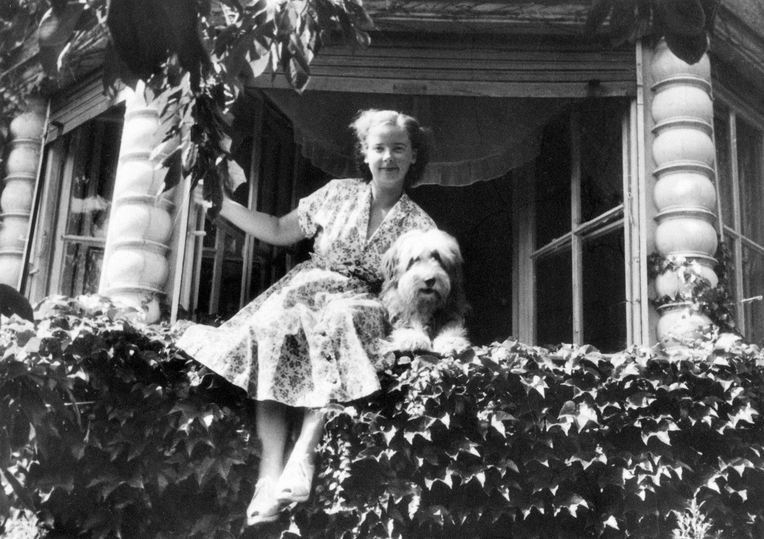


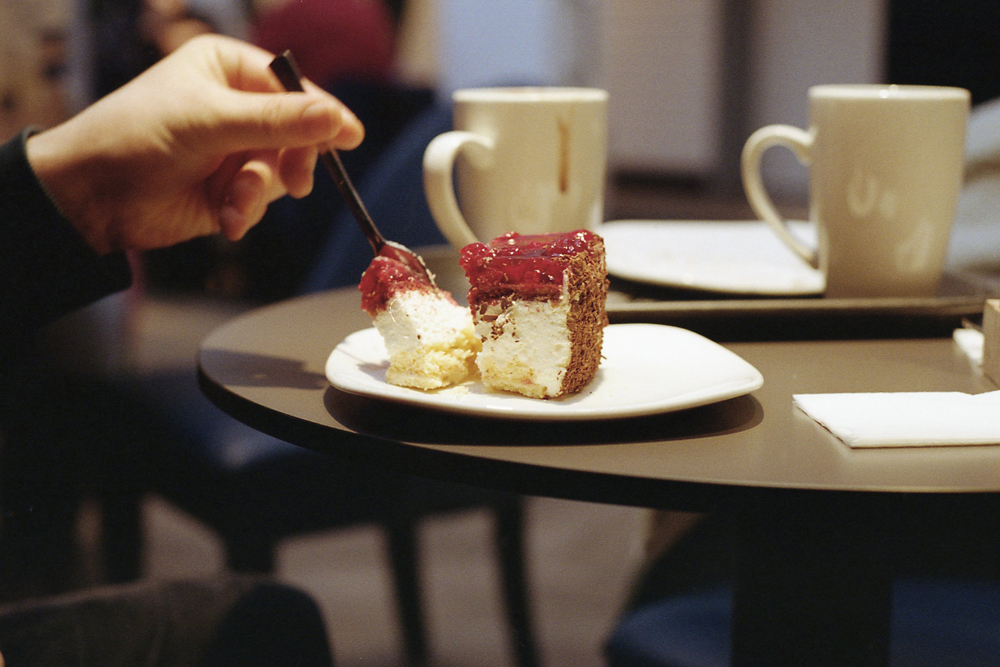


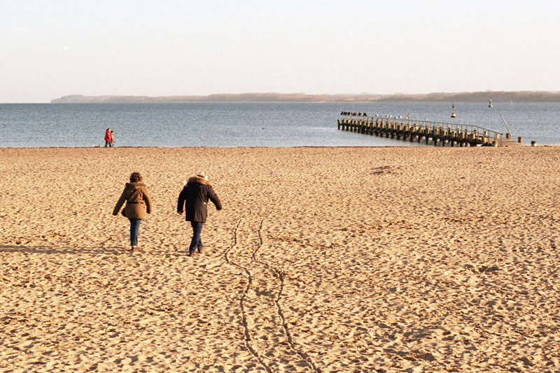
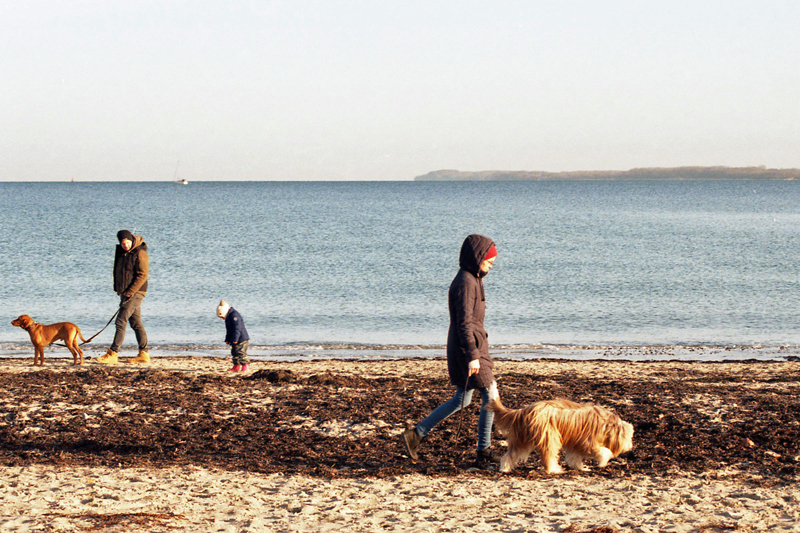
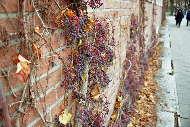
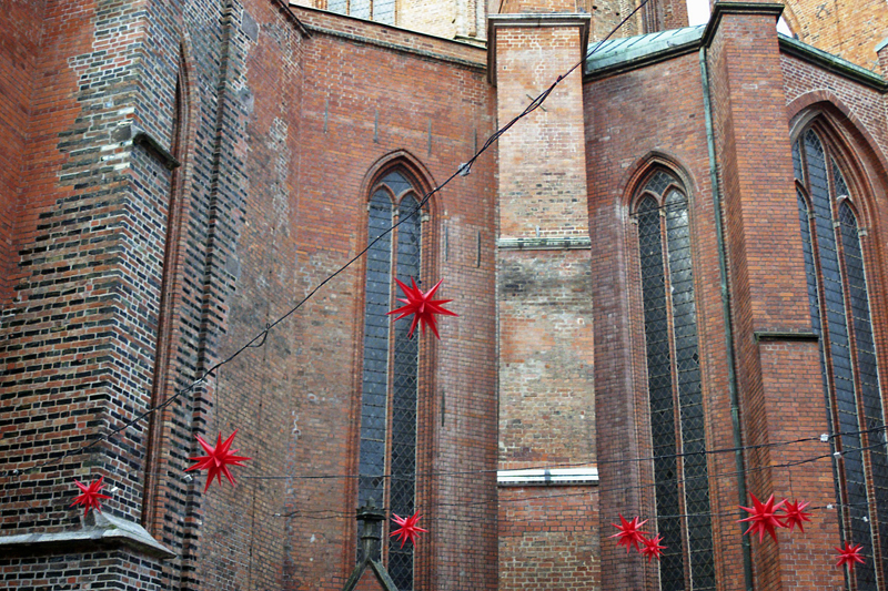
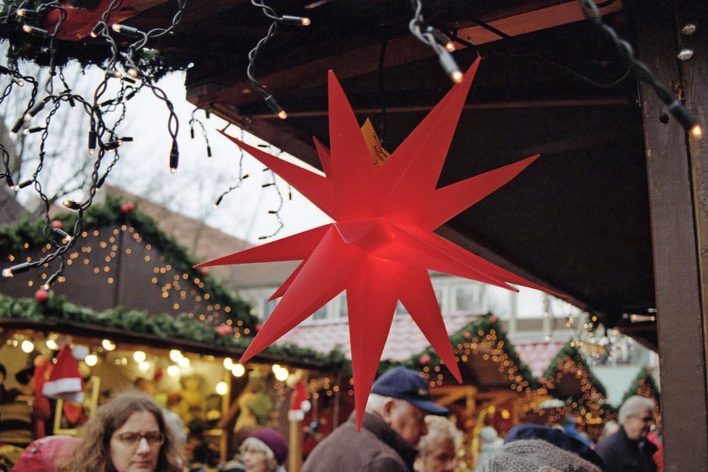
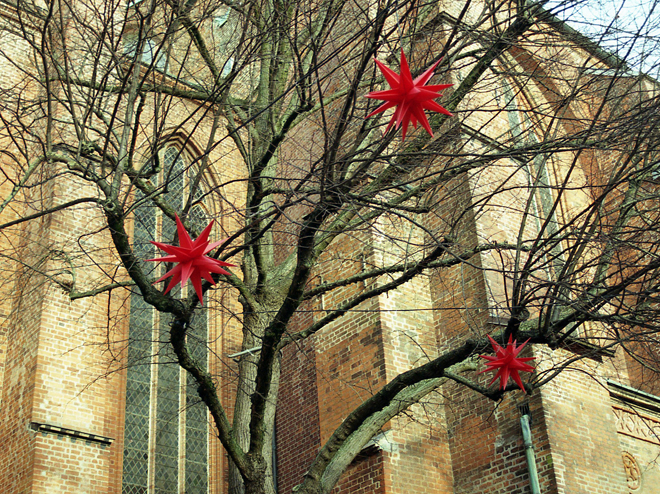
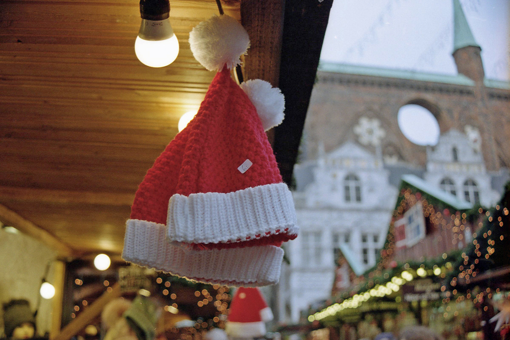
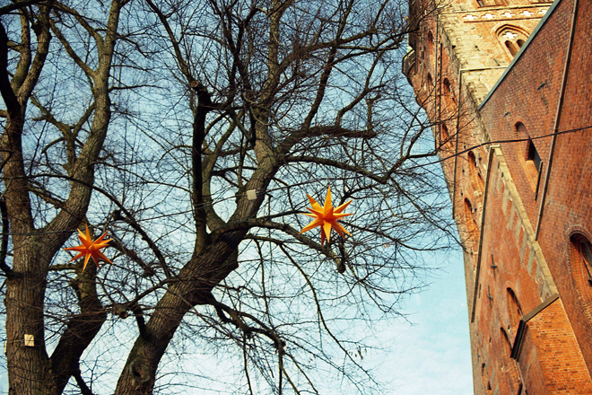


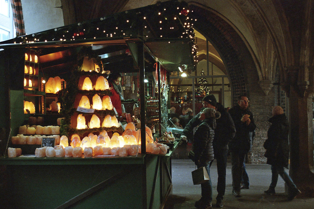


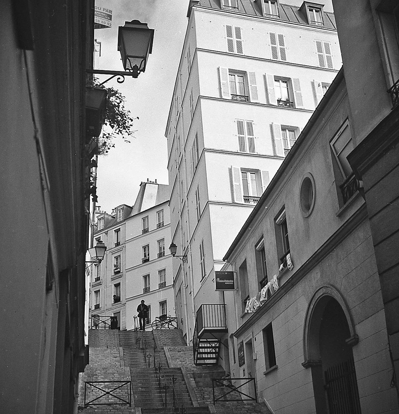
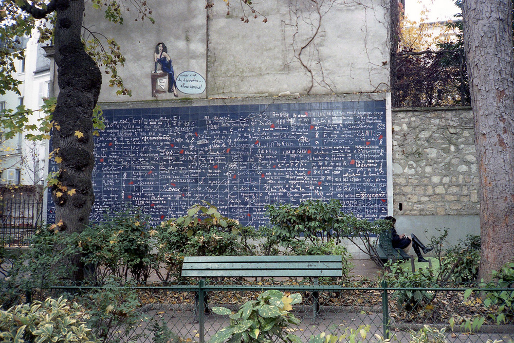


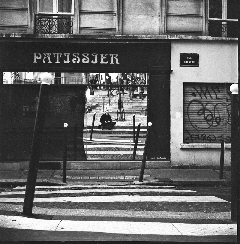


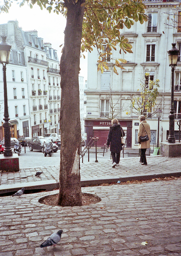
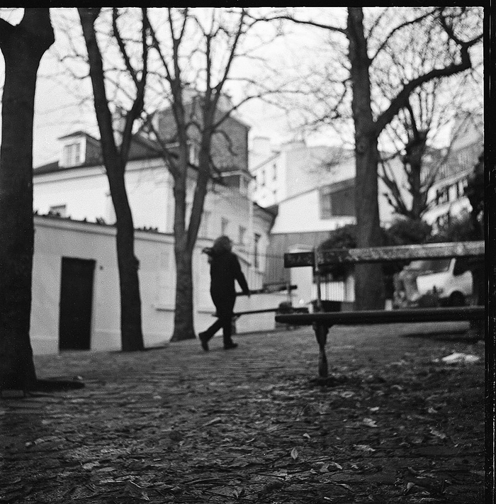

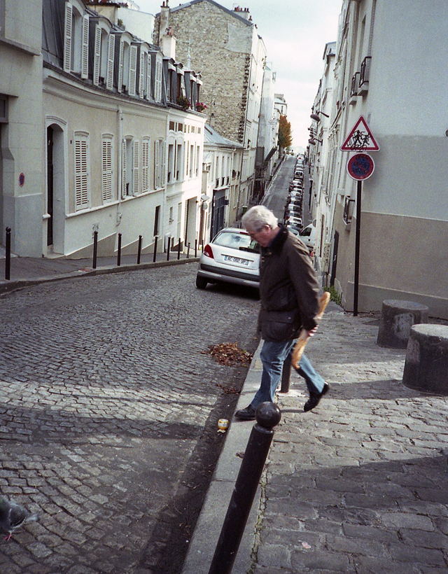
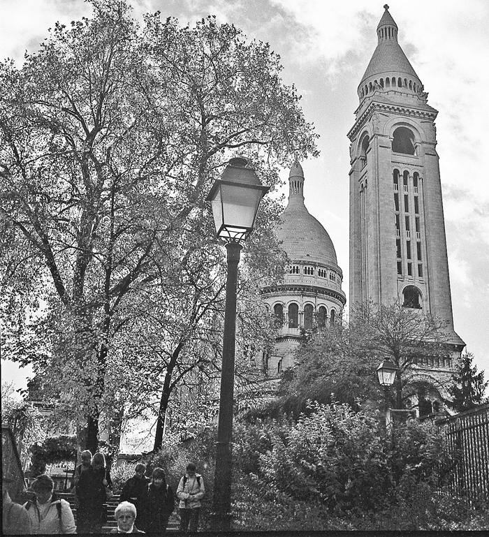


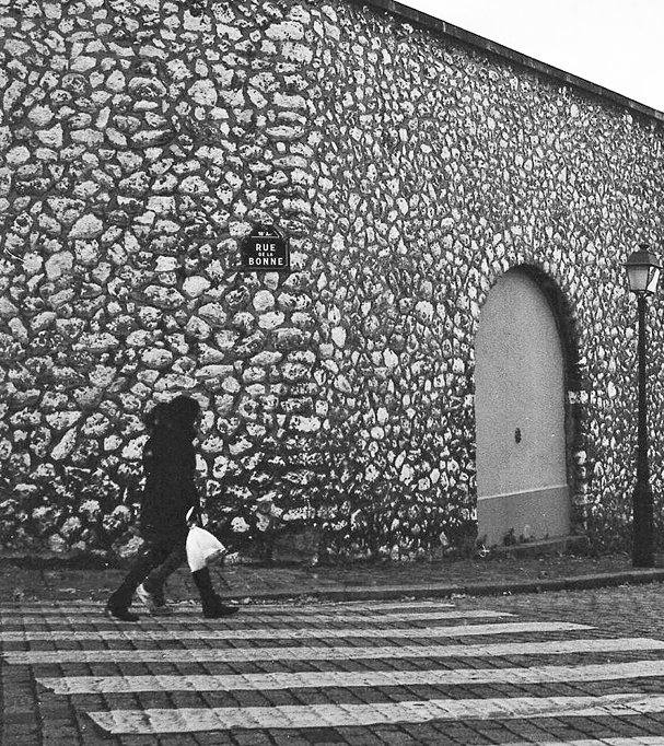


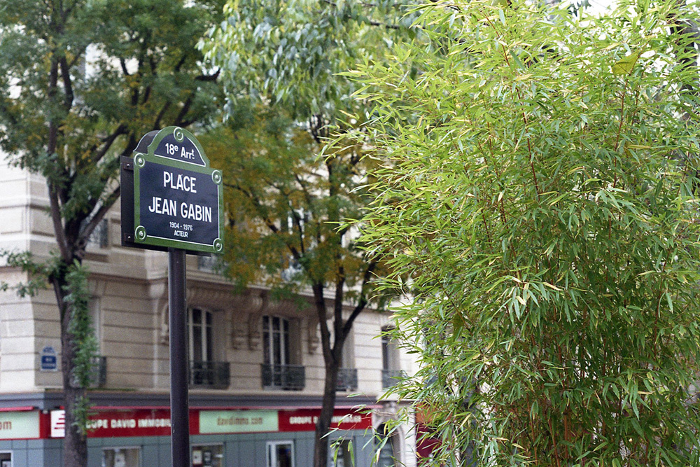


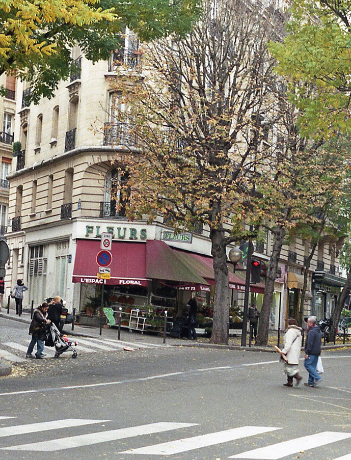

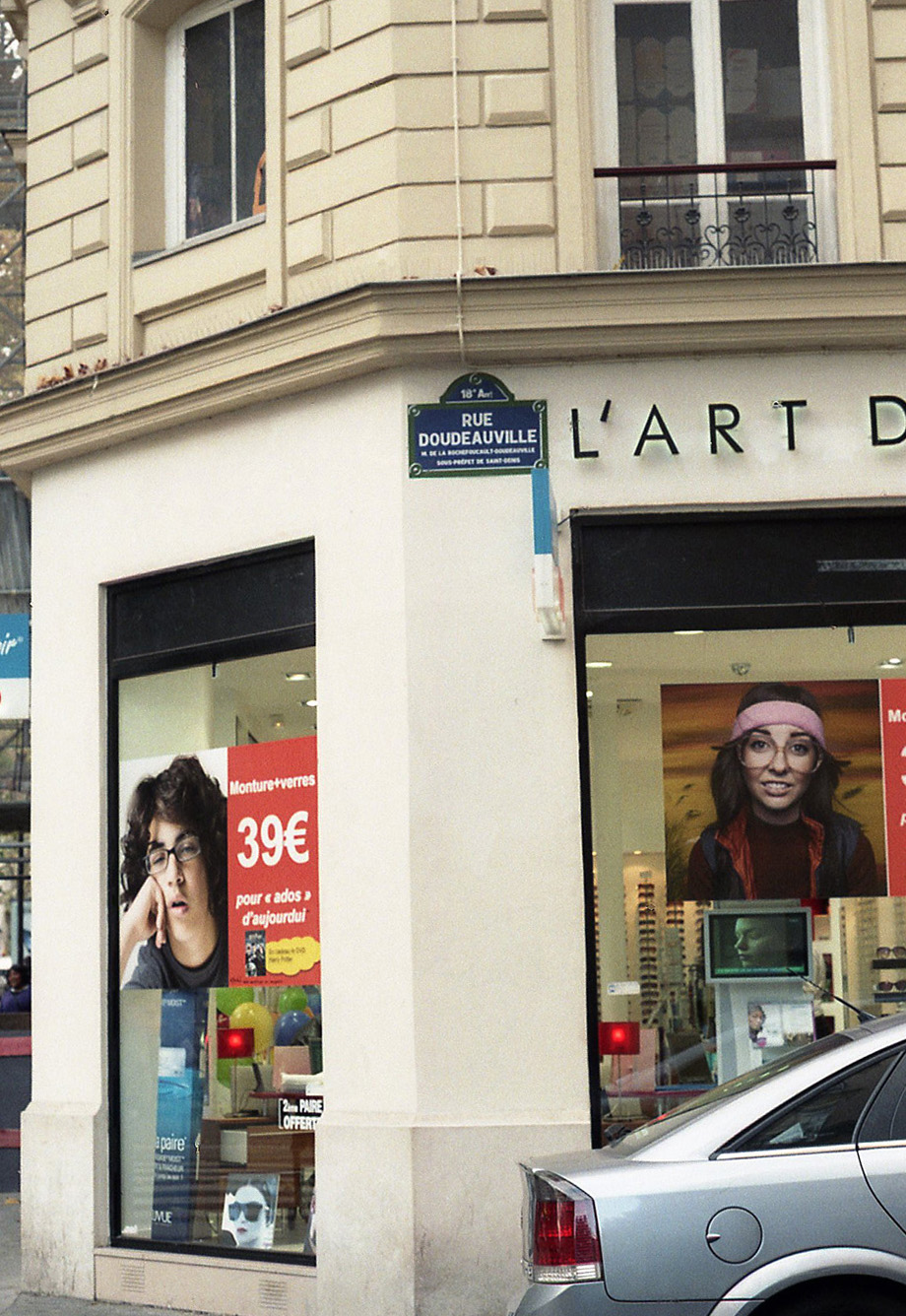
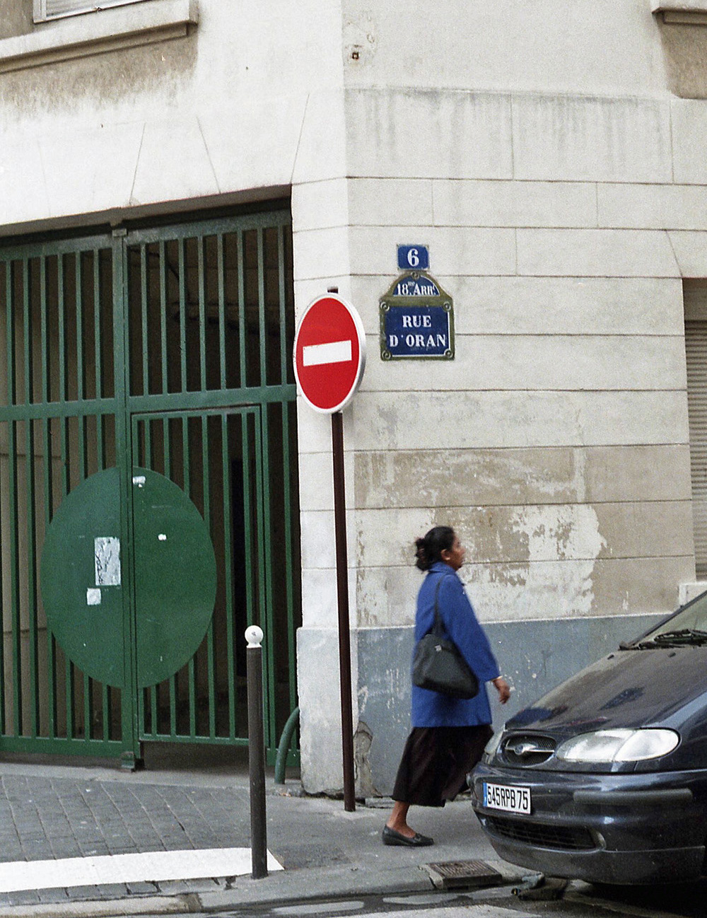
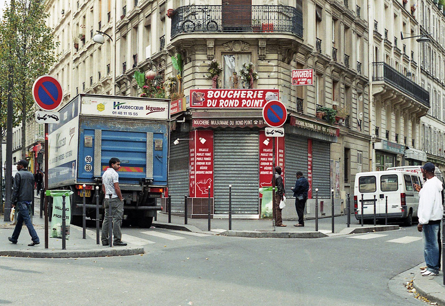


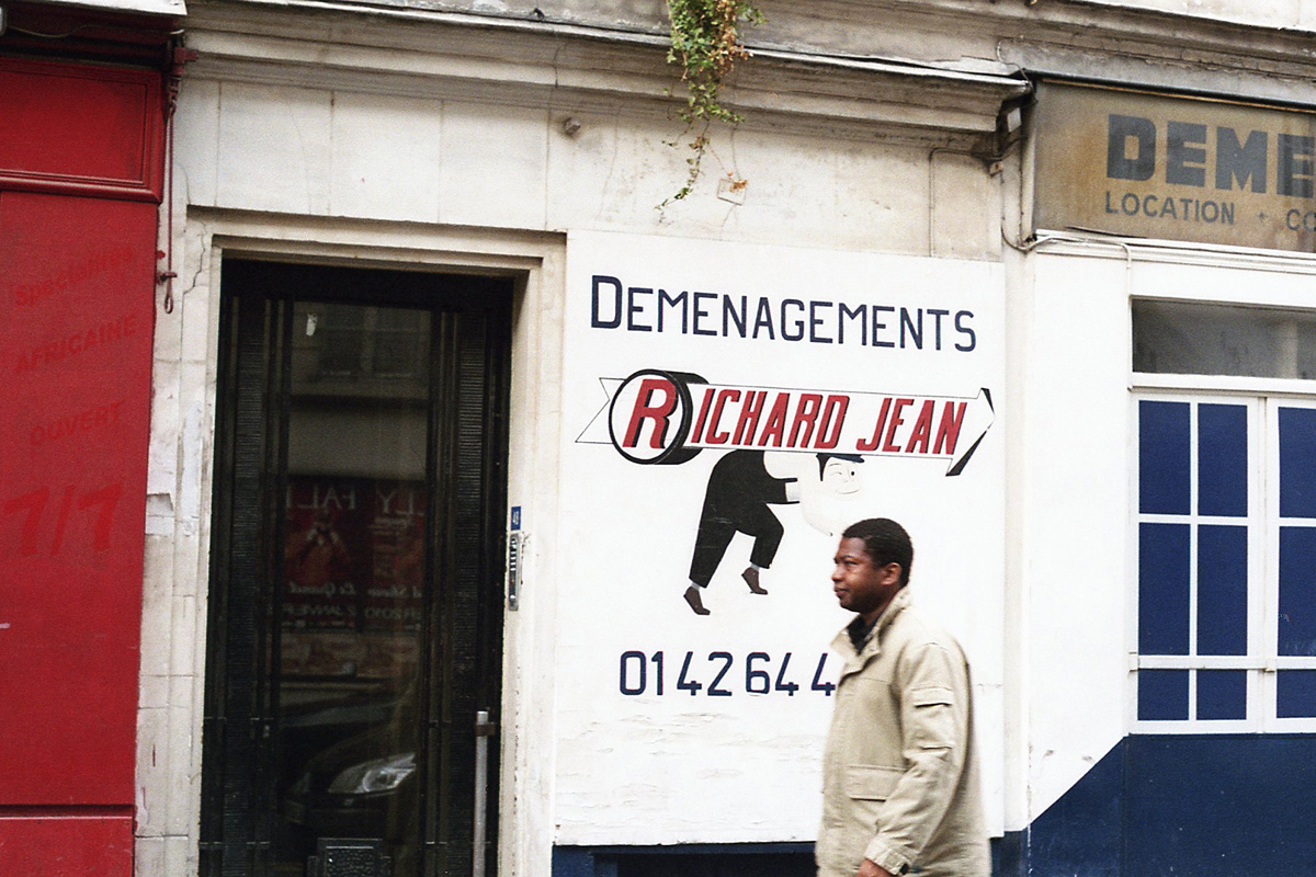

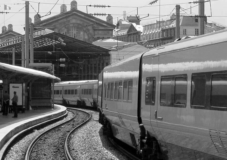


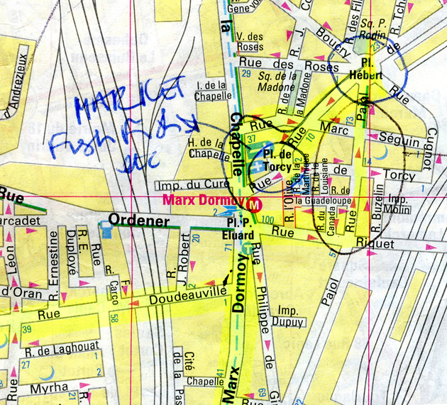

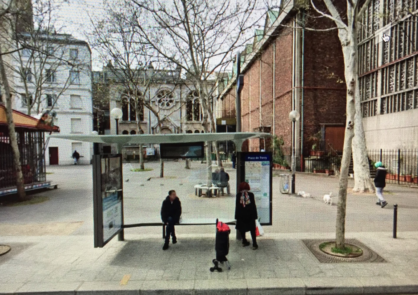

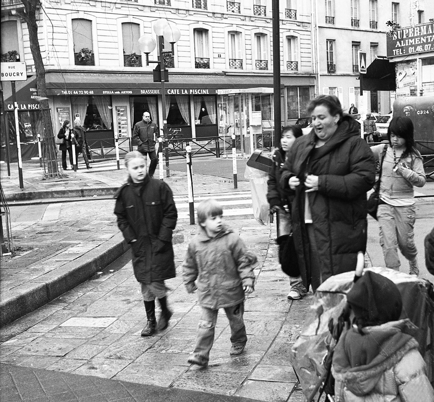


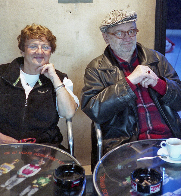
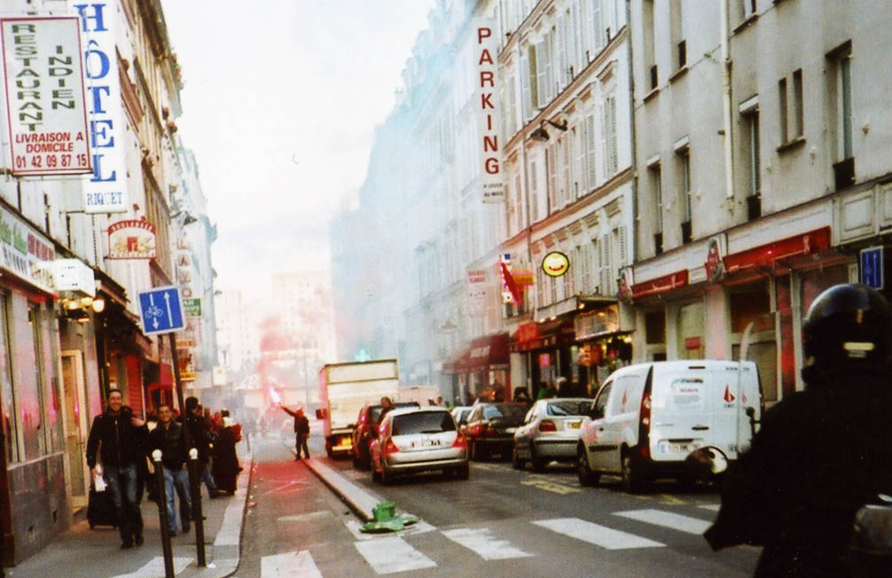


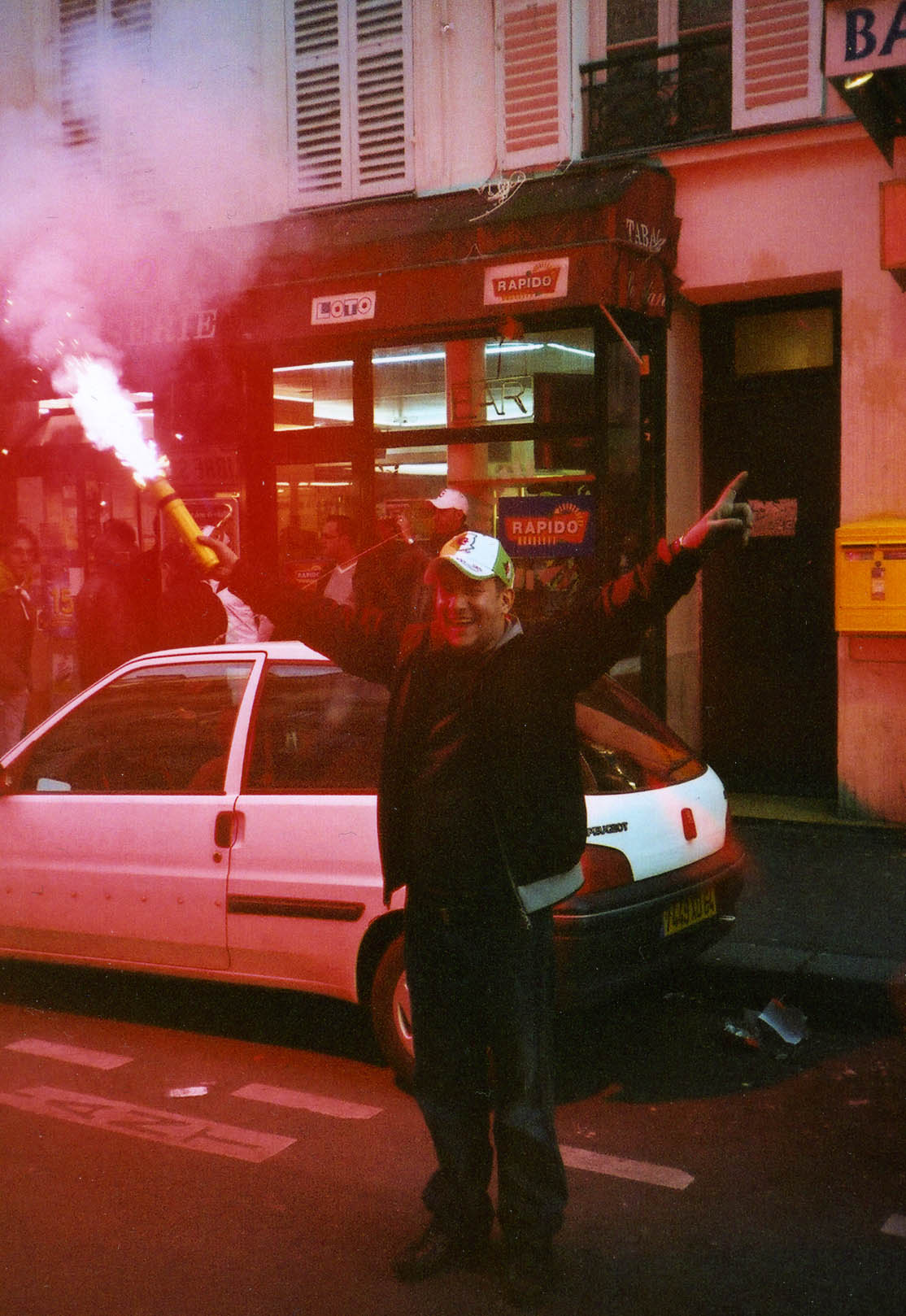


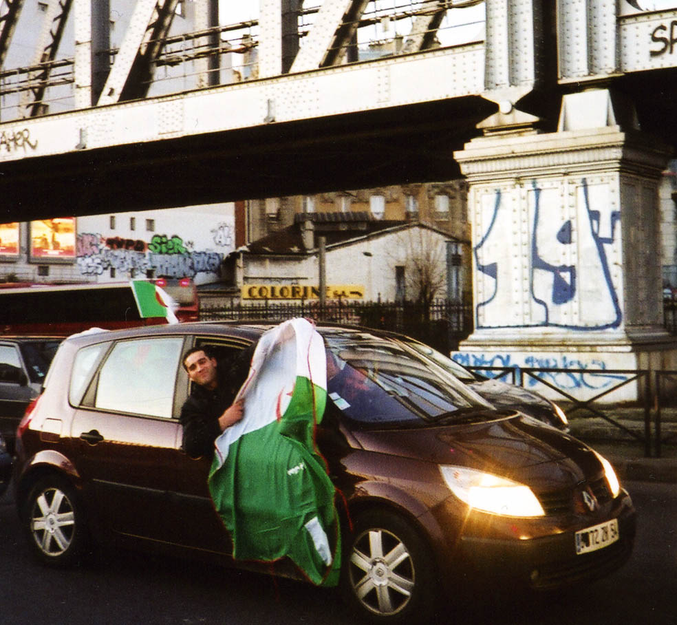


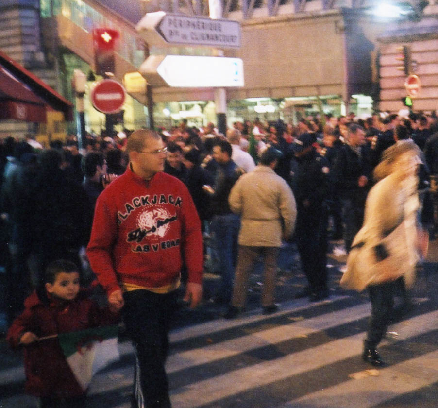


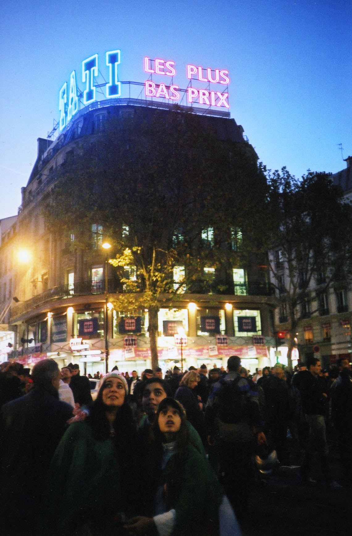
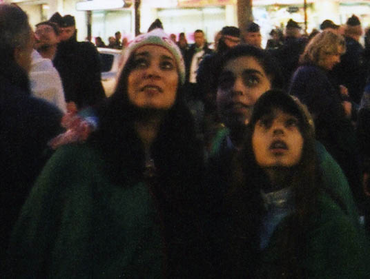


 Gosport High Street, circa late 1940s.
 Benouville Beach, Benouville and Benouville Bridge were in the “Sword” landing area, to the right.
 “Monday D Day Held Up”, London Daily Mirror, 7 June 1944.
 Approaching Benouville Beach, France, D Day, June 6, 1944.
 London Daily Mirror front page, 7 June, 1944.
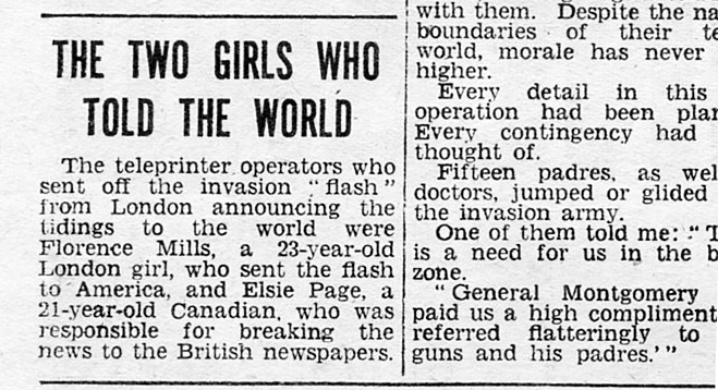 London Daily Mirror, 7 June, 1944.
 British radio programmes, D Day, 6 June, 1944. Source Birmingham Evening Despatch.
 British soldiers moving on from Benouville Beach, D Day, 6 June, 1944.
 “Field ambulance vehicles evacuating 6th Airborne wounded across Benouville Bridge, towards the beaches.” Note the Allied glider on the right.
 Birmingham Evening Despatch front page, 6.30 pm edition, D Day, 6 June 1944.
 “Late News” Birmingham Evening Despatch, D Day, 6 June, 1944.
 London Daily Mirror, 7 June 1944.
 Royal Engineer John Thorpe, centre, circa 1944. Photo Estate of John Thorpe.
 Royal Engineer John Thorpe, right. In Germany, circa 1945. Photo Estate of John Thorpe.
 Britain’s black-out, 7 June. Source London Daily Mirror, 7 June 1944.
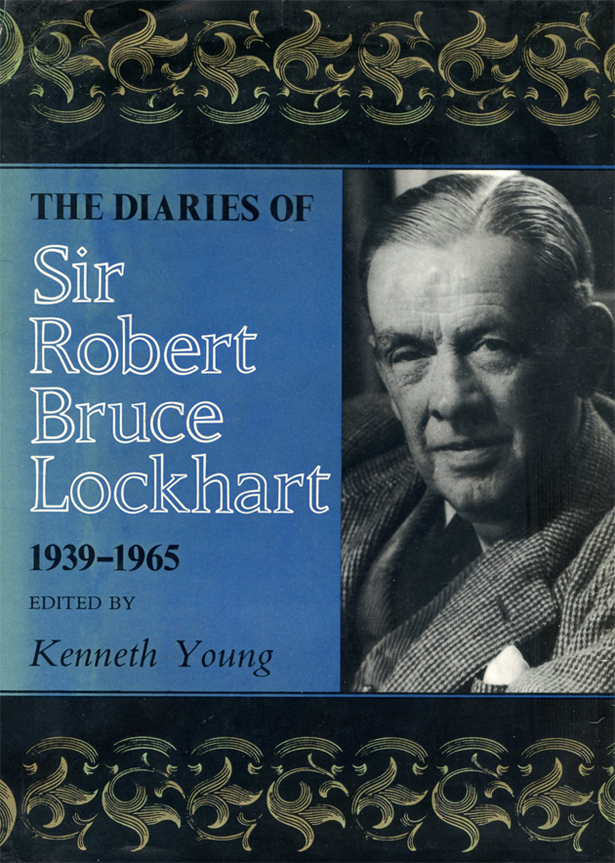
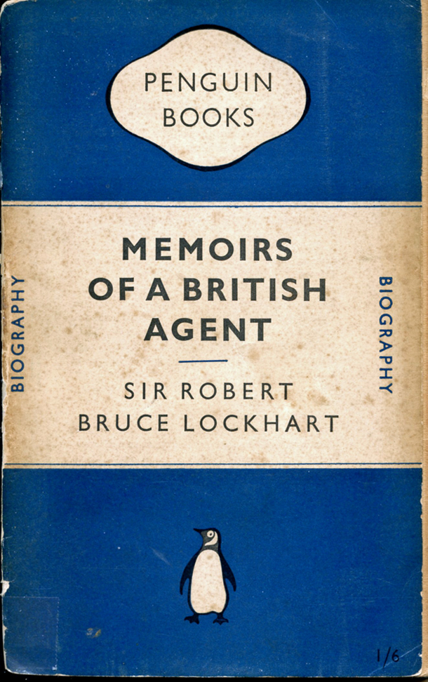
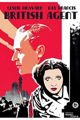
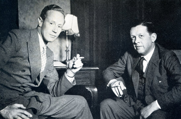
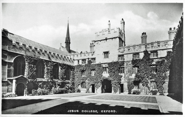


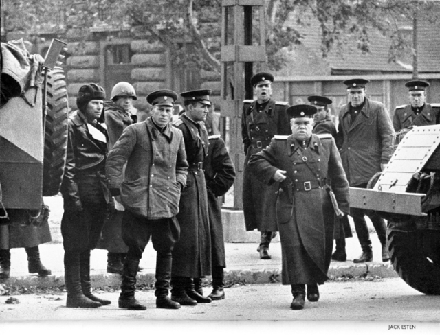


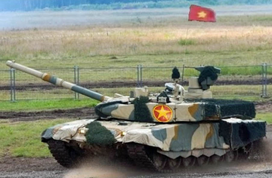
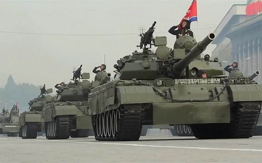

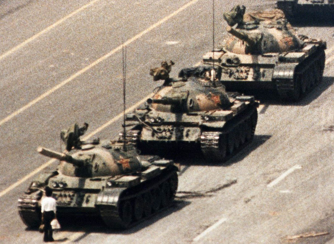
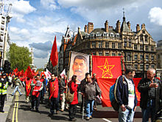

 Americans holidaying in the south of France, circa 1956. There is a rack of picture postcards by the door; the woman holds a pencil, the gent is displaying what seems to be a tourist guidebook.

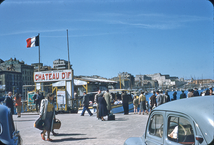 Chateau D’If, Tourisme Nautique – Vieux Port, Marseilles, circa 1956.
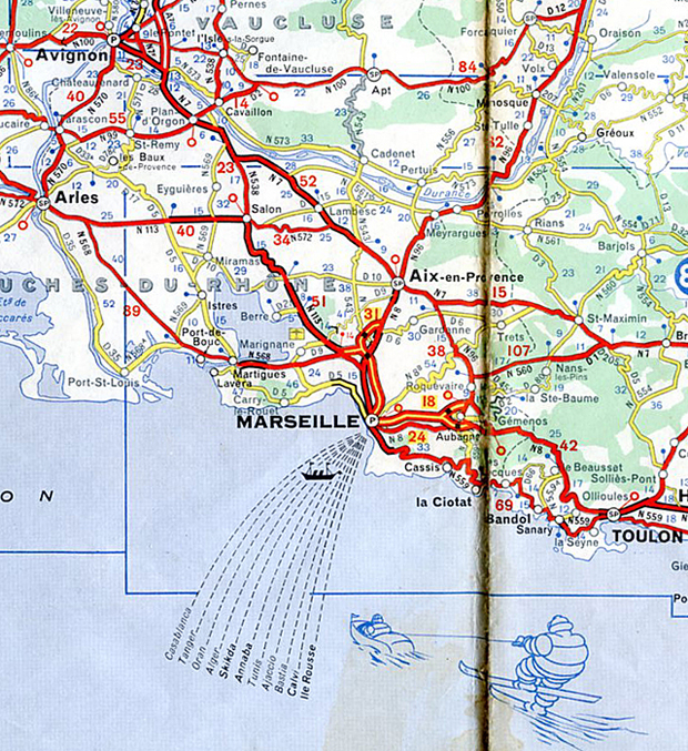 Extract from Michelin Map France Sud, 1965 revision. With grateful acknowledgment to Michelin.
 Vieux Port (The Old Port), Marseilles.
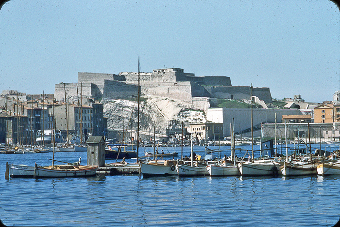 Vieux Port, Marseille, 1956.
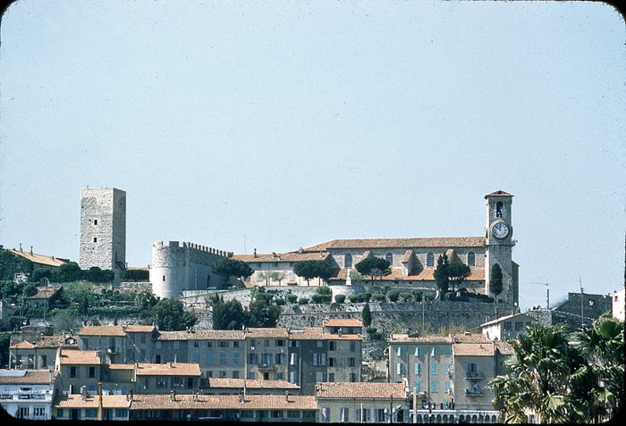 Vieux Port, Marseille. 1956.
 Both boys have sand/mud on their hands. In 2019 these boys will now be approaching their mid-seventies.
 The American couple stayed a night or two in a hotel possibly either in or near Arles or Avignon.
 The American woman with…? A fellow hotel guest, or Le Patron de L’Hotel ? Or…?
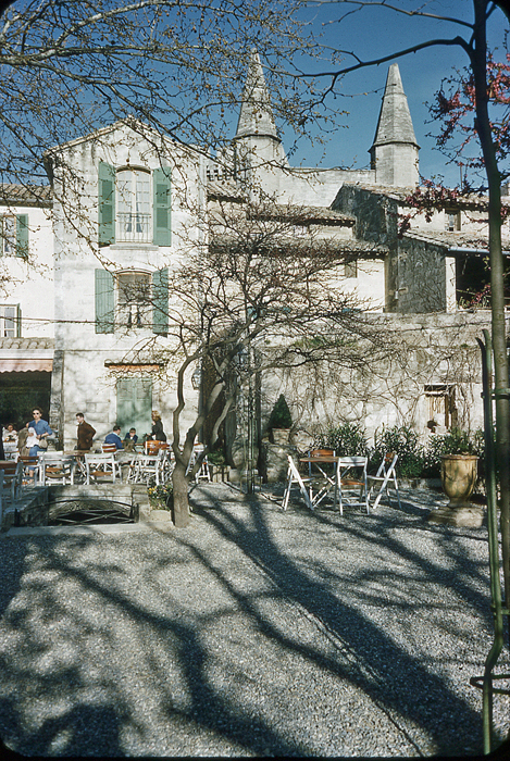
 The hotel dining room.
 The view from the hotel dining room. There is a chance the car seen on the left is a car hired by the American couple. There is a glimpse of a similar car in a photo of Le Palais des Papes (Palace of the Popes) in Avignon.
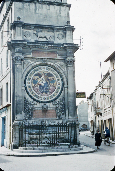 Arles.
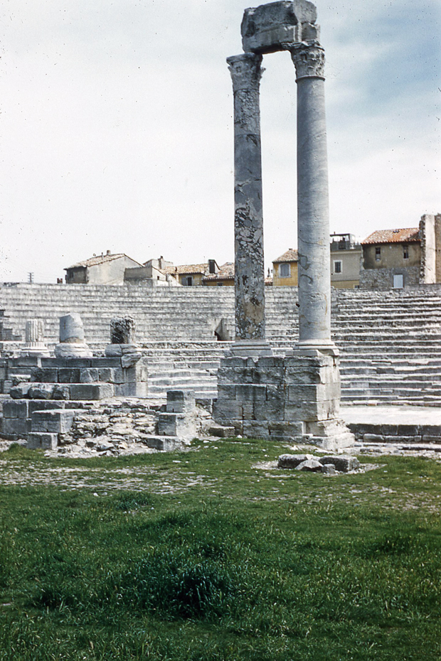 Arles, Roman ruins.
 Arles, price of entry to Roman ruins and a cat sniffing the sign.
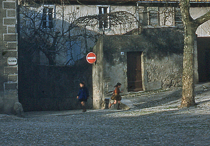 Two young girls. Assumed to be Arles or Avignon. Detail.
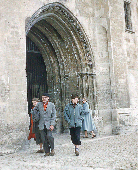 Church entrance, with daughter, son and father, possibly. Assumed to be either Arles or Avignon. Detail.
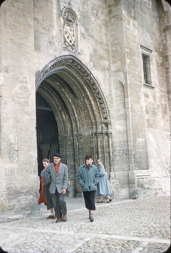
 Unidentified town square. “Cycles Magaly” and a Gendarme talks to a car passenger. Detail.
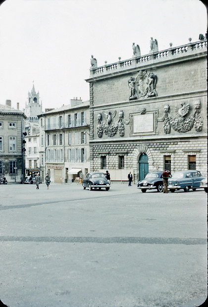
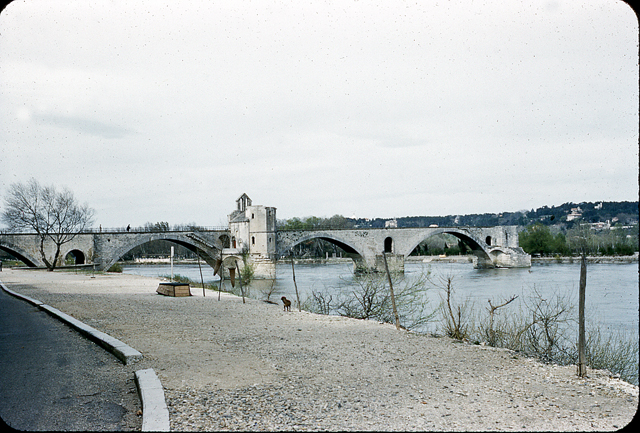 Pont d’Avignon (and dog).
 Avignon and a parked Cadillac, believed to be a Series 62, with a Norwegian plate. A sign to the right of the Banque de France indicates the way to Le Palais des Papes (The Palace of the Popes)
 Le Palais des Papes, Avignon.
 Avignon.
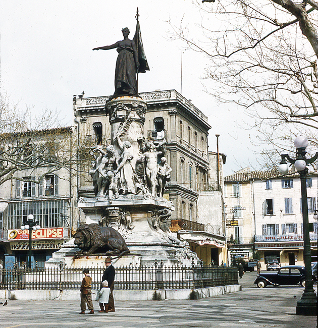 Monument du Centenaire (detail), Avignon. Someone is looking out of the window above the Creme Eclipse sign
 Monument du Centenaire, Avignon.
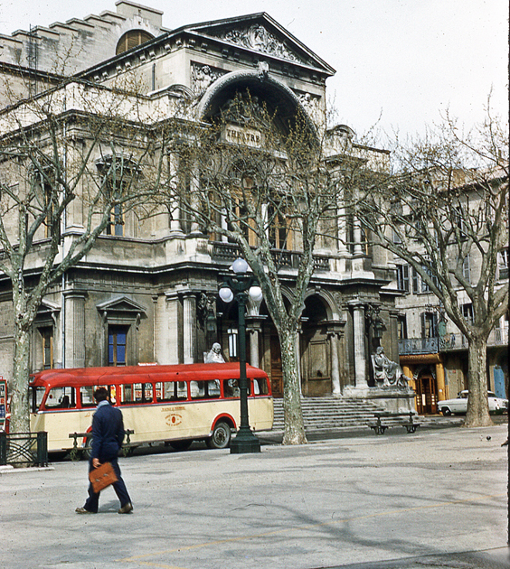 Theatre Building, Avignon, detail.
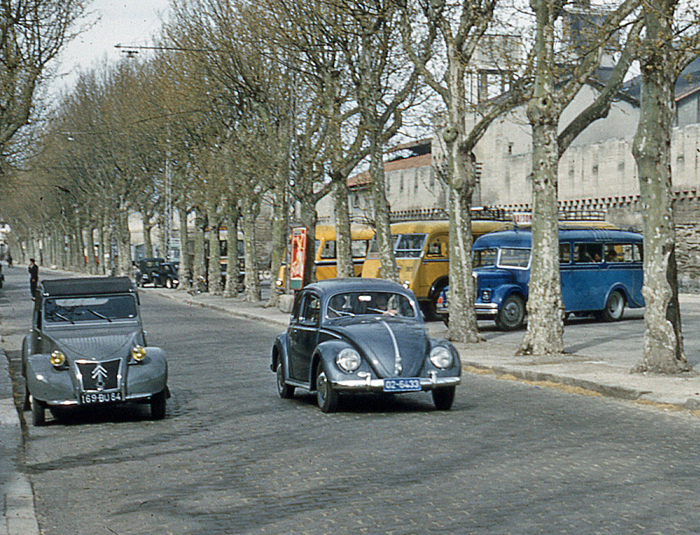 Citroen 2CV and Volkswagen Beatle, believed to be in Avignon. (Detail). The country of origin of the all numeral registration plate on the Volkswagen has not, yet, been identified.
 Avignon: “Services Touristiques, Provence Voyages“, and a Gendarme. Detail.
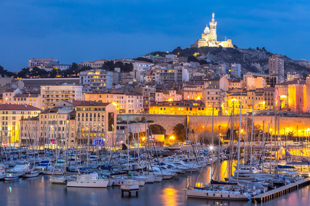 Marseilles, the Old Harbour. Grateful acknowledgement Vichie81/Shutterstock.
 Christmas 1950 at British Woman


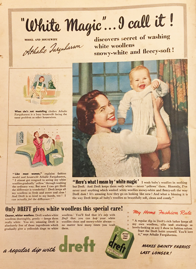


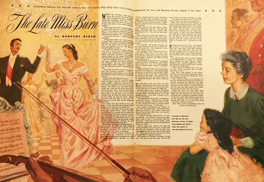
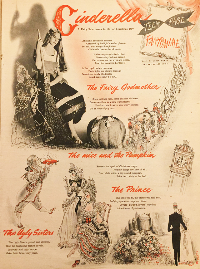
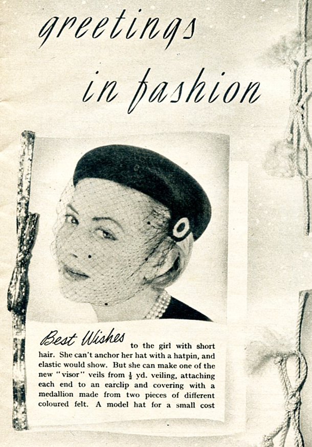


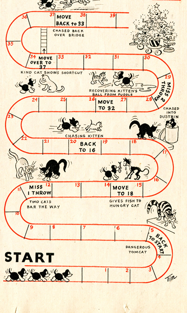


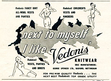
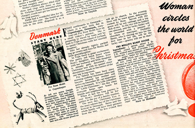

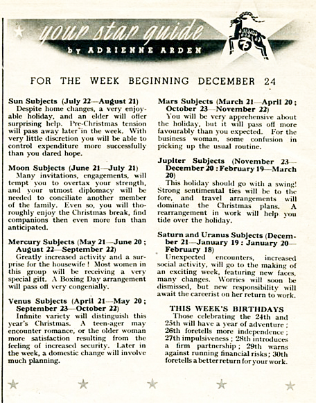
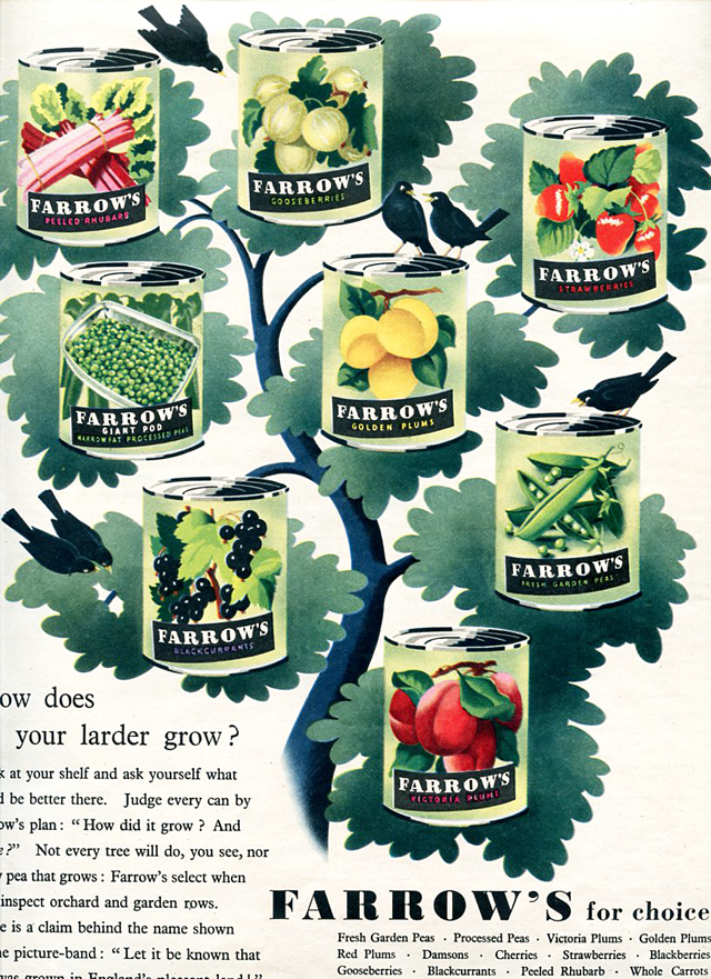


 ______________________________________
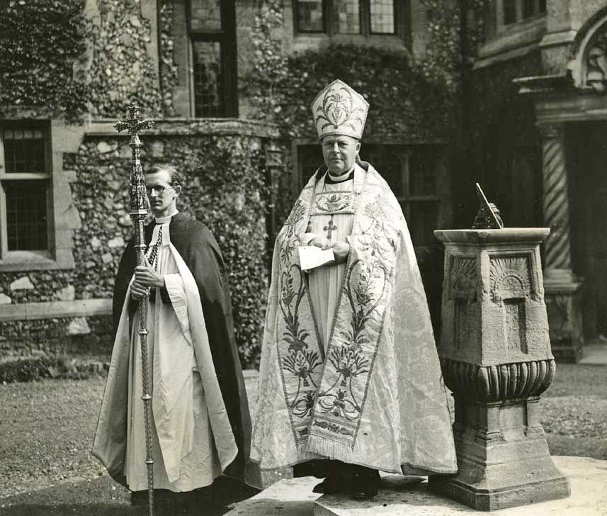


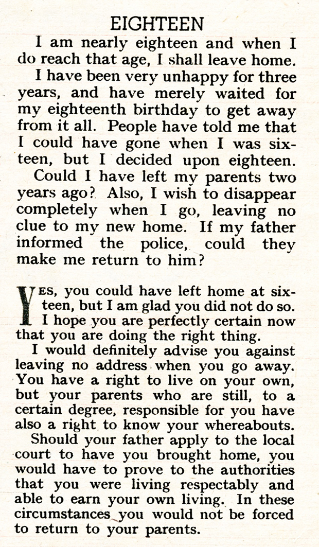


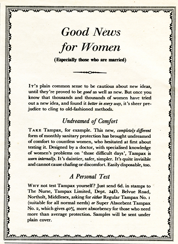
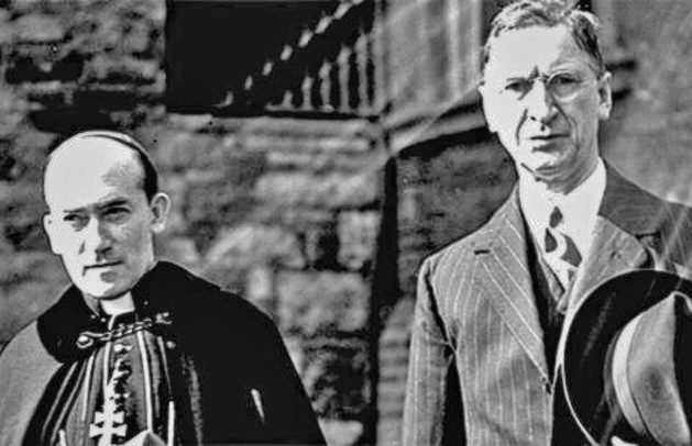
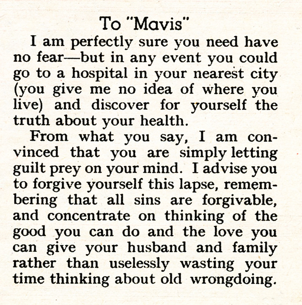
 ____________________________
 Henri Cartier-Bresson…?
 Edouard Boubat…?
 Sniper fire, Paris, August 1944. Photo: Robert Doisneau…?
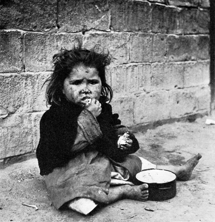 Spain, 1950. Photo: Eugene Smith…?
 Nehru. Photo: Margaret Bourke-White…?
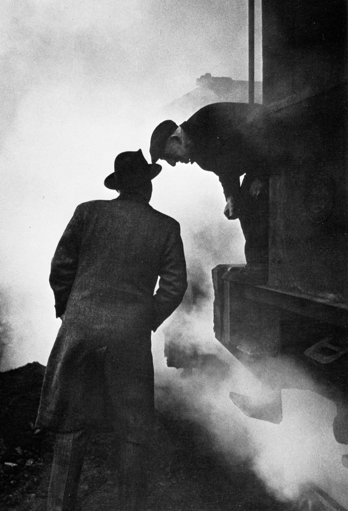 Photo by Willy Ronis…?
 Photo by Izis…?
 Photo by Robert Capa…?
 Photo by Robert Frank…?
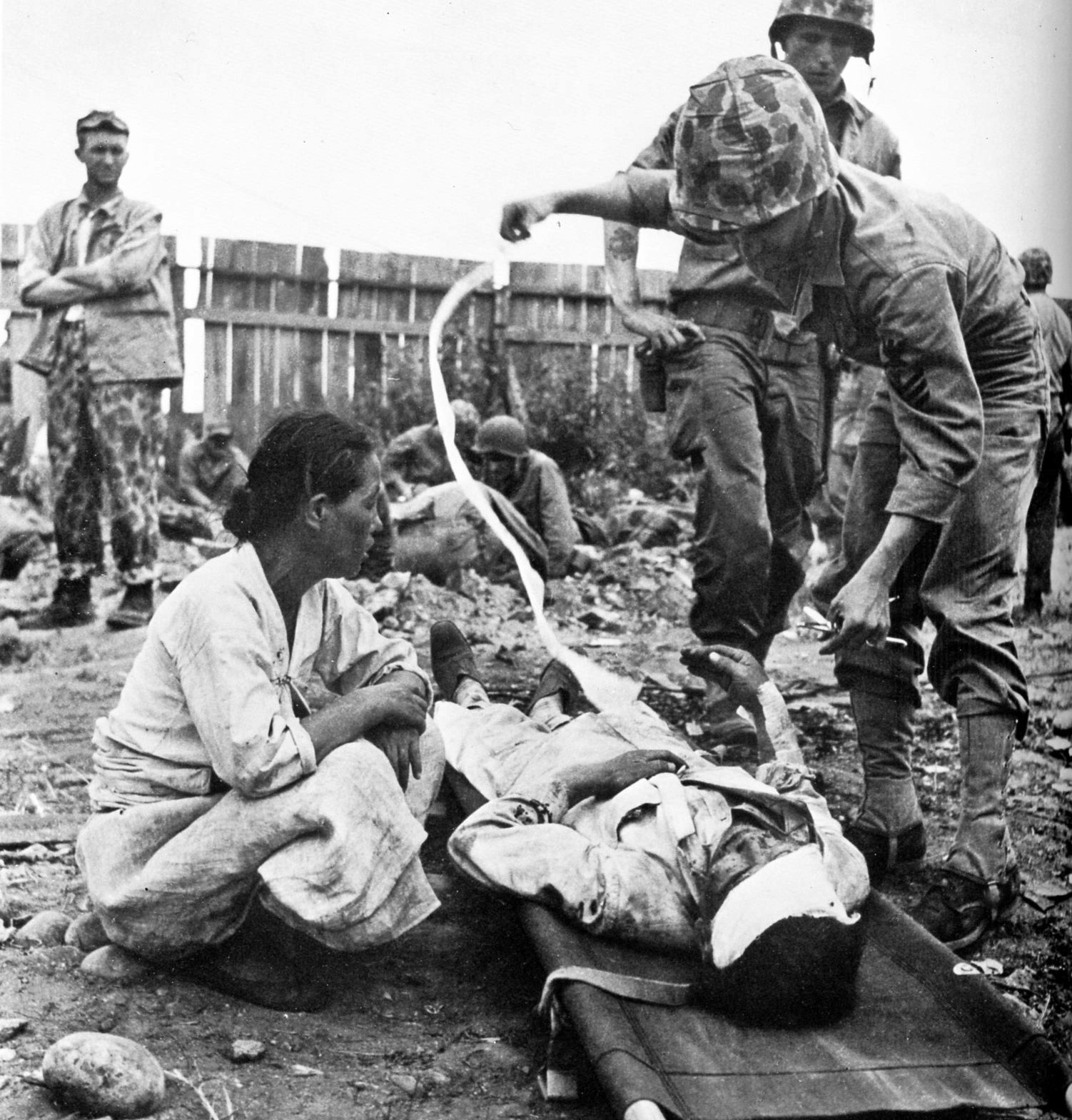 Photo by David Douglas Duncan…?
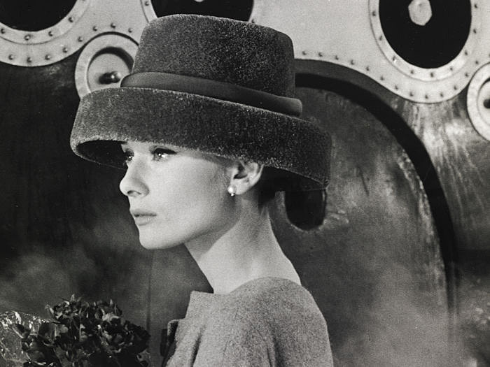 Audrey Hepburn, 1956. Photo by Bert Stern…?
 Baby Bert, Bert Hardy summer 1913, Priory Buildings, Blackfriars, London. “My Mum with myself at a few months old“. Source Bert Hardy: My Life, London 1985.
 King George V and Queen Mary, Blackfriars Road, London. Photo by a teenage Bert Hardy.
 “One of my earliest photos taken with flash powder. Bath time at the Priory Buildings”. Photo by a teenage Bert Hardy.
 Photo by Bert Hardy mid to late 1930s. Sold to The Bicycle.
 The Picture Post cover on the week Bert Hardy joined the magazine. Picture Post, March 9, 1940 from the Pete Grafton Collection.
 Mono reproduction of Bert Hardy cover for A Trawler in War-Time, Picture Post March 21, 1942. From Bert Hardy: My Story, London 1985.
 Bert Hardy photo aboard a trawler in heavy seas, Picture Post March 21, 1942. From Bert Hardy: My Life, London, 1985.
Carl Mydans and left, George Silk. Life magazine war correspondnets. Photo source: Getty, with grateful acknowledgement.
Robert Capa, war correspondent. Photo: unknown source.
 Bert Hardy in jeep with Wehrmacht prisoners on the bonnet. The prisoners are possibly there to deter enemy snipers or an ambush. Photographer unknown. From Bert Hardy: My Life, London 1985.
 “My first frightening encounter with the enemy came when we were heavily mortared. I came closer to death, however, when I nearly detonated a land mine in my efforts to seek cover.” Photo Bert Hardy. From Bert Hardy: My Life, London, 1985. Robert Capa was to die stepping on a landmine in French Indo-China (Vietnam) in 1954.
 Monochrome reproduction of Picture Post Cover, February 8, 1947, featuring Bert Hardy’s portrait of India’s first prime minister, Jawaharial Nehru.
 Chinese cafe, Liverpool. Photo: Bert Hardy.
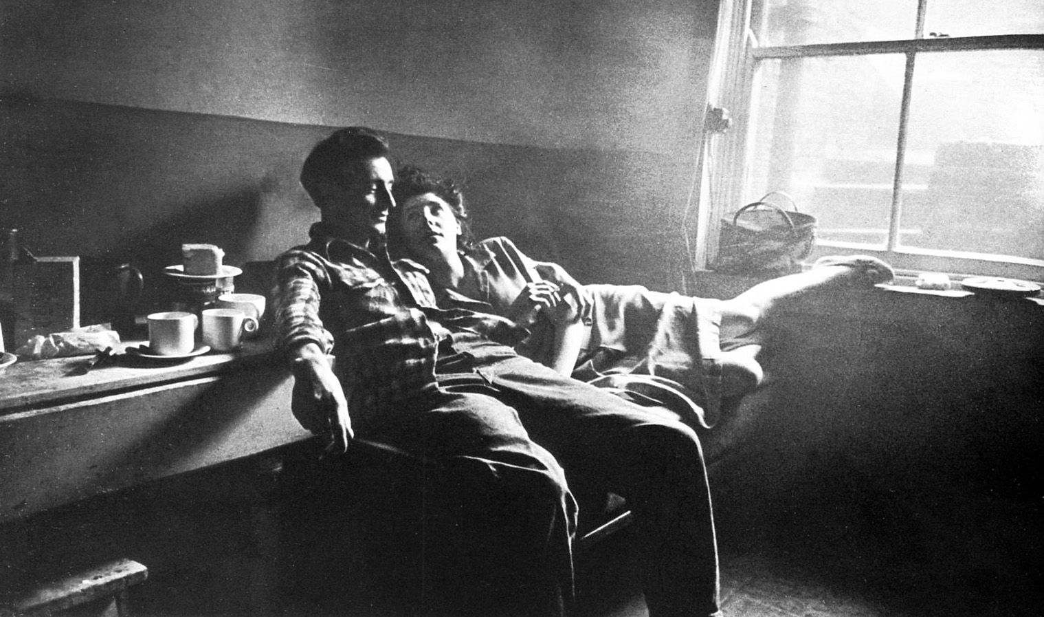 Couple in a basement room, from the Picture Post story on the Elephant & Castle area, London, late 1948. Photo Bert Hardy.
 Gorbals boys, 1948. Photo Bert Hardy. “My favourite picture: this reminds me of what I was like when I was a kid. In this story I concentrated on the children, and how they kept their spirits up in conditions which were often dreadful.” From Bert Hardy: My Story, London 1985.
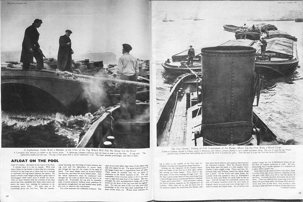


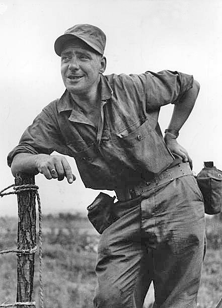 Bert Hardy in Korea, 1950. Unknown photographer. Copyright, with acknowledgment, Getty.
 Bound UN political prisoners, Korea, 1950. Photo by Bert Hardy, from Terror in Korea: We appeal to U.N. Text James Cameron, photos Bert Hardy. Supressed by Picture Post owner Edward Hulton.
 Bert Hardy: “The layout for the story that was never published, for which Tom Hopkinson was sacked.” From Bert Hardy: My Life, Godron Fraser, London, 1985.
  Journalist Katherine Whitehorn, Hyde Park, London, 1956. Photo Bert Hardy.
 Sunday morning on the Champs Elysees, Paris. Photo Bert Hardy.
 Chorus girls on the front at Blackpool. Photo Bert Hardy. Taken on amatuer Box Brownie camera.
 Kodak Box Brownie, similar to the one Bert Hardy used on the Blackpool photo. A basic camera but one that had extras such as a push-on close up lens and a yellow filter to bring out the depth of a blue sky and increase contrast.
 Family of Man exhibition book, New York, 1955.
 Bert Hardy full page in the Family of Man exhibition book, p.124, New York, 1955.
 Bert Hardy, Elephant & Castle couple , with other selected photos, p.131 Family of Man exhibition book, New York, 1955.
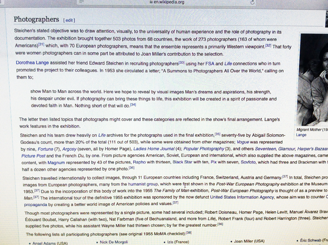
 “…Most photographers were represented by a single picture, some had several included; Robert Doisneau…” Wikipedia entry on the Family of Man Exhibition, on-screen shot October 19, 2108. Bert Hardy had three photographs selected.
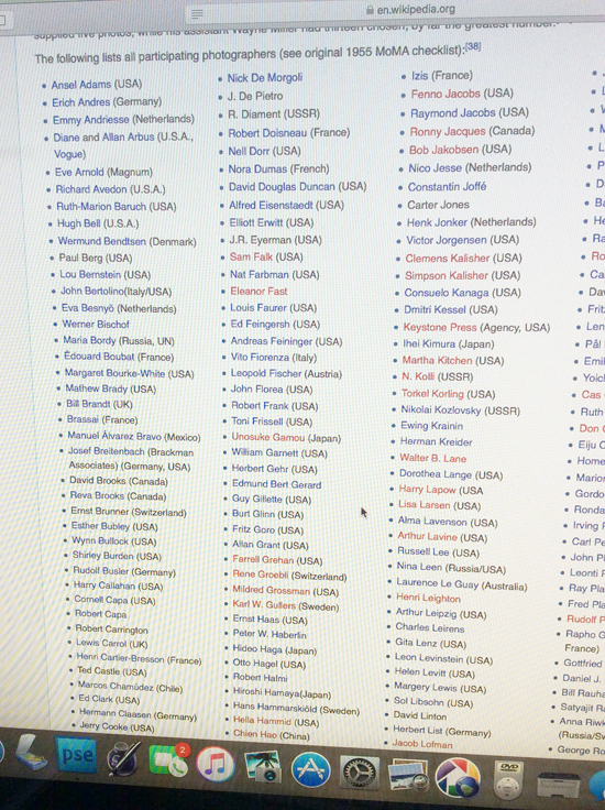 “The following lists all participating photographers. (see original 1955 MoMA checklist)” – online Wikipedia detail from their Family of Man item. Bert Hardy is not on this Wikipedia list, but is on the MoMA list.
 “At about midnight we were on the Albert Bridge, with some final shots of the model leaning against the parapet. Terry (his younger son) was holding a strong torch to get just enough light on the man’s face to make it look like a lamp-light.” Bert Hardy from Bert Hardy: My Life.
 “The Strand picture above was the first 35 mm photograph to be made into a 48-sheet poster” – Bert Hardy from Bert Hardy: My Life.
 Michael Caine as Alfie walks across a night-time Waterloo Bridge, Alfie, 1966.
 Bert Hardy ploughing at his farm. Photo Uncredited. The first time he got on a tractor at his new farm he wrote “I tried my hand at chain harrowing. It was the first time I had driven a tractor since the War when I was doing a story of Land Girls for Picture Post.” From Bert Hardy: My Story.
 “My two grand-daughters taken in 1978, in the lane leading to my house.” From Bert Hardy: My Life.
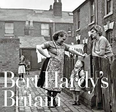 Bert Hardy’s Britain, Bluecoat Press, UK.
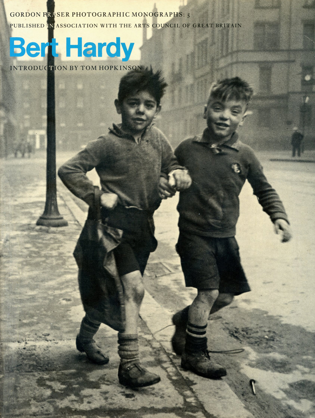 ______________________________________
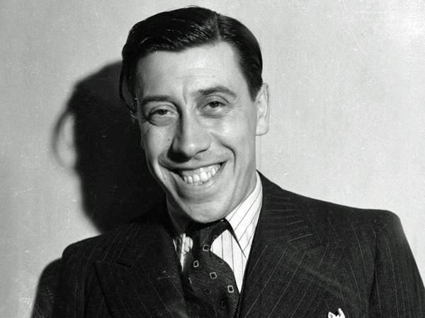

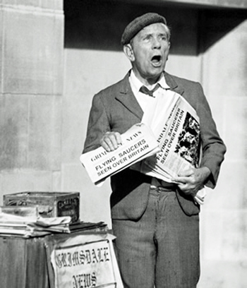


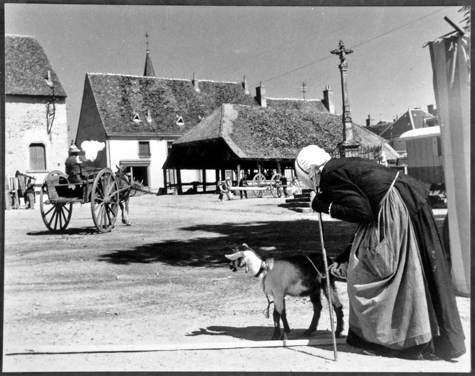


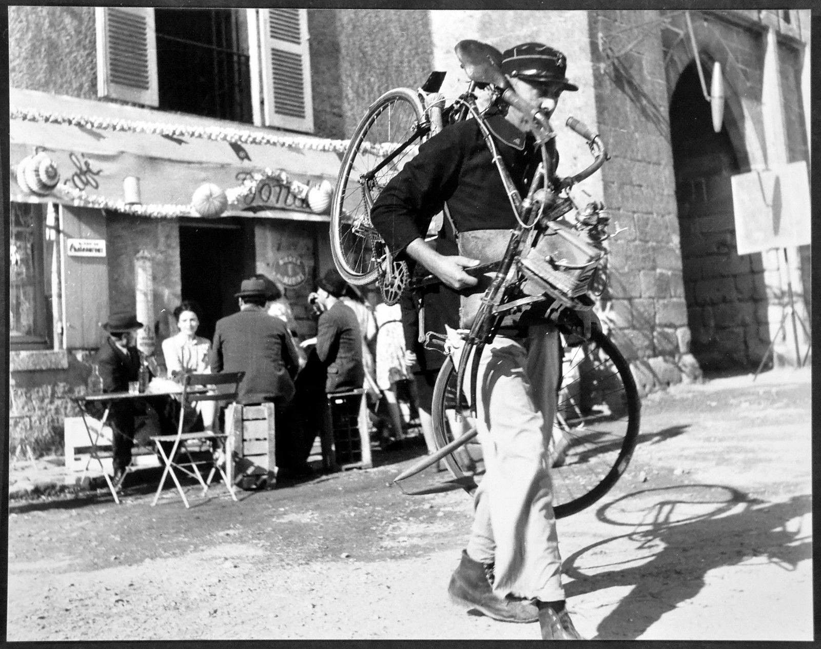
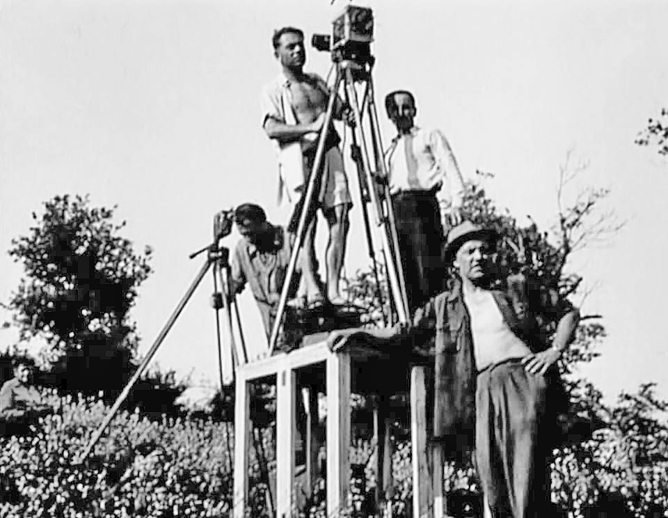


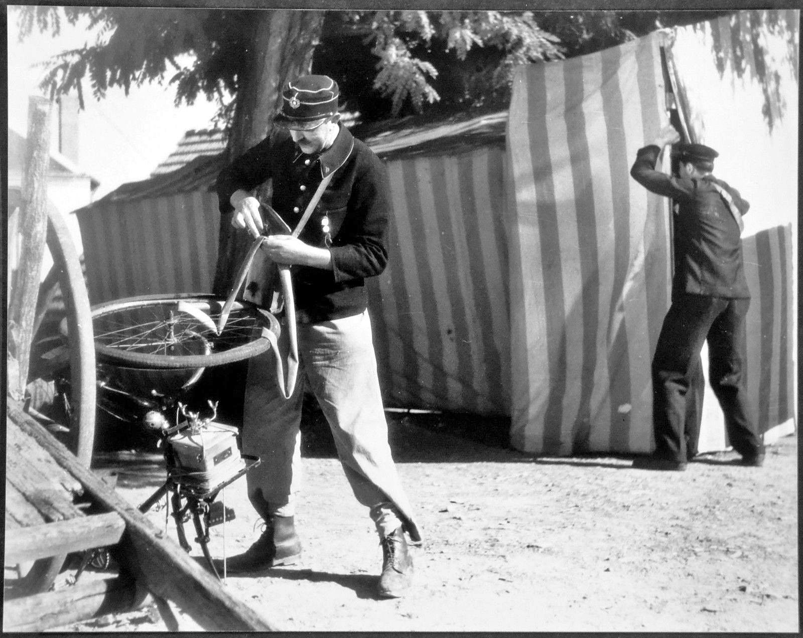


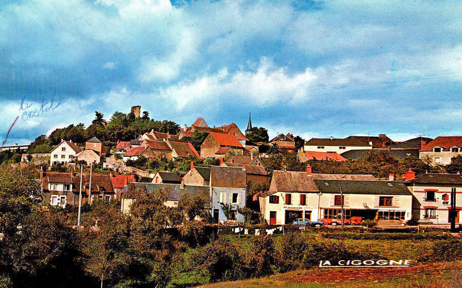


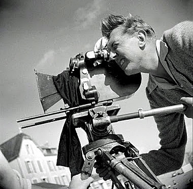


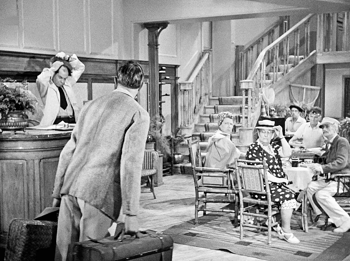
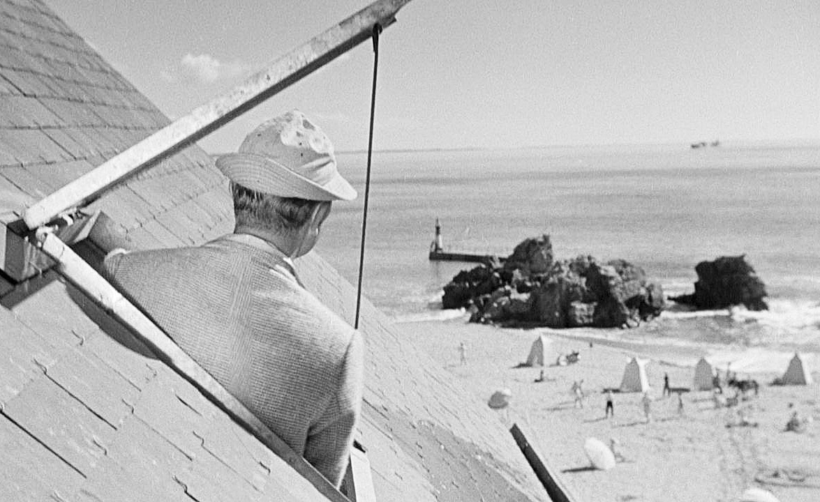
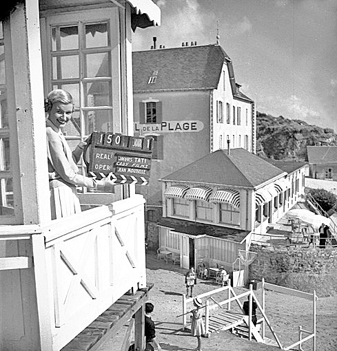


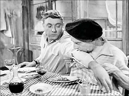


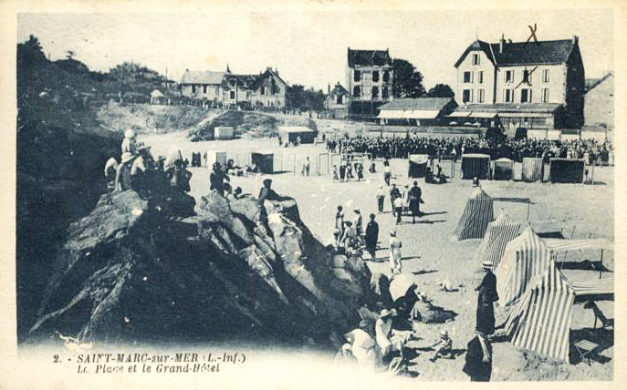


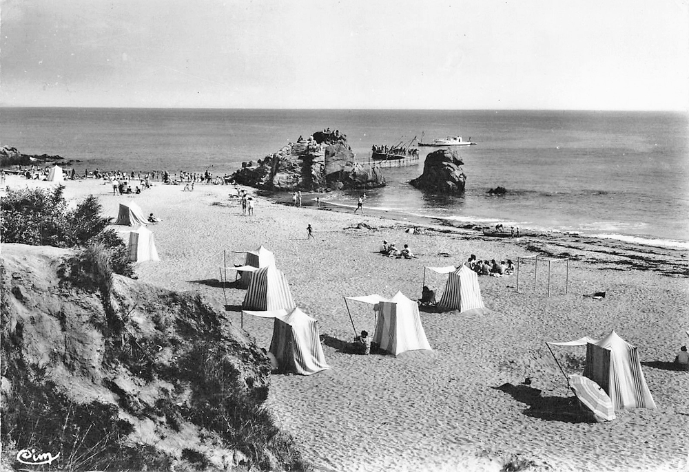
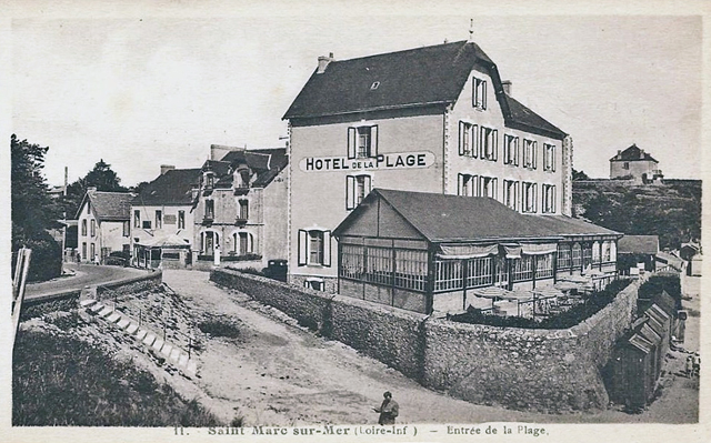


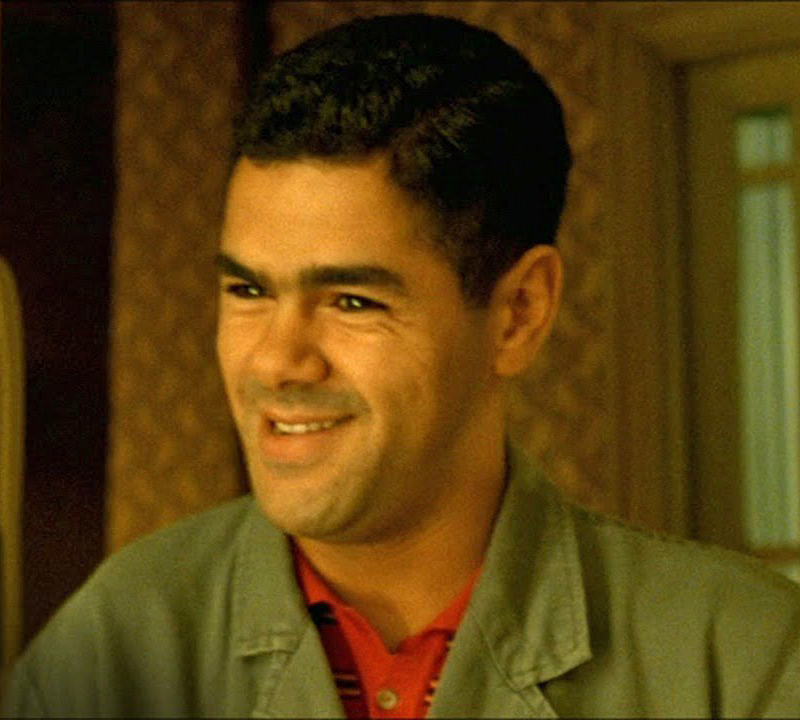


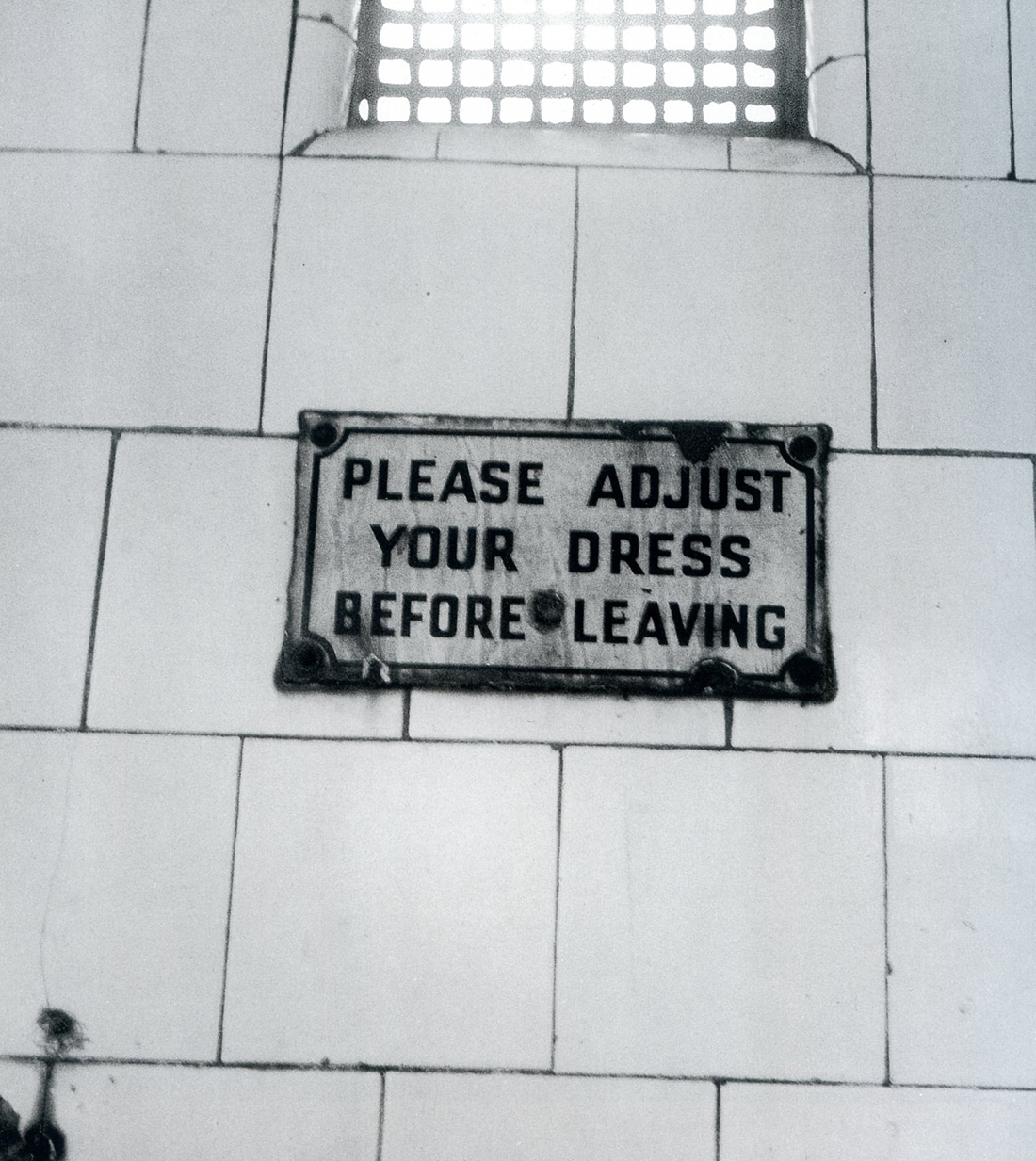


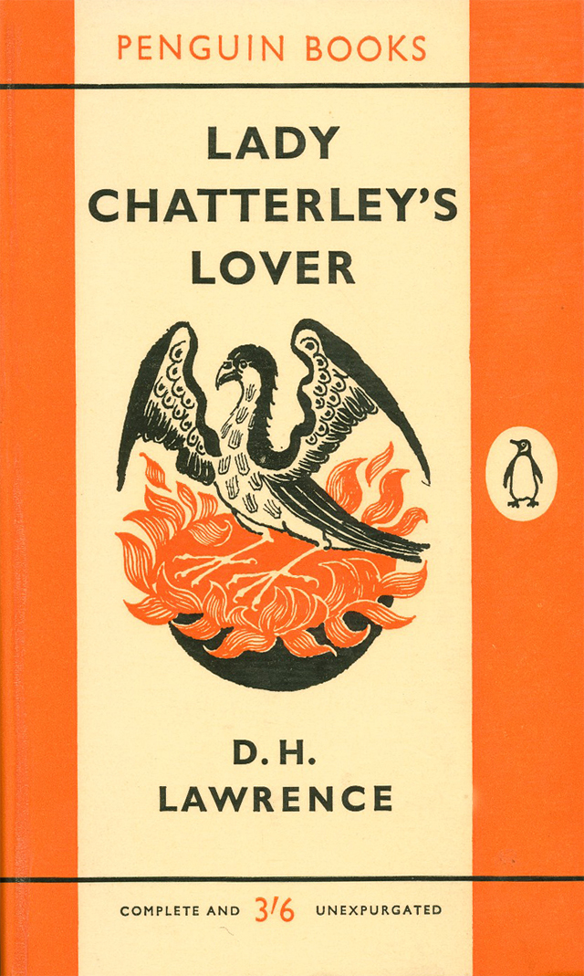


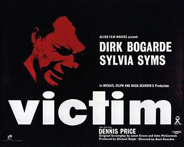


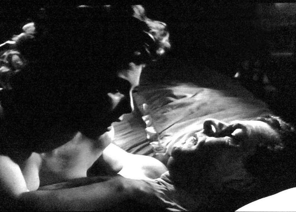


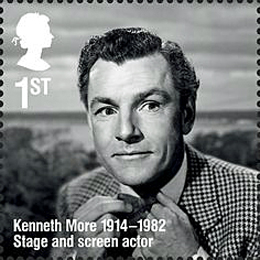

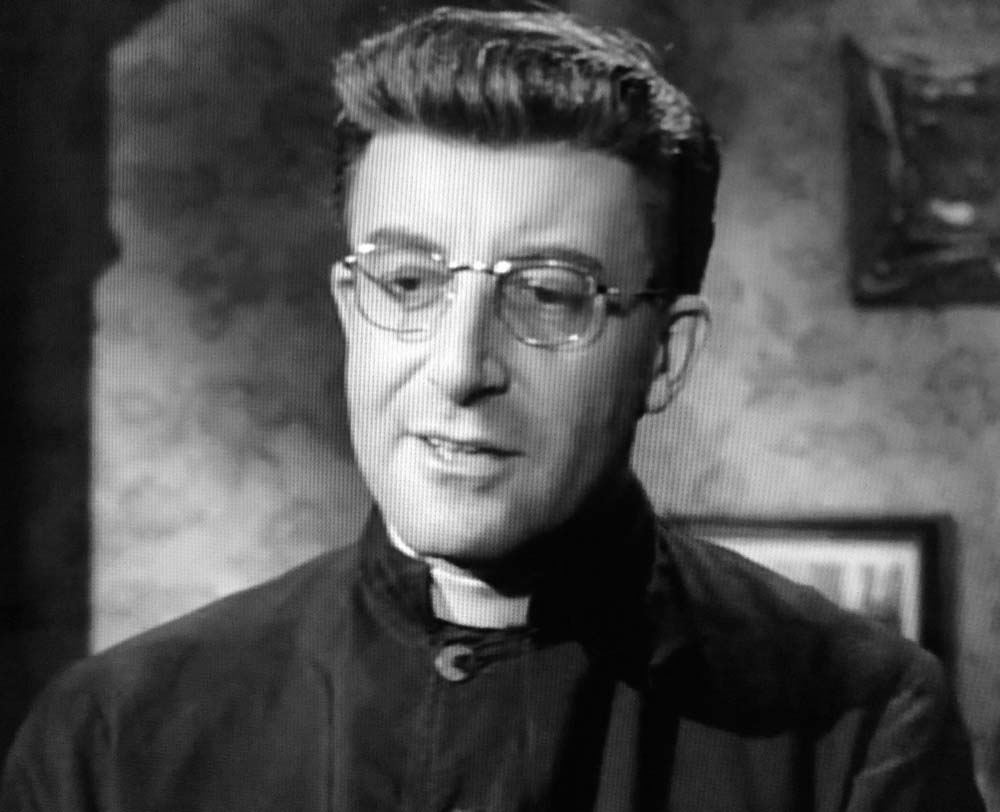


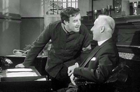


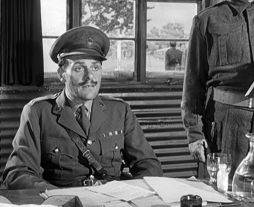


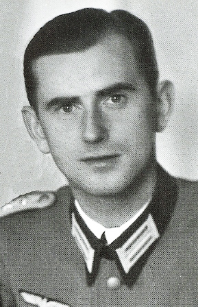

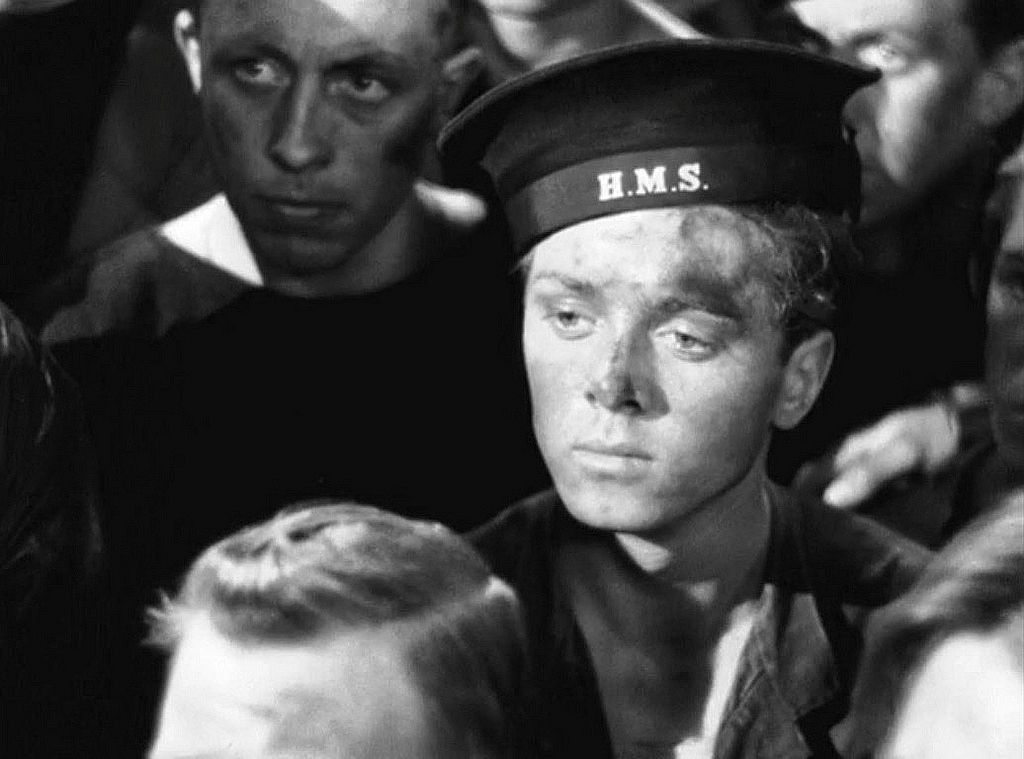

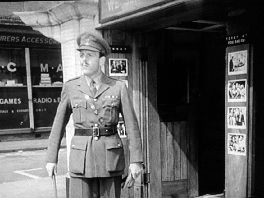

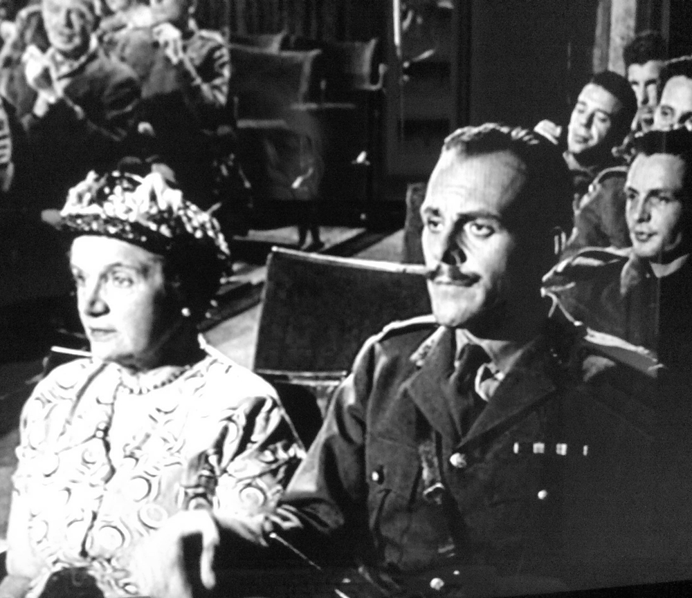


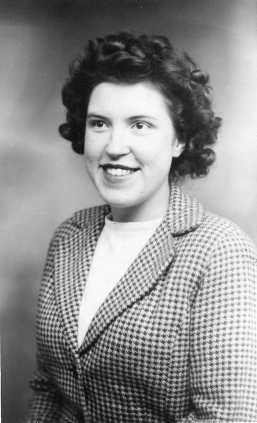
 Christmas Eve in ye old Home, 24 December, 1946.


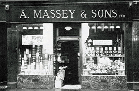


 The day before Hogmanay. (Have been busy making up your parcel – slacks & bra. etc and am now dashing off with it to the G.P.O.)


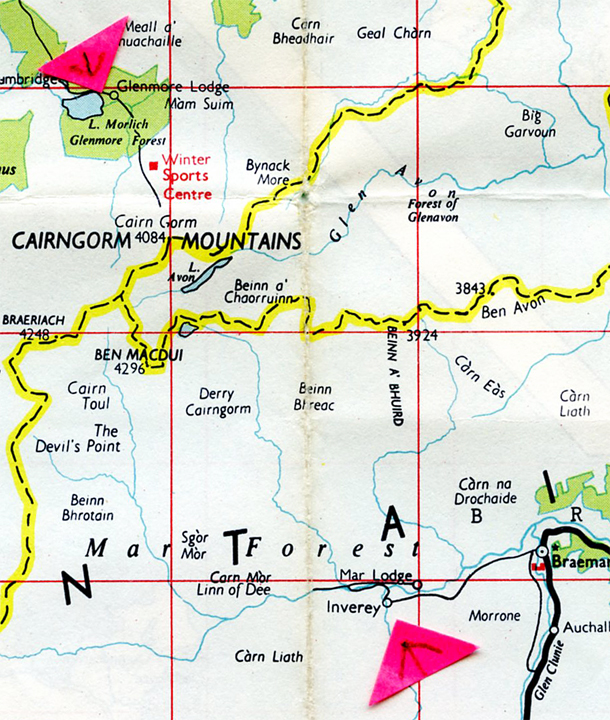


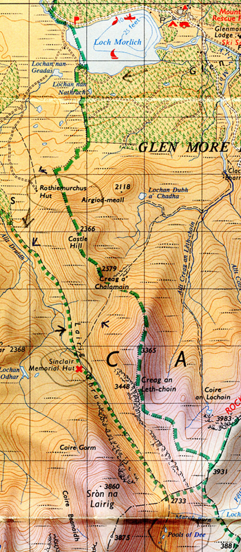


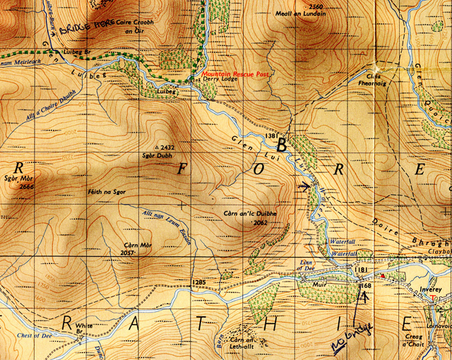


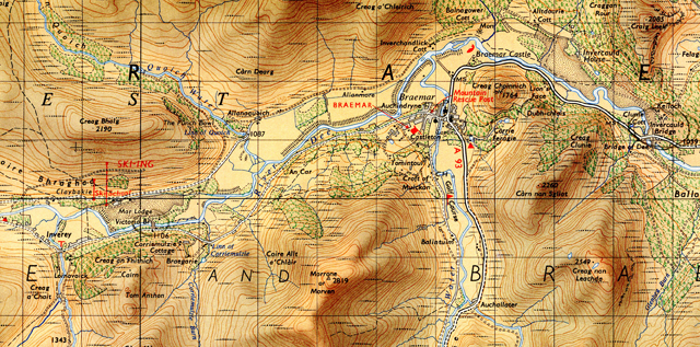
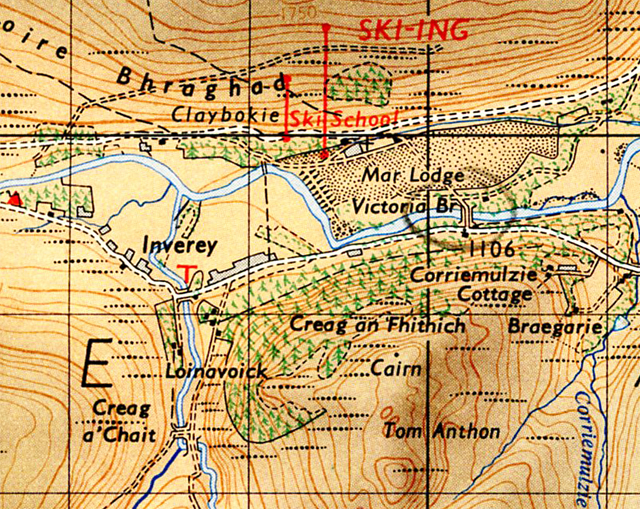
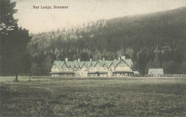
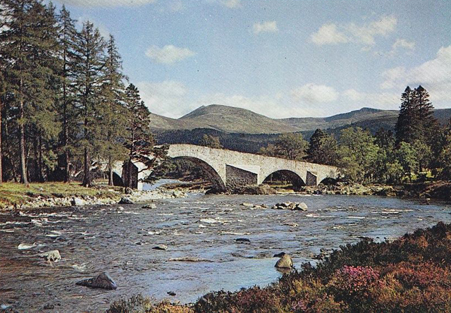
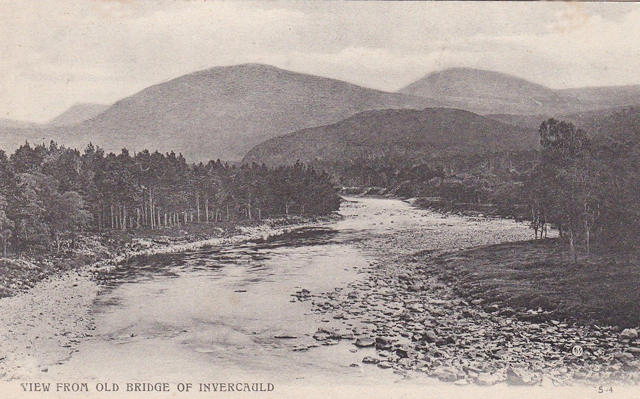
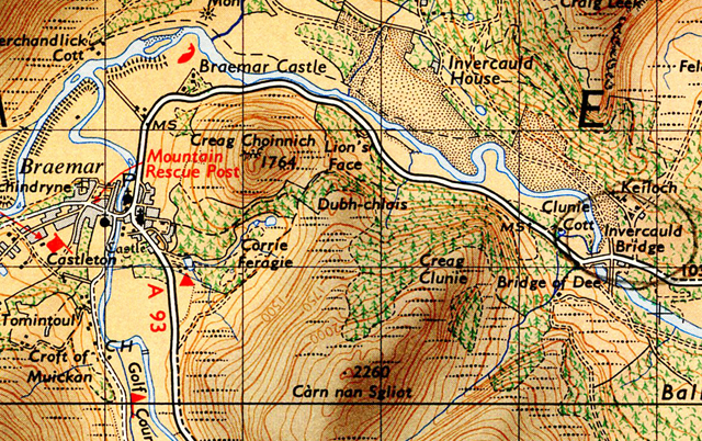

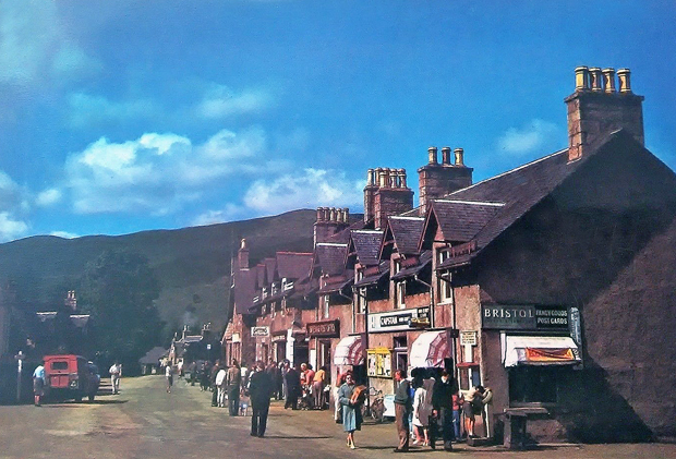


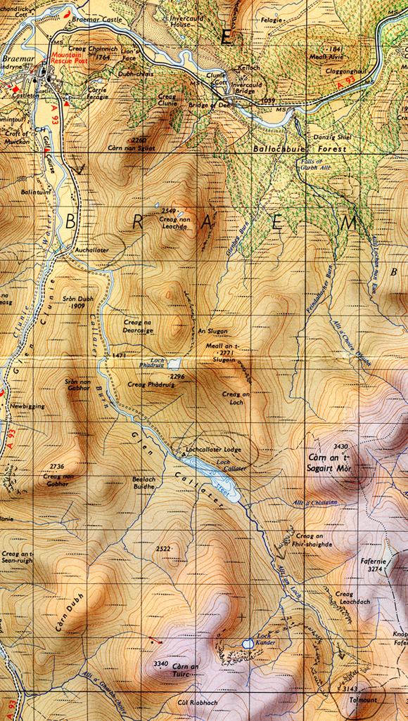
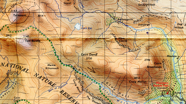

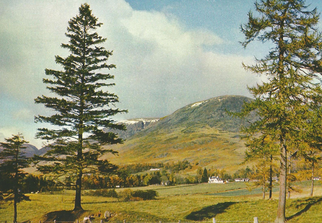
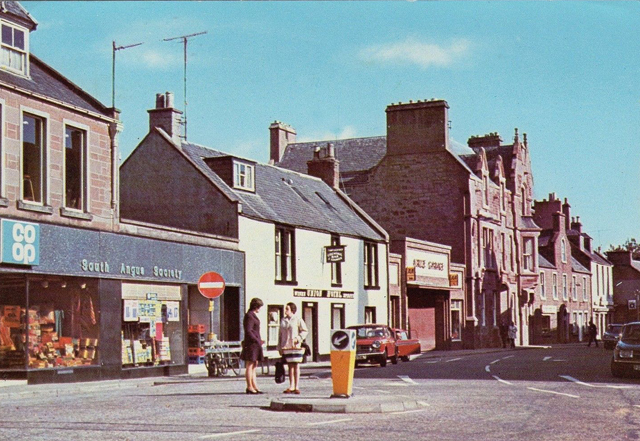
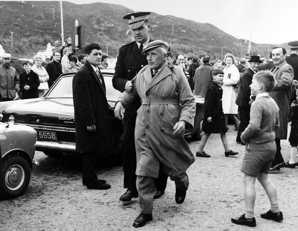
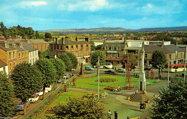
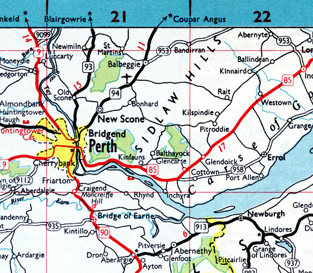

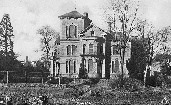


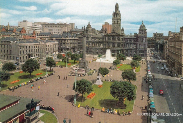


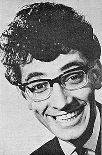

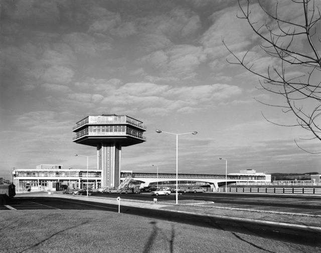


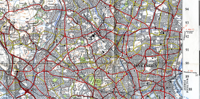


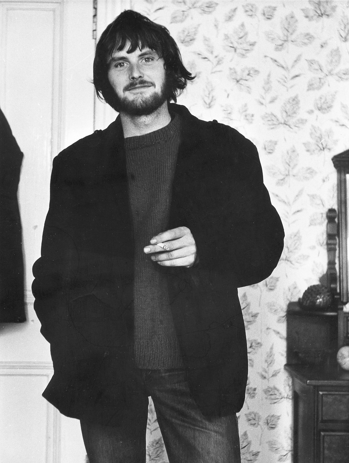
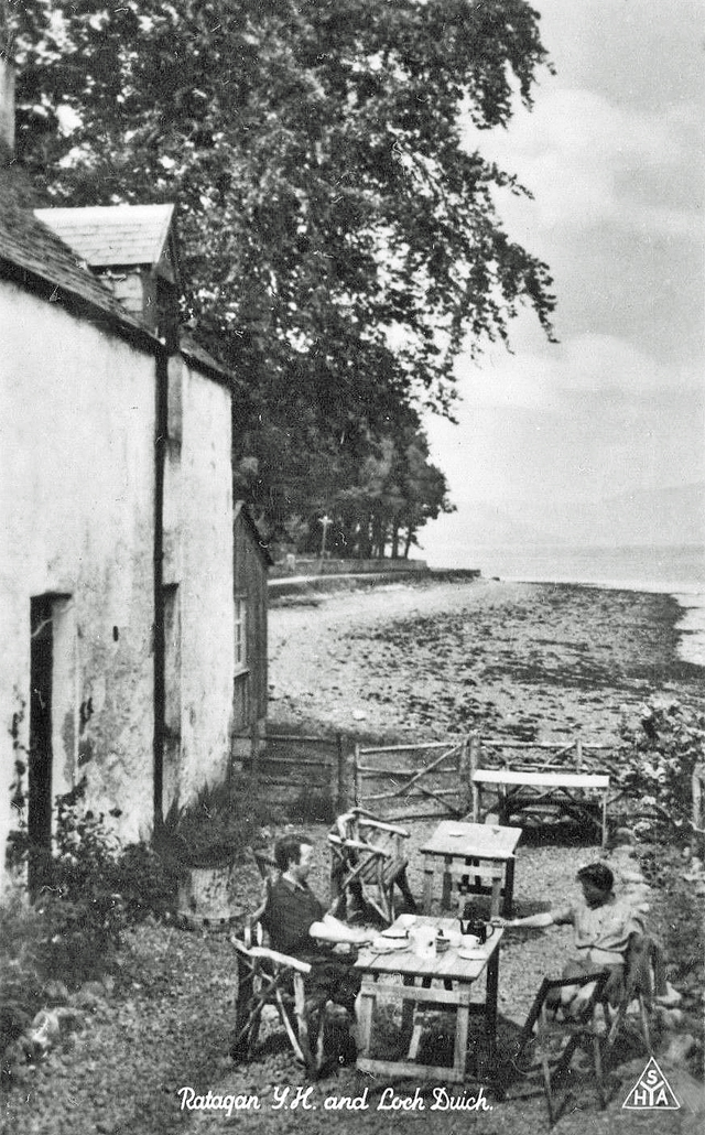


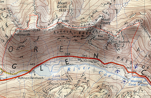
 And on either side there’s more spires and pinnacles coming up and big, deep gullies going down. Magnificent, but frightening. On my left the Three Sisters and occasionally the valley and road below when you catch a glimpse of it between the pinnacles. And on the right Ben Nevis all the time and Loch Leven. After 3080′ it’s plain forward green grass and wide ridge walking, and you see Loch Leven widening out into Loch Linnhe, and in the distance the sea.